€ 11.50
Fietskaart Fietsnetwerk Brugse Ommeland | Tourisme Vlaanderen

Fietskaart met de fietsknooppunten van het Brugse Ommeland Noord  met nuttige informatie op de keerzijde.

Het Fietsnetwerk Brugse Ommeland, dat is ruim 930 kilometer fietsplezier door bossen en polders, langs kastelen en kanalen met pittoreske dorpen en stadjes onderweg.


Stippel zelf je fietsroute uit en geniet van knooppunt tot knooppunt. De onmisbare fietsnetwerkkaart leidt je naar de leukste plekjes. De groen-witte bewegwijzering wijst je in twee richtingen de weg.

€ 14.99
Reisgids Michelin groene gids weekend Brussel | Lannoo

Voor wie slechts één compacte stadsgids in zijn tas wil stoppen en toch geen enkele bezienswaardigheid of topadres wil missen. Dé gids om Brussel écht te ontdekken: de plaatsen waar u de stad in zijn authenticiteit proeft, de evenementen van het ogenblik, de heerlijkste shoppingadressen...

En daarbovenop, een handige kaart van het openbaar vervoer en een uitneembaar stadsplan waarop alle in de gids besproken restaurants en hotels zijn aangeduid.

€ 11.95
Fietskaart - Wandelkaart 84976 Mayotte | IGN - Institut Géographique National

Goede en overzichtelijke kaart van Mayotte met toeristische informatie 


IGN (Institut Geographique National) is de autoriteit op het gebied van kaarten in Frankrijk. Of het nu gaat om wegenkaarten, wandelkaarten, fietskaarten of klimkaarten, IGN heeft het in het assortiment.


De kaarten worden wereldwijd geroemd om de goede leesbaarheid en het aantrekkelijke kleur- en schaduwgebruik.


Naast de gedetailleerde kaarten van Frankrijk, levert IGN ook kaarten van bestemmingen over de hele wereld, of speciale themakaarten.

€ 20.50
Wandelgids - Pelgrimsroute Jakobswege Österreich - Oostenrijk | Rother Bergverlag

Deze wandelgids beschrijft het Oostenrijkse gedeelte van de Jakobsweg. 

»Ich bin dann mal weg« – spätestens seit dem gleichnamigen Buch von Hape Kerkeling ist der Jakobsweg weithin bekannt. Weniger bekannt ist hingegen, dass es nicht nur »den« Jakobsweg in Spanien gibt, sondern dass in ganz Europa ein Netz von historischen Pilgerwegen besteht. Wer also nicht allzu weit weg will, der kann sich auch zum Beispiel in Österreich auf seine ganz persönliche Pilgerfahrt begeben und dabei sogar mehr Ruhe und innere Einkehr erleben als auf den bekannteren und damit auch frequentierteren Wegen.

Der österreichische Jakobsweg führt einmal quer durch das Land: Er beginnt in Hainburg im Osten Österreichs und führt nach Feldkirch in Vorarlberg, kurz vor der Schweizer Grenze. Vielfältig präsentiert sich die durchwanderte Landschaft, von idyllischer Donaulandschaft bis zu hohen Alpengipfeln. Der Weg folgt der historischen Pilgerroute und führt an einigen der bedeutendsten Sakralbauten Österreichs vorbei wie den Stiften Melk, Sankt Florian oder Zams, und an zahlreichen weiteren Kirchen und Kapellen, die dem heiligen Jakob oder anderen Pilgerheiligen gewidmet sind.

Dieser Rother Wanderführer stellt die Hauptroute des Österreichischen Jakobswegs sowie den neu konzipierten Weinviertler Weg vor. Dazu gehören zuverlässige Beschreibungen, Wanderkärtchen mit eingezeichnetem Routenverlauf und aussagekräftige Streckenprofile. Ausführliche Informationen zur Infrastruktur am Weg machen die Planung einfach. Zudem stehen auf der Internetseite des Bergverlag Rother GPS-Tracks bereit. Auch das Lesevergnügen kommt nicht zu kurz: Viel Wissenswertes zu Geschichte und Kultur findet sich ebenso wie zahlreiche Fotos, die auf das Pilgern einstimmen.


€ 13.95
Reisgids Rough Guide Pocket Reykjavik | Rough Guides

Een kleinere versie in zakformaat van de grotere versies van de Rough Guides. Als altijd weer vol met goede informatie over cultuur en praktische zaken. Achterin een kaart van de stad.

This compact, pocket-sized Reykjavík travel guidebook is ideal for travellers on shorter trips and those trying to make the most of Reykjavík. It’s light, easily portable and comes equipped with a pull-out map. 


This Reykjavík guidebook covers: Lækjartorg, Austurstræti, Austurvöllur, Aðalstræti, Hafnarstræti, Tryggvagata, The Harbour, Tjornin, Bankastræti, Hallgrimskirkja, Oskjuhlid, Hafnarfjörður, Reykjanes Peninsula, Blue Lagoon.


Inside this Reykjavík travel book you will find:


Curated recommendations of places – main attractions, off-the-beaten-track adventures, child-friendly family activities, chilled-out breaks in popular tourist areas 


Things not to miss – The Golden Circle, Seljalandsfoss, Skógar, Heimaey, Þjórsárdalur, Landmannalaugar, Þórsmörk, Landmannalaugar, Þórsmörk 


Ready-made itineraries samples –  created for different time frames or types of trip


Reykjavík at a glance – an overview map of Reykjavík with key areas and short descriptions of what you’ll find there


Day trips – extra information for those on longer breaks or wanting to venture further afield


Practical travel tips – information on how to get there and around, health guidance, tourist information, festivals and events, plus an A–Z directory


Handy language section – themed basic vocabulary for greetings, numbers and food and drink


Independent reviews – honest descriptions of places to eat, drink or stay, written by our expert authors


Accommodation – handy reference guide to a range of hotels for different budgets 


Pull-out map – easy to extract folded map with places to see marked


What’s new – a short overview of the changes in Reykjavík in recent years for repeat travellers


Fully updated post-COVID-19


The guide is a perfect companion both ahead of your trip and on the ground. It gives you a distinct taste of Reykjavík with a concise edit of all the information you’ll need.


€ 25.95
Reisgids Hiroshima and Nagasaki | Odyssey

Deze gids combineert geschiedenis, cultuur en reisinformatie in één. Voornamelijk geschikt als je meer te weten wilt komen over de rijke historie van deze twee steden. De reisinformatie beperkt zich tot ongeveer 40 pagina's.


An ambitious blend of history ancient and modern, literature and poetry, photography and art,... yet still also a travel guide: this is Odyssey's guide to the Japanese cities of Hiroshima and Nagasaki, by Magnus Bartlett and Robert O'Connor. Released in 2015 to coincide with the 70th anniversary of the atomic bombings. A powerful and thought-provoking read that - as with all Odyssey Guides - will challenge, inform, and inspire visitors and armchair travellers.


On August 6, 1945 at precisely 8.15am, the world changed forever. An atomic bomb was dropped on the Japanese city of Hiroshim and another would drop on Nagasaki three days later: both cities – and their populations – were destroyed.


This unique and eclectic book takes the reader through seven centuries of Japanese history, showing the significance of the two cities and their environs. Using rarely seen photographs and a wide range of extracts from literature, art, and film, it details the events leading up to and after the bombings, and also provides invaluable travel information for the modern-day visitor.


With the passing of the 70th anniversary of the bombings, this milestone book will prepare those who plan on making a pilgrimage to the cities, and promote lively discussion about nuclear weapons and their place in the modern world.

€ 22.50
Reisgids Reise-Taschenbuch Peloponnes - Peloponnesos | Dumont

Goede, fraai ogende gids, handzaam formaat en toch behoorlijk uitgebreid over de Peloponnessos. Deze serie reisgidsen zijn algemene reisgidsen en bevatten een brede selectie aan bezienswaardigheden, excursies, achtergronden, praktische tips en een uitneembare kaart.

Über das Buch

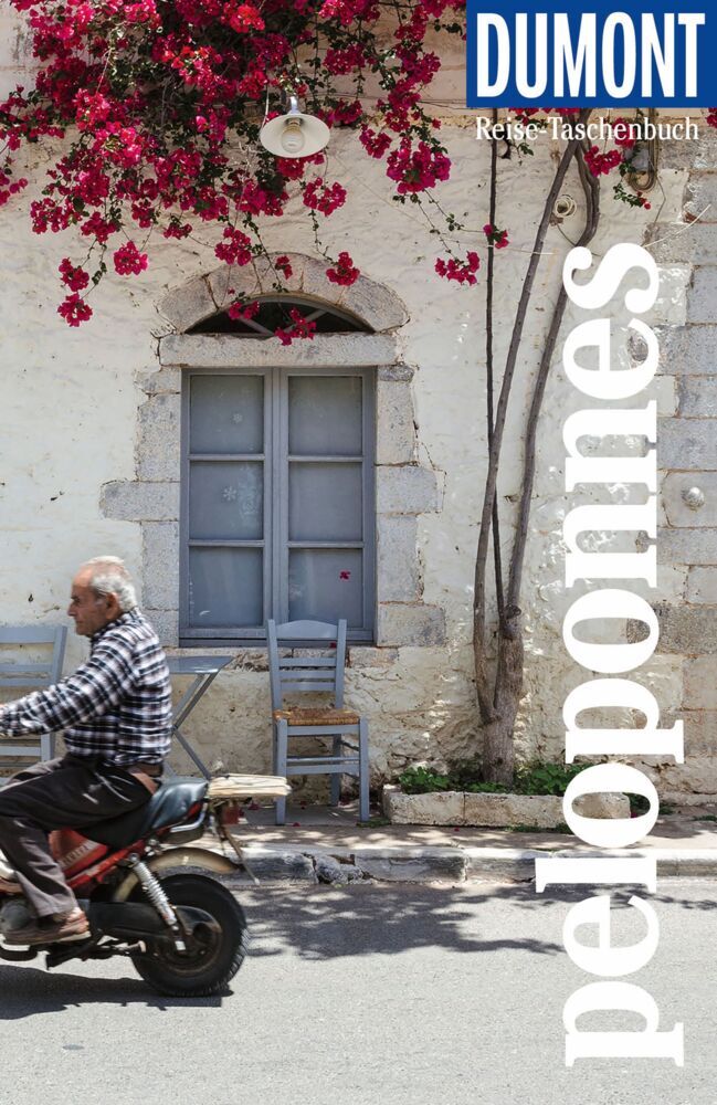
In der griechischen Region Peloponnes, zwischen der Großstadt Patras im Nordwesten und der kargen Halbinsel Máni im Süden, erwarten uns erstaunliche Entdeckungen und unerwartete Erlebnisse. Hier blieben viele Traditionen der Griechen noch fast unberührt erhalten. Zwischen langen Sandstränden, wild-einsamen Bergregionen wie dem Parnon und vielen romantischen Landstädtchen gibt es unendlich viele Möglichkeiten zur Entschleunigung: alte Orte wie Náfplio mit Bilderbuchflair, historische Burgen der Kreuzritter, antike Ruinen wie Olympia, Korinth oder Mykene - also fast eine echte Zeitreise. Natururlauber können sich an feinsandigen Stränden, auf Berg-Trails, in grünen Tälern voller Wasserfälle und sogar auf dem Methána-Vulkan nach Belieben austoben. Folgen Sie einfach den Touren und Lieblingsorten von Elisabeth Heinze.


Und so erleben Sie den Peloponnes mit dem DuMont Reise-Taschenbuch:

Persönlich und echt: Wir legen Wert auf ehrliche Erlebnisse, Nähe und Gegenwart Übersichtliche Gliederung: So findet sich jeder gut zurecht Eintauchen & Erleben: Ein Überblick über die besten Ziele eines jeden Kapitels. Macht Lust auf Entdeckungen Die Touren: Einfach losziehen, neue Wege gehen. Aktiv in Natur und Kultur eintauchen Die Lieblingsorte: Dort hat es der Autorin am besten gefallen Die Adressen: radikal subjektive Auswahl, mal stylish, mal ökologisch, immer individuell und persönlich Das Magazin: ein abwechslungsreiches Reisefeuilleton. Es packt auch kritische und kontroverse Themen an ... Die Karten: 7 Citypläne, 14 Tourenkarten, 6 Pläne antiker Orte, Übersichtskarte mit den Highlights des Peloponnes, Schnellüberblick zu jeder Region plus eine große Reisekarte


Inhalt

Senkrechtstarter, Überflieger, Querfeldein. Vor Ort - die Kapitel: Achaía und Ilía (Nordwesten), Messinía (Südwesten), Máni (Süden), Lakonía (Südosten), Arkadía (Zentrum), Argolída und Korinthía (Nordosten). Das Kleingedruckte (Reiseinfos von A bis Z). Das Magazin. Offene Fragen.


About the book

In the Greek region of Peloponnese, between the big city of Patras in the northwest and the barren peninsula of Máni in the south, amazing discoveries and unexpected experiences await us. Here, many traditions of the Greeks remained almost untouched. Between long sandy beaches, wild-lonely mountain regions such as the Parnon and many romantic country towns, there are endless possibilities for deceleration: old places such as Náfplio with picture book flair, historical castles of the crusaders, ancient ruins such as Olympia, Corinth or Mycenae - so almost a real journey through time. Nature holidaymakers can let off steam on fine sandy beaches, on mountain trails, in green valleys full of waterfalls and even on the Methána volcano as desired. Just follow the tours and favorite places of Elisabeth Heinze.


And so experience the Peloponnese with the DuMont Travel Paperback:


Personal and genuine: we value honest experiences, closeness and present

Clear structure: so everyone can find their way around well.

Immerse & Experience: An overview of the best goals of each chapter. Makes you want to discover

The tours: just get started, go new ground. Actively immerse yourself in nature and culture

The favourite places: where the author liked it best

The addresses: radically subjective selection, sometimes stylish, sometimes ecological, always individual and personal.

The magazine: a varied travel tool. It also tackles critical and controversial topics...

The maps: 7 city plans, 14 tour maps, 6 plans of ancient places, overview map with the highlights of the Peloponnese, quick overview of each region plus a large travel map.


€ 38.95
Wereldkaart 71 Wereld upside down, 136 x 100 cm | Maps International

Een totaal andere kijk op de wereld: hang het eens ondersteboven! De mooie heldere kaart van Maps International nu in een upside-down uitvoering. Engelstalig, geplastificeerd, met vlaggen

Afwerking: geplastificeerd

De wandkaart wordt afgewerkt met een inkapselingsproces. Inkapseling betekent dat de kaarten met warmte worden geperst tussen twee vellen film van industriële kwaliteit. Houd er rekening mee dat de randen van deze kaart niet zijn geplastificeerd.


Inkapseling geeft de kaart een schrijf- / veegafwerking, wat betekent dat met een droog afveegbare marker elk schrift op de kaart kan worden weggeveegd.


View the world from a different direction with Maps International's large political upside down world wall map. 

Map details: This is an upside down world wall map with everything reversed! The south is at the top of the map, the north is at the base and the southern hemisphere is now at the top. The countries you expect to see in the east are now on the left of the map, and those on the west traditionally, are now on the right of this upside down map. 


This large upside down political map has countries marked in different colours according to international country boundaries. Capital cities (including approximate population size) and hill shading are also shown on this upside down political world wall map. 

Abonneer op