€ 9.99
Reisverhaal As in Tas | Jelle Brandt Corstius

Elk voorjaar maakte Jelle Brandt Corstius een fietstocht met zijn vader. Een bestemming was er nooit, maar wel de zekerheid dat het niet langer dan twee dagen zou duren. Anders kregen ze ruzie.

Op 18 april 2014 begon Jelle Brandt Corstius weer aan een tocht, maar dan zonder zijn twee maanden eerder overleden fietsmaatje en vader, Hugo Brandt Corstius, een wonderlijke man die veel begreep van dingen waar de meeste mensen niets van begrepen (palindromen), maar weer heel weinig van de meest normale dingen (kinderen).

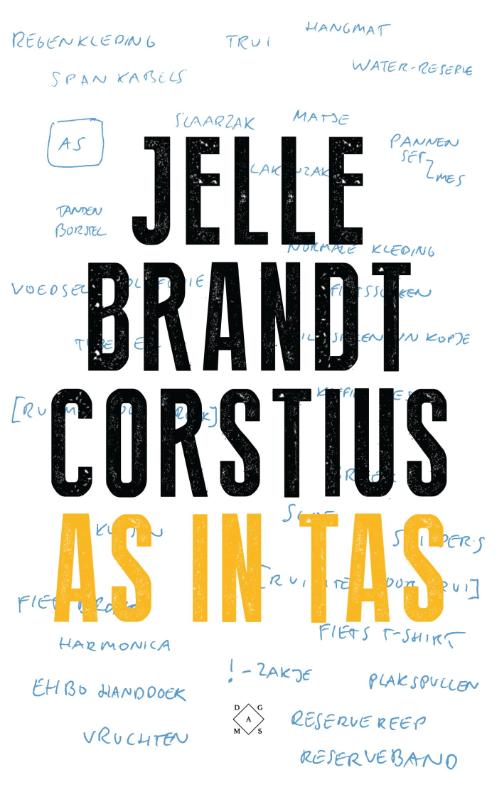
Met in zijn fietstas een deel van de as van zijn vader legt Brandt Corstius in zestien dagen 1.620 kilometer af. Hij kampeert op een troosteloze camping in Luxemburg, wordt beroofd door zigeuners (de as laten ze achter), logeert bij een Maastrichtse dame die eist dat hij het douchewater opvangt om de toilet mee door te spoelen en trekt overmoedig met vijftig kilo aan bagage door de Ardennen - tot hij aan de Middellandse Zee uitkomt, waar hij de as uitstrooit.


As in tas is Jelle Brandt Corstius' meest persoonlijke boek, over zijn bekende vader, geschreven op het moment dat hij zelf net vader is geworden, in de vorm die we van hem kennen: een reisverhaal.


OVER DE AUTEUR

Jelle Brandt Corstius (1978) is schrijver en programmamaker. Eerder verschenen Rusland voor gevorderden, Kleine landjes en Universele reisgids voor moeilijke landen, waarvan meer dan 60.000 exemplaren zijn verkocht. Ook schreef hij het boekenweekessay Arctisch Dagboek. Hij was twee keer presentator van Zomergasten en van veelgeprezen reisseries over Rusland en India.

€ 15.95
Wandelkaart Tour & Trail Formentera | Discovery Walking Guides

Goede, scheur- en watervaste, wandelkaart van Formentera.


Water-proof, split-proof, tear-proof, adventure-proof. Formentera Tour & Trail Super-Durable Map is simply the toughest, most accurate, easy to read, easy to use map of the island you can buy at any price. David & Ros Brawn surveyed this beautiful island in October 2015 carrying out their 'gps ground survey' pinpointing all the details needed to produce the definitive map of Formentera.


Large, 25k scale, easy to read map sheet includes a wealth of useful details. 20 metre and 100 metre contours combined with altitude shading bring the Formentera landscape to life. All of the legendary Tour & Trail attention to detail is included so that you will find those petrol stations, mirador viewpoints with parking, refreshment stops with parking and accurate road numbering that are so essential when adventuring by hire car; 'watts' new and unique to Formentera we have included the 'Electric hire car' recharging points making sure you never run out of go.


'Off-Tarmac' Formentera Tour & Trail Map is in a league of its own thanks to all the gps information for the cycling and walking trails plus all of the island's famous beaches are shown and named.Printed on a large 840mm by 620mm super-durable map sheet the island of Formentera at 25,000 scale is on the facing page of the map sheet which folds back to a pocketable 235mm by 120mm when folded. On the reverse side of the map sheet you will find large scale street plans along with a host of useful information to make the most of your time on the island. 'Super-Durable' means a waterproof, tear-proof, map that can take the roughest treatment and still folds up like new after your adventures.


Printed on Polyart using specialist 100% oxygenation inks produces a lightweight map that feels like silk but is a tough as old boots as it shrugs off water, resists tearing and damage better than any other map. 'Super-Durable' combined with our special concertina map fold means this 'near indestructible' Tour & Trail Map unfolds easily for use, and more importantly folds back up easily to its compact pocket size even after the toughest use. Custom Map digital edition for Garmin users is available from Discovery Walking Guides website dwgwalking.co.uk plus digital editions are available for 3/4G gps apps from Viewranger and MyTrails.Tour & Trail Super-Durable Maps are printed on Polyart using 100% oxygenation inks which produces a lighweight map that feels like silk while being both water-proof and incredibly tough so that after even the toughest of adventures your Tour & Trail Super-Durable Map will fold up like new.


€ 20.50
Reisgids Hunsrück mit Koblenz und Trier | Reise Know-How Verlag

Reise Know-How is een duitstalige praktische reisgids voor alle leeftijden, boordevol informatie over accommodatie van budget tot luxe, vervoer en plaatsbeschrijvingen. Kenmerk: brede cultuur en achtergrondinformatie, bondig geschreven.

„Mosel, Nahe, Saar und Rhein schließen rings den Hunsrück ein“ – mit diesem Merkspruch lernen Hunsrücker Schulkinder die geografische Einordnung ihrer Heimat im Herzen von Rheinland-Pfalz. Der Hunsrück zählt zu den waldreichsten Gebieten Deutschlands, immerhin fast die Hälfte der dünnbesiedelten Landschaft ist Waldfläche. Die bewaldeten Höhenzüge Soonwald, Idarwald und Hochwald machen den besonderen Reiz der Region aus.


Drei ausgedehnte Schutzgebiete gibt es im Hunsrück: den Naturpark Soonwald-Nahe, den Naturpark Saar-Hunsrück und den erst 2015 aus der Taufe gehobenen Nationalpark Hunsrück-Hochwald. Sie gehören zu den letzten Naturparadiesen Deutschlands mit einer intakten, artenreichen Tier- und Pflanzenwelt. Von Jahr zu Jahr wird das Wanderwegenetz dichter. Viele der Routen sind prämiert, allen voran der Saar-Hunsrück-Steig, der zu Deutschlands schönsten Fernwanderwegen zählt. Der 83 Kilometer lange Soonwaldsteig ist ebenfalls ein Qualitätswanderweg, aber noch immer ein Geheimtipp.


Touristisch erschlossen ist der Hunsrück noch nicht so richtig – dafür findet man Ruhe und Natur, romantische Dörfer und viele Möglichkeiten für Aktivurlauber.


Den Hunsrück, Koblenz und Trier mit diesem aktuellen Reiseführer entdecken:


Alle praktischen Reisefragen von A bis Z

Sorgfältige Beschreibung aller sehenswerten Orte und Landschaften

26 detaillierte Stadtpläne und Karten

Ausführliche Kapitel zu Trier (30 Seiten) und Koblenz (24 Seiten)

Kulinarische Tipps von Kennern: die ganze Vielfalt der hunsrückischen Küche

Unterkunftsempfehlungen für jeden Geldbeutel

Besichtigungstipps zu architektonischen Besonderheiten und Museen

Empfehlungen für den Urlaubsalltag: Einkaufs- und Ausgeh-Tipps, Märkte und Feste

Tipps für Aktivitäten: Wanderungen, Radtouren, Badeplätze, Kletterparks

Erlebnistipps für Kinder: Veranstaltungen, Sehenswertes, Tierparks, Schwimmbäder

Wissenswertes zu Natur, Geschichte, Kultur und Traditionen

€ 18.50
Reisgids CityTrip Bergen | Reise Know-How Verlag

Reise Know-How is een duitstalige praktische reisgids voor alle leeftijden, boordevol informatie over accommodatie van budget tot luxe, vervoer en plaatsbeschrijvingen. Kenmerk: brede cultuur en achtergrondinformatie, bondig geschreven.


Dieser aktuelle Stadtführer ist der ideale Begleiter, um alle Seiten der zweitgrößten Stadt Norwegens selbstständig zu entdecken: - Die wichtigsten Sehenswürdigkeiten und Museen der Stadt sowie weniger bekannte Attraktionen und Viertel ausführlich vorgestellt und bewertet- Faszinierende Architektur zwischen Hansehäusern und Festungsbauten- Abwechslungsreicher Stadtspaziergang- Erlebnisvorschläge für einen Kurztrip- Ausflüge in Bergens Inselwelt, nach Voss und zum Hardangerfjord- Shoppingtipps vom Fischmarkt bis zu norwegischem Design- Die besten Lokale der Stadt und allerlei Wissenswertes über die norwegische Küche- Tipps für die Abend- und Nachtgestaltung: vom Opernbesuch bis zur angesagten Szenekneipe- Durch Berg, Tal und Tunnel: die Bergenbahn- Bergen zum Träumen und Entspannen: die Hausberge, der Nordnesparken und der See Lille Lungegårdsvann- Ausgewählte Unterkünfte von preiswert bis ausgefallen- Alle praktischen Infos zu Anreise, Preisen, Stadtverkehr, Touren, Events, Hilfe im Notfall ...- Hintergrundartikel mit Tiefgang: Geschichte, Mentalität der Bewohner, Leben in der Stadt ...- Kleine Sprachhilfe Norwegisch mit den wichtigsten Vokabeln für den Reisealltag- Faltplan zum HerausnehmenDazu: kostenlose Web-App für Smartphone, Tablet und PC mit Stadtplan- und Satellitenansichten passend zum Text, Routenführung zu allen beschriebenen Sehenswürdigkeiten, Verlauf des Stadtspaziergangs, seitenbezogenen Updates nach Redaktionsschluss sowie einem Mini-Audiotrainer Norwegisch.+++ CityTrip - die aktuellen Stadtführer von Reise Know-How, mit über 120 Städtezielen die weltweit umfangreichste Kollektion. Fundiert, übersichtlich, praktisch.+++ REISE KNOW-HOW - Reiseführer für individuelle Reisen


€ 16.90
Wandelgids S5 Streekpad Brabants Vennenpad | Nivon

Brabant Vennenpad Noord-Brabant, de provincie van het rijke roomse leven met Brabants bont, bierbrouwerijen en worstenbroodjes… Het Brabants Vennenpad brengt u in het zuidoostelijk deel van de provincie, langs vennen in de Kampina, De Kempen en De Groote Heide, door het Land van Van Gogh en over landgoederen. Prachtige paadjes langs de meanderende Dommel brengen u steeds zuidelijker tot de Belgische grens.

€ 42.95
Fotoboek The Hidden Tracks | Gestalten Verlag

Scenic trails, adventures off the beaten track, and pristine hiking destinations around the world.

Embark on a thrilling exploration of the world's most exciting, magnificent, and varied walking trails and hiking destinations. Besides the better-known paths, The Hidden Tracks will also highlight some of the more out-of-the-way gems--be it an expedition on the other side of the world or a day's hike just a few hours from your hometown. From a magic trail leading through a forest of giant trees and breathtaking mountain ascents in South America to a trek among some of the highest sand dunes in the world in Mongolia, this selection of one-of-a-kind trails is presented with stunning imagery, detailed trail descriptions, overview maps, and insider advice on how to make the most of each trip. The book is both a visual journey and an invitation to pack your hiking boots and discover untouched hiking destinations.

€ 27.95
Reisgids The Unique States of America - USA | Lonely Planet

From the tiny gold-rush town of Chicken, Alaska to Las Vegas' dazzling Neon Museum and Maryland's famous blue crab, Lonely Planet's Unique States of America takes you on a journey across the 50 states to discover the country's most iconic - and unique - destinations and experiences.

Travel off the beaten path and into the heart of each state with our expert itineraries exploring some of the USA's finest art and culture, food and drink, history, sports, and family-friendly places. Get fascinating insights into unmissable sights, attractions, parks and more with Lonely Planet's expert commentary and stunning photography.

From roadside attractions to world-class museums, you'll discover pockets of nature on the crowded Northeast corridor, mural installations in Fort Worth, Arkansas, beckoning waters in Voyageurs National Park, Minnesota, and lots more.

Follow the Blue Ridge Parkway from Shenandoah National Park to the Great Smoky Mountains

Chase the ghost of Ernest Hemingway through the tropical island city of Key West, Florida

Witness the picturesque charms of New Hampshire's seemingly endless covered bridges

Make an architecture pilgrimage to Frank Lloyd Wright's Price Tower in Oklahoma or Martin House in Buffalo

Explore Marfa, Texas and Tippet Rise Art Center, Montana on a cross-country artistic odyssey

Track the course of Lewis and Clark, or travel back to the days of the Thirteen Colonies

Relish the Americana-overdose of Gatlinburg and Dollywood in Tennessee

Catch a wave in Hawaii, don a Derby hat in Kentucky, or hit the slopes in the Rockies

After a day's exploring, we tell you all about each state's most iconic eats, from Kansas City barbecue to Chicago deep dish pizza and some good old gooey butter cake in St Louis. Not to mention the new outgrowth of vineyards, distilleries, breweries and coffee roasters to quench the thirst of every traveller.

About Lonely Planet: Lonely Planet is a leading travel media company and the world's number one travel guidebook brand, providing both inspiring and trustworthy information for every kind of traveller since 1973. Over the past four decades, we've printed over 145 million guidebooks and grown a dedicated, passionate global community of travellers. You'll also find our content online, on mobile, video and in 14 languages, 12 international magazines, armchair and lifestyle books, ebooks, and more.

€ 16.95
Wandelgids Airbornepad Market Garden | OLAT

Mooi lange-afstands pad van Lommel naar Arnhem langs de route van de geallieerde opmars in de 2e wereldoorlog: 225 km. Goede kaarten en duidelijke routebeschrijving.

Bijna tachtig jaar na operatie Market Garden voert het Airbornepad de wandelaar langs talloze plekken die deze geallieerde opmars in herinnering brengen: kleine en grote monumenten; militaire begraafplaatsen; oorlogs- en bevrijdingsmusea en niet te vergeten al die bruggen waar zo zwaar om is gevochten. Maar het Airbornepad verschaft ook puur wandelplezier. Het doorkruist oude boerenlandschappen, prachtige beekdalen, heidevelden en stuifduinen, weidse uiterwaarden en beboste stuwwallen. Het komt langs historisch stedenschoon en industrieel erfgoed. En in de voetsporen van de bevrijders krijgt dit alles nog eens extra betekenis. 

€ 18.50
Wandelgids 5756 Wanderführer Piemont - Valle Maira | Kompass

Goede Duitstalige wandelgids met heldere beschrijvingen van de wandeltochten. Met hoogteprofiel, kaartje en de benodigde praktische informatie als bijvoorbeeld de startlocatie met GPS coordinaten. De wandelingen zijn ingedeeld in zwaarte en dan op verschillende kleuren weergegeven. Beschreven worden eenvoudige wandelingen tot pittige (berg)tochten, voor getrainde en ongetrainde wandelaars, een aantal wandelingen zijn geschikt om met kinderen te doen. Belangrijke toevoeging bij de Kompass wandelgidsen is een bijgevoegde losse wandelkaart van het betreffende gebied waarop de wandelingen uit de gids op de kaart heel duidelijk zijn ingetekend. Schaal 1:35.000


Kompass Hiking Guide Piedmont, Valle Maira

Piedmont with the Maira Valley offers majestic Alps, lonely valleys and charming villages. Hikers experience the alpine nature and traditional culture of this northern Italian region.


2-in-1 hiking guide Piedmont, Valle Maira + extra tour card.


Tours hiked by compass experts

Each tour with height profile and map cut-out

Excursion and overnight tips

Extra tour card supported with tour selection

Includes download of GPS data.


The Kompass hiking guide with extra tour map provides the relevant information you need for the planned hike. It accompanies you safely through the chosen hiking destination and offers other tips about lots of hiking tours. Map cut-outs give you local orientation, facts and reports in the hiking guide tell you stories about the area. For on the go, there is the lightweight and removable extra tour map with the marked tour routes. The Kompass hiking guide shows the best highlights: sporty peaks, family-friendly routes, enjoyable moments, cultural treasures or the personal highlight of the compass experts.


Tip: For all tours, there is GPS data in GPX format as a download to the hiking guide. So the hikes can be used directly on your smartphone or GPS device for navigation.


Discover breathtaking paths with the Kompass hiking guide and experience unforgettable adventures on foot - get your hiking guide now and let compass guide you!


€ 10.25
Stadsplattegrond Firenze - Florence | Borch

Borch Florence is een duidelijke, geplastificeerde plattegrond van het centrum met informatie over openbaar vervoer en bezienswaardigheden. Inclusief straatnamenregister.


Our soft-laminated folded map of Florence shows: Florence Centre 1:7 000, Fiésole 1:12 000, Pisa 1:7 000, Florence & Environs 1:80 000, Florence & Region 1: 450 000 Cathedral of Santa Maria del Fiore 1: 1 900, Italy administrative, Top 24 Sights of Florence and 12 of Pisa. Borch maps are easy to fold, durable and water-repellent with a wipeable surface. Borch Maps show hotels, museums, monuments, markets, top sights and points of interest, useful statistics, conversion charts for temperatures, weights and measurements, climate charts showing temperatures, sunshine hours, precipitation and humidity, overview maps, time zones, and much more...


Florence is famous for its unparalleled art and architecture and is known as the birthplace of the Italian Renaissance. It is the capital city of the region of Tuscany, is situated on the Arno River and is home to about 380,000 Tuscans. The historic center of Florence was declared a UNESCO World Heritage Site in 1982 and tourism is unquestionably its most important industry; the basilicas of Santa Croce, Santa Maria Novella and the Accademia and Uffizi museums are very important sights that must be seen. Between April and October locals are outnumbered by visitors from all over the world. Fashion is a major industry in Florence and the Salvatore Ferragamo empire resides here, as do subsidiaries of Gucci, Prada, Chanel and Roberto Cavalli. Food and wine have long been an important branch of the Florentine economy. Sangiovese grapes, which grow in the Chianti region (a winemaking region of world renown, south of Florence) feature prominently. A visit to beautiful Florence is simply a delight and indulgence for all the senses!


Abonneer op