€ 17.50
Wandelgids Noorwegen - Norwegen | Bruckmann Verlag

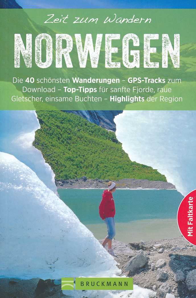
Wandelgids met 40 wandelingen over heel noorwegen, nadruk op zuiden onder Trondheim. Ook 3 wandelingen op de Lofoten. Goede informatie met schetsmatige gedetailleerde kaarten.

Fjorde, Seen, Gletscher, Polarlichter, Einsamkeit – wenn diese Begriffe für Sie wie Musik in den Ohren klingen, dann sind Sie in Norwegen goldrichtig. Von Touren entlang von Hochflächen über Fjordausläufer bis hin zu Gipfelbesteigungen: Hier wird dem ruhesuchenden Naturliebhaber alles geboten. Mit Karten inklusive Wegpunkten, Höhenprofilen, Tipps zu Sehenswertem am Wegesrand und GPS-Daten zum Download garantiert dieser Wanderführer die perfekte Orientierung

€ 11.99
Wegenkaart - landkaart 1 Frankrijk | ANWB Media

De ANWB heeft een grote serie wegenkaarten van de belangrijkste landen en streken. Het zijn echte overzichtskaarten van vaak een wat groter gebied. Deze keuze zorgt er voor dat de schaal vrij grof is en bepaalde details zijn weggelaten. De kleurstelling is een beetje flets waardoor je niet altijd even makkelijk onderscheid kan maken tussen verschillende landschappen of natuurlijke aspecten. 

Ook het register ontbreekt. Het grote voordeel is vaak dat het gebied op de kaart overeenkomt met de vraag van klanten. Voor het plannen van een vakantie een prima kaart!


Vergelijken met andere uitgevers van kaarten als Michelin, Freytag und Berndt of Reise KnowHow heeft de ANWB duidelijke keuzes gemaakt en gekozen voor een echte overzichtskaart. 


€ 16.50
Reisverhaal Hidden Bhutan - Entering the Kingdom of the Thunder Dragon | Martin Uitz

In 2006, Time magazine listed the King of Bhutan, Jigme Singye Wangchuk, as one of the 100 'leaders and revolutionaries' who are changing our world today. Yet it was only in the 1960s that the first road linking The Kingdom of the Thunder Dragon with India was opened, and since 1974 only a strictly limited number of tourists have been allowed to visit each year. Martin Uitz, a renowned expert on Bhutan, describes how the Bhutanese, in pursuit of the principle of 'Gross National Happiness', are carefully moving towards a more modern future, including a constitution and democracy, whilst preserving their traditional society and attempting to conserve the environment. Uitz made many fascinating discoveries in this enigmatic Kingdom. He was able to explain why the only traffic light was taken out of service, why six men are not allowed to go on a journey together, and what the subtle eroticism of a traditional hot-stone bath is all about. Along the way he also discovered that the Bhutanese hills are more alive with Edelweiss than the hills around his native Salzburg.

€ 15.50
Reisverhaal The Tao of Travel | Paul Theroux

A compendium of travel writing from a master travellerPaul Theroux celebrates fifty years of wandering the globe by collecting the best writing on travel from the books that shaped him, as a reader and a traveller. Part philosophical guide, part miscellany, part reminiscence, The Tao of Travel enumerates 'The Contents of Some Travellers' Bags' and exposes 'Writers Who Wrote About Places They Never Visited'; tracks extreme journeys in 'Travel As An Ordeal' and highlights some of 'Travellers' Favourite Places'. Excerpts from the best of Theroux's own work are interspersed with selections from travellers both familiar and unexpected, including Vladimir Nabokov, Henry David Thoreau, Graham Greene, Ernest Hemingway and more.


The Tao of Travel is a unique tribute to the pleasures and pains of travel in its golden age.

€ 11.95
Wandelkaart Region of Cluj and Vladeasa (Kalotaszeg) | Dimap

Region of Cluj and Vladeasa  (Kalotaszeg) 1:70.000 wandelkaart - DiMap met hoogtelijnen en hutten

Verschillende wandelroutes zijn op de kaart gemarkeerd. Natuurgebieden en beboste gebieden zijn aangegeven and symbolen laten zien waar grotten, watervallen, bronnen, hotels, campings en bezienswaardigheden te vinden zijn. Op de achterzijde van de kaart is praktische informatie en beschrijvingen van de routes te vinden.

€ 14.95
Wegenkaart - landkaart Karpatalja - Transcarpthia - Transkarpaten - Ukraine | Dimap

Zeer gedetaillerde wegenkaart van de Oekrainse Waldkarpaten (Karpato) en Sakarpatskaya Oblast 

alle plaatsnamen in de Oekraine zijn in het Cyrillisch en Engels.


Topografische Straßenkarte der Karpato-Ukraine (Waldkarpaten). Mit Stadtplänen von Uschgorod, Munkatsch (Mukaschewo) und Beregowo im Begleitheft. Ukrainische Namen sind kyrillisch geschrieben. Die Karte enthält zusätzlich die historischen ungarischen Bezeichnungen.


€ 9.95
Wegenkaart - landkaart Mapa Provincial Teruel | CNIG - Instituto Geográfico Nacional

Deze kaart is zuiver gericht op de provincie als in de titel. Gebieden naast de kaart worden zonder kleur weergegeven. Ideale kaart als het gaat om het onderscheid in topografische details als hoogte, nationale parken, vegetatie en plaatsen. Met schaduwrelief wordt hoogte goed zichtbaar. Zeker geschikt voor fietsers, al heb je er soms wel veel nodig.

Nadeel is het feit dat deze kaarten niet altijd even goed up-to-date zijn. Het komt soms wel voor dat bepaalde wegen inmiddels veel groter zijn geworden dan ingetekend op de kaart. Maar dan gaat het vooral om de grotere wegen: voor kleinere details is het een prima kaart.

One of the titles in a series of contoured road maps from Spain's civilian survey organisation, each covering one administrative province, excellent in presenting the country’s topography and locations of its many national and natural parks. The maps have contours at 100-metre intervals enhanced by relief shading, plus spot heights. Additional colouring is used to indicate various types of vegetation. Boundaries of national/natural parks are highlighted. Road network includes minor local roads and tracks, and motorways distinguish between free and toll routes. Railways show high speed, double, and single track lines. Unless indicated to the contrary in the individual descriptions, the maps have UTM grid, plus latitude and longitude margin ticks at 15' intervals, and an index of place names on the reverse. The legend is in Spanish only. Unlike in the older versions of this series, on each title all the information continues outside the provincial boundary, but without the relief shading and vegetation colouring.

€ 10.25
Wandelkaart 6 Mount Athos | Orama


Wandelkaart  van dit bijzondere stukje Griekenland: de berg Athos.


Mount Athos - Agion Oros (Greece) 1:60,000 Hiking Map, waterproof, GPS compatible, ORAMA

Mount Athos is a mountain and peninsula in Macedonia, Greece. A World Heritage Site, it is home to 20 Eastern Orthodox monasteries and forms a self-governed monastic state within the sovereignty of Greece. Today, Greeks commonly refer to Mount Athos as the "Holy Mountain" ( Agion Oros).


This is a double sided, very detailed, topographic hiking map of the peninsula at 1:60,000. Relief colouring with spot heights and contours (20 m interval) indicate the terrain. Symbols mark churches, monasteries, archaeological sites, campsites, beaches, etc.


Reverse side features a simplified map of the southern end of the peninsula with hiking routes highlighted and described (in Greek and English).


Added is an index of villages. Place names are in both Greek and Latin script, multilingual legend includes English, printed on synthetic paper, waterproof and tearproof, sheet size 98 x 68 cm / 38.5 x 26.5 inches. Authentic Greek cartography.

Abonneer op