€ 11.95
Wandelatlas The Great Glen Way | Cicerone

Handzaam gidsje met alleen de topografische routekaarten van 1:25000. De uitgebreide wandelgids (inclusief dit gidsje) is hier te bestellen.

This booklet of Ordnance Survey 1:25,000 Explorer maps has been designed for convenient use on the trail. It shows the full and up-to-date line of the Way, along with the relevant extract from the OS Explorer map legend. It is conveniently sized for slipping into a jacket pocket or top of a rucksack and comes in a clear PVC sleeve.


The companion guidebook – The Great Glen Way – describes the full route in both directions with lots of other practical and historical information. NOTE: The accompanying guidebook includes a copy of this map booklet.


The Great Glen Way is one of Scotland's Great Trails and follows the course of the Caledonian Canal through the Highlands from Fort William to Inverness over up to 79 miles (124km). The waymarked trail includes easy, level stretches, undulating forest tracks, lakeside paths and old drove and military roads as well as high-level alternatives for those looking for a greater challenge. Typically taking a week to walk, the route is an ideal introduction to long-distance walking.

€ 25.99
Reisgids Michelin groene gids Bali - Lombok - Oost-Java | Lannoo

De serie Groene Reisgidsen van Michelin is een beproefde en betrouwbare reisgidsenreeks. Of u nu lekker lang met vakantie gaat of er zomaar even tussenuit trekt, de Groene Reisgids wijst u de weg naar alle bijzonderheden die uw reisbestemming te bieden heeft, op een boeiende, grondige en praktische manier.


Door de opdeling in regio's of microregio's ontdekt u meteen wat u moet zien en waar u echt heen moet. Op bladzijde 1 vindt u een overzicht van de regio's uit de gids en op de binnenzijde van het omslag worden de behandelde regio's in kaart gebracht.


Toeristische plaatsen en bezienswaardigheden krijgen een duidelijke sterrenquotering. Hierdoor kunt u geen enkele 'topper' missen.

*** de reis waard

** een omweg waard

* interessant


In de adresboekjes vindt u naast praktische informatie en tips voor activiteiten ook logeeradressen en eetgelegenheden voor ieders budget.

Met kaarten en plattegronden gebaseerd op de bekende Michelincartografie.

€ 21.50
Wandelkaart - Fietskaart 2497 Sardinien Nord - Sardegna Nord | Kompass

Goede wandelkaart van Sardinië noord met vrijwel alle topografische details als hoogtelijnen, vegetatie, schaduwtekening maar ook de ingetekende wandelroutes en in veel gevallen ook fietsroutes (MTB). Gevaarlijke routes worden als zodanig weergegeven met een bepaalde markering. Berghutten en campings zijn goed terug te vinden op deze kaarten.


Daarnaast staan de toeristische bezienswaardigheden met symbolen vermeld. Kleurgebruik kan soms vrij fel overkomen, daardoor oogt deze detailkaart wellicht wat druk, maar het blijft een goed leesbare kaart. Sommige kaarten zijn geplastificeerd, maar helaas niet allemaal. De graden staan aan de zijkanten van de kaart, daardoor te gebruiken voor GPS.


Steden/dorpen/gebieden:

Olbia, Sassari, Alghero, Bosa, Macomer, Sindia, Thiesi, Ozieri, Porto Torres, Stintino, Portobello di Gallura, Arzachena, Tempio Pausania, Berchidda, Ala dei Sardi, Padru, San Teodoro, Palau, Isola la Maddalena, Isola dell'Asinara

€ 25.95
Wandelgids Wild Guide Scandinavia | Wild Things Publishing

Inspirerende gids voor deze noordelijke landen: Zwemmen, kamperen, kanoen en ontdekken!


The award-winning Wild Guide series travels to Scandinavia’s most beautiful and exciting landscapes. From the

midnight sun of the Arctic Circle to the amazing beaches of Denmark, Ben Love shares 700 ideas for the perfect wild adventure:


• Wild swimming, hot springs, waterfalls and islands

• Canoe camping and secret beaches • Ancient woodlands, summer meadows and wildlife wonders

• Northern lights, midnight sun and stunning wild camping

• Sacred stones and viking remains

• Caverns, ruins and castles

• Traditional local foods and foraging

• Forest cabins, gypsy caravans and boutique retreats


Canoe camp through hidden Norwegian fjords. Hike to Sweden's cosiest lakeside bothies and feast on locally sourced regional specialities. Wild swim in the secret hot springs of Iceland. Discover the best of Denmark's golden sand beaches. Perfect for family explorers or romantic adventurers. With informative descriptions and 24 detailed maps, including the best places for secret beaches, fantastic hikes, canoe trips and mountain train and boat adventures, as well as special places in which to stay, enjoy the best local food and discover the wildlife. Travelling from high above the Arcti Circle to the very south of Sweden and Denmark the landscapes you will discover are as varied as they are idyllic.

€ 22.50
Fietskaart 6/8 Vestlige Jylland - West Jutland (Denemarken) | Scanmaps

Eindelijk een fietskaartenserie van Denemarken. Gedrukt op scheur- en watervastpapier, met een schaal van 1:100.000, zijn het zeer overzichtelijke fietskaarten. De basis is de 1:100.000 topografische kaart waarop de nationale, regionale en lokale fietsroutes op zijn ingetekend. Op de achterzijde staat informatie over fietstransport met het openbaar vervoer. Gewone fietspaden en toeristische informatie zoals campings en fietsenmakers staan er echter niet op vermeld. 


Deze kaarten hebben dan ook vooral zin voor de bestaande fietsroutes. Echter aangezien er verder niet veel is aan detailkaarten met dit soort informatie, zijn deze kaarten wel degelijk bijzonder nuttig voor de fietser in Denemarken.

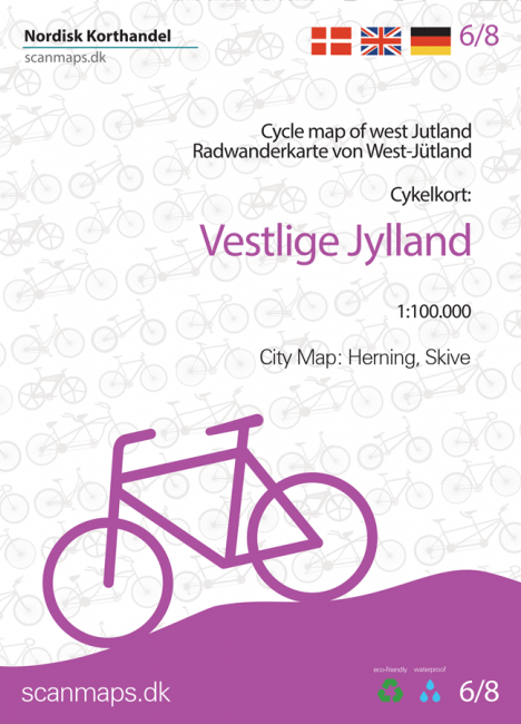
Cycle map of Western Jutland


Although the west coast of Denmark is known for its particullar fresh winds along the coast, there are plenty of cycling routes to try - also further inland. So this map is for both the sea lovers and those who want to ride along the fields.


For a better overview and planning of your bicycle trip through Denmark, a full map of Denmark in the scale 1:500.000 is avaible here: Cycle map of Denmark & Copenhagen


The map includes:


European Cycle Route: 12 (EuroVelo)


National cycle routes: 1, 2, 3, 4


Regional cycle routes: 7, 11, 16, 17, 18, 19, 20, 21, 24, 25, 28, 29, 30, 31, 32, 35, 36, 37, 38, 55, 56


Local cycle routes: 50, 51, 53, 81, 91, 118, 760, 800, 803, 805, 807 (Viborg) as well as Bakkeruten, Kystruten, Butiksruten (Fur), Faddersbøl, Reservatruten, Vandet Sø, Vangså ruten (Nationalpark Thy), Herborg-Videbæk, Skive Vestsalling jernbane and Sunds Sø


Panorama routes 408, 409, 410, 411 and 412


City map of: Herning and Skive.


The new route Kystsporet (Coastal trail), which runs along National Cycle Route 1 on the north-west coast from Blokhus in the north to Nørre Vorupør in the west, but takes detours along the way, is of interest to both cycling tourists and hikers with boots.


General information about overnight stays on bikes, bringing bikes on trains etc. Information and mapped locations for grocery stores, bike shops & mechanics, national attractions, tourist offices, campgrounds, tent sites, hostels, beaches and bike-friendly churches.


The legend and information is in Danish, German and English.


With map data from the Danish Agency for Data Supply and Efficiency, the Danish Road Directorate and with expert knowledge from consultants, we have put together a detailed cycling map of the highest quality.


The map is printed on the durable and waterproof stone paper - a material that can be easily folded and is completely unaffected by moisture and rain. The matt coating significantly improves the legibility of the map, unlike plastic-coated maps made of ordinary paper. Rock paper is a product based on lime and because it has no fibres, unlike ordinary paper, it can be folded without the same wear and tear. In addition, rock paper does not need to be bleached in production and does not require water unlike traditional paper.


€ 16.95
Wandelkaart 447 Schluchtensteig Schwarzwald | Publicpress

Wandelkaart, geplastificeerd. In harmonica-vorm gevouwen kaart met de route en informatie op de achterzijde.

Der 118 km lange Schluchtensteig führt vom Südrand des Schwarzwaldes weiter westlich über den Schluchsee, St. Blasien und Todtmoos durch das Wehratal nach Wehr. Die als Qualitätsweg Wanderbares Deutschland prämierte Route ist von Anfang Mai bis November passierbar, führt anspruchsvoll nicht nur durch Täler, sondern auch auf Hochflächen, Felskanzeln und Berggipfel des Naturparks Südschwarzwald. Infos zu einzelnen Orten gibt’s auf jeder Seite der Wanderkarte Schluchtensteig mit seiner praktischen Leporello-Falzung. 

€ 12.50
Wegenkaart - landkaart Adventure map Cuba | TerraQuest

De kracht zit hem in het feit dat deze kaart in delen is geplastificeerd en daardoor ook - ondanks de plastic laag - makkelijk in delen is te vouwen. 

Inclusief gedetailleerde plattegronden van Havana (1:17.000) en Varadero (1:50.000)

Terraquest say 'TerraQuest maps are designed and developed primarily for tourists preparing for treks to remote corners of the world. Our proven map laminating technology allows you to freely use the maps even in harsh conditions, while appreciating the clear and easy-to-read information compiled by our team of qualified cartographers. The distinctive feature of terraQuest laminated maps is the manufacturing method. Due to a special lamination process and patented map joining techniques, the maps easily adjust to your choice of format , even for one-hand use only. They are exceptionally durable and may be folded repeatedly. You can also add and erase your own notes directly onto the map with an erasable pen without damage to the map'

€ 15.50
Reisgids Handbook Kilimanjaro & Northern Tanzania | Footprint

Kleine versie van de grotere Handbooks serie van Footprint, daardoor een stuk handzamer voor wie zich beperkt to dit bepaalde gebied. Nog altijd vol met goede tips, veel praktische informatie en handige kaartjes.

From the snow-capped beauty of Mount Kilimanjaro, Africa's highest mountain, to the vast plains of the Serengeti, the north of Tanzania offers enormous diversity. Whether you're spotting the Big Five on safari, trekking spectacular peaks or exploring the incredible Ngorongoro Crater, Footprint's Kilimanjaro & Northern Tanzania Handbook covers all the top attractions in this fascinating region, plus tips for escaping the crowds and getting off the beaten track.

Practicalities section with essential advice on getting there and around.

Highlights map & inspirational color section, so you know what not to miss.

Comprehensive listings including where to eat, sleep and relax - whatever your budget.

Detailed street maps for Dar es Salaam, Arusha and other key locations & national parks in the region.

Slim enough to fit in your pocket.

Loaded with advice and information, this concise Footprint Handbook will help you get the most out of Northern Tanzania without weighing you down.

Abonneer op