€ 20.95
Wandelgids Cotswold Way | Trailblazer Guides

Goede wandelgids van de hele route van Chipping Campden naar Bath. Met veel details zijn alle etappes beschreven. Tevens informatie over overnachtingen en openbaar vervoer.

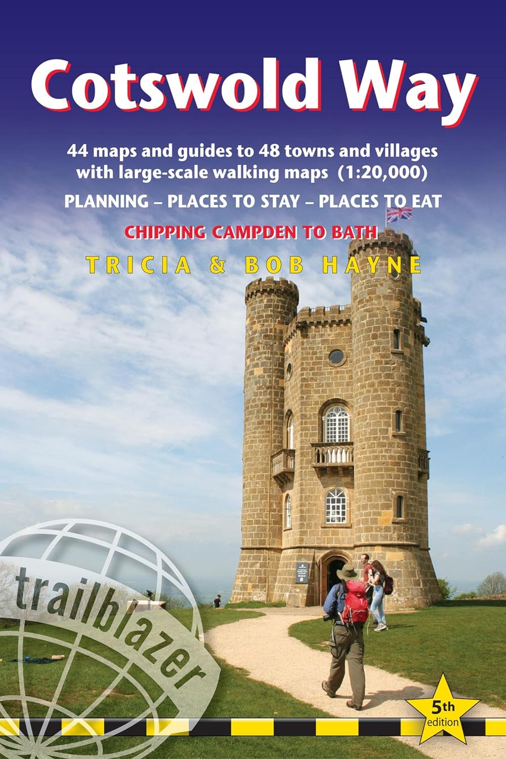
All-in-one hiking route guide and maps for the Cotswold Way, a 102-mile National Trail that runs from Chipping Campden to Bath, following the beautiful Cotswold escarpment, this is the fully revised and updated 4th edition. The trail leads through quintessentially English countryside with little villages of honey-coloured stone to the well-known town of Bath. Includes:


* 44 large-scale maps at just under 1:20,000 (3 1/8 inches to 1 mile) - showing route times, places to stay, points of interest and much more and trail profiles;


* 8 town plans - Chipping Campden, Broadway, Winchcombe, Cheltenham, Painswick, Dursley, Wotton-under-Edge, and the city of Bath and 8 overview maps.


* Full details of all accommodations and campsites, teashops, restaurants and pubs with reviews.


* Itineraries for all walkers - whether walking the route in its entirety over seven to eight days or sampling the highlights on day walks and short breaks.


* Practical information for all budgets: where to eat, what to see.


* Comprehensive public transport information - for all access points on the Cotswold Way.


* Flora and fauna - four page full colour flower guide plus an illustrated section on local wildlife.


* Green hiking - understanding the local environment and minimizing our impact on it.


* Bath city guide.


* Downloadable gps waypoints.

€ 13.50
Reisgids Eyewitness Top 10 Chicago | Dorling Kindersley

Een compacte gids met veel illustraties, veel aandacht voor cultuur en bevolking en hier en daar praktische informatie. Kleine versie, handig in de binnenzak.

Admire Impressionist masterpieces at the Art Institute of Chicago, window shop on the Magnificent Mile, get a bird's eye view of four states from the Skydeck of Willis Tower or cruise along the river for for a great view of Chicago's landmark architecture: everything you need to know is clearly laid out within colour-coded chapters. Discover the best of Chicago with this indispensable travel guide.


Located on the shores of Lake Michigan, Chicago offers both urban and natural wonders in abundance - think soaring skyscrapers, art-filled parks, world-class museums, and beautiful beaches. Make the most of your trip to the Windy City with DK Eyewitness Top 10 Chicago. Planning is a breeze with our simple lists of ten, covering the very best that Chicago has to offer and ensuring that you don't miss a thing. Best of all, the pocket-friendly format is light and easily portable; the perfect companion while out and about. DK Eyewitness Top 10 Chicago is your ticket to the trip of a lifetime.


Inside DK Eyewitness Top 10 Chicago you will find:


-Detailed Top 10 lists of Chicago's must-sees including Millennium Park, the Art Institute of Chicago, Field Museum, and Chicago Riverwalk


-Easy-to-follow itineraries including ideas for day trips, weekends and a week's worth of plans to make the most out of each and every day


-Expert advice: honest recommendations on Chicago's most interesting areas, with the best places for shopping, eating out and sightseeing, with top tips on getting ready, getting around and staying safe


-Themed lists including the best skyscrapers, parks and beaches, niche museums, blues and jazz joints, and much more


-Practical tips: Inspiration for different things to enjoy during your trip, including family activities and things to do for free


-Detailed maps including a laminated pull-out map of Chicago, plus five full-colour area maps


-Covers: Chicago Highlights, Willis Tower and Its Views, The Art Institute of Chicago, Field Museum, Museum of Science and Industry, Navy Pier, John G. Shedd Aquarium, Chicago Riverwalk, Magnificent Mile, Millenium Park, Frank Lloyd Wright's Oak Park,Moments in History, Skyscrapers, Niche Museums, Film Locations, Parks and Beaches, Off the Beaten Path, Kid's Chicago, Performing Arts, Blues and Jazz Joints, Bars and Clubs, Places to Eat, Shopping Destinations, Chicago for Free, Festivals and Events, The Loop, Near North, Northside, South Loop, and Far South.


Looking for more on Chicago's culture, history, and attractions? Don't forget to check out DK Eyewitness Chicago.


€ 24.95
Wandelgids Bierwandelboek België | Luster

Liefhebbers van lekker bier en mooie wandelingen: deze gids is voor jullie!


De 40 wandelingen in dit boek zijn geselecteerd omwille van hun mooie setting maar ook (en niet in het minst) omwille van hun eindpunt: elke wandeling leidt je naar een brouwerij of café waar je van een goed glas bier kunt genieten.


Bij elke wandelroute krijg je gedetailleerde aanwijzingen: de moeilijkheidsgraad, de duur, de hoogteverschillen, de bezienswaardigheden onderweg, hoe je er geraakt met het openbaar vervoer…  Aan het einde van elke route wordt een lokale brouwerij of een authentiek café voorgesteld, en raadt de auteur een bier aan.


EEN NIEUWE REDEN OM OP WANDELTOCHT TE VERTREKKEN

WANDEL, PROEF, EN STEUN DE MICROBROUWERIJEN

OOK GESCHIKT VOOR WANDELAARS DIE LIEVER EEN THEETJE DRINKEN

MET GPX-FILES OM TE DOWNLOADEN

€ 15.50
Reisgids ANWB extra Nederland | ANWB Media

Beleef Nederland met de nieuwe reisgids ANWB Extra Nederland!

Beleef Nederland met de nieuwe reisgids ANWB Extra Nederland!  Als het even kan, trekken we in eigen land eropuit. Nederland biedt zo veel variatie: van de Rotterdamse haven tot de Waddenzee en van de heide en bossen van de Veluwe tot de Amsterdamse grachtengordel. 

De ANWB Extra reisgids Nederland biedt naast veel praktische tips over, hotels, restaurants en vervoer ook 15 inspirerende bezienswaardigheden die je niet mag missen. Doe een dagje bourgondisch Den Bosch, hop van Texel naar Schiermonnikoog of fiets langs containers en tankers in Rotterdam.

Deze kleine reisgids past gemakkelijk in de tas en heeft een handige uitneembare kaart met daarop de beste tips voor overnachten, winkelen, eten en drinken en uitgaan.


ANWB Extra is de succesvolste reisgidsenserie van Nederland! Met meer dan 120 gidsen biedt deze serie een reisgids voor nagenoeg iedere denkbare bestemming. 

€ 15.50
Reisgids ANWB extra Sydney | ANWB Media

Beleef Sydney met de nieuwe reisgids ANWB Extra Sydney! Sydney is een heerlijke stad voor een lang bezoek. Het jaarlijkse aantal zonuren is hoog en nodigt samen met de zee uit tot zonnen, zwemmen en surfen. Natuurreservaten met origineel bushland strekken zich uit tot de rand van de stad. Met de talloze hippe rooftopbars is deze onofficiële hoofdstad de perfecte bestemming tijdens je rondreis door Australië. De ANWB Extra reisgids Sydney biedt naast veel praktische tips over hotels, stranden en vervoer ook 15 inspirerende bezienswaardigheden die je niet mag missen. Ga op zoek naar Australische, Aziatische en Europese kunst in de Art Gallery of New South Wales, houd een kroegentocht door de historische wijk The Rocks of pak de veerboot naar Manly om volgens velen de mooiste boottocht van de wereld te maken. Deze kleine reisgids past gemakkelijk in de tas en heeft een handige uitneembare kaart met daarop de beste tips voor overnachten, winkelen, eten en drinken en uitgaan. ANWB Extra is de succesvolste reisgidsenserie van Nederland! Met meer dan 120 gidsen biedt deze serie een reisgids voor nagenoeg iedere denkbare bestemming.

€ 18.95
Wandelgids P056 Le Queyras et le Guillestrois... à pied | FFRP

Franstalige wandelgids met een beschrijving van een aantal dagtochten. Uitstekende beschrijvingen met duidelijk kaartmateriaal. Mislopen is nauwelijks mogelijk, maar ja .. de franse taal! Ook praktische informatie staat in deze gids. Alle gidsen bevatten een door ons toegevoegde uitgebreide frans - nederlandse wandelwoordenlijst.

Le Queyras et le Guillestrois sont intimement liés. L'accès principal au premier passe par le second. Le premier est constitué de vallées dominées par des pics dépassant les 3 000 m, mais possède un caractère accueillant qu'il doit à ses pentes raisonnables recouvertes de forêts et d'alpages, à ses cours d'eau nombreux, à son architecture originale et à son air de petite Engadine. Le second est plus ouvert sur la vallée de la Durance et présente des paysages plus vastes où la vue porte loin, sur les massifs voisins des Ecrins et de l'Ubaye. 

De nombreux cols les relient et font, comme par magie, passer d'un environnement de type steppique durancien à des paysages de douces prairies de montagnes piquetées de bosquets de mélèzes.

€ 9.95
Historische Kaart Waterloo 1815 | NGI - Nationaal Geografisch Instituut

Unieke historische kaart van Waterloo en dirercte omgeving waarbij de Slag om Waterloo in 1915 geografisch wordt weergegeven. Men heeft hiervoor een topografische kaart 1:50.000 gebruikt met daarop ingetekend de posities en richtingen van dee diverse legers. Op de achterzijde nog een aantal inzetten van deelgebieden met veel informatie, o.a. de herdenkingsplaatsen Ligny, Quatre Bras en Waver


€ 13.95
Wegenkaart - landkaart Banff - Jasper national parks | ITMB

Gedetailleerde wegenkaart van deze 2 bekende nationale parken in Canada. Naast toerischtische informatie zjn de belangrijkste wandelpaden schetsmatig ingetekend en worden de campings weergegeven, hogtelijnen geven een goed beeld van de hoogteverschillen en bergern in het gebied.. Jasper staat op de ene kant en Banff op de andere zijde. 

Banff is the first national park declared anywhere in the world, done at a time when the idea of reserving huge tracts of land for the enjoyment of future generations was an admirable, though unheard of, concept. The park in the Rocky Mountains of western Alberta remains as lovely and as enjoyable as it must have seemed to the early CPR railway surveyors searching for a route through the mountains to join the then-colony of British Columbia to Canada. Nowadays, the park is laced with roads and hiking trails, and the town of Banff within the park is severely pressed to maintain a balance between serving the needs of the millions of visitors each year and the responsibility of maintaining a pristine wilderness environment. This is the Number One national park in the world to this day! Immediately adjacent to Banff NP is Jasper National Park, which was created a bit later but for the same reason – to protect a wonderful pristine wilderness while pushing through a rail line to the coast to bind British Columbia more closely, but also to provide access to a second west coast port (Prince Rupert). The park has only one small urban area, the town of Jasper, and is home to the marvelous Columbia Icefield at the Athabasca Glacier, the loveliest lake in the world, Maligne, and the majestic peaks of the massive Victoria Range. As a bonus, Mount Robson Park is also included, as are townsite insets for both Banff and Jasper, so anyone visiting the Canadian Rockies can benefit from using this map.


Map size: 27*39"


This map is also available in digital format for $39.95 (per file) and flat map for $39.95 (per side). Please contact map@itmb.com if you would want to place an order or for more information.

Legend Includes:

Roads by classification, Railways, Elevation, Museum, Camping sites, skiing areas, Viewpoints, Hot Springs, Waterfalls and much more.


€ 19.95
Historische wereldkaart Wereld antiek 1651 90,5 x 69 cm | Freytag & Berndt

Historische wereldkaart uit het jaar 1651. Deze papieren wereldkaart wordt geleverd in een stevige plastic koker. 


The map is marked with the names of countries, major cities and ports of the time, along with the charted seas and islands. The exceptions are the extreme north of America, and Australia, which is alluded to as 'Psittacorum Regio or the Country of Parrots, soo called from ye extreaordinary and almost incredible bignes of those birds there'.


Surrounding the map are many interesting insets: the celestial hemispheres are shown, along with their  constellations; two diagrams explain pictorially how solar and lunar eclipses occur; 'A Figure of the Sphere' and 'The Heavens and Elements' occupy the top corners; and portraits of four notable explorers including Magellan and Drake are also shown.

€ 34.00
Wereldkaart Peters Projection - Peters Projectie 130 x 82 cm | Huber Verlag

Een bijzondere wereldkaart die gebruik maakt van de Peters Projectie. Hierdoor worden de oppervlaktes correct weergegeven op de kaart. Bekijk de wereld anders! 

De landen van de aarde in gebiedsbrede weergave. Peters projectie 1: 63.060 gerolde kaart Formaat: 82,5 x 129,5 cm Schaal: 1: 630 609 475 Arno Peters, een historicus uit Bremen, ontwikkelde voor onze tijd een nieuwe wereldkaart.

Trouw aan schaal in gebied, as en positie, reproduceert het nauwkeurig de verhoudingen van de noordelijke en zuidelijke hemisferen. De Peters-wereldkaart is een verfrissende afwijking van de verouderde Eurocentrische kijk die onze kijk op de wereld al 400 jaar beïnvloedt. De Peters-kaart toont elk land in zijn werkelijke gebiedsgrootte en op een direct vergelijkbare basis.

The Fidelity Pojection is gebaseerd op het decimale gradennetwerk gecreëerd door Arno Peters. Het verdeelt het aardoppervlak - waarbij de 0-merdian op de gecorrigeerde datumlijn wordt geplaatst - in 100 velden met gelijke breedte en 100 velden met gelijke breedte, kwadrateert de rechthoeken die zich op de evenaar bevinden en construeert het resterende vlakke vlak waar gebied. De nummers van de nieuwe lengte- en breedtevelden zijn te vinden in de kaartgrens naast de cijfers van het conventionele gradennetwerk waarvan de lijnen zijn getekend.


Abonneer op