
Wandelgids 046 Pathfinder Guides Aberdeen & Royal Deeside | Ordnance Survey
Wandelgids van een deel van Schotland. Deze gids bevat 28 dagwandelingen, variërend van korte tochten tot pittige dagtochten. De bijbehorende kaarten zijn uitstekend: men heeft de topografische kaarten van Ordnance Survey gebruikt waarop de route is ingetekend. Daarnaast praktische informatie over de wandeling en wat beschrijvingen van het gebied.
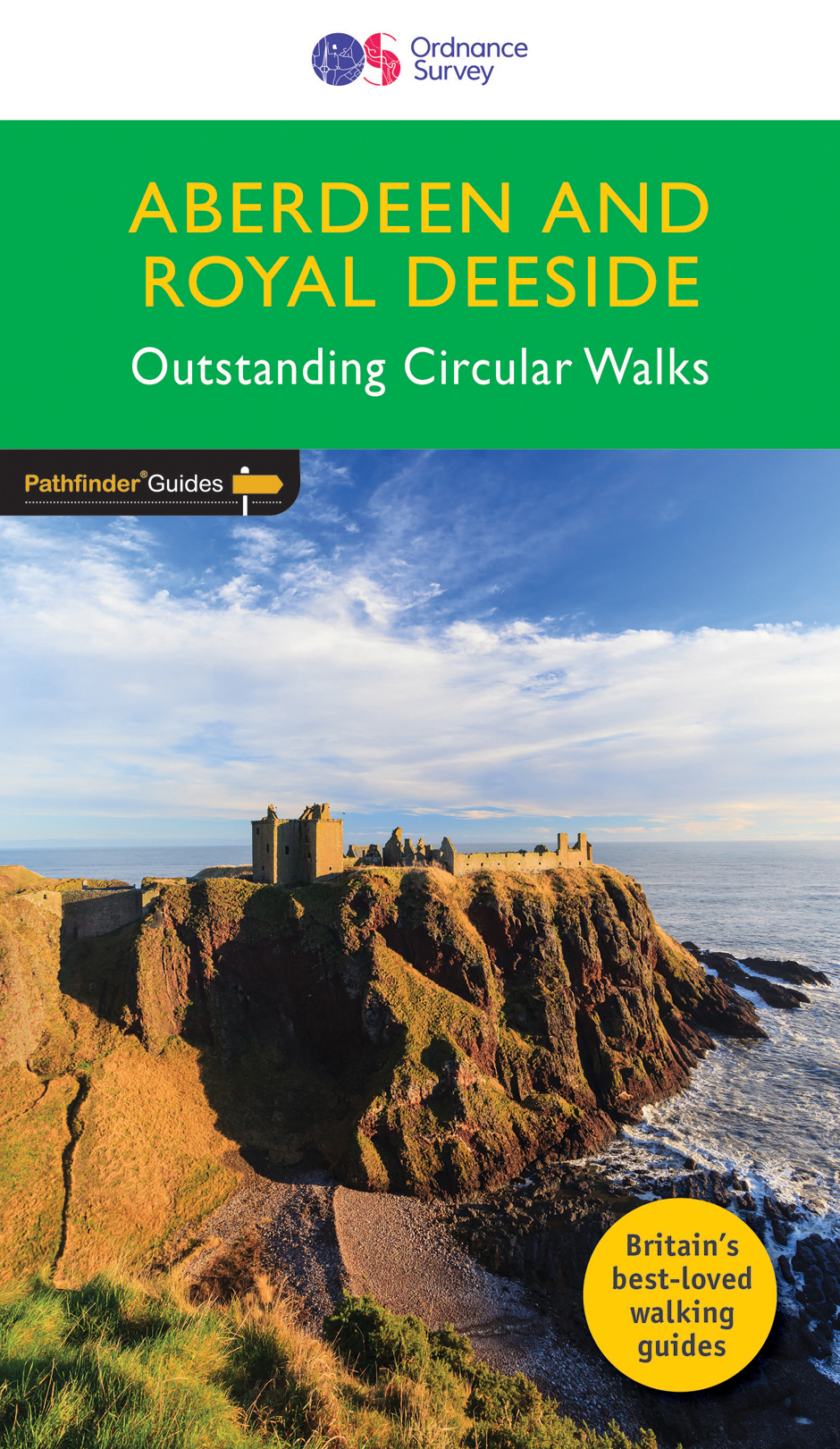
The Aberdeen and Grampian Tourist Board describes the area as 'Royal Deeside, Whisky, Castles and Coast' and it is easy to see why. The royal connection is most obvious around Balmoral, and there are castles and distilleries throughout the area.
There are also spectacular coastal routes, such as Collieston and the Sands of Forvie, Cruden Bay and the Bullers of Buchan, and a route from Cullen along a disused railway that takes walkers past Bow Fiddle Rock. Magnificent views of the surrounding countryside can be seen from Scolty Hill, Tap o'Noth (site of an Iron Age fort) and Tyrebagger Hill.
This book features details of 28 circular, graded walks all tried and tested by seasoned walkers. The routes range from extended strolls to exhilarating hikes, so there is something for everyone.
€ 18,50
Verzendkosten: € 2,95Specificaties
Merk:
n.b.
EAN:
Je bestelt bij:
De Zwerver
Categorie:
Subcategorie:
Maat:
n.v.t.
Materiaal:
n.v.t.
Levertijd:
Aantal beschikbaar:
n.b.
Verkoopprijs
€ 18,50
Prijzen vanaf:
n.v.t.
Verzendkosten:
€ 2,95
ISBN:
9780319090558
Editie:
29-05-2017
Uitgever:
Ordnance Survey
Beschrijft het volgende gebied:
Europa - Schotland - Schotse Hooglanden & Speyside
Taal:
Engels
Direct bestellen: