
Wandelgids Northumberland Coast Path | Aurum Press
Goede beschrijving van de aantrekkelijke route. Kaartmateriaal van Ordnance Survey - de Engelse topografische dienst op een schaal van 1:25.000. Praktische info voor overnachten ed. niet altijd uitgebreid, maar die is op de site van de Ramblers (de engelse wandelorganisatie) te vinden.
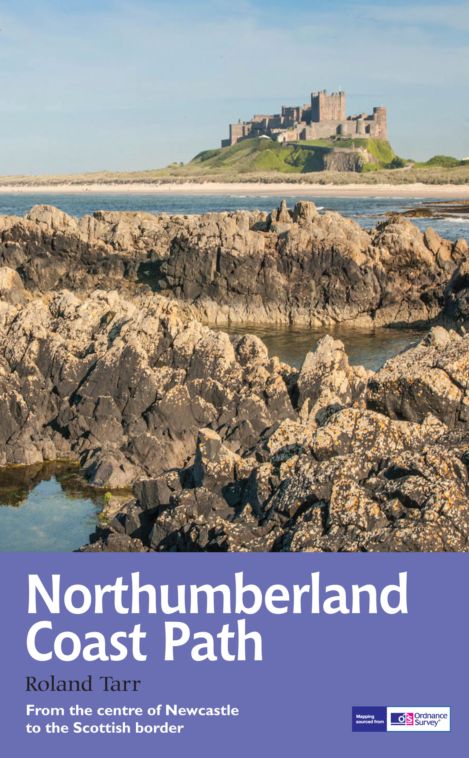
The Northumberland coastline stretches from the outskirts of Newcastle up to the Scottish border at Berwick-upon-Tweed – a popular holiday destination for its wild and sweeping landscape of endless beaches of pale sand, succession of spectacular castles like Bamburgh and Dunstanburgh, congenial resorts like Alnmouth, and unique offshore attractions like Holy Island and the Farne Islands. Now, Roland Tarr’s new Trail Guide maps out the walker’s route along the entire coast, starting from the centre of Newcastle and including an extension beyond Berwick to the seabird crags of St Abb’s Head.
Along the way the guide covers the remarkable industrial heritage of this coastline – the coalmining town of Ashington that gave birth to both the Ashington Group of Pitmen Painters and the Charlton brothers – and its fabulous wildlife, with seals and puffins off the shore. From a handsome Tyneside city to a distinguished border town straddling the Tweed, this is a superbly bracing walking country for the ever-increasing number of tourists who discover Northumberland every year.
€ 20,95
Verzendkosten: Zie website leverancierSpecificaties
Merk:
n.b.
EAN:
Je bestelt bij:
De zwerver
Categorie:
Subcategorie:
Maat:
n.v.t.
Materiaal:
n.v.t.
Levertijd:
Aantal beschikbaar:
n.b.
Verkoopprijs
€ 20,95
Prijzen vanaf:
n.v.t.
Verzendkosten:
Zie website leverancier
ISBN:
Editie:
Uitgever:
Beschrijft het volgende gebied:
Europa - Engeland -
Taal:
Direct bestellen: