
Wandelkaart 02 Tignes - Val d'Isere - Gran Paradiso | L'Escursionista editore
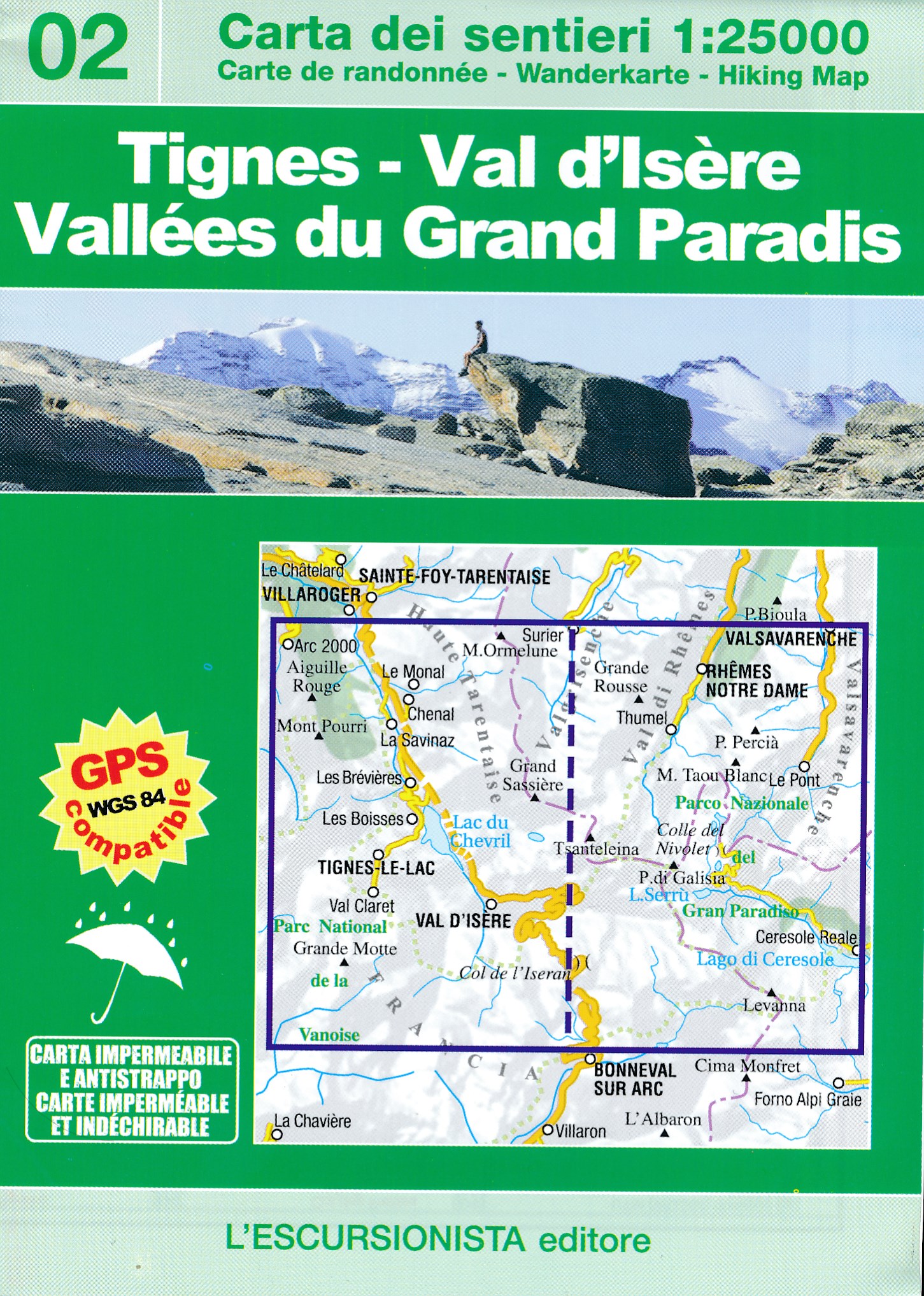
Wandelkaart nr. 02 uit de grensoverschrijdende serie Italië/Frankrijk. Het beslaat het gebied van de bovenste Valgrisenche, Val di Rhêmes en Valsavarenche (Valle d'Aosta), Valle dell'Orco (Piemonte), de gemeenten Tignes en Val d'Isère (Haute Tarentaise), reikend tot aan de poorten van de stad Bonneval-sur-Arc (Haute Maurienne) en Les Lanches (in de Peisey-Nancroix-vallei). Met bewegwijzerde wandel- en mountainbikeroutes, evenals alle kleinere routes. Gedrukt op water- en scheurvast papier, met satellietvolging van de paden via GPS. Verpakt in plastic zak met fotogids van 32 pagina's.
De kaart is gedrukt op scheur- en watervast papier en tweezijdig bedrukt.
This publication is the first of a series of hiking maps of the border mountains between Italy and France. The map covers the areas surrounding La Thuile (Italy) and Bourg-Saint-Maurice, Montvalezan, Sainte Foy-Tarentaise, Séez, Villaroger, including the ski resorts of La Rosière and Les Arcs (France - Haute Tarentaise). The map includes all hiking and mountain-bike routes. It is printed on water resistant paper and is GPS compatible. The product comes in a plastic cover with a photographic booklet included. All marked paths have been mapped on foot with a GPS device.
€ 15,95
Verzendkosten: € 2,95Specificaties
Merk:
n.b.
EAN:
Je bestelt bij:
De Zwerver
Categorie:
Subcategorie:
Maat:
n.v.t.
Materiaal:
n.v.t.
Levertijd:
Aantal beschikbaar:
n.b.
Verkoopprijs
€ 15,95
Prijzen vanaf:
n.v.t.
Verzendkosten:
€ 2,95
ISBN:
9788898520626
Editie:
2017
Uitgever:
L'Escursionista editore
Beschrijft het volgende gebied:
Europa - Frankrijk - Alpen - Vanoise - Savoie
Taal:
Direct bestellen: