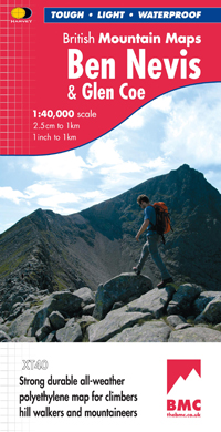
Wandelkaart Ben Nevis & Glen Coe | Harvey Maps
"This excellent Ben Nevis and Glen Coe map provides all the details needed for safe navigation on these iconic mountains". Cameron McNeish, outdoor writer and broadcaster.
Detailed map for hillwalkers and climbers of Ben Nevis and Glen Coe at 1:40,000 scale.
Section on navigation on Ben Nevis and detailed 1:15,000 enlargement of the summit with bad visibility descent route.
The map area includes 44 Munros, 14 Corbetts and 9 Grahams.
Serious map for serious mountains. The latest addition to the British Mountain Map series is a real heavyweight. Ben Nevis/Glencoe is the first Scottish title in this highly successful & innovative range. The map at 1:40000 has 43 Munros & 14 Corbetts on one sheet & is printed on polyethylene which is durable, tearproof & 100% waterproof. There is also colour shading for easy identification of hills and valleys & weighs less than half the weight of a laminated map. The reverse of the map has an enlargement of Ben Nevis summit, a Geological map, navigation advice & useful local phone numbers & websites.
€ 29,95
Verzendkosten: Zie website leverancierNu bestellen bij De Zwerver

