
Wandelkaart NS504 Upper and Lower Dolpa - Dolpo | Himalayan Maphouse
Goede duidelijk leesbare map voor trekkings in Dolpo. Van Juphal en Jejargaon in het westen tot Kagbeni in Mustang aan de oostkant van de kaart. De trekkingroutes staat goed ingetekend. Shey Phoksundo National Park staat er ook geheel op.
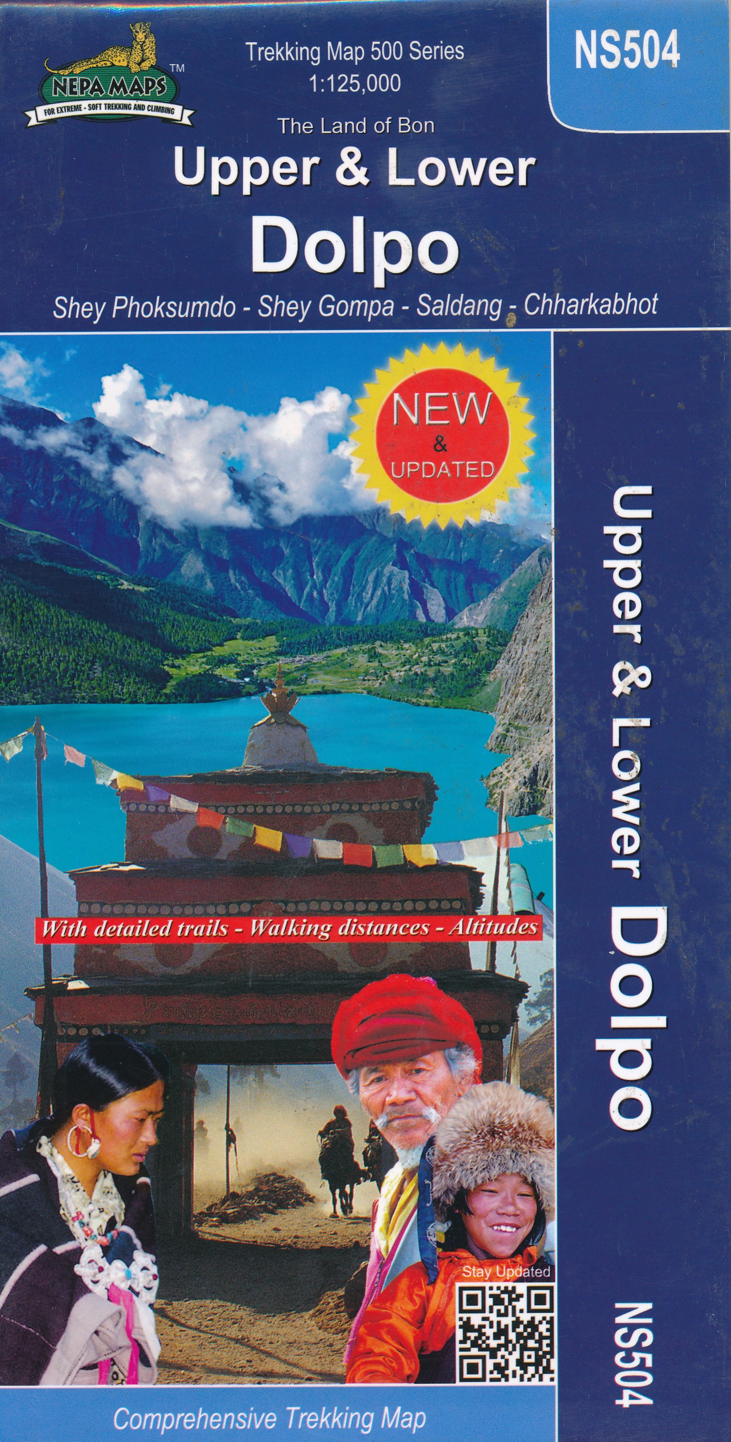
Large area centred on Dho Tarap, lying between the Upper and Lower Dolpa regions, in the Nepa Maps series which provides extensive coverage of trekking areas of Nepal on detailed contoured maps with trekking routes and hiking trails, huts and camp sites, local places of interest and other tourist information.
Cartography is based on the country’s topographic survey, with contours usually at 40m or 50m intervals, enhanced by relief shading, colouring and graphics to show various features of the terrain, including glaciers, forested or cultivated areas, etc. Numerous peaks, with additional spot heights, plus names of glaciers and mountain ranges are prominently shown. The network of rivers, streams and lakes is shown in great detail, with many smaller rivers and lakes named.
Overprint highlights main trekking routes and numerous local trails, with symbols indicating various places of interest and tourist facilities. Most maps are indexed and include additional information such as route profiles, glossaries, etc. All the information is in English and heights are given in metres.
*In this title:* trekking map of a large area centred on Dho Tarap, lying between the Upper and Lower Dolpa regions. Coverage extends from Jomsom and Muktinath in the south east to Kanjirowa peak in the north west. Much of the Shey Phoksumdo National Park is thus included. Trekking routes include the Dolpa Experience circuit and routes connecting Jomsom to Ringmogaon.
Contours are at 80m intervals, with bold relief shading and vegetation colouring. Index lists places, peaks, passes, lakes and monasteries. Margin ticks show latitude and longitude at intervals of 5’. Additional information includes tables showing the route in stages with altitudes in metres and feet and trekking times.
€ 12,95
Verzendkosten: € 2,95Specificaties
Merk:
n.b.
EAN:
Je bestelt bij:
De Zwerver
Categorie:
Subcategorie:
Maat:
n.v.t.
Materiaal:
n.v.t.
Levertijd:
Aantal beschikbaar:
n.b.
Verkoopprijs
€ 12,95
Prijzen vanaf:
n.v.t.
Verzendkosten:
€ 2,95
ISBN:
9789937649308
Editie:
meest recente versie
Uitgever:
Himalayan Maphouse
Beschrijft het volgende gebied:
Azië - Nepal - Himalaya
Taal:
Engels
Direct bestellen: