
Wandelkaart Picos de Europa National | Adrados Ediciones
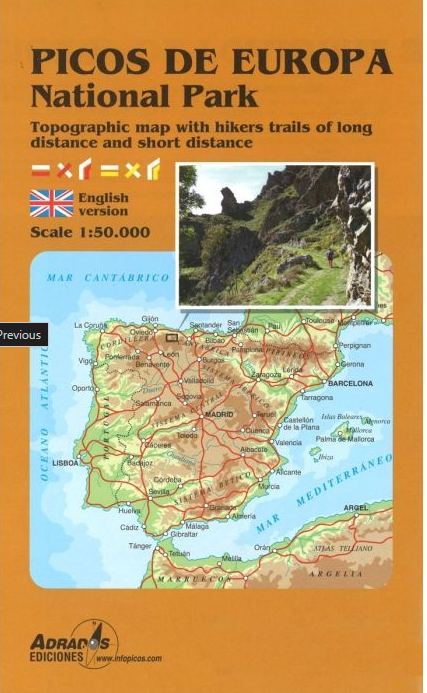
Picos de Europa National Park Short and Long-Distance Trails at 1:50,000 on an excellent, contoured and GPS compatible map from Adrados Ediciones highlighting three hiking routes which can be combined into a Tour of the Picos, plus English language descriptions of the routes and lists of mountain huts and refuges.
The map covers the whole of the National Park area and extends north and west beyond its borders to include Potes and other surrounding villages. Very fine cartography provides an excellent presentation of the terrain through contours at 20m intervals enhanced by relief shading and altitude colouring, numerous spot heights, and plenty of names of peaks and other topographic features. Symbols highlight locations of campsites, mountain huts, refuges and hostels, as well as petrol stations on local roads. The map has a 1-km UTM grid.
A special feature of this map is an overprint highlighting three long-distance hiking routes: a circuit of the western massif, a traverse of the central and the eastern massifs, plus additional stages which together with parts of the first two routes can be combined into a Tour of the Picos de Europa. On the reverse the three routes have stage-by-stage descriptions, illustrated with colour photos. Also provided are details of local mountain huts and refuges. Map legend and all the text are in English.
€ 14,95
Verzendkosten: € 2,95Specificaties
Merk:
n.b.
EAN:
Je bestelt bij:
De Zwerver
Categorie:
Subcategorie:
Maat:
n.v.t.
Materiaal:
n.v.t.
Levertijd:
Aantal beschikbaar:
n.b.
Verkoopprijs
€ 14,95
Prijzen vanaf:
n.v.t.
Verzendkosten:
€ 2,95
ISBN:
9788494080784
Editie:
meest recente editie
Uitgever:
Adrados Ediciones
Beschrijft het volgende gebied:
Europa - Spanje - ♦ Picos de Europa
Taal:
Direct bestellen: