
Wandelkaart Snowdonia Zuid | Harvey Maps
"The 1:40,000 scale used by British Mountain Maps is excellent for hill walking. These maps provide clear, detailed information." Sir Chris Bonington, mountaineer.
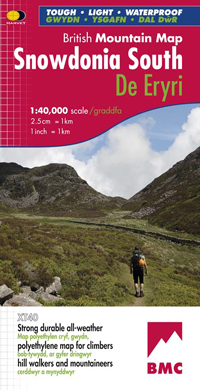
The key mountains of Southern Snowdonia on one map at 1:40,000 scale.
Includes Cadair Idris, the Arans and Arenig Fawr.
Snowdonia South is the latest title in the highly successful and innovative British Mountain Map series. It adjoins existing title, Snowdonia and covers the very popular Cadair Idris, the Rhinogs, the Arans and Arenig Fawr. Printed on polyethylene this map is durable, tearproof and 100% waterproof. Colour shading is used for easy identification of the hills and valleys. The map is also less than half of the weight of a laminated map. The reverse side of the map includes a map extension south to Aberdovey, a geological map, mountain incident, first aid and navigation advice. Local phone numbers and website addresses are also listed.
€ 29,95
Verzendkosten: € 2,95Specificaties
Merk:
n.b.
EAN:
Je bestelt bij:
De Zwerver
Categorie:
Subcategorie:
Maat:
n.v.t.
Materiaal:
n.v.t.
Levertijd:
Aantal beschikbaar:
n.b.
Verkoopprijs
€ 29,95
Prijzen vanaf:
n.v.t.
Verzendkosten:
€ 2,95
ISBN:
9781851374694
Editie:
20-07-2010
Uitgever:
Harvey Maps
Beschrijft het volgende gebied:
Europa - Engeland - ♦ Snowdonia Nationaal Park
Taal:
Direct bestellen: