
Wandelkaart Torres del Paine | Viachile Editores
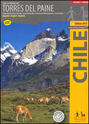
Topografische wandelkaart met hoogtelijnen en toeristische informatie van het nationaal park Torres del Paine (Patagonie) in het zuiden van Chili.
The most complete map to explore the world famous Torres del Paine National Park, in the Chilean Patagonia. With pictures of the most beautiful attractions and drawings of the local fauna. Information in three languages (English-German-Spanish).
Map 1:100,000: Covers the whole National Park, with hiking routes (distances in km), lodgings, campings, boat connections etc.
Map 1:50,000: The Paine massif in the center of the park, with Paine Circuit, W hike, hiking trails (distances in km), huts, hotels, campings etc.
Map 1:500.000: Overview map of the Ultima Esperanza county between Puerto Natales and the Torres del Paine National Park
City map Puerto Natales: With hotels, restaurants, bus terminals, supermarkets etc.
€ 18,95
Verzendkosten: Zie website leverancierSpecificaties
Merk:
n.b.
EAN:
Je bestelt bij:
De Zwerver
Categorie:
Subcategorie:
Maat:
n.v.t.
Materiaal:
n.v.t.
Levertijd:
Aantal beschikbaar:
n.b.
Verkoopprijs
€ 18,95
Prijzen vanaf:
n.v.t.
Verzendkosten:
Zie website leverancier
ISBN:
Editie:
Uitgever:
Beschrijft het volgende gebied:
Zuid-Amerika - Chili -
Taal:
Direct bestellen: