
Wandelkaart Yorkshire Dales Noord West | Harvey Maps
Covers a large area yet is handily compact. Pocket perfect!
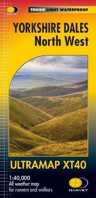
Detailed map for runners and walkers of the north western part of the Yorkshire Dales National Park at the magic scale of 1:40,000.
Features the Howgill Fells, the Calf, Cautley Crag, and Wild Boar Fell. Includes Sedbergh, Hawes and Kirkby Stephen.
€ 19,50
Verzendkosten: € 2,95Specificaties
Merk:
n.b.
EAN:
Je bestelt bij:
De Zwerver
Categorie:
Subcategorie:
Maat:
n.v.t.
Materiaal:
n.v.t.
Levertijd:
Aantal beschikbaar:
n.b.
Verkoopprijs
€ 19,50
Prijzen vanaf:
n.v.t.
Verzendkosten:
€ 2,95
ISBN:
9781851375813
Editie:
15-03-2016
Uitgever:
Harvey Maps
Beschrijft het volgende gebied:
Europa - Engeland - ♦ Yorkshire Dales Nationaal Park
Taal:
Direct bestellen: