
Wandkaart 56P Europa, 139 x 100 cm | Maps International
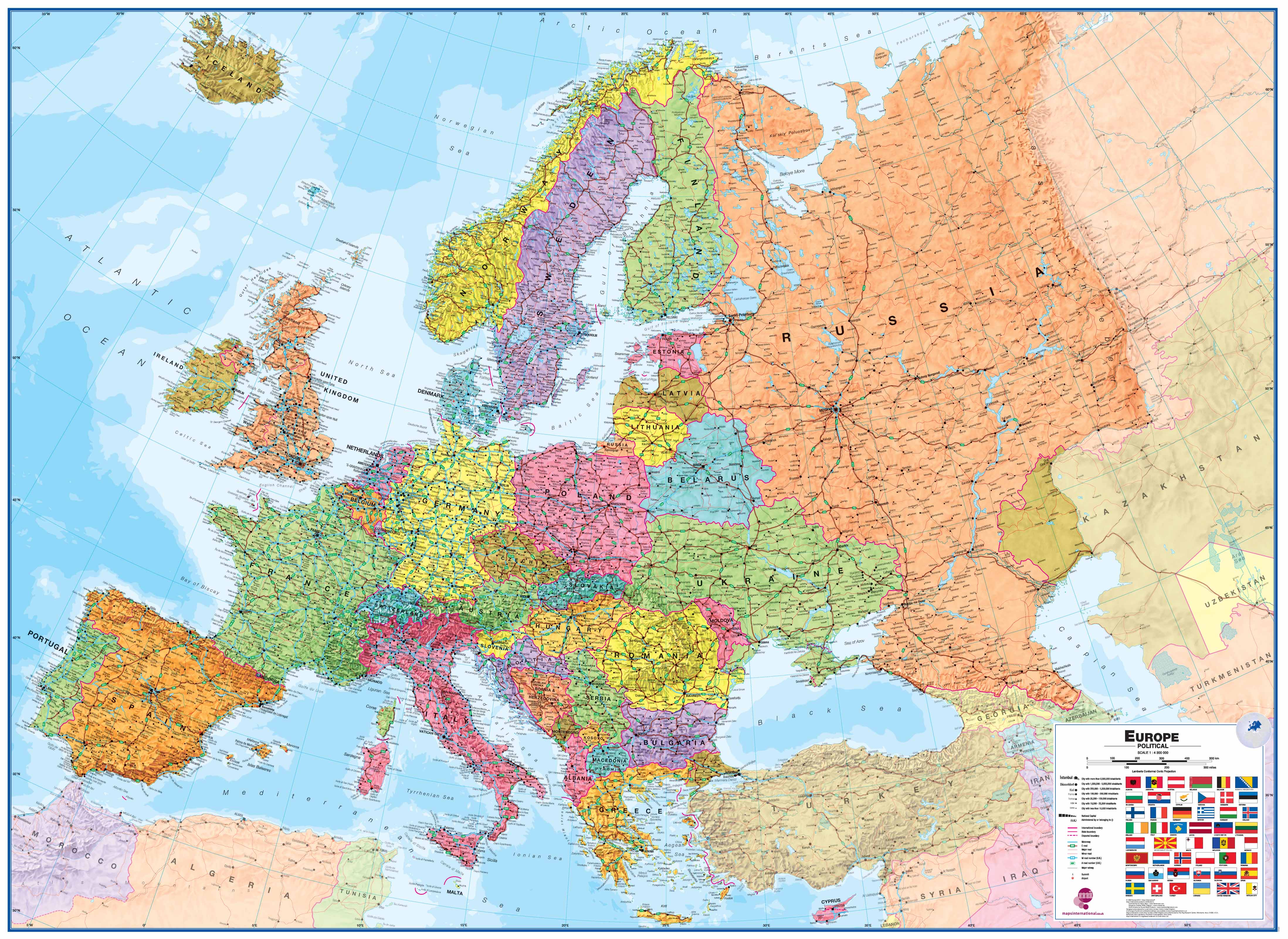
Fraaie politieke kaart van het continent, waarbij vooral de politieke aspecten heel duidelijk te lezen zijn. Alle landen hebben verschillende kleuren, steden en belangrijke verbindingen zijn goed te vinden. geplastificeerde versie.
Maps International's large European political wall map is great looking map available to buy.
This politically coloured wall map of Europe features countries marked in a different colour, with international boundaries shown. All major towns and cities are featured within our large map of Europe. Map contains hill and sea shading adding to the vibrant overall effect. The wall map also contains a section showing the different flags of countries in Europe.
Maps International's Europe map is available either plain or laminated. If you are looking to buy a map of Europe, you won't be disappointed with this large stunning wall map.
€ 38,95
Verzendkosten: € 5,95Specificaties
Merk:
n.b.
EAN:
Je bestelt bij:
De Zwerver
Categorie:
Subcategorie:
Maat:
n.v.t.
Materiaal:
n.v.t.
Levertijd:
Aantal beschikbaar:
n.b.
Verkoopprijs
€ 38,95
Prijzen vanaf:
n.v.t.
Verzendkosten:
€ 5,95
ISBN:
9781903030677
Editie:
15-05-2023
Uitgever:
Maps International
Beschrijft het volgende gebied:
Europa - -
Taal:
Engels
Direct bestellen: