
Wandkaart Centraal Amerika, 73 x 55 cm | National Geographic
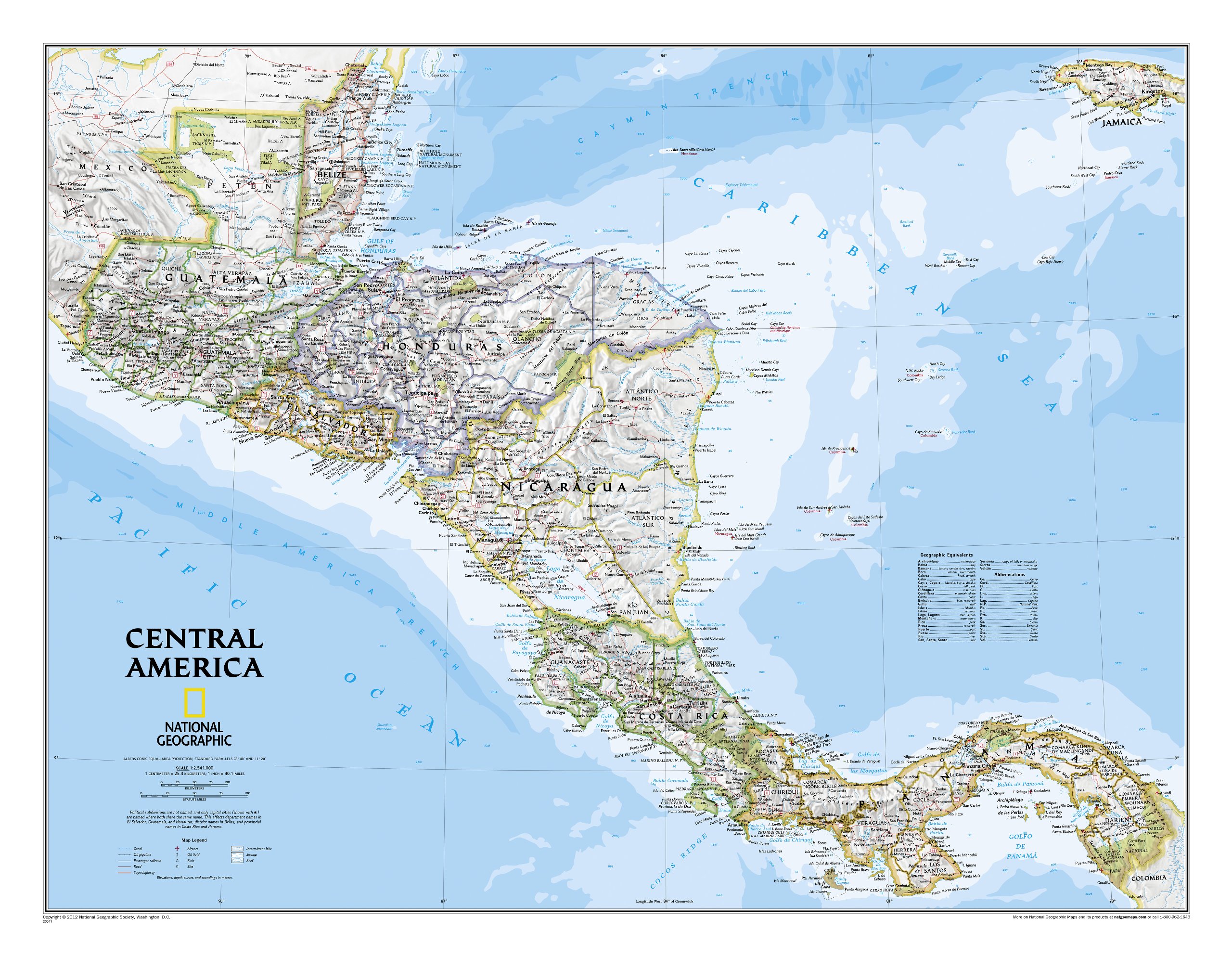
This Central America Wall Map by National Geographic contains extensive political information with political boundaries clearly presented with different color-bands for each country. Beautifully shaded to show physical terrain, this map is both a useful reference tool and a quality piece of art, perfect for any home, office or classroom.
Details featured on this wall map of Central America include:
• Political Boundaries
• Major Cities and Capitals
• Physical Terrain Shading
• Mountain Ranges, Highest Point
• Lakes, Seas, Rivers and Waterways
• Sand, Swamp, Salt Desert, Dry Salt Lake or Coral Reef
• Latitude and Longitude Lines
• Basic Bathymetry (Ocean Depths)
• Major Airports
• National Parks
• Major Roads and Highways
• Oil Fields, Railroads, and Ruins
€ 31,95
Verzendkosten: € 5,95Specificaties
Merk:
n.b.
EAN:
Je bestelt bij:
De Zwerver
Categorie:
Subcategorie:
Maat:
n.v.t.
Materiaal:
n.v.t.
Levertijd:
Aantal beschikbaar:
n.b.
Verkoopprijs
€ 31,95
Prijzen vanaf:
n.v.t.
Verzendkosten:
€ 5,95
ISBN:
9780792250241
Editie:
None
Uitgever:
National Geographic
Beschrijft het volgende gebied:
Midden-Amerika - -
Taal:
Engels
Direct bestellen: