
Wandkaart Cuba, 92 x 61 cm | National Geographic
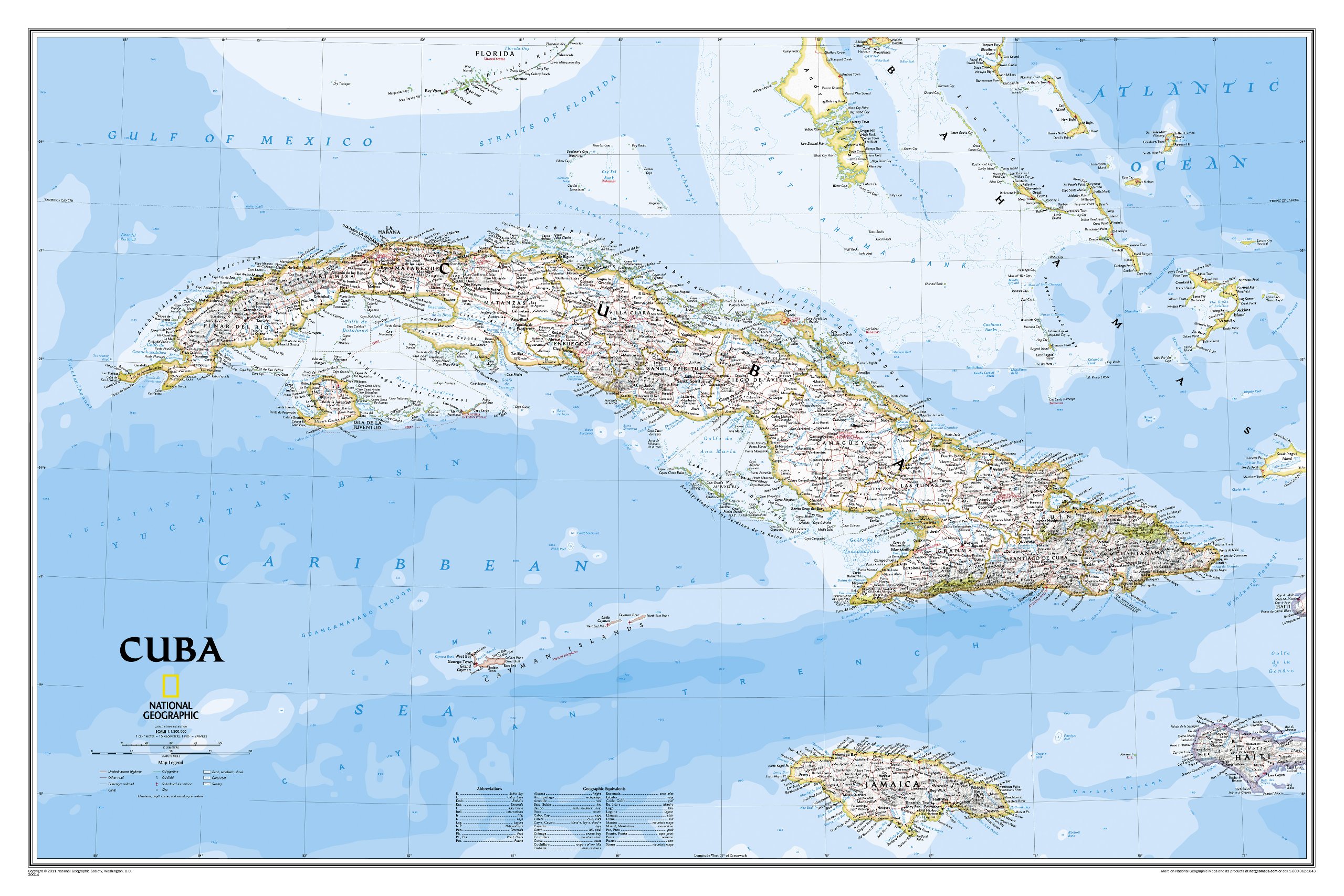
The most accurate and richly detailed reference map available for the iconic Caribbean island nation, our Cuba Classic Map contains National Geographic’s proprietary fonts and world recognized border bands in a bright and appealing color palette with striking blue oceans on a crisp white background.
Cuba’s many offshore islands, reefs, and rivers are noted, as are sites of interest. Ocean bathymetry with depth curves and soundings, peak elevations, and handcrafted shaded relief provide topographical detail. Jamaica, the Cayman Islands, the Florida Keys, and most of the Bahamas and Haiti are shown, presenting Cuba in the context of its important geographical position in the Caribbean.
Cuba contains thousand of place names, accurate political boundaries, and infrastructure making it the perfect reference for student, home, or business.
Additional content unique to this map includes:
Sites of interest including national parks and reserves
Geographic equivalents provide translations from Spanish to English
Transportation detail including highways, roads, canals, ferry routes, and airports
Geographical detail including mountain relief, swamps, and coastal reefs
Elevations, depth curves, and soundings
Coverage includes Havana, Pinar del Rio, Baracoa, Trinidad, Caya Largo, Santa Clara, Varadero, Isla de la Juventad
€ 34,95
Verzendkosten: € 5,95Specificaties
Merk:
n.b.
EAN:
Je bestelt bij:
De Zwerver
Categorie:
Subcategorie:
Maat:
n.v.t.
Materiaal:
n.v.t.
Levertijd:
Aantal beschikbaar:
n.b.
Verkoopprijs
€ 34,95
Prijzen vanaf:
n.v.t.
Verzendkosten:
€ 5,95
ISBN:
9781597754385
Editie:
None
Uitgever:
National Geographic
Beschrijft het volgende gebied:
Midden-Amerika - Cuba -
Taal:
Engels
Direct bestellen: