
Wandkaart Noord Amerika, politiek, 100 x 120 cm | Maps International
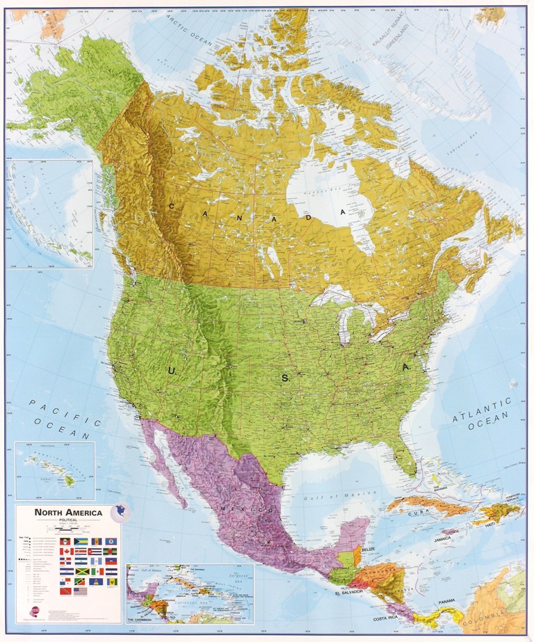
Fraaie politieke kaart van het continent, waarbij vooral de politieke aspecten heel duidelijk te lezen zijn. Alle landen hebben verschillende kleuren, steden en belangrijke verbindingen zijn goed te vinden. Dit is geplastificeerde uitvoering zonder ophangsysteem.
Maps International's North America political wall map covers a huge expanse of land from Alaska and Canada through the United States down to Mexico, Central America and the Caribbean. One of the finest maps money can buy!
This political wall map of North America features countries shown in different colours, international boundaries and major transport networks. The wall map also contains a panel of flags relating to the countries shown in this North American continent map. Also shown is city population detail, capital cities and all the major towns and cities in this continent of North America.
Maps International's North America map is available either plain or laminated. Ideal for an office, classroom or when planning a trip to this American continent.
€ 38,95
Verzendkosten: € 5,95Specificaties
Merk:
n.b.
EAN:
Je bestelt bij:
De Zwerver
Categorie:
Subcategorie:
Maat:
n.v.t.
Materiaal:
n.v.t.
Levertijd:
Aantal beschikbaar:
n.b.
Verkoopprijs
€ 38,95
Prijzen vanaf:
n.v.t.
Verzendkosten:
€ 5,95
ISBN:
9781904892045
Editie:
02-09-2022
Uitgever:
Maps International
Beschrijft het volgende gebied:
Noord-Amerika - Canada -
Taal:
Engels
Direct bestellen: