
Wandkaart Spanje, 70 x 50 cm | CNIG - Instituto Geográfico Nacional
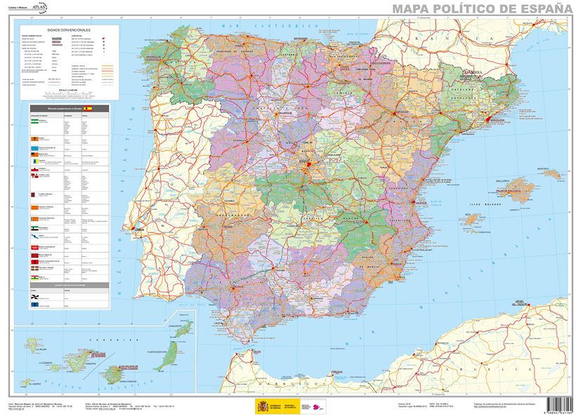
Administrative provinces of Spain shown in bright colours on a wall map at 1:2,250,000, size 70 x 50cm (27.5" x 20" approx), from IGN/CNIG - the country’s civilian survey organization, plus a panel of regional flags. Each province is presented in a different colour and the map also shows boundaries and names of administrative regions. Town symbols and names indicate their size and administrative status. The map shows the network of main roads and railways. Latitude and longitude lines are drawn at intervals of 1°. Map legend is in Spanish only.
Next to the map is a panel listing Spain’s autonomous regions, including Ceuta and Melilla, each with its flag, plus a list of its constituent provinces and their capitals.
Mapa General de España (Península Ibérica, Baleares, Canarias, Ceuta, Melilla y posesiones españolas en el norte de África) a escala 1:2.000.000, con división autonómica. Proyección Lambert.
€ 16,95
Verzendkosten: € 5,95Specificaties
Merk:
n.b.
EAN:
Je bestelt bij:
De Zwerver
Categorie:
Subcategorie:
Maat:
n.v.t.
Materiaal:
n.v.t.
Levertijd:
Aantal beschikbaar:
n.b.
Verkoopprijs
€ 16,95
Prijzen vanaf:
n.v.t.
Verzendkosten:
€ 5,95
ISBN:
9788441637160
Editie:
01-12-2015
Uitgever:
CNIG - Instituto Geográfico Nacional
Beschrijft het volgende gebied:
Europa - Spanje -
Taal:
Spaans
Direct bestellen: