
Wegenatlas Easy to Read Road Atlas Britain 2025 | Philip's Maps
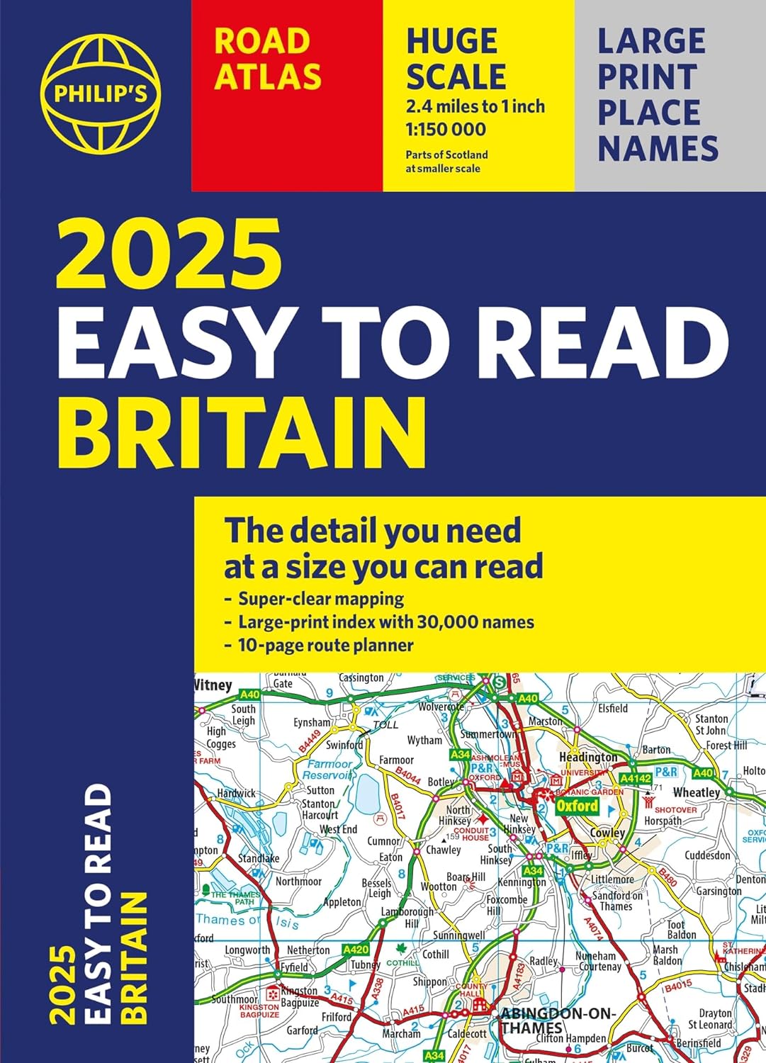
"The detail you need at a size you can read". The latest 2025 Philip's Easy to Read Road Atlas of Britain from the best-selling Road Atlas range has over 350 pages packed with exceptionally clear mapping and everything you need for exploring Britain. Now available as a practical paperback, it will enhance any trip.
· Clear maps packed with extra details for a better journey
· Huge 1:150,000 scale (approx 2.4 miles to 1 inch)
· Large print place names
· Large print index
· Super-clear 10-page route planner to create the best journeys
· Thousands of attractions clearly mapped, including castles, theme parks, gardens, zoos and more.
· London's expanded ULEZ clearly shown on approach mapping
At last, a road atlas that everyone can read easily, in or out of the car, no matter what the conditions. With up-to-date mapping technology, your travels have never been easier to plan. This edition contains a wealth of useful information, including tourist attractions, to ensure the best possible journey. Whether it's dark, or if you just can't find your glasses, the 2025 Philip's Easy to Read Road Atlas of Britain is the ultimate road companion.
€ 22,50
Verzendkosten: Zie website leverancierSpecificaties
Merk:
n.b.
EAN:
Je bestelt bij:
De Zwerver
Categorie:
Subcategorie:
Maat:
n.v.t.
Materiaal:
n.v.t.
Levertijd:
Aantal beschikbaar:
n.b.
Verkoopprijs
€ 22,50
Prijzen vanaf:
n.v.t.
Verzendkosten:
Zie website leverancier
ISBN:
Editie:
Uitgever:
Beschrijft het volgende gebied:
Europa - Engeland -
Taal:
Direct bestellen: