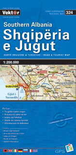
Wegenkaart - landkaart 324 Zuid Albanië - Shqipëria e Jugut | Vektor
Geplastificeerde wegenkaart van het zuiden van Albanië. De kaart bevat het volledige wegennetwerk, belangrijke toeristische bezienswaardigheden en een index met plaatsnamen.
A three-sheet set that gives complete coverage of Albania. The maps use contour lines, spot heights, and color tinting to show elevation and relief. Regional, prefectural, and some municipal boundaries are shown. Roads are clearly marked, many with distances between road junctions. Villages are marked and there is a city/village index and multilingual legend
€ 9,95
Verzendkosten: Zie website leverancierNu bestellen bij De zwerver
Specificaties
Merk:
n.b.
EAN:
Je bestelt bij:
De zwerver
Categorie:
Subcategorie:
Maat:
n.v.t.
Materiaal:
n.v.t.
Levertijd:
Aantal beschikbaar:
n.b.
Verkoopprijs
€ 9,95
Prijzen vanaf:
n.v.t.
Verzendkosten:
Zie website leverancier
ISBN:
Editie:
Uitgever:
Beschrijft het volgende gebied:
Europa - Albanië -
Taal:
Direct bestellen:

