
Wegenkaart - landkaart Adventure Travel Map Vancouver Island | National Geographic
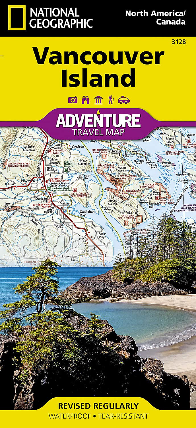
Wegenkaart van Vancouver Island met vermelding van veel bezienswaardigheden, nationale parken en attrakties. Watervast en scheurvast. Juist door deze vermeldingen onderscheidt de kaart zich van andere wegenkaarten.
National Geographic's Vancouver Island Adventure Map provides global travelers with the perfect combination of detail and perspective in a highly functional travel tool. Cities and towns are clearly indicated and easy to find in the user-friendly index. A road network complete with distances and designations for roads, motorways, and expressways will help you find the route that's right for you. Secondary routes are also marked for those seeking to explore off the beaten path. Hundreds of points of interest and diverse and unique destinations are highlighted including national parks, nature reserves, World Heritage sites, archeological sites, ski areas, hot springs, beaches, museums, and more.
The south side of the print map shows Victoria the capital of British Columbia, Pacific Rim National Park Reserve, and the costal town of Nanaimo. The northern half of the printed map covers the much more remote part of the island. There are many large protected areas in the north of the island including Strathcona, Cape Scott, Tahsish-Kwois Provincial Parks.
Every Adventure Map is printed on durable synthetic paper, making them waterproof, tear-resistant and tough -- capable of withstanding the rigors of international travel.
€ 17,50
Verzendkosten: € 2,95Specificaties
Merk:
n.b.
EAN:
Je bestelt bij:
De Zwerver
Categorie:
Subcategorie:
Maat:
n.v.t.
Materiaal:
n.v.t.
Levertijd:
Aantal beschikbaar:
n.b.
Verkoopprijs
€ 17,50
Prijzen vanaf:
n.v.t.
Verzendkosten:
€ 2,95
ISBN:
9781566958202
Editie:
meest recente editie
Uitgever:
National Geographic
Beschrijft het volgende gebied:
- -
Taal:
Direct bestellen: