
Wegenkaart - landkaart Denemarken | Hallwag
STRASSENKARTEN MIT DISTOGUIDE Aktuelle Information, übersichtliche Darstellung, einfache Handhabung: das Markenzeichen der Hallwag-Strassenkarten. Das internationale Programm mit neuen Ideen für besseres Reisen bietet Ihnen überzeugende Vorteile.
Distoguide - der eingebaute «Kilometerzähler» - auf der Aussenseite des Kartendeckels. Für den einfachen und schnellen Zugriff. Sehr praktisch für Planung und Reise! Mit Leichtigkeit lassen sich auf dem im Kartendeckel integrierten Distanzenschieber über 2000 Entfernungen ablesen. Massstab: 1 : 400 000
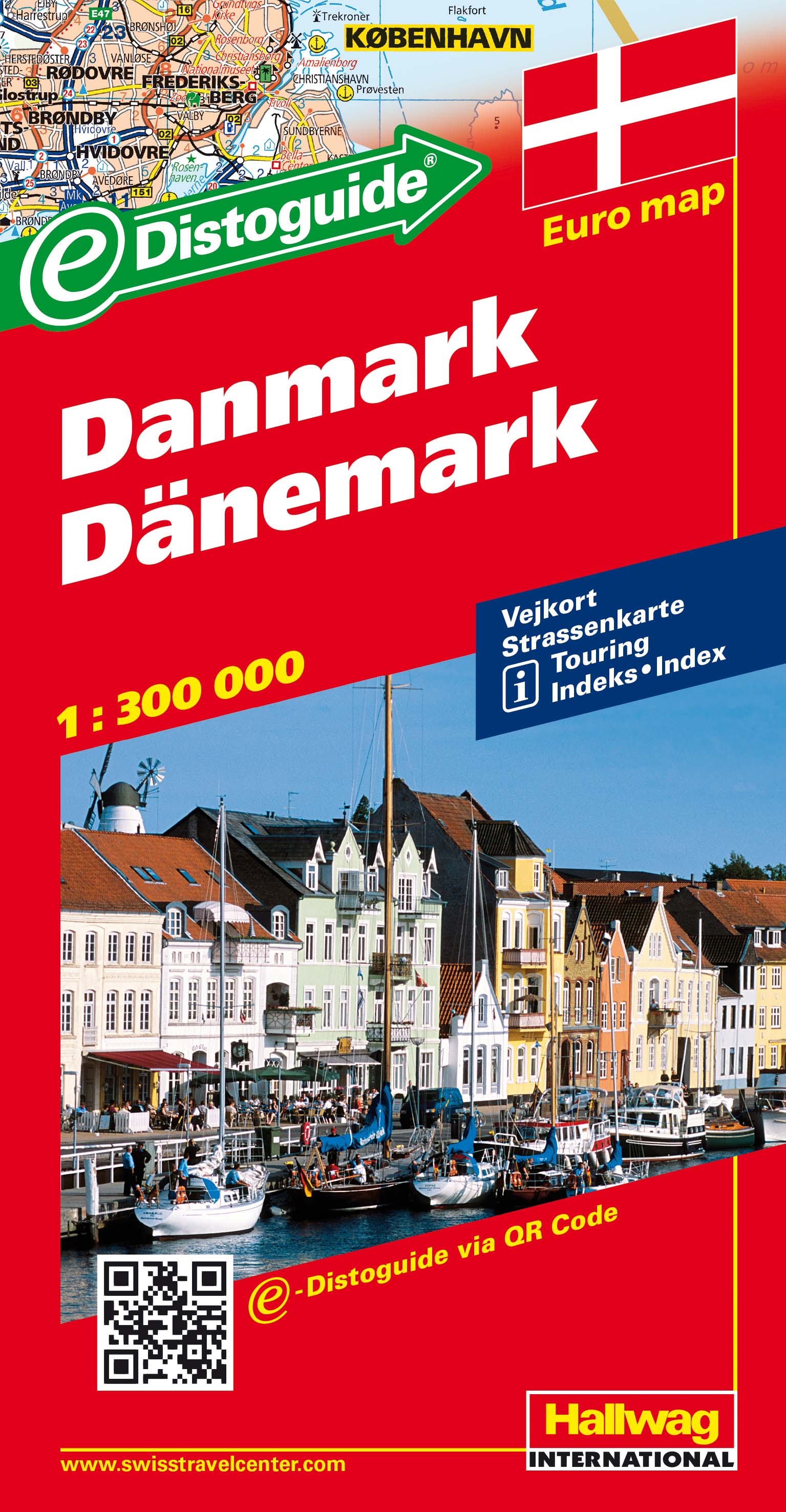
Detailed touring map of Denmark, also south-western Sweden between Malmo and Gothenburg and extending south to Hamburg and Bremenhaven and covering the whole of the Baltic coast of Germany. The map shows seven different kind of roads, with road names and junction numbers, intermediate driving distances in km, petrol stations, restaurants and motels along main roads. Railways, ferry lines and shipping routes, airports and administrative boundaries are also marked alongside spot elevation in metres, wood, heath and recommended beaches. A number of symbols also indicates places of interests, viewpoints, notable buildings and ruins, monuments and campsites. The map also includes a special "Distoguide" incorporated into the map cover, showing at a glance road distances between several Swedish cities. Map index is in a separate booklet attached to the cover. All texts are in six different European languages including English.
€ 14,50
Verzendkosten: Zie website leverancierSpecificaties
Merk:
n.b.
EAN:
Je bestelt bij:
De Zwerver
Categorie:
Subcategorie:
Maat:
n.v.t.
Materiaal:
n.v.t.
Levertijd:
Aantal beschikbaar:
n.b.
Verkoopprijs
€ 14,50
Prijzen vanaf:
n.v.t.
Verzendkosten:
Zie website leverancier
ISBN:
Editie:
Uitgever:
Beschrijft het volgende gebied:
Europa - Denemarken -
Taal:
Direct bestellen: