
Wegenkaart - landkaart Serengeti, Masai Mara, Ngorogoro and Oldupai | Harvey Maps
Mooie kaart van een gedeelte van de Serengeti, Masai Mara, Ngorogoro en Oldupai met veel extra informatie.
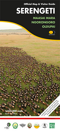
Offical map and visitor guide of Serengeti, Masai Mara, Ngorogoro and Oldupai
Detailed map made in collaboration with Frankfurt Zoological Society
The only fully detailed map of this entire eco-system, this map embodies years of research done by Frankfurt Zoological Society and is the official management map for staff in the field
This is far more than just a map: on the reverse side is a wealth of authorative information including migration patterns, wildlife, the peoples of the Serengeti, climate, landscape and habitat. Front cover, and other Visitor Guide photos, by Felix Borner.
Shows tracks, seasonal tracks and major camps
Migration patterns and the Serengeti-Mara eco-system
Checklist of large mammals
Climate, habitat, the people, history
Enlarged (1:125,000 scale) inset maps of Grumeti River and Seronera
Map size 960x1088mm, folded top 272x120mm.
Supplied in a protective plastic pocket
Scale 1:250,000
€ 25,95
Verzendkosten: € 2,95Specificaties
Merk:
n.b.
EAN:
Je bestelt bij:
De Zwerver
Categorie:
Subcategorie:
Maat:
n.v.t.
Materiaal:
n.v.t.
Levertijd:
Aantal beschikbaar:
n.b.
Verkoopprijs
€ 25,95
Prijzen vanaf:
n.v.t.
Verzendkosten:
€ 2,95
ISBN:
9781851374045
Editie:
None
Uitgever:
Harvey Maps
Beschrijft het volgende gebied:
Afrika - Tanzania -
Taal:
Engels
Direct bestellen: