€ 20.95
Wandelgids Walking on Gran Canaria | Cicerone

Uitgebreide wandelgids van dit deel van Gran Canaria: goede beschrijvingen, veel keuze, kaarten wat minder goed.


Guidebook describing 45 day walks on Gran Canaria, generally averaging 10 to 12km each. A long-distance coast-to-coast route on the GR131 is included, and shorter walks can be linked to form longer itineraries. One of the larger Canary Islands, Gran Canaria is a popular destination but offers many peaceful, rural areas perfect for walking.


Seasons

High summer is popular, but too hot for walking. Good winter walking is possible, with only a very rare chance of snow on high mountains. Spring is ideal and autumn is tolerable.


Centres

Most people stay in the city or resorts - Las Palmas, Maspalomas and Playa del Inglés - but there are quieter alternatives.


Difficulty

Routes vary from short and easy to long and arduous. Many paths are rough and stony, so good footwear is required. The highest mountains are sometimes covered by low cloud, but sun protection will be needed more than waterproofs. Plenty of water should be carried in some arid places.


Must See

Rugged, well-settled uplands dominated by towers of rock - Roque Nublo and Roque Bentayga. Long-distance coast to coast route. Deep and rugged barrancos. Scenery from mountains to extensive pine and laurisilva forests, with semi-desert and amazing cliff coastlines. Peaceful and charming rural locations, despite being in one of the world's most popular holiday spots.


€ 17.50
Wegenkaart - landkaart 3304 Adventure Map Italy - Italië | National Geographic

Wegenkaart van Italië met vermelding van veel bezienswaardigheden, nationale parken en attrakties. Watervast en scheurvast. Juist door deze vermeldingen onderscheidt de kaart zich van andere wegenkaarten.


National Geographic's Italy Adventure Map is designed to meet the unique needs of adventure travelers—detailed, durable, and accurate. Italy includes the locations of thousands of major cities and towns with an index for easily locating them, plus a clearly marked road network complete with distances and designations for expressways, motorways, and more.


What sets National Geographic Adventure Maps apart from traditional road maps are the hundreds of points of interest that highlight the diverse and unique destinations within Italy. National parks, World Heritage sites, caves, scenic viewpoints, archeological sites, castles, palaces, churches, monasteries, and museums are included, making it invaluable to travelers hoping to experience all the history, art, and culture this amazing country has to offer. Additional aids including the location of airports, lighthouses, ferry routes, and border crossings make travel within and beyond the country easier.


The front side of the Italy map shows the northern half of the country from its borders with France, Switzerland, Austria, and Slovenia to its capital, Rome, and includes the provinces of Aosta Valley, Piedmont, Lombardy, Trentino-Alto Adige, Friuli-Venezia Giulia, Veneto, Emilia-Romagna, Liguria, Tuscany, Marche, Umbria, Lazio, Abruzzo, and Molise. The southern half of the country including the Mediterranean islands of Sicily and Sardinia, and the provinces of Campania, Apulia, Basilicata, and Calabria are covered on the reverse side of the map.

€ 17.50
Wegenkaart - landkaart 3206 Adventure Map Tanzania - Rwanda - Burundi | National Geographic

Wegenkaart van Tanzania, Rwanda en Burundi met vermelding van veel bezienswaardigheden, nationale parken en attrakties. Watervast en scheurvast. Juist door deze vermeldingen onderscheidt de kaart zich van andere wegenkaarten.

National Geographic's Tanzania, Rwanda, and Burundi Adventure Map is designed to meet the unique needs of adventure travelers with its durability and accurate information. This folded map provides global travelers with the perfect combination of detail and perspective, highlighting hundreds of points of interest and the diverse and unique destinations within the country. The map includes the locations of cities and towns with a user-friendly index, plus a clearly marked road network complete with distances and designations for major highways, main roads, and tracks and trails for those seeking to explore more remote regions.


The front side of the Tanzania map details the southern region of the country, from Zambia to the south, to the bordering country of Burundi to the west. The reverse side of the map details the northern region, showing the bordering country of Kenya to the north, and the Indian Ocean to the east.


Key Features:

Waterproof and tear-resistant

Accurate topography/terrain with a clearly labeled road network

Hundreds of points of interest, including the locations parks and nature reserves, protected lands, historical and cultural attractions

Thousands of place names including towns and natural features; detailed place names index\

Important travel networks including airports, lighthouses, ferry routes, and rail lines

€ 17.50
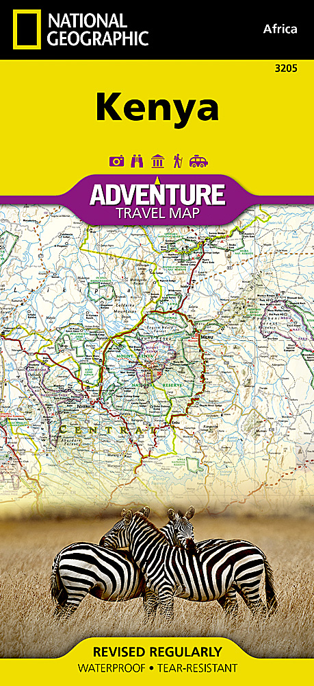
Wegenkaart - landkaart 3205 Adventure Map Kenya - Kenia | National Geographic

Wegenkaart van Kenia met vermelding van veel bezienswaardigheden, nationale parken en attrakties. Watervast en scheurvast. Juist door deze vermeldingen onderscheidt de kaart zich van andere wegenkaarten.


National Geographic's Kenya Adventure Map is designed to meet the unique needs of adventure travelers with its durability and accurate information. This folded map provides global travelers with the perfect combination of detail and perspective, highlighting hundreds of points of interest and the diverse and unique destinations within the country. The map includes the locations of cities and towns with a user-friendly index, plus a clearly marked road network complete with distances and designations for major highways, main roads, and tracks and trails for those seeking to explore more remote regions.


The front side of the Kenya map details the southern region of the country, from The Indian Ocean to the east, to the bordering country of Tanzania to the southwest. The reverse side of the map details the northern region, showing the bordering country of Ethiopia to the north, Somalia to the east, and Uganda to the west.


Key Features:

Waterproof and tear-resistant

Accurate topography/terrain with a clearly labeled road network

Hundreds of points of interest, including the locations parks and nature reserves, protected lands, historical and cultural attractions

Thousands of place names including towns and natural features; detailed place names index

Important travel networks including airports, lighthouses, ferry routes, and rail lines

€ 10.95
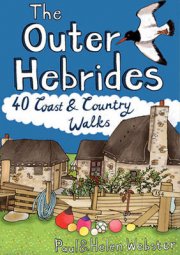
Wandelgids Outer Hebrides | Pocket Mountains

Handige compacte wandelgids met 40 dagwandelingen. Deze gids bevat kleine kaartjes en leuke uitgebreide informatie over wat er langs de route te zien is. Goede wandelkaarten zijn echter we noodzakelijk voor deze tochten: de Ordnance Survey explorer maps of Landanger maps zijn zeer geschikt.

The Outer Hebrides are a place apart, an island chain stretching almost 200km from the Butt of Lewis to Barra Head with some of Britain's most mesmerising beaches, dramatic mountain ranges, wonderful wildlife, a long and fascinating history and a rich and vibrant Gaelic culture. This book features 40 mostly moderate walks, with many ideal for families, which take in magnificent sweeps of sand, soaring sea cliffs and memorable hill ascents, as well as celebrated cultural sights such as the haunting Standing Stones at Callanish and the blackhouse village of Na Gearrannan.

€ 26.95
Treinreisgids Europe by Eurail 2024 | Globe Pequot

Handige reisgids voor treinreizen door Europa. Met praktische informatie als treinlijnen en soms tijden maar ook bezienswaardigheden. Voor diegene die met interrail Europa doorgaan ook geschikt, al vind je net veel budget accommodatie.


Europe by Eurail has been the train traveler's one-stop source for visiting Europe's cities and countries by rail for more than forty years. This comprehensive guide provides the latest information on fares, schedules, and pass options, as well as detailed information on more than one hundred specific rail excursions. The book contains information readers need to enjoy visits in historic cities, romantic villages, and scenic hamlets on more than ninety rail trips starting from twenty-eight base cities located in twenty countries.


Sample rail-tour itineraries combine several base cities and day excursions into fifteen-day rail-tour packages complete with hotel recommendations and sightseeing options. . Packed with practical information, step-by-step directions, advice on where to go and what to see and do, and complemented by the inclusion of twenty maps, Europe by Eurail takes the puzzle out of European Rail Travel.


€ 8.95
Reisgids Te gast in Myanmar | Informatie Verre Reizen

Samengesteld door en voor reizigers: verhalen van auteurs die er wonen, werken of gereisd hebben. Met veel insiders informatie over land en bevolking. 


In Myanmar tintelt en gist de tropische lucht van geloof in verandering. Sinds er hervormingen hebben plaatsgevonden en toeristen het land ontdekken, transformeert het land razendsnel. Tegelijkertijd vind je nog veel plekken waar de tijd geen haast heeft. Uiteraard is er in deze uitgave veel aandacht voor de politieke hervormingen die in 2015 hebben plaatsgevonden.


De nieuwe democratie biedt de bevolking meer vrijheden. De censuur werd afgeschaft waardoor momenteel de hiphopscene floreert. De opheffing van economische sancties opent de deuren voor buitenlandse investeerders. Die gaan zo voortvarend te werk dat de bewakers van het culturele erfgoed alle zeilen bij moet zetten om te voorkomen dat alle koloniale panden van Yangon met de grond gelijk gemaakt worden.


Verder in deze uitgave aandacht voor religie en astrologie, enkele typische Birmese gewoonten zoals het gebruik van thanaka op het gezicht en voor eetgewoontes en speciale gerechten. Er wordt ingegaan op de betrekkingen tussen Birma en Hollandse kooplieden in de tijd van de VOC. We bieden een kijkje achter de schermen bij de Pa-O minderheid in de Shan-provincie, bezoeken in het zuidelijk gelegen Mawlamyine het beroemde meditatieklooster van Pa-Auk en zijn in Yangon getuige van het spectaculaire Waterfestival. Tot slot de rubriek 'reisinformatie' met handige tips en een boekenlijst

€ 25.95
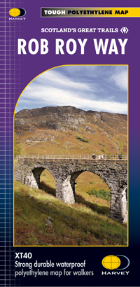
Wandelkaart Rob Roy Way | Harvey Maps

Mooie, duidelijke kaart van de Rob Roy Way in Schotland. Geplastificeerd met veel extra informatie en uitsnedes van de route. 


One of Scotland's Great Trails


Rob Roy Way is a walk across part of the Southern Highlands of Scotland taking in some of the most beautiful countryside in the UK. Starting from Drymen it goes north east to finish in Pitlochry. The Way is 77mls or 94 mls (124Km or 151Km) depending on your route choice. The tracks and paths you follow were used by Rob RoyMacGregor in the 17th & 18th centuries, other historical characters throughout the Jacobite uprisings and during the feuds between the local clans. Places you will pass through include Aberfoyle, Callander, Strathyre, Killin or Amulree and Aberfeldy. Lochs you will walk along include Venachar, Lubnaig and Tay passing by Ben Ledi, Ben Chonzie and Ben Lawers.


XT40 New generation of tough polyethylene maps


The HARVEY series of Long Distance Route maps is an established success. Now the advanced technology used in the creation of our best-selling British Mountain Maps is also applied to the route maps. These maps are a leap forward in technical excellence. They are tough, durable, light and 100% waterproof - virtually indestructible in normal use. They are light to carry, and compact - not the great bulky package you get with a laminated map.


The map is detailed, with the routes clearly marked. It also contains general information, useful telephone numbers and a full key

€ 17.50
Wegenkaart - landkaart 3009 Adventure Map China West | National Geographic

Wegenkaart van West China met vermelding van veel bezienswaardigheden, nationale parken en attrakties. Watervast en scheurvast.


National Geographic's China West Adventure Map is designed to meet the unique needs of adventure travelers with its durability and detailed, accurate information. The map includes the locations of thousands of cities and towns with a user-friendly index, plus a clearly marked road network complete with distances and designations for major highways, major routes and secondary roads. The China Adventure Map is printed in the United States on a durable synthetic paper, making it waterproof, tear-resistant and tough—capable of withstanding the rigors of international travel.


The China West Adventure Map differs from a traditional road map for it includes hundreds of points of interest that highlight diverse and unique destinations in the region. UNESCO World Heritage sites, national parks and reserves, archaeological sites, temples, mosques, museums, ruins, caves and points of interest such as the Great Wall of China are included, making it an invaluable resource to travelers hoping to experience all the history and culture China has to offer. The front side of the China West map details the western region of the country, from its border with Russia, Kazakhstan and Kyrgyzstan, to its border with India and Bhutan in the south. The autonomous region of Tibet is featured as well as the city of Urumqi. The reverse side of the map covers the area extending south of Mongolia and includes the cities of Baotao, Chengdu, Chongqing, Hohhot, Lanzhou, Shijiazhuang, Taiyuan, Xi’an, Yinchuan and Zhengzhou.


Key Features:

Waterproof and tear-resistant

Detailed topography complete with activity symbols, ideal for exploring the country

Hundreds of points of interest, including the location of World Heritage sites, national parks and reserves, archeological sites, temples, the Great Wall of China and more

Thousands of place names

Important travel aids including airports, ferry routes, and rail lines


€ 32.50
Wandkaart Scandinavië en IJsland, 75 x 100 cm | Norstedts

Prachtige wandkaart van Scandinavië met een inzet van IJsland. Hele duidelijke kaart waar door het kleurgebruik de natuurkundige aspecten als hoogte, bergen en fjorden heel goed uitkomt. Daarnaast zjin er belangrijke geografische aspecten als veel plaatsen en een behoorlijk aantal wegen zichtbaar.

Deze kaart  heeft een afmeting van 75 cm breed en 100 cm hoog.

Abonneer op