€ 15.50
Wandelkaart 078 Südtiroler Weinstraße, Meran, Bozen | Kompass

Goede wandelkaart met vrijwel alle topografische details als hoogtelijnen, vegetatie, schaduwtekening maar ook de ingetekende wandelroutes en in veel gevallen ook fietsroutes (MTB). Gevaarlijke routes worden als zodanig weergegeven met een bepaalde markering. Berghutten en campings zijn goed terug te vinden op deze kaarten.


Daarnaast staan de toeristische bezienswaardigheden met symbolen vermeld. Kleurgebruik kan soms vrij fel overkomen, daardoor oogt deze detailkaart wellicht wat druk, maar het blijft een goed leesbare kaart. Sommige kaarten zijn geplastificeerd, maar helaas niet allemaal. De graden staan aan de zijkanten van de kaart, daardoor te gebruiken voor GPS.


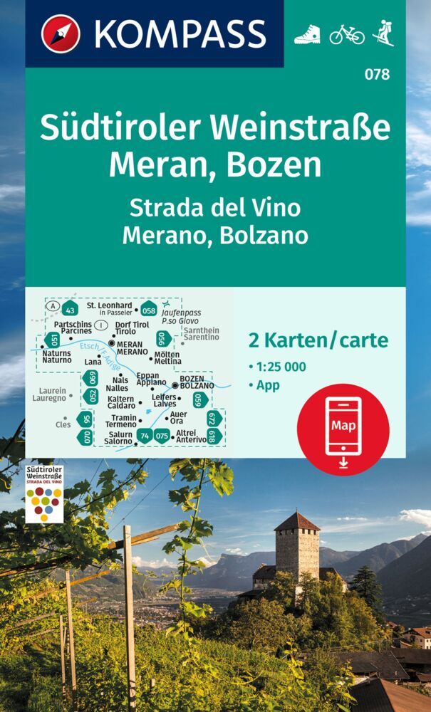
Steden/dorpen/gebieden:

St. Leonhard, Dorf Tirol/Tirolo, Partschins/Parcines, Naturns/Naturno, Meran/Merano, Mölten/Meltina, Nals/Nalles, Eppan/Appiano, Bozen/Bolzano, Kaltern/Caldaro, Leifers/Laives, Tramin/Termeno, Auer/Ora, Salurn/Salurno, Altrei/Anterivo, Etsch/Adige


Die KOMPASS Wanderkarte ist jetzt noch übersichtlicher und besser lesbar. Die kostenlose App für unterwegs gibt es auch noch dazu. Das bildet die perfekte Grundlage für die Planung einer Wandertour. Die präzise Kartografie zeigt alle begehbaren Wanderwege inklusive Klassifizierung. Informationen wie Schwimmbäder, Klettersteige, Kinderspielplätze, Hütten und vieles mehr sind in der Karte ebenfalls enthalten.


€ 12.50
Reisverhaal Across the Caspian | Norman Handy

An exciting adventure starting in the bizarre capital of Turkmenistan, Ashgabat, then crossing the Caspian Sea to Baku in Azerbaijan. This is the lowest point in Europe. Then the journey heads inland up the Kura River to stay in a caravanserai before crossing into Georgia, famous for its wines and monasteries. There is a visit to Kazbegi high up in the mountains before visiting Gori, Stalin's birthplace, and the museum dedicated to his memory. The journey through the Caucasus reaches the Black Sea and after a visit to Cappadocia and Istanbul, then returns to the Russian side of the Caucasus for the ascent of Europe's tallest mountain, Mount Elbrus.

€ 19.50
Reisgids Madrid | Odyssee Reisgidsen

Deze Odyssee Reisgids neemt je mee naar de diverse wijken in de metropool Madrid. Ze hebben elk een eigen karakter: de ene traditioneel waar de tijd lijkt stil te staan en de andere juist modern en levendig. Hoe dan ook, ze hebben allemaal één ding gemeen: eten en drinken kan er op elke straathoek.

Handige gids in pocketformaat, boordevol informatie over Madrid. Met Odyssee´s aanraders, kaarten, up-to-date informatie over bezienswaardigheden,  lokale producten, eten & drinken, uitgaan, verblijf,  praktische info van A Z en een woordenlijst.   

€ 14.90
Wandelgids Zagoria-Trek Griekenland | Conrad Stein Verlag

Handzaam boekje met de routebeschrijving inclusief een heleboel praktische informatie. De beschrijving is uitstekend, maar kaarten zijn beperkt en schetsmatig aanwezig. Duits.

Der Zagoria-Trek zeigt ein Griechenland, das die wenigsten Reisenden kennen: ein bergiges Land mit schroffen Felsmassiven, unzähligen Wasserquellen, weiten Wäldern, frei lebenden Pferden und Kühen und der tiefsten Schlucht der Welt. In bis zu 9 Etappen (bis zu 130 km), die individuell verkürzt oder verlängert werden können, führt der Rundwanderweg durch diese einmalige Landschaft.

Der Wanderführer beschreibt mögliche Etappenkombinationen und liefert zu jeder Etappe eine ausführliche Wegbeschreibung mit Übernachtungs- und Einkehrmöglichkeiten, Karten, Höhenprofilen und GPS-Tracks. Als Extra finden Sie zudem eine  Beschreibung für den Aufstieg auf den höchsten Gipfel des Olymps, der ebenfalls im Norden Griechenlands liegt.

€ 12.50
Stadsplattegrond Plan de ville - Street Map Bangkok | Michelin

Goede geplastificeerde stadsplattegrond van Bangkok op schaal 1:15.000. Met extra inzetten van de meest interessante delen van de stad en aan de zijkant een korte beschrijving van de bezienswaardigheden. Op de achterzijde een overzichtskaart van de omgeving. Met register. 

€ 13.95
Wegenkaart - landkaart Guadeloupe & Dominica | ITMB

Een degelijke kaart met aanduidingen van o.a. nationale parken, vliegveld, benzinepomp, dirt-roads en kleine plattegrond van hoofdstad. Als overzichtskaart goed te gebruiken.

Guadeloupe 1:110.000
Dominica 1:50.000

€ 18.50
Wandelgids Walking the Galloway Hills | Cicerone

Uitstekende wandelgids van galloway!


This guide covers 35 day walks and one long-distance route in the wild and remote hills of Galloway. Although there are some shorter and easier routes, many of these hill walks are long and on rugged terrain, so are more suitable for experienced walkers. The walks cover the evocative areas of The Merrick, The Awful Hand, The Rhinns of Kells, the Minnigaff hills and Cairnsmore of Fleet, among others.


The guide uses OS 1:50,000 maps with detailed route descriptions and inspirational photos accompanying each route. Key information such as distance, time, and ascent are given. A 'harshness' grade gives an indication of how rough the ground is expected to be, and suggestions of variants, shortcuts and ways to extend each walk are also given. Plenty of background information is given on the region's fascinating and important history.


If you like your wild landscape really wild… If you like your lakes to have whooper swans in the middle and no ice-cream vans around the edge… If you like to have one foot on bare rock and the other one deep in a peat bog… If you like your granite with goats on… Then Galloway is the place to go.


Steden en Dorpen

Newton Stewart; Glen Trool (Glentrool village and Loch Trool); Dalmellington (Ayrshire); Carsphairn and St John's Town of Dalry (Glenkens).

€ 20.95
Wandelgids The Cambrian Way | Cicerone

Uitstekende wandelgids van de Cambrian Way, waarbij naast alle noodzakelijke informatie ook gebruik gemaakt wordt van de echte topografische kaart. 

Dubbed 'the mountain connoisseurs' walk', the Cambrian Way stretches 479km between the mighty castles of Cardiff in the south and Conwy on the north coast. Traversing the heartland of Wales, the challenging route crosses the Brecon Beacons, the Cambrian Mountains and Snowdonia, passing through two national parks and visiting many of the country's iconic summits, including Pen y Fan, Pumlumon, Cadair Idris and Snowdon itself. It can be walked in three weeks (or in shorter sections) and is suitable for experienced hillwalkers with sound navigational skills.


The guide presents the route in 21 stages, offering comprehensive route description illustrated with OS 1:50,000 mapping and elevation profiles. Details of accommodation and facilities are provided, along with a helpful trek planner showing their distribution along the route: although the trail passes through remote areas, it is possible to stay under a roof every night – though camping is also a possibility, should you prefer. There are background notes on Wales's history and geology and local points of interest, and a glossary of Welsh place-names, useful contacts and accommodation listings can be found in the appendices.


From the Black Mountains to the Rhinogs, Glyderau and Carneddau, the route takes in lofty ridges, striking peaks and picturesque lakes. There are also fascinating glimpses into the country's ancient and more recent past: Iron Age hillforts, Norman castles, a Cistercian abbey, the Chartist Cave and relics from the mining industry. Offering superlative scenery, the Cambrian Way is a celebration of some of the best mountain walking Wales has to offer and promises a unique opportunity to immerse yourself in these celebrated landscapes.


Steden en Dorpen

Cardiff, Pontypool, Abergavenny, Crickhowell, Llandovery, Strata Florida, Devil's Bridge, Ponterwyd, Dinas Mawddwy, Barmouth, Beddgelert, Pen-y-Pass, Ogwen, Conwy

€ 10.95
Reisgids Pocket Guide Poland - Polen | Berlitz

Pocket Guide Berlitz is een handzaam engelstalige reisgids met bezienswaardigheden, kaartjes, hotels en restaurants. Past makkelijk in de binnenzak.

Berlitz Pocket Guide Poland combines snappy text with full-colour photography to highlight the very best that this remarkable country has to offer. The Where To Go chapter details all the key sights that you will not want to miss; from constantly evolving capital Warsaw, to the port town of Gdansk in the north and the country’s artistic and spiritual heart of Krakow in the south. The What to Do chapter explores Poland’s musical scene and opportunities to sample its famed vodka, whilst the Eating Out chapter investigates the local cuisine and provides a list of recommended restaurants for you to try. Top 10 Attractions and A Perfect Tour itinerary present inspiration for experiencing the very best of Poland. Background information about the turbulent history of the country and the character of its people is also provided to help you really understand the culture you have come to experience. Clear and detailed maps plot all the major sights, and the Travel Tips section offers practical advice on how to get there and where to stay.

Abonneer op