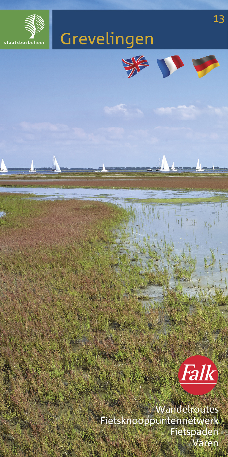
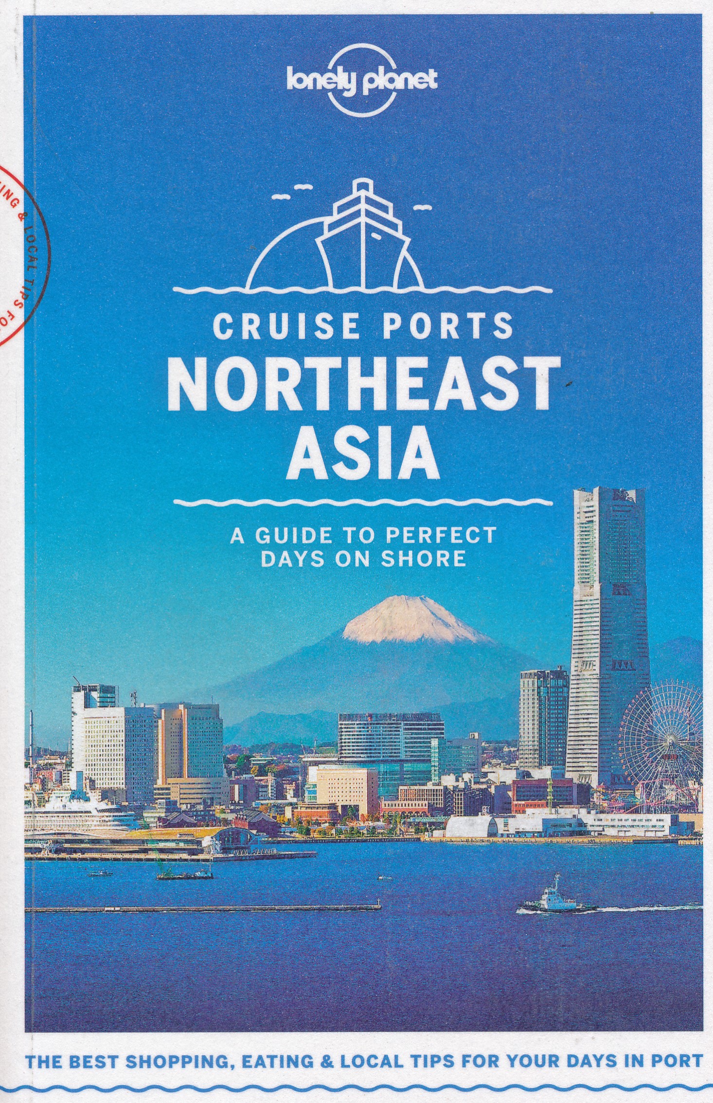
€ 11.95
Wandelkaart 331 Samos | Terrain maps

Gedetailleerde wegenkaart en wandelkaart met alle kleine wegen, wandelpaden, hoogtelijnen en toeristische informatie aangegeven. Alle tekst is tweetalig in Engels en Grieks en de waterproof kaart is geschikt voor gebruik met GPS.

This is a great map because:

• It is waterproof and rip-proof. You can fold and unfold it a thousand times, fold it in irregular ways, dunk it in the sea or leave it out in the rain. This map is indestructible!

• It is the first time the island’s entire coastline is mapped. Cartography was done with TERRAIN’s specially equipped and staffed cartographic vessel. This means that you can locate all beaches of the island, down to the tiniest cove! In fact, the special features of every single beach are recorded: whether it is sandy or pebbled, whether it features natural tree shade, water, a beach bar or organized water sports, whether the seabed in front of the beach is sandy or rocky (so that you will know where to anchor).

• It features the most complete road network.

• It features the trails of Samos for the first time, with total precision since TERRAIN’s cartographers walked them one-by-one. The length of all trails is measured in kilometers so you can estimate the duration of your hike, plus 6 of the trails are described in full detail on the back of the map (including the two ascents to Kerkis, the tallest peak on Samos).

• It features the rock climbing crags of Samos.

• It features a detailed map of the city of Samos.

€ 19.50
Wandelgids 183 Ostfriesland - Oost-Friesland | Rother Bergverlag

Uitstekende wandelgids met een groot aantal dagtochten. Met praktische informatie en beperkt kaartmateriaal! Wandelingen in verschillende zwaarte weergegeven in rood/blauw/zwart.

Dünen, Wattenmeer und Hochmoore, Vogelschutzgebiete und Hafenstädte – Ostfriesland ist ein ein-zigartiger Naturraum und lässt sich am intensivsten zu Fuß erleben. In 50 Touren erschließt der Rother Wanderführer »Ostfriesland« die Küstenlandschaften und Inseln im UNESCO-Weltnaturerbe Wattenmeer sowie Glanzpunkte im Binnenland zwischen Ems und Jade.

Eindrucksvoll sind die Wanderungen am Wattenmeer: Sie führen die Küste entlang, über die Salzwie-sen und grünen Deiche, vorbei an Leuchttürmen und Kutterhäfen. Nicht nur Dünen und Strände, sondern auch Pflanzenoasen lassen sich auf den angrenzenden Inseln entdecken. Die Touren im ostfriesischen Binnenland führen vorbei an herrschaftlichen Schlösser und Windmühlen, durch alte Alleen und auf künstlichen Hügeln erbaute Warfendörfer mit ihren trutzigen mittelalterlichen Kirchen. Auch in Deutschlands größtem Hochmoor, dem »Ewigen Meer«, bieten sich attraktive Wanderungen an und für Ornithologen sind die Vogelrückzugsgebiete während der Zugzeiten ein Highlight. 

Die Touren sind durch Kurzinfos, exakte Wegbeschreibungen, Kartenausschnitte mit Routenverlauf und Streckenprofile gut nachvollziehbar. Ergänzend stehen auf der Internetseite des Bergverlag Rother GPS-Daten zum Download bereit. Einkehrtipps, Hinweise auf Sehenswürdigkeiten und die zahlreichen Fotos machen Lust, in diesem einzigartigen Naturraum auf Entdeckungstour zu gehen.

Der in Ostfriesland lebende, erfahrene Wanderbuchautor Bernhard Pollmann hat die 2. Auflage seines Wanderführers sorgfältig aktualisiert und etliche Touren durch neue ersetzt.

€ 12.50
Wandelkaart 161 Donau | Kompass

Goede 2-delige wandelset met een Naturführer Wiesenblumen als toevoeging, met vrijwel alle topografische details als hoogtelijnen, vegetatie, schaduwtekening maar ook de ingetekende wandelroutes en in veel gevallen ook fietsroutes (MTB). Gevaarlijke routes worden als zodanig weergegeven met een bepaalde markering. Berghutten en campings zijn goed terug te vinden op deze kaarten.


Daarnaast staan de toeristische bezienswaardigheden met symbolen vermeld. Kleurgebruik kan soms vrij fel overkomen, daardoor oogt deze detailkaart wellicht wat druk, maar het blijft een goed leesbare kaart. Sommige kaarten zijn geplastificeerd, maar helaas niet allemaal. De graden staan aan de zijkanten van de kaart, daardoor te gebruiken voor GPS.


Steden/dorpen/gebieden:

Regensburg, Riedenburg, Kelheim, Altmannstein, Abensberg, Neustadt (an der Donau), Wellheim, Harburg, Donauwörth, Neuburg, Ingolstadt, Rottenburg (an der Laber), Manching, Mainburg, Pöttmes, Wertingen, Schrobenhausen, Landshut, Langweid (am Lech), Pfaffenhofen (an der Ilm), Moosburg (an der Isar), Aichach, Altenmünster, Gersthofen, Freising


Rivieren/meren:
Donau, Lech, Amper, Isar


€ 13.95
Wandelkaart 13 Best of Lake Louise Map and Guide | Gem Trek Maps

Mooie, gedetailleerde kaart uit de serie van Gem Trek Hiking map-guides, van het gebied Lake Louise. Helder kleurgebruik en met de beste / mooiste wandelroutes, hikes, fietsroutes, autoroutes en interessante plaatsen erop aangegeven.

This map is designed for people who only plan to be in the Lake Louise area for one to three days, and want to know what the highlights are and how to find them.


On the front is a 1:35,000-scale detailed topographic map of the Lake Louise area, including the network of trails around Lake Louise Village, as well as those up at the Chateau Lake Louise.


Included on the front are trail descriptions of six classic hikes, including the Lake Louise Lakeshore Trail, the Saddleback and Fairview Mountain and hikes to the rustic teahouses at Lake Agnes and Plain of the Six Glaciers. As well as highlights, each trail has a difficulty rating, trail distance, elevation gain and an approximate time to allow.


On the back of the map are descriptions of must-see sights in the area, such as the Chateau Lake Louise and the Sightseeing Gondola, three highly recommended scenic drives, four of the best biking trails in the area and brief descriptions of recommended restaurants. Also included is a Lake Louise Village map with hotels and services marked.


Eight color photos accompany the text.


Everything the visitor needs to make the most of their time in Lake Louise.


In addition to the standard features, this map also includes:


contour lines at 25-metre (80-foot) intervals 

relief-shaded map

full color on both sides

printed on waterproof material

€ 13.95
Wegenkaart - landkaart Central Asia - Centraal Azie | ITMB

Een degelijke kaart met aanduidingen van o.a. nationale parken, vliegveld, benzinepomp, dirt-roads en kleine plattegrond van hoofdstad. Als overzichtskaart goed te gebruiken.

The collapse of the Soviet Union in the early 1990s created several independent nations in the ‘soft underbelly’ of mother Russia. Thus far, these new nations have been feeling their way into a new, more commercial, reality. Kazakhstan, Uzbekistan, and Turkmenistan have developed significant tourism potential, and even the more easterly states of Tajikistan and Kyrgyzstan, which are in my opinion the most scenic countries in Central Asia, are proving to be welcoming of exploring visitors. This is a travel destination unlike any other and this double-sided map, covering from the Aral Sea to the Himalaya chain, is just the map to use to explore this fascinating part of our world. Printed on paper.

Legend Includes:

Roads by classification, ruins, bird sanctuary, national parks, hotels, national parks, wild life reserves, beaches, skiing, mosques, bus museums, points of interest and other information.

€ 13.95
Wegenkaart - landkaart Canada | ITMB

Een degelijke kaart met aanduidingen van o.a. nationale parken, vliegveld, benzinepomp, dirt-roads en kleine plattegrond van hoofdstad.

Well, it’s about time, eh?!? ITMB, after only thirty years on the go, finally gets around to publishing a map of Canada. When we first started mapping, there was a pressing need for good maps of Central and South America, then of Africa, then etc etc and we never found time to concentrate on our own country until fairly recently. This map was prepared by Natural Resources Canada and is, as a result, as accurate a map as one could hope to have. We are very proud of it, and very pleased to be able to use such top-rate cartography. The map covers all of the land mass of Canada, from its southernmost point to the top of Ellesmere Island and from the Atlantic coast to the Pacific. It’s an excellent map, but I’m going to give one proviso. Canada is the second-largest country on the face of the planet and there is no way that a single-sided sheet can portray a country this vast comprehensively. That said, it’s a great map. CMO doesn’t make a bad map. We published it because we feel that it fills a big niche. It shows major roads, rail lines, lots of urban areas (not just the big ones), major tourist sites and parks, world heritage sites, and it even includes St. Pierre et Miquelon, the French possession south of Newfoundland. It is printed on paper.

Legend Includes:

Roads by classification, Trans-Canada highway, national parks, points of interest, world heritage sites, and more.

€ 13.95
Reisgids Rough Guide Pocket Copenhagen - Kopenhagen | Rough Guides

Een kleinere versie in zakformaat van de grotere versies van de Rough Guides. Als altijd weer vol met goede informatie over cultuur en praktische zaken. Achterin een kaart van de stad.

This compact, pocket-sized Copenhagen travel guidebook is ideal for travellers on shorter trips and those trying to make the most of Copenhagen. It's light, easily portable and comes equipped with a pull-out map.


This Copenhagen guidebook covers: Tivoli and Rådhuspladsen, Strøget and the Inner City, Slotsholmen, Nyhavn and Frederiksstaden, Rosenborg and around, Christianshavn and Holmen, Vesterbro and Frederiksberg, Nørrebro and Østerbro, Malmö.


Inside this Copenhagen travel book you will find:


- Curated recommendations of places - main attractions, off-the-beaten-track adventures, child-friendly family activities, chilled-out breaks in popular tourist areas

- Things not to miss in Copenhagen - Den Blå Planet, Nationalmuseet, Nyhavn, Torvehallerne, Tivoli, Designmuseum Danmark, Zoologisk Have, Rundetårn, Nørrebro, Statens Museum for Kunst, Den Sorte Diamant (The Black Diamond), Guards at Amalienborg, Frederiksborg Slot, Louisiana Museum of Modern Art, Kødbyen

- Ready-made itineraries samples - created for different time frames or types of trip

- Copenhagen at a glance - an overview map of Copenhagen with key areas and short descriptions of what you'll find there

- Day trips - extra information for those on longer breaks or wanting to venture further afield

- Practical travel tips - information on how to get there and around, health guidance, tourist information, festivals and events, plus an A-Z directory

- Handy language section - themed basic vocabulary for greetings, numbers and food and drink

- Independent reviews - honest descriptions of places to eat, drink or stay, written by our expert authors

- Accommodation - handy reference guide to a range of hotels for different budgets

- Pull-out map - easy to extract folded map with places to see marked

- What's new - a short overview of the changes in Copenhagen in recent years for repeat travellers

- Free download of the eBook - available after purchase of the printed Copenhagen guidebook

- Fully updated post-COVID-19


The guide is a perfect companion both ahead of your trip and on the ground. It gives you a distinct taste of Copenhagen with a concise edit of all the information you'll need.


€ 9.95
Wegenkaart - landkaart Fleximap Sri Lanka | Insight Guides

Geplastificeerde kaart van Sri Lanka, met register. Voor de 'gewone' toerist een handige kaart, geen groot formaat, overzichtelijk met alle belangrijke plaatsen goed weergegeven.


Met stadsplattegrond van Colombo.


In addition to the mapping, Fleximap Sri Lanka also gives a list - with descriptions and some photographs - of 18 recommended sights, divided by theme and linked to the mapping by numbered markers. There is also a handy information section with concise details on getting around, tourist offices, money, tipping, opening times, public holidays, telecommunications, emergency telephone numbers and climate.

€ 11.50
Wegenkaart - landkaart Portugal | Turinta

Landkaart van heel Portugal, duidelijk leesbaar. Ondanks de wat grove schaal toch heel wat details, met afstandsaanduidingen, nationale parken en register.  Deze kaart is met name goed als het gaat om aanduiding van campings, sommige hotels en poussadas. Daarnaast staan op de achterzijde centrumkaarten van diverse steden. 

€ 49.90
Fotoboek - Reisverhaal Saigoku | Cees Nooteboom

De Saigoku-pelgrimstocht is de belangrijkste, langste en zwaarste van alle bedevaarten die je in Japan kunt doen. De tocht loopt langs niet minder dan 33 boeddhistische tempels die alle aan Kannon, de godin van barmhartigheid zijn gewijd. Sommige tempels bevinden zich in en om Kyoto, de voormalige hoofdstad van het Heian-rijk (794-1185). Andere liggen hoog in de bergen of op een eiland en zijn moeilijk bereikbaar.

Schrijver Cees Nooteboom en fotografe Simone Sassen hebben zich tweemaal gewaagd aan de pelgrimage naar het prachtige Saigoku. Het koppel reisde per bus, met de trein en te voet. Ze liepen kilometers ver en klommen soms well meer dan 800 trappen hoog. Simone Sassen fotografeerde de tempels in de verschillende seizoenen. Op die manier wist zij poëtische beelden van sneeuw, kersenbloesems en herfstbladeren vast te leggen. 

Sommige van de tempels die ze bezochten, dateren uit de Heian-tijd waardoor Nooteboom ze linkt aan de klassieke Japanse tekst Het Verhaal van Genji van Murasaki Shikibu. Dit verhaal werd geschreven rond het jaar 1000 en wordt beschouwd als de eerste echte roman in de literatuurgeschiedenis. 

De wisselwerking tussen beeld en tekst resulteert in een unieke publicatie. Japan wordt in dit boek op zijn mooist geportretteerd.

Abonneer op