€ 11.50
Stadsplattegrond Turin - Turijn | Touring Club Italiano

Goede stadskaart van Turijn met register en openbaar vervoernet. Bezienswaardigheden en hoogtepunten zijn helder zichtbaar.

The plan covers Turin with the outer suburbs. Main traffic arteries across the city are highlighted and car parks in the city’s historic centre are marked. The metro line is clearly marked and stations are shown with their names. Churches and other important historic or municipal buildings are prominently coloured and named. For those wanting to venture outside the city centre, coverage includes both Juventus’s Stadio delle Alpi and the Fiat Mirafiori complex.

€ 13.95
Stadsplattegrond Geneve en Zwitserland | ITMB

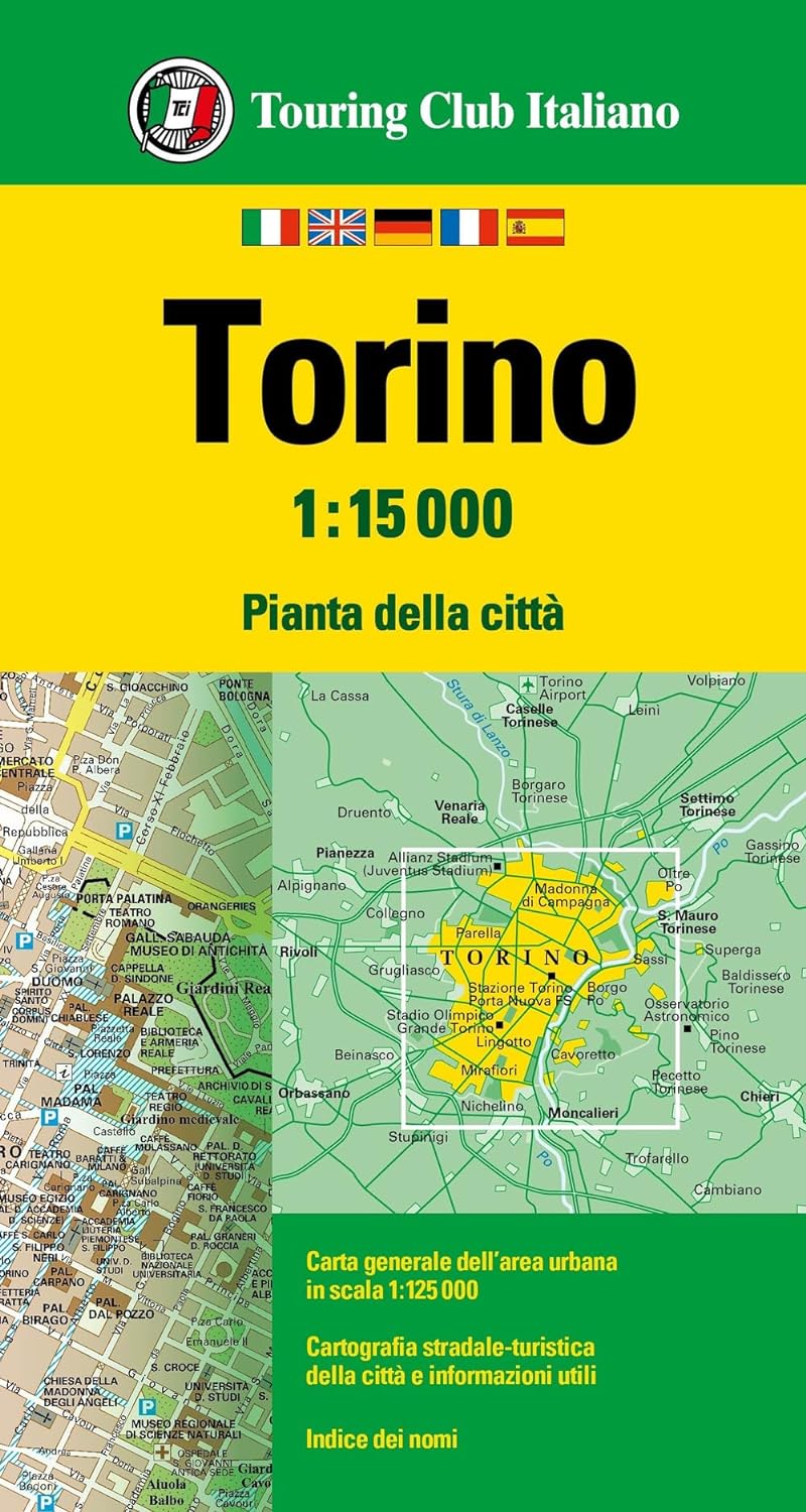
This map has been a long time in development preparation. The data for a sophisticated country like Switzerland needs delicate handling to do justice to this lovely country. We did not want to do 'just' another road map, similar to those available from a variety of European publishers. Our version shows the physical reality of this mountainous country to good advantage without obscuring the places of interest to visitors. The road/rail infrastructure within the country is well shown with perhaps more villages being included than would normally be the case. The road network in surrounding countries has been simplified to focus attention on Switzerland itself. Touristic points, such as castles, fortresses, ski areas, and museums have been included, but we removed a lot of data, such as gas stations, schools, post offices, most churches and police stations in an effort to avoiding cluttering the map with an over-load of information. The Geneva side of the map goes from the airport in the north to south of the Old Town and from the Lancy area in the west to the UN complex in the east, showing an improved range of major buildings and businesses as well as hotels, restaurants, pedestrian walkways, churches, tram and train lines and stations, and of course, the famous Jet D'Eaux.


Legend Includes:

Road by classification, Motorways,, Main Roads, Rail Ways, Ferry Routes, National parks, Province Border, International Border, Lakes, Hotels, Motels, Viewpoints, Point of Interests and much more...

€ 7.95
Historische Kaart Groningen - De Kleine Haubois 1652 | GRAS


Afbeeldinge der Stadt Groningen met de omliggende fortressen


Wie kent niet de kaarten van Egbert Haubois (1643) en stadsarchitect Siebe Jan Bouma (1925)? Iedere kaart is een kunstwerk op zich en meer dan een weergave van straten en bebouwing alleen. Samen vertellen ze ons het verhaal van de stad; haar historie, haar groei en hoe de Groningers leefden. De mooiste kaarten, waaronder ook deze, worden in stijl heruitgegeven en voorzien van bijzondere achtergrondinformatie. 


Deze kaart, de ‘Kleine Haubois’, is een bijzondere versie van de oorspronkelijke kaart van Egbert Haubois uit 1643: de kaart die decennia lang de meest betrouwbare plattegrond van de stad Groningen was. De oorspronkelijke Haubois kaart verscheen al eerder in de serie. Deze kleurrijke ‘kleine’ versie is verrijkt met nieuwe informatie en bevat bovendien portretten van de stadhouders van Groningen en prachtige afbeeldingen van de destijds rond de stad Groningen liggende forten.