€ 12.50
Stadsplattegrond Düsseldorf | Falk Ostfildern

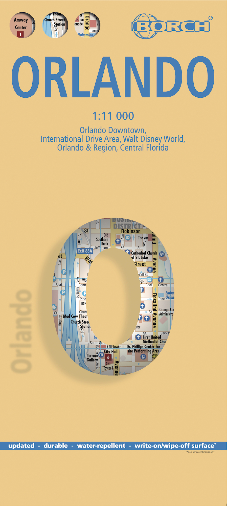
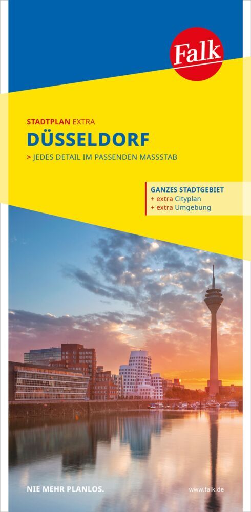
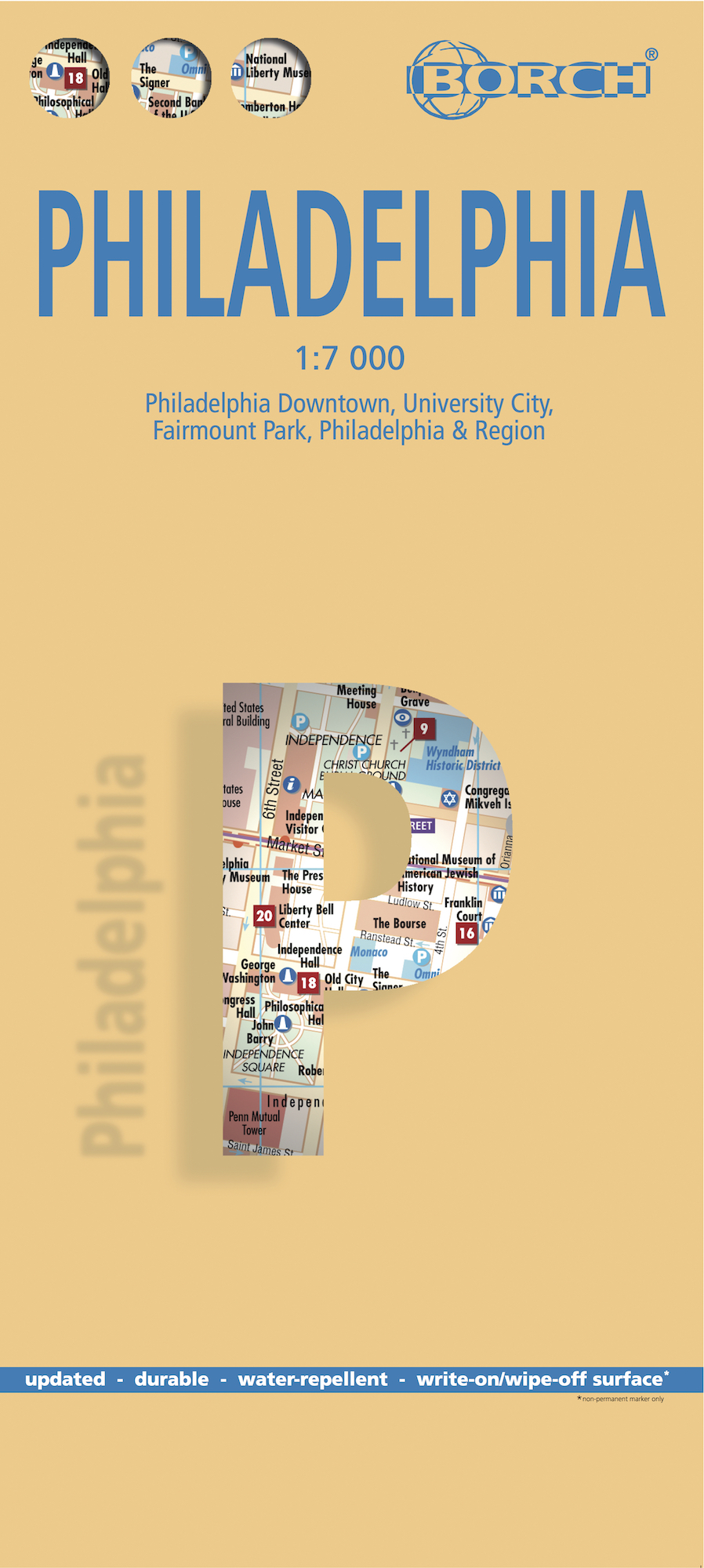
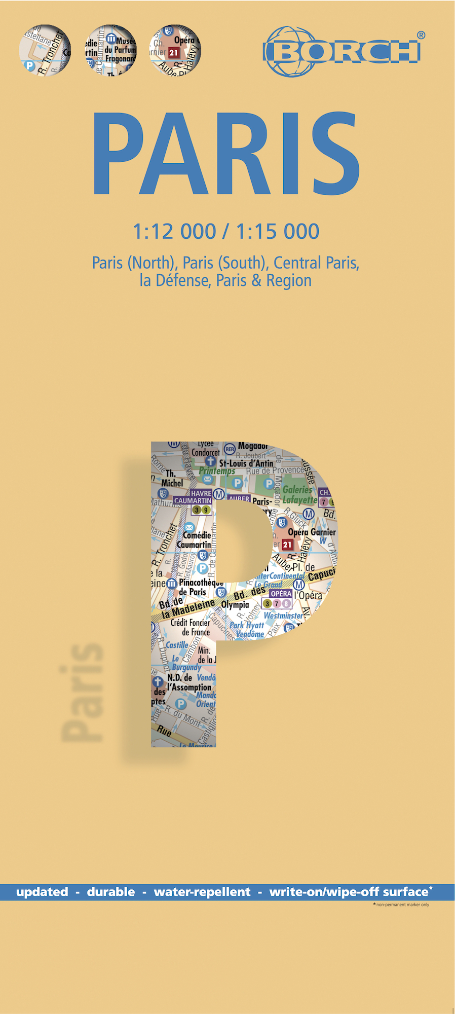
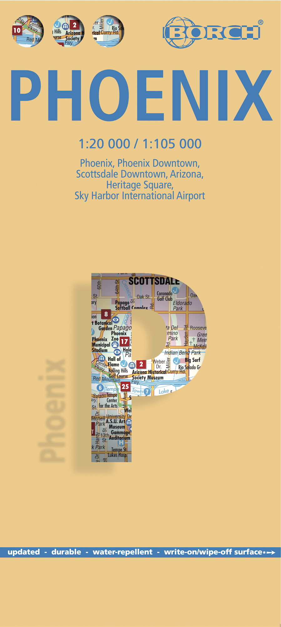
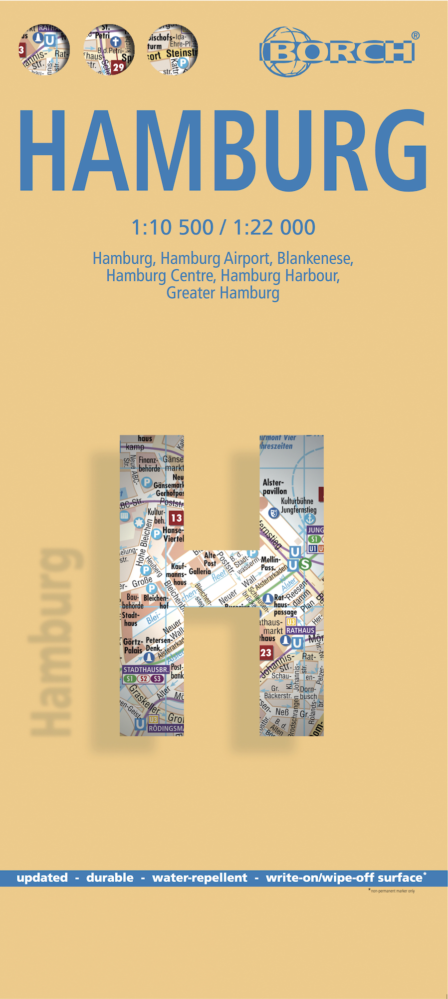
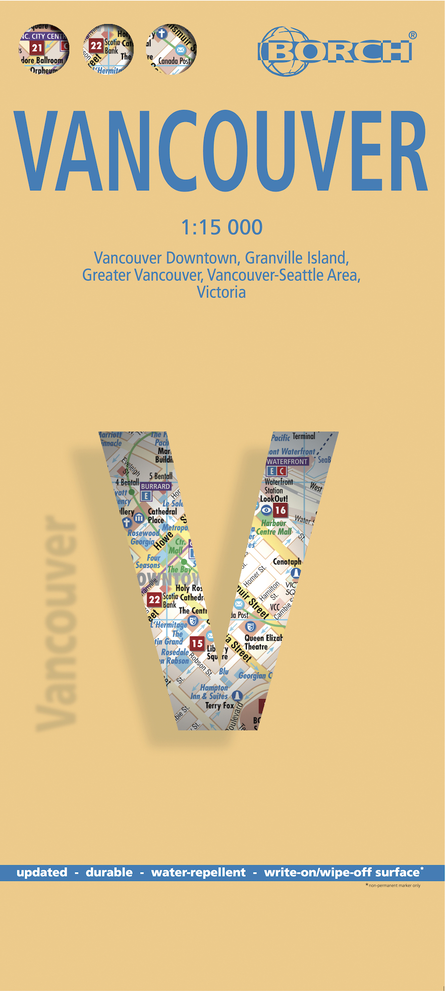
Gedetailleerde stadsplattegrond van Düsseldorf en toegevoegde centrumkaart, metrokaart, vliegveldkaart en een kaart van de omgeving met o.a. de dorpen Unterbach, Erkath, Hilden, Meerbusch, Neuss, en Ratingen.

Der detailgenaue, aber dennoch übersichtliche Stadtplan ist die ideale

Orientierungshilfe in der fremden Stadt. Ob im Zentrum oder im

Randbereich, mit dem Falk Stadtplan Extra findet man jedes gesuchte

Ziel. Der Plan ist dank seiner Leporello-Faltung sehr leicht zu

handhaben.


Den Reisenden wird dieser Falk Stadtplan ein unentbehrlicher

"Fremdenführer" sein, zeigt er doch neben dem umfangreichen

Straßenverzeichnis und den Postleitzahlen auch alle für den Touristen

wichtigen Informationen. Die Straßenkarte, 1:150.000 auf der Rückseite

des Stadtplanes, bietet zusätzlich noch interessante touristische

Hinweise für die Umgebung der Titelstadt.


Nebenkarten sind für einen schnellen Zugriff geschickt im Beiheft

platziert und zeigen Detailinformationen zum Innenstadtbereich, bilden

Übersichten zum Thema Öffentlicher Nahverkehr ab und geben wertvolle

Auskünfte zu den Postzustellbezirken.


€ 10.25
Stadsplattegrond Budapest - Boedapest | Borch

Borch Budapest is een duidelijke, geplastificeerde plattegrond van het centrum met informatie over openbaar vervoer en bezienswaardigheden. Inclusief straatnamenregister.


Our soft-laminated folded map of Budapest shows: Budapest 1:11 000, Budapest & Region 1:400 000, Margaret Island 1:11 000, Public Transportation Budapest, Top 30 Sights, Hungary administrative and time zones. Borch Maps are easy to fold, durable and water-repellent with a wipeable surface. Borch Maps show hotels, museums, monuments, markets, public transport, top sights and points of interest, useful statistics, conversion charts for temperatures, weights and measurements, climate charts showing temperatures, sunshine hours, precipitation and humidity, overview maps, time zones, and much more...


Budapest is the capital and largest city of Hungary and its commercial, transport and cultural center. Located on the famous Danube river, the Buda half of the city lies on the western bank while Pest is located on the eastern bank. Once the second most important city in the Austro-Hungarian Empire, with a settlement history including Celts, Romans and Ottoman Turks, Budapest's landmarks bear testimony to its dramatically rich history. Sights that must be seen include the largest synagogue in Europe, the second largest baroque castle in the world, the third largest parliament building in the world, the third largest church in Europe and innumerable museums and beautiful palaces which can all be accessed via a reliable public transport system. Budapest is a great place to shop, so look out for the antiques and flea markets and make sure to visit the Great Market Hall and bring home some of the famous Hungarian paprika. April to October are the best months to visit!


€ 10.25
Stadsplattegrond Sydney | Borch

Borch Sydney is een duidelijke, geplastificeerde plattegrond van het centrum met informatie over openbaar vervoer en bezienswaardigheden. Inclusief straatnamenregister.

Our soft-laminated folded map of Sydney shows: Inner Sydney 1:15 000, Sydney CBD 1:7 500, Sydney 1:120 000, Sydney & Region 1:450 000, Homebush Bay Olympic Park 1:15 000, Airport Sydney 1:25 000, Public Transport Sydney, Australia administrative & time zones, Top 30 Sights. Borch Maps show hotels, museums, monuments, markets, public transport, top sights and points of interest, useful statistics, conversion charts for temperatures, weights and measurements, climate charts showing temperatures, sunshine hours, precipitation and humidity, overview maps, time zones, and much more...


Sydney, the capital city of the state New South Wales, is Australia's most populous city with an estimated 4.2 million inhabitants in its metropolitan area. Located on the southeastern coast, Sydney is built around Port Jackson, a section of Sydney Harbour, hence its nickname "harbour city". Sydney was the first European colony in Australia and subsequently the entryway for innumerable immigrants from all parts of the world. This heritage has made Sydney one of the most multicultural cities in the world. It is acknowleged as a city of global importance and has been host to such important sports events as the 2003 Rugby World Cup and the Summer Olympics in 2000. Sydney isn‘t just Australia's largest financial center and its most expensive city to live in, but also a well-frequented tourist destination with fantastic beaches and world-famous sights including the Opera House and Harbour Bridge

€ 10.25
Stadsplattegrond Beijing - Peking | Borch

Borch Beijing is een duidelijke, geplastificeerde plattegrond van het centrum met informatie over openbaar vervoer en bezienswaardigheden. Inclusief straatnamenregister.


Our soft-laminated folded map of Beijing shows: Beijing 1:75 000, Central Beijing 1:24 000, Beijing and Region 1:1 200 000, Forbidden City 1:6000, Summer Palace 1:6000, Chengde 1:30 000, Fragrant Hills Park 1:13 000, Badaling 1:18 000, Public Transport Beijing, Top 30 sights, Beijing Shi administrative and China administrative and time zones. Borch maps are easy to fold, durable and water-repellent with a wipeable surface. Borch Maps show hotels, museums, monuments, markets, top sights and points of interest, useful statistics, conversion charts for temperatures, weights and measurements, climate charts showing temperatures, sunshine hours, precipitation and humidity, overview maps, time zones, and much more...


Beijing, formerly known as Peking, is the capital and second most populous city of the People's Republic of China. With regard to culture, education and politics, Beijing is considered the center of the PRC, whereas Shanghai and Hong Kong predominate in economic importance. Beijing is a hub for all means of transportation: railways, roadways and air traffic, both national and international, entering and leaving in all directions. Beijing, rich in history, is home to many attractions reflecting Chinese culture and tradition. The Forbidden City, the Badaling section of the Great wall of China, the Summer Palace or the Temple of Heaven, are just a few sites which have remained unscathed by invasion, revolution or more recently - intense urbanisation. All are featured on our map.


€ 10.25
Stadsplattegrond New York City | Borch

Borch New York City is een duidelijke, geplastificeerde plattegrond van het centrum van New York (Manhattan) en nog een stukje van Brooklyn en Queens met informatie over openbaar vervoer en bezienswaardigheden. Inclusief straatnamenregister.


Our soft-laminated folded map of New York City shows: Central New York City 1:15 000, Flushing Meadows 1:15 000, Five Boroughs 1:100 000, Public Transport New York City, USA administrative & time zones. Borch Maps are easy to fold, durable and water-repellent with a wipeable surface. Borch Maps show hotels, museums, monuments, markets, public transport, top sights and points of interest, useful statistics, conversion charts for temperatures, weights and measurements, climate charts showing temperatures, sunshine hours, precipitation and humidity, overview maps, time zones, and much more...


Nicknamed "The Big Apple", NYC is the most populous city in the United States. Situated in the state of New York, the city has served as the gateway to the USA for countless immigrants from countries all over the world. New York has the highest population density in North America and its metropolitan area counting approx. 18.9 million residents is one of the largest urban areas in the world. New York is the ultimate world metropolis, influential as a business and economic center, and since World War II as a financial center of both national and global importance. Home to the United Nations, New York is a major platform for international diplomacy. Innumerable galleries, performance venues and hundreds of museums confirm the fact that New York is one of the most important cultural centers of the world. Various movements such as the Harlem Renaissance in visual art and literature, abstract expressionism in painting and hip-hop in music, had their beginnings in this cultural melting pot. Always something to do, hear, see, experience - New York really is "the city that never sleeps".


€ 13.95
Stadsplattegrond Shanghai & China zuidoost | ITMB

Goede stadsplattegrond van Shanghai. Met register en suburban treinsysteem. De echte buitenwijken van deze megastad staan er niet op. daarnaast een overzichtskaart van zuidoost China.

This updated map of rapidly-changing Shanghai has been enhanced in this edition by being printed on ITM waterproof plastic paper and by the addition of a separate map on the reverse side of all of South East China. The regional map covers from Nanning to Beijing, so perhaps covers a wider area than just Fujian and Guangdong provinces, but this is a much more detailed map than anything we have attempted before, and is an excellent aid to anyone based in Shanghai and thinking of travelling to Xi’an, or Guilin, as well as closer destinations. The Shanghai side has been updated with the latest road and subway additions including, for the first time on any map, the route of the new MAGLEV line being built through the southern part of the city. Double-sided, on ITM plastic,

Legend Includes:
Roads/highways, public transportation, points of interest, accommodation, temples, information, and other attractions.

€ 10.25
Stadsplattegrond Brussel | Borch

Borch Brussel is een duidelijke, geplastificeerde plattegrond van het centrum met informatie over openbaar vervoer en bezienswaardigheden. Inclusief straatnamenregister.


Our soft-laminated folded map of Brussels shows: Brussels 1:12 000, Brussels Center 1: 10 900, Grand Place, Brussels Region 1:100 000, Public Transport Brussels and Belgium administrative. Borch maps are easy to fold, durable and water-repellent with a wipeable surface. Borch Maps show hotels, museums, monuments, markets, top sights and points of interest, useful statistics, conversion charts for temperatures, weights and measurements, climate charts showing temperatures, sunshine hours, precipitation and humidity, overview maps, time zones, and much more...


Brussels is considered the capital city of the European Union because of the numerous EU institutions headquartered here. Organisations with their main seat in Brussels include the North Atlantic Treaty Organisation (NATO) and the European Organisation for the Safety of Air Navigation (Eurocontrol). Apart from being the capital city of Belgium, Brussels is the capital of the French Community of Belgium and the capital of Flanders. Brussels is a European metropolis situated almost directly in the center of the small country. Notable trademarks of Brussels include the Grande Place, a beautiful gothic market ensemble, the recently renovated Atomium from the 1958 World Expo and "Manneken Pis" - the child of the city. Brussels stands for exquisite cuisine, delicious Belgian chocolates and intricate lacework. Interesting museums, galleries, art-deco architecture, fine shopping and nightlife, all distinctly European, await the visitor. Europe par excellance!


€ 10.25
Stadsplattegrond Dublin | Borch

Borch Dublin is een duidelijke, geplastificeerde plattegrond van het centrum met informatie over openbaar vervoer en bezienswaardigheden. Inclusief straatnamenregister.

Our soft-laminated folded map of Dublin shows: Central Dublin 1:12 000, Phoenix Park 1:25 000, Temple Bar & Grafton Street 1:10 000, Dublin & Environs 1:125 000, East Coast 1:700 000, Public Transport Dublin, Ireland administrative & time zones, Top 30 Sights. Borch Maps are easy to fold, durable and water-repellent with a wipeable surface. Borch Maps show hotels, museums, moanuments, markets, public transport, top sights and points of interest, useful statistics, conversion charts for temperatures, weights and measurements, climate charts showing temperatures, sunshine hours, precipitation and humidity, overview maps, time zones, and much more...


The bustling Irish capital has much to offer the visitor, especially with regard to literary history. Once home to Oscar Wilde, James Joyce, W.B. Yeats, G.B. Shaw, Samuel Beckett, Bram Stoker, Jonathan Swift, to name but a few, Dublin today bears testimony to its literary genius in countless museums, galleries, libraries and arts centres. In this city, where the spoken word is at least as entertaining as the written, you'll find many sights of historical significance, as well as monuments dear to Dubliners, such as the statue of Molly Malone, a beautiful fishmonger, also known as "The Tart With The Cart", "The Dish With The Fish" or "The Trollop With The Scallop", "The Floozie In The Jacuzzi" (statue of Anna Livia), "The Quare In The Square" (Oscar Wilde) and "The Time (or Chime) In The Slime" (an underwater clock in the River Liffey). Not to mention Dublin's vibrant nightlife, the liveliest of which can be found in the Temple Bar district. Dublin of course has it's own microclimate, temperatures are normally mild and extremes are rare, but it's always a good idea to keep an umbrella at hand.

€ 10.25
Stadsplattegrond Washington DC | Borch

Borch Washington D.C. is een duidelijke, geplastificeerde plattegrond van het centrum met informatie over openbaar vervoer en bezienswaardigheden. Inclusief straatnamenregister.


Our soft-laminated folded map of Washington D.C. shows: Washington Downtown 1:15 000, The Mall 1:13 000, Washington and Region 1:200 000, Alexandria 1:25 000, Public Transport Washington D.C., Street System, Top 30 Sights and USA administrative and time zones. Borch maps are easy to fold, durable and water-repellent with a wipeable surface. Borch Maps show hotels, museums, monuments, markets, public transport, top sights and points of interest, useful statistics, conversion charts for temperatures, weights and measurements, climate charts showing temperatures, sunshine hours, precipitation and humidity, overview maps, time zones, and much more...


Washington "DC" (District of Columbia) is commonly referred to as "The District" or "DC". The capital city of the United States of America is named after the first U.S. president, George Washington. "DC" is situated on the Potomac River and is home to the current president, the White House being the country's most historically and politically relevant landmark. All three branches of the federal U.S. government are in The District, as well as the World Bank headquarters, the Organization of American States and the International Monetary Fund. The National Mall, an open area in the middle of the city connecting the White House with many national monuments, is the site of political demonstrations and protests. Other points of interest include the world-renowned Smithsonian Institute (a collection of museums focusing on art, the sciences, fauna, history) and the National Art Gallery, the Library of Congress, the National Archives and the Martin Luther King Jr. Memorial Library (which is an outstanding feat of architecture designed by Mies van der Rohe). Washington is also acclaimed as a center for the arts, predominantly the performing arts.


€ 10.25
Stadsplattegrond Rome | Borch

Borch Rome is een duidelijke, geplastificeerde plattegrond van het centrum met informatie over openbaar vervoer en bezienswaardigheden. Inclusief straatnamenregister.


Our soft-laminated folded map of Rome shows: Rome 1:15 000, Rome Centre 1:11 000, Vatican 1:7 000, Rome & Region 1:250 000, Roman Forum 1:7 000, Public Transport Rome, Italy administrative and Top 30 Sights. Borch Maps are easy to fold, durable and water-repellent with a wipeable surface. Borch Maps show hotels, museums, monuments, markets, public transport, top sights and points of interest, useful statistics, conversion charts for temperatures, weights and measurements, climate charts showing temperatures, sunshine hours, precipitation and humidity, overview maps, time zones, and much more...


According to legend the Roman Empire's capital city was founded by Romulus and Remus, two brothers reared by a she-wolf. Rome was built on seven hills and was the centre of the ancient world. Classical masonic ruins bear witness to the splendour of an age gone by. A majestic aura still dominates the capital and largest city of Italy, even though modern sounds, sights and smells have permeated the ancient atmosphere. The carefree, energetic flow of Italian life can be experienced at every landmark, in any of the numerous bars, at the markets, on the piazzas, in the restaurants serving delicious Italian specialties, indeed at every corner. The countless churches, Vatican City, world-renowned museums and works of architecture comprise the ancient backdrop, but it is the Romans themselves who add the distinguishing touch and ensure that each visitor personally experiences the unique Roman character of "The Eternal City".


€ 13.95
Stadsplattegrond Hanoi & North Vietnam - Noord Vietnam | ITMB

Overzichtelijke stadsplattegrond met register, schaal 1:15700 en een kaart van  Noord Vietnam op schaal 1:920.000.

Double-sided map with north Vietnam on one side and a street plan of Hanoi on the reverse. The road map at 1:920,000 shows the area’s road and rail networks and local airports. National parks, nature reserves, beaches and numerous places of interest are highlighted. Provincial boundaries are marked and names of administrative regions prominently shown. Topography is indicated by altitude colouring. Latitude and longitude lines are drawn at 30’ intervals.

On the reverse is a street plan of Hanoi at 1:15,700 annotated with numerous places of interest, accommodation, and various facilities. An enlargement shows the Old Town at 1:10,000, and a further inset covers the city’s suburbs area at 1:920,000.

Both the road map and the street plan are indexed. All place names are shown in the Roman alphabet but with scrupulous transliteration, since the map was prepared by a company with strong Vietnamese connections and a number of local cartographers.


€ 11.50
Stadsplattegrond Philadelphia | Borch

Borch Philadelphia is een duidelijke, geplastificeerde plattegrond van het centrum met informatie over openbaar vervoer en bezienswaardigheden. Inclusief straatnamenregister.


Our soft-laminated folded map of Philadelphia shows: Philadelphia Downtown 1:7 000, Philadelphia & Region 1:125 000, University City 1:12 000, Fairmount Park 1:15 000, Public Transport Philadelphia, Top 30 Sights, USA administrative & time zones. Borch Maps are easy to fold, durable and water-repellent with a wipeable surface. Borch Maps show hotels, museums, monuments, markets, public transport, top sights and points of interest, useful statistics, conversion charts for temperatures, weights and measurements, climate charts showing temperatures, sunshine hours, precipitation and humidity, overview maps, time zones, and much more...


Thanks to Benjamin Franklin, one of the founding fathers of the United States, the ideas and actions leading to the American Revolution were formed in Philadelphia and for this reason the city is known as "The Birthplace of America". Philadelphia was the center of the original 13 American colonies and is today the largest city in Pennsylvania. Affectionately called "Philly", Philadelphia is an important commercial, educational and cultural center. The most impressive sight of historical importance is Independence Hall, where the Declaration of Independence was signed and the Liberty Bell can be seen in the nearby Liberty Bell Center. Apart from its many historical museums the city has several art museums, science museums and museums for natural history, archaeology and anthropology. Philly's vibrant night life can be experienced on South Street and in the Old City, and music fans shouldn't miss the Avenue of the Arts in City Center, home to the Philadelphia Opera and Orchestra as well as many excellent restaurants.


€ 10.25
Stadsplattegrond Miami | Borch

Borch Miami is een duidelijke, geplastificeerde plattegrond van het centrum met informatie over openbaar vervoer en bezienswaardigheden. Inclusief straatnamenregister.


Miami Downtown 1:15 000, Miami Beach 1:15 000, Coconut Grove 1:15 000, Greater Miami 1:350 000, Southern Florida 1:500 000, Public Transportation


Our soft-laminated folded map of Miami shows: Miami Downtown 1:15 000, Miami Beach 1:15 000, Coconut Grove 1:15 000, Greater Miami 1:350 000, Southern Florida 1:500 000, Coral Gables 1:30 000, Public Transportation Miami, Top 30 Sights, USA administrative & time zones. Borch Maps are easy to fold, durable and water-repellent with a wipeable surface. Borch Maps show hotels, museums, monuments, markets, public transport, top sights and points of interest, useful statistics, conversion charts for temperatures, weights and measurements, climate charts showing temperatures, sunshine hours, precipitation and humidity, overview maps, time zones, and much more...


Exotic Miami is known as "the Gateway to the Americas" and stands out as one of the country‘s most important economic, transport and tourism hubs. It has very strong cultural and commercial ties with Latin America and is one of the most expensive US cities in which to live. The City of Miami itself has only a small population, but its urban area has one of the highest population densities in the USA. Miami has been named the cleanest city in America. It boasts no less than three official languages (English, Spanish and Haitian Creole) and is a premier arts, culture and sports venue in a melting pot of Latin, Caribbean, North American and European influences in daring art-déco/neon-disco/haute-couture-with-hotpants style. Points of interest include countless museums and entertainment venues, a vibrant dance and music scene, some great restaurants and a very stylish club scene. Its smooth blend of contradictions are what make Miami so unique. Hurricane season: June to November!


€ 10.25
Stadsplattegrond Munchen - Munich | Borch

Borch München is een duidelijke, geplastificeerde plattegrond van het centrum met informatie over openbaar vervoer en bezienswaardigheden. Inclusief straatnamenregister.

Our soft-laminated map of Munich shows: Munich City Centre 1:11 000, Munich 1:22 000, Greater Munich 1:130 000, Munich Exhibition Centre 1:22 000, Allianz Arena 1:22 000, Alpine Foreland 1: 850 000, Public Transport Munich, 30 top sights, Germany administrative & time zones, interesting statistics, conversion chart for temperatures, weights and measures, climate chart with temperatures, sunshine hours, precipitation and humidity.


The Hofbräuhaus and the annual Oktoberfest are only two of many reasons to visit Munich, a charming city in the south of the German state of Bavaria, which is still best known for its many breweries and tasty beer. But beautiful palaces in and around the city, fascinating museums, churches, great cafés, theaters, opera houses, the zoo, charming parks, classical squares, and the stunning alpine lake country south of Munich, are also sights which should not be missed. Schwabing is the center of Munich's vibrant nightlife and of course the visitor shouldn't miss drinking an original Bavarian brew in one of the traditional beergardens or beer halls. Munich boasts an efficient, extensive and safe public transport system, low pollution levels and a thriving economy, besides having the 8th highest quality of life worldwide. Munich hosted the infamous 1972 Summer Olympics. It is an important national political center and home to the Bavarian state parliament.

€ 10.25
Stadsplattegrond Parijs - Paris | Borch

Borch Parijs is een duidelijke, geplastificeerde plattegrond van het centrum met informatie over openbaar vervoer en bezienswaardigheden. Inclusief straatnamenregister.


Our soft-laminated folded map of Paris shows: Paris North 1:15 000, Paris South 1:15 000, Central Paris 1:12 000, La Defense 1:15 000, Paris & Region 1:130 000, Public Transport Paris, Top 30 Sights and France administrative. Borch Maps are easy to fold, durable and water-repellent with a wipeable surface. Borch Maps show hotels, museums, monuments, markets, public transport, top sights and points of interest, useful statistics, conversion charts for temperatures, weights and measurements, climate charts showing temperatures, sunshine hours, precipitation and humidity, overview maps, time zones, and much more...


Paris is the capital city of France and French commerce, fashion, art, design and science. The "city of love" or "city of light" ("la ville lumière") is home to the Eiffel Tower, the Louvre housing Leonardo da Vinci’s famous Mona Lisa, among others, the Basilica de Sacre Coeur, Moulin Rouge, Disneyland Paris, more cafés than you can count and about 2.2 million inhabitants within the Périphérique (depicted clearly on our map). Almost 12 million live in the greater urban area. A vast array of museums, galleries, parks and gardens, restaurants and cafés, will keep you fully occupied day and night, not to mention the stunning architecture, great shopping, delicious cuisine, fascinating history and the thrill of finding yourself in the most romantic city in the world!


€ 10.25
Stadsplattegrond Phoenix (Arizona) | Borch

Borch Phoenix is een duidelijke, geplastificeerde plattegrond van het centrum met informatie over openbaar vervoer en bezienswaardigheden. Inclusief straatnamenregister.


Our soft-laminated folded map of Phoenix shows: Phoenix 1:105.000, Downtown Phoenix 1:20.000, Downtown Scottsdale 1:20.000, Arizona 1:3.050.000, Heritage Square 1: 3.000, Sky Harbour International Airport, USA administrative & time zones, Top 30 sights. Borch maps are easy to fold, durable and water-repellent with a wipeable surface. Borch Maps show hotels, museums, monuments, markets, public transport, top sights and points of interest, useful statistics, conversion charts for temperatures, weights and measurements, climate charts showing temperatures, sunshine hours, precipitation and humidity, overview maps, time zones, and much more...


Phoenix, denoting a city born from the ruins of a former civilization (namely the Hohokam Native Americans), is the largest city and the capital of the state of Arizona and home to 1.5 million "Phoenicians". Located in the Salt River Valley or "Valley of the Sun", the city is surrounded by mountains and has an arid climate with extremely hot summers often exceeding 100F (38C) and temperate winters. Cultural attractions include the performing arts, several fine museums, a zoo, a thriving arts scene (most galleries are in Downtown Phoenix), and a major sports scene (mainly football, basketball, hockey) as several professional sports franchises are based here, as well as countless parks and recreation areas. The waterparks are a welcome refreshment from the searing heat and you'll also find beautiful botanical gardens and golf courses.


€ 10.25
Stadsplattegrond Hamburg | Borch

Borch Hamburg is een duidelijke, geplastificeerde plattegrond van het centrum met informatie over openbaar vervoer en bezienswaardigheden. Inclusief straatnamenregister.


Our soft-laminated folded map of Hamburg shows: Hamburg 1:22 000, Hamburg Centre 1:10 500, Blankenese 1:22 000, Hamburg Airport 1:22 000, Hamburg Harbour 1:25 000, Greater Hamburg 1:130 000, public transport, Top 30 sights, Germany administrative & time zone. Borch Maps are easy to fold, durable and water-repellent with a wipeable surface. Borch Maps show hotels, museums, monuments, markets, public transport, top sights and points of interest, useful statistics, conversion charts for temperatures, weights and measurements, climate charts showing temperatures, sunshine hours, precipitation and humidity, overview maps, time zones, and much more...


Located on the southern tip of the Jutland peninsula between continental Europe, Scandinavia, the North and the Baltic Sea, the Hanseatic City of Hamburg is Germany's second largest and has the world's eleventh largest port and one the world's most important transatlantic shipping hubs. Largely devastated by World War II air raids, modern Hamburg is the commercial and cultural center of northern Germany. Hamburg is the country's sports capital, home to Europe's tallest town hall, one of its largest planetariums, at least 79 museums, and is also a major theater hub and venue for many famous shows. Hamburg's most famous street, the "Reeperbahn" where the Beatles began their career, is the city's red-light district. Tourism plays a significant role in the city's economy, Hamburg's port and the Reeperbahn being the two most visited tourist sites in Germany. Sistered with Chicago, Marseille, Shanghai, Prague and others, the beautiful German maritime city of Hamburg is best visited in the spring or summer months.


€ 10.25
Stadsplattegrond Istanbul | Borch

Borch Istanbul is een duidelijke, geplastificeerde plattegrond van het centrum met informatie over openbaar vervoer en bezienswaardigheden. Inclusief straatnamenregister.


Our soft-laminated folded map of Istanbul shows: Istanbul 1:11 000, Topkapi Palace 1:4 000, Grand Bazaar 1:3 000, Üsküdar 1:13 000, Greater Istanbul 1:150 000, Northwestern Turkey 1:2 000 000, Public Transport Istanbul, Turkey administrative & time zones, Top 30 sights. Borch Maps are easy to fold, durable and water-repellent with a wipeable surface. Borch Maps show hotels, museums, monuments, markets, public transport, top sights and points of interest, useful statistics, conversion charts for temperatures, weights and measurements, climate charts showing temperatures, sunshine hours, precipitation and humidity, overview maps, time zones, and much more...


Istanbul (formerly known as Byzantium and Constantinople) is Europe's most populous city (circa 13 million inhabitants) and is located on the Bosphorus Strait. It is the only city in the world extending over two continents. Once the capital of the Roman, Byzantine and Ottoman empires, modern Istanbul is incredibly loud and busy, yet teems with ancient history and culture. Its skyline is marked by both modern structures and ancient minarets, the city simultaneously echoes frenetic activity and the prayer call of the muezzin. Istanbul is Turkey’s financial, economic and cultural center, surpassing the expectations of both leisure and business visitors. A thriving arts scene, buzzing nightlife, breathtaking sights including ancient mosques, beautifully-designed gardens and excellent museums, delicious seafood and luxurious hotels, will convince you to visit whenever you can! Istanbul is above all a destination for the senses, so we recommend a visit to a Hammam (traditional Turkish steam bath) and of course sampling the delicious "Loukoum" or Turkish Delight!


€ 7.95
Stadsplattegrond Pocket Street Map Cambridge | A-Z Map Company

Stadsplattegrond van Cambridge in 48 pagina´s, inclusief index met straatnamen en belangrijke plaatsen. Bevat tevens een detail weergave van het centrum.


Navigate your way around Cambridge with detailed street maps from A-Z This up-to-date, folded A-Z street map includes more than 2,000 streets in and around Norwich. As well as the Norwich Cathedral and central Norwich, the other areas covered include Cringleford, Lakenham, Whitlingham Country Park, Thorpe St Andrew, New Catton and Hellesdon. The large scale 1 mile to 5.5 inch (1 km to 8.68 cm) street map includes the following: • Places of interest • One-way streets and car parks • Index to streets, places of interest, place and area names, park and ride sites, national rail stations, hospitals and hospices The perfect reference map for finding your way around Norwich.


€ 10.25
Stadsplattegrond Seattle | Borch

Borch Seattle is een duidelijke, geplastificeerde plattegrond van het centrum met informatie over openbaar vervoer en bezienswaardigheden. Inclusief straatnamenregister.


Our soft-laminated map of Seattle includes: Seattle Downtown 1:10 000,

Washington University 1:10 000, Olympic National Park 1:500 000, North Cascades National Park 1:400 000, Mount Rainier National Park 1:200 000, Seattle & Region 1:250 000, Western Washington 1: 1 200 000, Public Transport Seattle, 30 top sights, USA administrative & time zones, interesting statistics, conversion chart for temperatures, weights and measures, climate chart with temperatures, sunshine hours, precipitation and humidity.


Seattle, located in the Pacific Northwest between Puget Sound and Lake Washington, is Washington State's largest and best known city. The Space Needle has defined Seattle's skyline since 1962, however it is neither the city's tallest building, nor is it located downtown. The tallest skyscraper in Seattle is the Columbia Center and the largest building is the Starbucks Center, which houses the world-renowned coffee empire. Seattle has a reputation for very high coffee consumption and indeed many manufacturers and independent coffee roasters and producers are to be found here. Seattle, the birthplace of grunge, has been rated the most literate city in America because it boasts the highest number of college graduates living there. Thanks to its mild climate and location it is an excellent place for outdoor recreation. A beautiful and interesting city most certainly worth a visit!


€ 13.95
Stadsplattegrond Havana - Cuba Central | ITMB

Op één zijde van de kaart staat een heldere stadsplattegrond van Havana (schaal 1:12.000) met register en op de andere zijde het centrale deel van Cuba (schaal 1:420.000) met een uitsnede van Varadero (schaal 1:21.000), Trinidad (schaal 1:12.000) en Cienfuegos (schaal 1:20.000). Overzichtelijke kaart met onder andere stranden, hotels en dirtroads aangegeven.

Legend Includes:

Roads by classification, sands, swamps, reefs, parks, point of interests, diving areas, beaches, viewpoints, caves, dams, ports, hotels, gas stations, camping, airports, airfields, shipwrecks, lighthouses, mines, attractions, and more.

€ 10.25
Stadsplattegrond Boston | Borch

Borch Boston is een duidelijke, geplastificeerde plattegrond van het centrum met informatie over openbaar vervoer en bezienswaardigheden. Inclusief straatnamenregister.


Our soft-laminated folded map of Boston shows: Boston Downtown 1:11 000, Eastern Massachusetts 1:600 000, Boston and Region 1:200 000, Logan International Airport 1:33 000, Public Transport Boston, Top 30 Sights and USA administrative and time zones. Borch maps are easy to fold, durable and water-repellent with a wipeable surface. Borch Maps show hotels, museums, monuments, markets, top sights and points of interest, useful statistics, conversion charts for temperatures, weights and measurements, climate charts showing temperatures, sunshine hours, precipitation and humidity, overview maps, time zones, and much more...


Founded in 1630, Boston is often referred to as the cradle of American democracy, due to major events having taken place here during the American Revolution. Boston is an important port and manufacturing center and is today one of the new world's most culturally relevant old cities. Boston is the capital of the Commonwealth of Massachusetts and Greater Boston is America’s 11th largest metropolitan area. Boston's residents are known as "Bostonians" and the city is acclaimed as a center of education and healthcare, with a solid, long-standing economy based on finance, research and technology, primarily biotechnology. Re-live history along the famous Freedom Trail, experience the Irish Heritage Trail from the waterside, feel like a scholar on the campus grounds of Harvard University and M.I.T., visit the museums, theaters and markets; there's really something for everyone in Boston, a beautiful, historical city unquestionably worth a visit.


€ 10.25
Stadsplattegrond Berlin - Berlijn | Borch

Geplastificeerde stadsplattegrond van Berlijn voor toeristisch gebruik. Met metrokaart en omgevingskaart. Inclusief index.


Our soft-laminated folded map of Berlin shows: Berlin 1:18 000, Berlin Mitte 1:11 500, Greater Berlin 1:130 000, Public Transport Berlin, Berlin Wall, Germany administrative and Top 30 sights. Borch Maps are easy to fold, durable and water-repellent with a wipeable surface. Borch Maps show hotels, museums, monuments, markets, public transport, top sights and points of interest, useful statistics, conversion charts for temperatures, weights and measurements, climate charts showing temperatures, sunshine hours, precipitation and humidity, overview maps, time zones, and much more...


The second most populous city in the EU, Berlin is influential in European politics, culture and science. Due to its location directly in the center of Europe, Berlin is a major transport hub. Renowned universities, high-profile sports and social events and famous orchestras and museums, are all to be found here. Berlin is the capital city of the Federal Republic of Germany and its largest, counting 3.5 million inhabitants. Berlin is also one of Germany‘s sixteen states. Set off by the fall of the Berlin Wall, the city has blossomed as a rapidly-evolving metropolis in both economic and cultural terms. A broad range of services encompassing convention venues, research institutes, life-science corporations and creative industries have emerged since 1990. Berlin has gained international acclaim for its festivals, nightlife, avant-garde arts and contemporary architecture. Berlin is attractive to all who seek artistic freedom and a liberal lifestyle, Berlin has become a major tourist center and home to people from more than 180 different cultural backgrounds. Berlin is always worth a visit, any time of year.


€ 10.25
Stadsplattegrond Frankfurt am Main | Borch

Borch Frankfurt is een duidelijke, geplastificeerde plattegrond van het centrum met informatie over openbaar vervoer en bezienswaardigheden. Inclusief straatnamenregister.


Our soft-laminated folded map of Frankfurt shows: Frankfurt a. M. 1:12 000, Frankfurt Centre 1:8 250, Greater Frankfurt 1:110 000, public transport Frankfurt, Germany administrative, Top 30 Sights. Borch Maps are easy to fold, durable and water-repellent with a wipeable surface. Borch Maps show hotels, museums, monuments, markets, public transport, top sights and points of interest, useful statistics, conversion charts for temperatures, weights and measurements, climate charts showing temperatures, sunshine hours, precipitation and humidity, overview maps, time zones, and much more...


The modern city of Frankfurt am Main - also known as "Bankfurt", "Mainhattan" or "The Big Äppel" - is Germany's fifth largest city and the country's financial and business center. It is home to the European Central Bank, the German Federal Bank and the Frankfurt Stock Exchange. It is also Germany's premier traffic hub and home to one of the world's busiest airports and largest rail terminals. In the Holy Roman Empire, Frankfurt was an imperial city, subordinate only to the Holy Roman Emperor himself, not to a regional ruler. Although its major historic landmarks were largely destroyed in World War II, those reconstructed to their former glory include the Roemer, the Old Opera House, the Hauptwache and the Goethe House, all worth seeing. Further points of interest include the Senckenberg Natural History Museum and the Museum of Modern Art. Culinary specialties of Frankfurt are of the more hearty variety and include wurst, kraut, green sauce, and apple wine.


€ 10.25
Stadsplattegrond Praag | Borch

Borch Praag is een duidelijke, geplastificeerde plattegrond van het centrum met informatie over openbaar vervoer en bezienswaardigheden. Inclusief straatnamenregister.

Our soft-laminated folded map of Prague shows: Old Town & Lesser Quarter 1:10 000, Prague 1:15 000, Prague Castle 1:5 000, Prague & Region 1:100 000, Czech Republic (West) 1:1 200 000, Public Transport Prague, Czech Republic administrative. Borch Maps are easy to fold, durable and water-repellent with a wipeable surface. Borch Maps show hotels, museums, monuments, markets, public transport, top sights and points of interest, useful statistics, conversion charts for temperatures, weights and measurements, climate charts showing temperatures, sunshine hours, precipitation and humidity, overview maps, time zones, and much more...


Prague, also known as "the Golden City" or "the City of a Hundred Spires" is the capital and largest city in the Czech Republic. Situated in the center of Bohemia it is set romantically on the banks of the Vltava River. Prague is home to 1.2 million people with an additional estimated 300,000 commuters. Due to Prague's multifold architectural palette - from ultra modern to Gothic, from Renaissance to Art Nouveau, Baroque, Cubist and Neoclassical - this city has become one of the most popular tourist destinations in Europe since the fall of the iron curtain. Prague Castle, the largest ancient castle in the world, is just one of many sights in this fascinating city. Fortunately, Prague's original architectural structures were not greatly damaged in World War II, the entire historic center of the city has been well preserved and since 1992 listed as a World Heritage Site. Prague is a truly splendid city with a fascinating history and it is well worth a visit - not just for the architecturally inclined.


€ 11.95
Stadsplattegrond 73 Valencia | Michelin

Uitstekende stadskaart van Valencia. Met register.

The Michelin Street Plan of Valencia at 1:11,000 scale is a comprehensive & accurate, detailed, clear & easy to read high-scale street plan with a street index on the map. Road types are clearly marked, including motorways, dual carriageways, complex junctions, areas subject to restrictions, one-way streets and pedestrian areas. Additional road/street details such as footpaths, bridges, tunnels, arches, stepped streets & pedestrian subways are also shown.

Land use is shown through shading, indicating built-up areas, parkland, undeveloped land and industrial areas. Public buildings including churches, public galleries & museums, hospitals and government buildings are highlighted, and separate highlighting shows other selected building of interest/significance.

A range of symbols denote features & places of tourist interest, including UNESCO World Heritage sites, monuments, covered markets, and sport & leisure facilities such as golf courses, gymnasiums, swimming pools & sports grounds. Practical facilities such as hospitals, police, tourist information points, post offices & telephones are also shown.

Detailed transportation information is also mapped, showing stations & lines for city rail/tram, and bus & metro stations (routes not shown). Taxi ranks & parking are also marked. Multilingual legend includes English. No topographical information is shown.


€ 7.95
Historische Kaart Groningen uit 1887 | GRAS

In het laatste kwart van de 19de eeuw werd de stad Groningen eindelijk verlost van haar vestingwallen. Eindelijk, want lange tijd moest de vesting onaangeroerd blijven. Groningen was immers een vestingstad en had een belangrijke rol in de landsverdediging. Dat kwam de veiligheid misschien ten goede, voor de ontwikkeling van de stad was het ongunstig. Buiten de vesting mocht niet gebouwd worden, en binnen de vesting nam het aantal inwoners toe. Dat zorgde niet bepaald voor een prettige, schone woonomgeving.

De Kaart van Casparie en Scholtens en Zoon uit 1887 is een van de eerste stadsplattegronden die de stad toont zonder haar vesting... al is de structuur van die vesting nog goed zichtbaar. De plattegrond toont een stad in ontwikkeling: rond het oude centrum, op de plek van de voormalige vestingwallen, ontwaren we verschillende bouwterreinen. Ook is de eerste nieuwe villabouw langs de singels en het Zuiderpark zichtbaar. Het Noorderplantsoen is al geheel ingetekend, al was de aanleg in werkelijkheid nog in volle gang. Ook laat de kaart zien hoe de stad inmiddels opgenomen is in het landelijke treinnetwerk. Er lopen spoorlijnen naar Leeuwarden en Zwolle.

€ 13.95
Stadsplattegrond Moskou - Moscow | ITMB

Een overzichtelijke stadsplattegrond met stratenindex en aanduiding van toeristische informatie en culturele instellingen zoals musea, monumenten, schouwburgen en sportaccomodaties. Daarnaast bevaten de meeste kaarten een heldere aanduiding van het openbaarvervoer (opstappunten van metro), parkeergelegenheden, postkantoren en andere praktische informatie.

€ 10.25
Stadsplattegrond Kopenhagen - Copenhagen | Borch

Borch Kopenhagen is een duidelijke, geplastificeerde plattegrond van het centrum met informatie over openbaar vervoer en bezienswaardigheden. Inclusief straatnamenregister.


Our soft-laminated folded map of Copenhagen shows: Copenhagen 1:11 000, Copenhagen & Region 1:115 000, Kastrup Airport 1: 30 000, Zealand 1:700 000, Public Transport Copenhagen, Denmark administrative and Top 30 sights. Borch Maps are easy to fold, durable and water-repellent with a wipeable surface. Borch Maps show hotels, museums, monuments, markets, public transport, top sights and points of interest, useful statistics, conversion charts for temperatures, weights and measurements, climate charts showing temperatures, sunshine hours and precipitation, overview maps, time zones, and much more...


Copenhagen is the capital city of Denmark, as well as its seat of government and monarchy. This well- organised, tolerant, friendly and welcoming city, with its merchant seafaring history dating back to 1000 AD, is considered one of the best cities worldwide in which to live. Its high quality of living is impressive, it is home to friendly and courteous people, most Danes speak excellent English, and Copenhagen is generally considered very safe. Copenhagen is home to many important cultural and historic sights, palaces, monuments, museums and galleries and is the birthplace of Hans Christian Andersen's charming fairytales. Cultural developments in recent years have made Copenhagen an insider tip in the culinary scene and among gourmets in search of unusual and exotic fusion cuisine. It is home to no less than eleven Michelin-starred restaurants!


€ 8.95
Stadsplattegrond City Pocket Brussel | Freytag & Berndt

Stadsplattegrond met register in handig zakformaat en geplastificeerd.


Helder kaartbeeld waarbij de naamgeving goed leesbaar is weergegeven. Met de toeristische bezienswaardigheden in symbolen weergeven: monumenten, musea, stadions e.a. Daarnaast handige zaken als postkantoren, parkeergarages en stations. Veelal ook met een openbaar vervoer of metro kaart als inzet


wasserfest - laminiert - reißfest


The Big Five: Einkaufen, Kulinarik, Kultur, Nachtleben,

Sehenswürdigkeiten

10 Sprachen

laminiert

beschriftbar

U + S-Bahnplan

Farbleitsystem

Piktogramme

Fotos

Index

www-adressen

€ 14.95
Stadsplattegrond Crumpled City Maps Barcelona | Palomar

These are pretty much the coolest maps ever, unlike traditional paper maps which can be awkward to deal with, the Barcelona Crumpled City Map can be easily crammed into your pocket, backpack or the carrying pouch provided without having to worry about refolding it along the original creases. Moreover, the map is printed on special technological material that makes it the lightest and most resistant map on the market, as well as 100% waterproof. The map provides details about a large part of the city, including streets, monuments, museums, art galleries and much more, it also includes a sightseeing index and a list of unique "Soulsights".

Crumple it before use!

The map includes all the most important information about Barcelona as well as a list "SoulSights".

It just takes 2 seconds to open and close this innovative soft map.

Weighing only 20 grams, it is super resistant and 100% waterproof.


The map uncrumples to around 87 x 58cm.

€ 10.25
Stadsplattegrond Jerusalem - Jeruzalem | Borch

Borch Jerusalem is een duidelijke, geplastificeerde plattegrond van het centrum met informatie over openbaar vervoer en bezienswaardigheden. Inclusief straatnamenregister.


Jerusalem 1:8 000, Bethlehem 1:11 000, Greater Jerusalem 1:30 000, Central Israel 1:400 000, Dome of the Rock, Holy Sepulchre, The Middle East administrative & Time Zones


Our soft-laminated folded map of Jerusalem shows: Jerusalem 1:8 000, Bethlehem 1:11 000, Greater Jerusalem 1:30 000, Central Israel 1:400 000, Dome of the Rock, Holy Sepulchre, The Middle East administrative & time zones and Top 30 Sights. Borch maps are easy to fold, durable and water-repellent with a wipeable surface. Borch Maps show hotels, museums, monuments, markets, public transport, top sights and points of interest, useful statistics, conversion charts for temperatures, weights and measurements, climate charts showing temperatures, sunshine hours, precipitation and humidity, overview maps, time zones, and much more...


One of the most fascinating and historic cities in the world, Jerusalem is the capital and largest city of Israel and dates back to 4,000 BC. It is a major center for all three monotheistic religions (Judaism, Christianity and Islam) and boasts an Old City (listed as a UNESCO World Heritage Site) teeming with religious monuments, e.g. Temple Mount, Western Wall, Church of the Holy Sepulchre, Dome of the Rock, al-Aqsa Mosque, among many others. Located 60 kms east of Tel Aviv, Jerusalem is located between the Mediterranean and the Dead Sea, which is only 35kms away, 420 meters below sea level and renowned for its therapeutic Dead Sea Salt. Beyond its omnipresent religious significance, Jerusalem is also known for its arts and culture scene. The Jerusalem Symphony Orchestra, the Palestinian National Theatre, the International Convention Center and Jerusalem Film Festival, as well as many other events and institutions, broaden the palette of fascinating sights and activities.


€ 10.25
Stadsplattegrond Bangkok | Borch

Borch Bangkok is een duidelijke, geplastificeerde plattegrond van het centrum met informatie over openbaar vervoer en bezienswaardigheden. Inclusief straatnamenregister.

Our soft-laminated folded map of Bangkok shows: Bangkok City 1:14 000, Wat Phra Kaeo & Royal Grand Palace 1:6 000, Bangkok & Region 1:100 000, Public Transport Bangkok, Top 30 Sights, Thailand administrative and time zones. Borch Maps are easy to fold, durable and water-repellent with a wipeable surface. Borch Maps show hotels, museums, monuments, markets, public transport, top sights and points of interest, useful statistics, conversion charts for temperatures, weights and measurements, climate charts showing temperatures, sunshine hours, precipitation and humidity, overview maps, time zones, and much more...


Krung Thep Maha Nakhon (Bangkok) on the Chao Phraya river is the capital city of Thailand and the country's economic center. It is one of the most populous cities in the world with its number of inhabitants very roughly estimated at somewhere between 6 and 22 million people. Bangkok is the modern skyscraper-lined gateway to Asia and one of the region's largest air transport hubs. The city has plenty of parks and green zones, a surprisingly laid-back atmosphere, a tropical monsoon climate and higher temperatures than in any other city in the world. Over 90% of its inhabitants are Buddhist. The city is known as a safe destination - overcharging and petty theft are far more common than violent crime, which is rare. Tourist sights are in abundance and include countless palaces, famous temples and other cultural highlights. Bangkok also offers relaxing retreats nearby, luxurious shopping, and many insights into the fascinating culture of Thailand.

€ 10.25
Stadsplattegrond Vancouver | Borch

Borch Vancouver is een duidelijke, geplastificeerde plattegrond van het centrum met informatie over openbaar vervoer en bezienswaardigheden. Inclusief straatnamenregister.


Our soft-laminated folded map of Vancouver shows: Vancouver Downtown 1:15 000, Greater Vancouver 1:125 000, Vancouver - Seattle Area 1:1 800 000, Granville Island 1:5 500, Victoria 1:30 000, Public Transport Vancouver, Canada administrative & time zones, Top 30 Sights. Borch Maps are easy to fold, durable and water-repellent with a wipeable surface. Borch Maps show hotels, museums, monuments, markets, public transport, top sights and points of interest, useful statistics, conversion charts for temperatures, weights and measurements, climate charts showing temperatures, sunshine hours, precipitation and humidity, overview maps, time zones, and much more...


Vancouver on the Pacific Rim, a major seaport city with an imposing skyline, ranked in 2012 as being the third most livable of all cities worldwide, after Melbourne and Vienna,. It is located in the Canadian province of British Columbia ("B.C.") and is inhabited by ethnically-diverse "Vancouverites", half of whom speak a first language other than English. Vancouver enjoys a temperate climate, an excellent public transport system, a thriving arts and culture scene, excellent restaurants, as well as a stable economy and a significant film industry. Vancouvers beautiful natural surroundings, including ocean, mountains, rivers and lakes, are highly appreciated for their recreational value by locals and visitors alike. Vancouver hosted the Winter Olympics in 2010. Museums worth visiting include the Vancouver Maritime Museum, the Vancouver Art Gallery, the Museum of Anthropology and the Vancouver Museum.


€ 10.25
Stadsplattegrond Firenze - Florence | Borch

Borch Florence is een duidelijke, geplastificeerde plattegrond van het centrum met informatie over openbaar vervoer en bezienswaardigheden. Inclusief straatnamenregister.


Our soft-laminated folded map of Florence shows: Florence Centre 1:7 000, Fiésole 1:12 000, Pisa 1:7 000, Florence & Environs 1:80 000, Florence & Region 1: 450 000 Cathedral of Santa Maria del Fiore 1: 1 900, Italy administrative, Top 24 Sights of Florence and 12 of Pisa. Borch maps are easy to fold, durable and water-repellent with a wipeable surface. Borch Maps show hotels, museums, monuments, markets, top sights and points of interest, useful statistics, conversion charts for temperatures, weights and measurements, climate charts showing temperatures, sunshine hours, precipitation and humidity, overview maps, time zones, and much more...


Florence is famous for its unparalleled art and architecture and is known as the birthplace of the Italian Renaissance. It is the capital city of the region of Tuscany, is situated on the Arno River and is home to about 380,000 Tuscans. The historic center of Florence was declared a UNESCO World Heritage Site in 1982 and tourism is unquestionably its most important industry; the basilicas of Santa Croce, Santa Maria Novella and the Accademia and Uffizi museums are very important sights that must be seen. Between April and October locals are outnumbered by visitors from all over the world. Fashion is a major industry in Florence and the Salvatore Ferragamo empire resides here, as do subsidiaries of Gucci, Prada, Chanel and Roberto Cavalli. Food and wine have long been an important branch of the Florentine economy. Sangiovese grapes, which grow in the Chianti region (a winemaking region of world renown, south of Florence) feature prominently. A visit to beautiful Florence is simply a delight and indulgence for all the senses!


€ 10.25
Stadsplattegrond Oslo | Borch

Borch Oslo is een duidelijke, geplastificeerde plattegrond van het centrum met informatie over openbaar vervoer en bezienswaardigheden. Inclusief straatnamenregister.

Our soft-laminated folded map of Oslo shows: Oslo Centre 1:11 000, Holmenkollen & Tryvannshogda 1:25 000, Oslo & Region 1:200 000, Western Norway 1:800 000, Public Transport Oslo, Norway administrative & time zones, Top 30 Sights. Borch Maps show hotels, museums, monuments, markets, public transport, top sights and points of interest, useful statistics, conversion charts for temperatures, weights and measurements, climate charts showing temperatures, sunshine hours, precipitation and humidity, overview maps, time zones, and much more...


The capital city of Norway was founded by King Harald III around 1048 and is located at the northern end of the Oslofjord. Today Oslo, home of the Nobel Peace Center Foundation, is the commercial, maritime, financial, governmental and cultural center of the country. It has a population of approx. 1.4 million and is the fastest growing city in Europe by population, due to immigration, while the Norwegian population of the city actually decreases annually. Due to its northern latitude, daylight hours vary greatly - from 18 daylight hours with hardly any real darkness in midsummer to 6 daylight hours in midwinter. Summers are mild to warm, quite often with heatwaves, and winters are, well, cold, with most snow falling from January to March - see our climate chart for details. Oslo has no less than 40 islands within its city limits and 343 lakes, the largest being Maridalsvannet. This friendly and safe city with its excellent public transport system, many parks, recreation areas, museums, galleries, restaurants, music and many other festivals, events and sights, is surrounded by beautiful forests, lakes and waterfalls..

€ 10.25
Stadsplattegrond Amsterdam | Borch

Amsterdam Borch is een duidelijke, geplastificeerde plattegrond van het centrum met informatie over openbaar vervoer en bezienswaardigheden. Inclusief straatnamenregister.


Our soft-laminated folded map of Amsterdam shows: Amsterdam 1:11 000, Central Amsterdam 1:6 000, Greater Amsterdam 1:100 000, Public Transport Amsterdam, Top 30 Sights and The Netherlands administrative. Borch Maps are easy to fold, durable and water-repellent with a wipeable surface. Borch Maps show hotels, museums, monuments, markets, public transport, top sights and points of interest, useful statistics, conversion charts for temperatures, weights and measurements, climate charts showing temperatures, sunshine hours, precipitation and humidity, overview maps, and much more.


The capital city of the Netherlands is also its financial and cultural center, although not its seat of government or monarchy (which is The Hague). Once the center of the world economy, Amsterdam is today renowned as one of the most romantic and charming cities in Europe. Known for its bohemian flair, this multicultural melting pot of international inhabitants, social tolerance, canals, boats, bridges, interesting architecture, "coffee shops", bicycles, tulips, and so much more, can be visited all year round due to it's agreeable climate. This city is friendly, safe, and very charming!

€ 10.25
Stadsplattegrond Las Vegas | Borch

Borch Las Vegas is een duidelijke, geplastificeerde plattegrond van het centrum met informatie over openbaar vervoer en bezienswaardigheden. Inclusief straatnamenregister.


Our soft-laminated folded map of Las Vegas shows: Las Vegas 1:20 000, Las Vegas & Region 1:150 000, Las Vegas & National Parks 1:3 000 000, Grand Canyon National Park 1:225 000, Grand Canyon Village 1:40 000, USA administrative & time zones, Top 30 Sights. Borch Maps are easy to fold, durable and water-repellent with a wipeable surface. Borch Maps show hotels, museums, monuments, markets, public transport, top sights and points of interest, useful statistics, conversion charts for temperatures, weights and measurements, climate charts showing temperatures, sunshine hours, precipitation and humidity, overview maps, time zones, and much more...


Las Vegas, literally translated as "The Meadows", is also known as "Sin City" and is the most populous city in the state of Nevada, with the largest number of hotel rooms in the U.S. Las Vegas is famous for shopping, entertainment, dining, and ... gambling! Established in 1905 as a popular railroad town, today's Las Vegas, in particular Las Vegas Boulevard South - better known as "The Strip" - is home to enormous casino resorts and world-famous shows. Despite losing its status as the world's highest grossing gambling center to Macau in 2006 and the consequences of the 2008 world finance shock surely didn't help, the combined driving forces behind its economy - tourism, gaming, conventions, and most recently technology - are steady. Its most famous casino hotels include the MGM Grand, the Bellagio and the Mirage, to name but a few. Many hotels have contributed to making The Strip more pedestrian-friendly by installing new facades and footbridges, but with an arid desert climate and temperatures of over 100F (38C) in the months of July and August, you might want to revert to a more temperate form of indoor entertainment.


€ 10.25
Stadsplattegrond Montréal | Borch

Borch Montréal is een duidelijke, geplastificeerde plattegrond van het centrum met informatie over openbaar vervoer en bezienswaardigheden. Inclusief straatnamenregister.


Our soft-laminated folded map of Montreal shows: Montreal Center 1:15 000, Olympic Park 1:15 000, Old Montreal 1:6500, Montreal & Region 1:250 000, Public Transport Montreal, Underground City Montreal, Top 30 Sights, Canada administrative & time zones. Borch Maps are easy to fold, durable and water-repellent with a wipeable surface. Borch Maps show hotels, museums, monuments, markets, public transport, top sights and points of interest, useful statistics, conversion charts for temperatures, weights and measurements, climate charts showing temperatures, sunshine hours, precipitation and humidity, overview maps, time zones, and much more...


Named for Mont Royal in the center of downtown, which provides some interesting vistas, Canada's third-largest city is the largest in Quebec province. Montreal, the cultural center of Quebec, is also a financial, commercial, industrial, and film and television hub, although several other Canadian cities have by now surpassed its growth and commercial influence. Home to two international airports, an excellent public transport system, many cultural sights, museums, theaters, superb restaurants and world-class nightlife, including a world-famous jazz scene, Montreal has plenty of French-Canadian charm to offer the visitor. Due to its warm summers and snowy winters Montreal is a great destination any time of year


€ 10.25
Stadsplattegrond Singapore | Borch

Borch Singapore is een duidelijke, geplastificeerde plattegrond van het centrum met informatie over openbaar vervoer en bezienswaardigheden. Inclusief straatnamenregister.

Our soft-laminated folded map of Singapore shows: Singapore City 1:14 000, Singapore 1:120 000, Sentosa Island 1:25 000, Changi Airport 1:4 000 and the Public Transportation SMRT schematic map. Borch Maps are easy to fold, durable and water-repellent with a wipeable surface. Borch Maps show hotels, museums, monuments, markets, public transport, top sights and points of interest, useful statistics, conversion charts for temperatures, weights and measurements, climate charts showing temperatures, sunshine hours, precipitation and sea temperatures, overview maps and much more...


The Republic of Singapore (also known as "Lion City", although history tells us Singapore's founder probably meant "tigers") is a very clean and orderly city-state located on the southern tip of the Malay Peninsula, with Changi airport usually placed at the top of the "world's best" lists. It is the fifth wealthiest country in the world and the smallest state in southeastern Asia, although far larger than Monaco and Vatican City (the world's only other sovereign city-states). It is the only Asian country which has English as its first language, 36% of its population are foreigners, it is the second most densely populated country in the world and its standards in just about everything are very high. Singaporean cuisine is diverse and delicious and like the culture a blend of Chinese, Malay, Indian and Arabic influences. Independence from Britain was declared in 1963 and Singapore gained its sovereignty in 1965. See the Orchard Road, the temples, Singapore Zoo, go on a night safari, eat at the food courts, pay homage to Sir Stamford Raffles (the founder of modern-day Singapore) by enjoying a Singapore Sling in the world-famous Long Bar in Raffles Hotel, see the casinos at Sentosa Resort, the list of attractions is far too long for this small space.

€ 11.50
Stadsplattegrond Stockholm | Borch

Borch Stockholm is een duidelijke, geplastificeerde plattegrond van het centrum met informatie over openbaar vervoer en bezienswaardigheden. Inclusief straatnamenregister.


Our soft-laminated folded map of Stockholm shows: Stockholm 1:15 000, Gamla Stan 1:7 500, Greater Stockholm 1:100 000, Public Transport Stockholm, Sweden administrative & time zones, Top 30 Sights. Borch Maps show hotels, museums, monuments, markets, public transport, top sights and points of interest, useful statistics, conversion charts for temperatures, weights and measurements, climate charts showing temperatures, sunshine hours, precipitation and humidity, overview maps, time zones, and much more...


Stockholm is Sweden's capital, largest and most populous city, with a population of just under one million in the city and just over two million in its major metropolitan area. Founded around the 13th century, Stockholm was always and remains the cultural, political and economic center of Sweden and is today a city of global importance with top rankings in international surveys. This famously beautiful city and environmentally exemplary capital (with no heavy industry) is home to both the parliament (Riksdag) and monarchy (Drottningholm Palace, one of several). Geographically located on Sweden's south central east coast, where Lake Mälaren meets the Baltic Sea, 26% of "Stockholmers" are of a non-Swedish background, this fact may contribute to the international range of restaurants here, which include nine Michelin stars. The old town is known as "Gamla Stan" (featured on our map), is located on one of the original city islets and has an interesting medieval street network. Apart from the above, festivals of every type, museums, palaces, art galleries and fascinating architecture make beautiful Stockholm so much more than just another lovely Scandinavian city.


€ 10.25
Stadsplattegrond Toronto | Borch

Borch Toronto is een duidelijke, geplastificeerde plattegrond van het centrum met informatie over openbaar vervoer en bezienswaardigheden. Inclusief straatnamenregister.


Our soft-laminated folded map of Toronto shows: Toronto City 1:17 500, The Beaches 1:17 500, Toronto Islands 1:20 000, Toronto & Region 1:500 000, Niagara Falls 1:25 000, Public Transport Toronto, Canada administrative & time zones and Top 30 Sights. Borch Maps are easy to fold, durable and water-repellent with a wipeable surface. Borch Maps show hotels, museums, monuments, markets, public transport, top sights and points of interest, useful statistics, conversion charts for temperatures, weights and measurements, climate charts showing temperatures, sunshine hours, precipitation and humidity, overview maps, time zones, and much more...


Toronto, Canada’s largest city and commercial capital, is the capital of the province of Ontario. Telecommunication, transportation, aerospace, business services, finance, media, film, arts, television productions, publishing, medical research, education and the tourism and sports industries are only some of the main economic sectors of this globally-recognised business capital. The Toronto Stock Exchange, the seventh largest in the world, as well as many important Canadian corporations and numerous professional sports teams, are at home here. The CN Tower dominates the imposing skyline of this great city. The Torontonians enjoy living in their city noted for its international and cosmopolitan flair, which is ranked internationally as one of the cleanest, safest, as well as one of the most environmentally responsible and livable cities in the world. Worth visiting!


€ 8.95
Stadsplattegrond Potsdam Stadtplan Extra | Falk Ostfildern

Stadsplattegrond van Potsdam met omgeving.

Falk Stadtpläne Extra in der Standardfaltung gibt es von rund 500 deutschen Städten und Gemeinden. Mit großer Umgebungskarte, öffentlichem Nahverkehrsnetz, Rad- und Wanderwegen, Parkmöglichkeiten, Einbahnstraßen und Fußgängerzonen. Farbige Symbole helfen bei der Orientierung, Sehenswürdigkeiten sind deutlich verzeichnet. Selbst wichtige Telefonnummern und Adressen sind im Registerheft angegeben.

€ 8.95
Stadsplattegrond 21 Kathmandu City | Nepal Kartenwerk

Stadsplattegrond van Kathmandu in kleur, in Engels.

Nepal-Kartenwerk der Arbeitsgemeinschaft für vergleichende Hochgebirgsforschung e.V.


Stadtplan Kathmandu City Karte Nr. 21 | Maßstab 1:10.000


Zwölf farbige Einzelblattkarten mit Höhenlinien in einer Äquidistanz von 40 m (1:50.000) bzw. 100 m (1:100.000), Schummerung, detaillierte Darstellung der Felsen, Gletscher, Moränen, Wald- und kultivierten Flächen und Siedlungen, teilweise mit Wegmarkierungen, ohne Angabe der Projektionsarten, in unterschiedlichen Formaten. Desweiteren sind zwei Stadtpläne erschienen.


Die erste Karte erschien 1965. Teilweise gibt es Neuauflagen, bis zur 4. Auflage (1980er und 1990er Jahre)

€ 10.25
Stadsplattegrond Orlando | Borch

Borch Orlando is een duidelijke, geplastificeerde plattegrond van het centrum met informatie over openbaar vervoer en bezienswaardigheden. Inclusief straatnamenregister.


Our soft-laminated folded map of Orlando shows: Orlando Downtown 1:11 000, Central Florida 1:1 200 000, Orlando and Region 1:200 000, Walt Disney World 1:25 000, International Drive Area 1:25 000, Top 30 Sights, USA administrative and time zones. Borch Maps are easy to fold, durable and water-repellent with a wipeable surface. Borch Maps show hotels, museums, monuments, markets, public transport, top sights and points of interest, useful statistics, conversion charts for temperatures, weights and measurements, climate charts showing temperatures, sunshine hours, precipitation and humidity, overview maps, time zones, and much more...


Orlando, America’s fantasy capital, has the second largest number of hotel rooms in the country and is home to the Walt Disney World Resort (including the Magic Kingdom, Epcot, Disney's Hollywood Studios and Animal Kingdom), Universal Orlando Resort and Sea World Orlando, among others. Besides the Orlando Museum of Art, Orlando Science Center and the Arboretum of the University of Central Florida, Orlando's "culture coast" (Daytona Beach, Ormond Beach and New Smyrna Beach) is home to the Museum of Arts and Sciences, Atlantic Center for the Arts, Southeast Museum of Photography, Ormond Beach Art Museum and many smaller, quaint establishments. Moderate temperatures and low rainfall can be expected from November to March, the rest of the year is hot, humid and rainy, hurricane season usually lasting from June to November. The list of attractions and activities in the Greater Orlando area is very long indeed and wholesome family fun can be enjoyed by all.


€ 9.95
Stadsplattegrond Fleximap Marrakech | Insight Guides

Geplastificeerde centrumkaart van Marrakech, met register. Voor de 'gewone' toerist een handige kaart, geen groot formaat, overzichtelijk met alle belangrijke plaatsen goed weergegeven.

Flexi Map Marrakesh is much more than just a laminated map. The tourist information section includes detailed descriptions and some stunning photographs of a carefully selected number of recommended sights, these sights are linked to the mapping by easy to find numbered markers. There is also an abundance of helpful information on getting around, tipping, opening times, public holidays, emergency telephone numbers and much more. 


The comprehensive index has been divided into different categories to make locatin...g places as easy as possible. The laminated, tear-resistant finish is tough, weatherproof and can be written on using a non-permanent marker.


The main map shows the city at a scale of 1:15 000 (1cm = 0.15km) and highlights numerous places of interest such as public buildings, hotels, embassies and parks, there is also an enlargement of the souk area. For exploring further afield there are maps of Greater Marrakesh and Southern Morocco as well as city plans for Agadir and Essaouira.


€ 9.95
Stadsplattegrond Fleximap Budapest - Boedapest | Insight Guides

Geplastificeerde kaart van Boedapest, met register. Voor de 'gewone' toerist een handige kaart, geen groot formaat, overzichtelijk met alle belangrijke plaatsen goed weergegeven.


Flexi Map Budapest is much more than just a laminated map. The Tourist Information section includes detailed descriptions and some stunning photographs of a carefully selected number of recommended sights, these sights are linked to the mapping by easy to find numbered markers. There is also an abundance of helpful information on getting around, tipping, opening times, public holidays, emergency telephone numbers and much more.


The comprehensive index has been divided into different categories to make locating places as easy as possible. The laminated finish is tough, weatherproof and can be written on using a non-permanent marker. The main map shows the city at a scale of 1:12 500 (1cm = 0.125km) and highlights numerous places of interest such as public buildings, hotels and parks.


For those wishing to travel slightly further afield there is a map of the area surrounding Budapest, the scale of this map is 1:300 000 (1cm = 3km).

€ 10.25
Stadsplattegrond Barcelona | Borch

Borch Barcelona is een duidelijke, geplastificeerde plattegrond van het centrum met informatie over openbaar vervoer en bezienswaardigheden. Inclusief straatnamenregister.


Our soft-laminated folded map of Barcelona shows: Barcelona Centre 1:11 000, Royal Palace 1: 11 000, Parc Güell 1:11 000, Old Town 1:5 500, Barcelona and Region 1:150 000, Public Transport Barcelona, Top 30 Sights and Spain administrative. Borch maps are easy to fold, durable and water-repellent with a wipeable surface. Borch Maps show hotels, museums, monuments, markets, top sights and points of interest, useful statistics, conversion charts for temperatures, weights and measurements, climate charts showing temperatures, sunshine hours, precipitation and humidity, overview maps, time zones, and much more...


The city of Barcelona is situated on the beautiful Mediterranean coast and is bordered by the Serra de Collserola mountain ridge and the estuaries of the Llobregat and Besòs rivers. The capital city of "Catalunya" is not only an important economic and cultural center, but it is the second-largest Spanish city with the second-largest airport. Barcelona is home to the Parliament and Supreme Court of Catalonia and the Generalitat de Catalunya of the Catalan autonomous government. The city has a pleasantly mild climate with flourishing Mediterranean vegetation and enjoys a truly Mediterranean lifestyle. Among its many highlights are numerous architectural works by Antoni Gaudi and Lluis Domenech i Montaner, which are UNESCO World Heritage Sites. Enjoy delicious tapas along one of the elegant promenades, after a wonderful day of seeing the sights of this fine city.


€ 10.25
Stadsplattegrond Wenen | Borch

Borch Wenen is een duidelijke, geplastificeerde plattegrond van het centrum met informatie over openbaar vervoer en bezienswaardigheden. Inclusief straatnamenregister.


Our soft-laminated folded map of Vienna shows: Vienna Centre 1:11 000,

UNO-City 1:11 000, Schönbrunn 1:11 000, Hofburg 1: 7 000, Vienna & Region 1:100 000,

Public Transport Vienna, Austria administrative and Top 30 sights. Borch Maps are easy to fold, durable and water-repellent with a wipeable surface. Borch Maps show hotels, museums, monuments, markets, public transport, top sights and points of interest, useful statistics, conversion charts for temperatures, weights and measurements, climate charts showing temperatures, sunshine hours, precipitation and humidity, overview maps, time zones, and much more...


Vienna, situated in the east of Austria, is not only its largest city but also its capital in cultural, economic and political terms. Vienna boasts a high standard of living and was designated a UNESCO World Heritage site in 2001. Vienna is an important European cultural center with a vastly rich historical background, to which countless architectural masterpieces pay tribute. Vienna, seat of the former Austro-Hungarian empire, has brought forth myriad composers, scientists, doctors and inventors, all of world renown, not to mention the Viennese Waltz, incredible coffeehouses, and delectable cake! Take a break from the sightseeing to enjoy a piece of delicious "Sacher Torte" in one of the traditional Viennese cafés, just one of many culinary delights this wonderful city has to offer. Don't miss seeing the town from the seat of a traditional, horse-drawn "Fiaker" - this leisurely carriage ride through one of the prettiest and most interesting cities in Europe is a truly Viennese experience!


€ 10.25
Stadsplattegrond Athene | Borch

Borch Athene is een duidelijke, geplastificeerde plattegrond van het centrum met informatie over openbaar vervoer en bezienswaardigheden. Inclusief straatnamenregister.


Our soft-laminated folded map of Athens shows: Athens 1: 7500, Athens & Region 1:100 000, Attica 1: 750 000, Acropolis 1:2 400, Epidavros 1:7 000, Mycenae 1:3 500, Public Transport Athens, Greece administrative & time zones, Top 30 Sights. Borch Maps are easy to fold, durable and water-repellent with a wipeable surface. Borch Maps show hotels, museums, monuments, markets, public transport, top sights and points of interest, useful statistics, conversion charts for temperatures, weights and measurements, climate charts showing temperatures, sunshine hours and precipitation, overview maps, time zones, and much more...


Named after the Greek goddess Athena, Athens is so much more than just another interesting European capital. In addition to countless epic landmarks, temples, monuments and gardens, this place also happens to be the cradle of western civilization and democracy. It also used to be an ancient center of learning that nurtured great minds like Plato and Aristotle. Modern Athens with its sprawling suburbs, modern and ancient Olympic sites, bustling city life, delicious and healthy Mediterranean food, vibrant nightlife and awesome archaeological museums, embraces and reflects its ancient heritage whilst moving with modern times, making it a memorable destination for all who visit.


€ 10.25
Wegenkaart - landkaart Buenos Aires | Borch

Borch Buenos Aires is een duidelijke, geplastificeerde plattegrond van het centrum met informatie over openbaar vervoer en bezienswaardigheden. Inclusief straatnamenregister.


Our soft-laminated folded map of Buenos Aires in the 7th edition shows: Buenos Aires Centre 1:15 000, Isla Martín Garcia 1:18 000, Núnez 1:15 000, Boca 1:15 000, Buenos Aires 1:75 000, Greater Buenos Aires 1:530 000, Argentina Central 1:3 000 000, Public Transport Buenos Aires, Argentina administrative and time zones, Top 30 Sights. Borch Maps are easy to fold, durable and water-repellent with a wipeable surface. Borch Maps show hotels, museums, monuments, markets, public transport, top sights and points of interest, useful statistics, conversion charts for temperatures, weights and measurements, climate charts showing temperatures, sunshine hours, precipitation and humidity, overview maps, time zones, and much more...


Buenos Aires, located on the Rio de la Plata inlet on the southeastern side of the South American continent, is the capital and largest city of Argentina as well as its financial, industrial and cultural center. It is also home to one of the world's busiest ports. Buenos Aires has always been strongly influenced by European culture - indeed it is known as the "Paris of South America" and boasts a plethora of museums, theaters, art galleries, famous composers, writers and artists, lots of South American temperament and a flourishing arts scene. Tango, originally born in the brothels of the poorer suburbs and accepted and adopted into Parisian high society in the 1920s, very much represents the spirit of this fascinating city and the passion of its people. So when you visit a local café be prepared for more than just a cup of coffee: you might be lucky enough to witness the locals literally sweeping each other off their feet. The most popular tourist attractions can be found in the inner city and include beautiful architecture, monuments and artworks, and of course plenty of tango shows!


€ 13.95
Stadsplattegrond Osaka and Western Japan | ITMB

Een degelijke kaart met aanduidingen van o.a. nationale parken, vliegveld, benzinepomp, dirt-roads en aan de andere zijde een plattegrond met kleine metrokaart van Osaka. 

Roads by classification, train stations, Parks, Shinto Shrines, Buddhist Temples, Accommodations, Churches, Museums, Points of Interest, Post Offices, Police Stations, Tourist Information, Theatres, Cinemas, Department Stores, Bus Terminals, Stadiums, Consulates, Hospitals, Internet Cafe, Hot Springs, Ski Resorts, Beaches, Lighthouses, Lakes, Rivers, Waterfalls, National Park, Caves, Seaports and more. Roads by classification, train stations, Parks, Shinto Shrines, Buddhist Temples, Accommodations, Churches, Museums, Points of Interest, Post Offices, Police Stations, Tourist Information, Theatres, Cinemas, Department Stores, Bus Terminals, Stadiums, Consulates, Hospitals, Internet Cafe, Hot Springs, Ski Resorts, Beaches, Lighthouses, Lakes, Rivers, Waterfalls, National Park, Caves, Seaports and more.

€ 10.25
Stadsplattegrond Tokyo - Tokio | Borch

Borch Tokio is een duidelijke, geplastificeerde plattegrond van het centrum met informatie over openbaar vervoer en bezienswaardigheden. Inclusief straatnamenregister.


Our soft-laminated folded map of Tokyo shows: Tokyo 1:17 000, Tokyo Bay & Shinagawa 1:19 000, Tokyo & Region 1:1 300 000, Tokyo Subway Route Map, Japan administrative and time zones, Top 30 Sights. Borch Maps are easy to fold, durable and water-repellent with a wipeable surface. Borch Maps show hotels, museums, monuments, markets, public transport, top sights and points of interest, useful statistics, conversion charts for temperatures, weights and measurements, climate charts showing temperatures, sunshine hours, precipitation and humidity, overview maps, time zones, and much more...


Tokyo, the vast capital city of Japan, is also one of the 47 Japanese prefectures. Tokyo means "Eastern Capital", is located in the Kanto region on the southeastern tip of Honshu (the main island of Japan), is home to the Japanese government and to the Imperial family, as well as being the country’s finance, industry and arts center. Tokyo’s sights are almost as numerous as its inhabitants (circa 13 million in Tokyo prefecture). The sights can be easily reached via the local public transport system (subway/rail), which is reputed to be excellent. Its many attractions include countless palaces, museums, temples, parks, gardens, festivals, great shopping, excellent food and exhilirating nightlife. Tokyo is a major international financial center ranking alongside New York City and London with Tokyo stock exchange being the third largest in the world.


€ 13.95
Stadsplattegrond Letland - Latvia & Riga | ITMB

Een degelijke kaart met aanduidingen van o.a. nationale parken, vliegveld, benzinepomp, dirt-roads en plattegrond van hoofdstad. Als overzichtskaart goed te gebruiken.

This is a brand new mapping area for ITMB. We have had a map of Riga for years, but not the country of Latvia, which now graces one side of the sheet while Riga occupies the other. The country is larger than one might think, touristically friendly, historically significant, and strategically important. Wedged between Estonia on the north and Lithuania on the south, Latvia tends to be a fast north-south route through the Baltic States, but its strength lies in being an east-west country with a very long coastline. Riga itself is a very interesting city, and our map shows it to perfection. This map would be very useful for anyone going to the Baltic Sea countries and firs very well with our companion map of Estonia/Talinn

€ 10.25
Stadsplattegrond Lissabon - Lisbon | Borch

Borch Lissabon is een duidelijke, geplastificeerde plattegrond van het centrum met informatie over openbaar vervoer en bezienswaardigheden. Inclusief straatnamenregister.


Our soft-laminated folded map of Lissabon shows: Lisbon 1:14 000, Baixa, Alfama, Mouraria 1:8 250, Cascais & Estoril 1:12 500, Lisbon & Region 1:135 000, Lisbon District 1:650 000, Portugal administrative & time zones, Public Transport Lisbon and Top 30 sights. Borch Maps show hotels, museums, monuments, markets, public transport, top sights and points of interest, useful statistics, conversion charts for temperatures, weights and measurements, climate charts showing temperatures, sunshine hours, precipitation and humidity, overview maps, time zones, and much more...


Lisbon is the capital, largest city and political center of Portugal, and the westernmost capital city in central Europe. It has been invaded by the Romans, Moors and even Napoleon and boasts some fabulous historical sites and architecture all bearing testimony to its rich cultural heritage. Lisbon has an agreeable Mediterranean climate strongly influenced by the warm Gulf Stream and an excellent public transport system, which will bring you to the many palaces, museums, galleries and other sights, swiftly and safely. The Baixa district is the heart of the city, Alfama is the oldest district, and lovely Cascais is a coastal town famous for its charming center and sports events. Portuguese cuisine and wine are excellent, make sure you try the famous grilled sardines.


€ 12.50
Stadsplattegrond Dakar | Laure Kane

Stadsplattegrond van Dakar met stratenindex. Frans- en engelstalig.

Nouvelle mise à jour du plan de Dakar encore plus détaillée et précise qui regroupe maintenant la totalité des Parcelles assainies et le début de Cambérène, jusqu’à l’autoroute à Péage ! La visibilité est globale sur la presqu’île du Cap-Vert.


Avec ce nouveau plan, vous découvrirez en couleurs la capitale sénégalaise et vous y repérerez facilement. 

Indispensable et pratique, le plan de Dakar est de plus en plus renseigné grâce à une mise à jour annuelle. La plage de Yoff, l’île de Ngor, les marchés Kermel ou Sandaga, la Place de l’Indépendance, le Monument de la Renaissance Africaine, la porte du Troisième Millénaire, le nouvel échangeur Patte d’Oie, la gare routière, le Cap Manuel, vous trouverez toutes les informations pratiques dont vous avez besoin.


€ 10.25
Stadsplattegrond Madrid | Borch

Borch Madrid is een duidelijke, geplastificeerde plattegrond van het centrum met informatie over openbaar vervoer en bezienswaardigheden. Inclusief straatnamenregister.


Our soft-laminated folded map of Madrid shows: Central Madrid 1:10 000, Madrid & Region 1:200 000, Province of Madrid 1:700 000, Toledo 1:9 000, Segovia 1:8 500, Public Transport Madrid, Spain administrative. Borch maps are easy to fold, durable and water-repellent with a wipeable surface. Borch Maps show hotels, museums, monuments, markets, public transport, top sights and points of interest, useful statistics, conversion charts for temperatures, weights and measurements, climate charts showing temperatures, sunshine hours, precipitation and humidity, overview maps, time zones, and much more...


Madrid, located on the Manzanares River, is the capital and largest city of Spain and also its political and geographic center. Local residents are called Madrileños. Not only is Madrid one of the main financial centers of the Iberian Peninsula, but because of its economic, political and cultural significance it is regarded as a city of global importance. Along with London, Paris and Berlin, Madrid ranks high among the most populous cities/urban areas in the European Union. This city offers the visitor a multitude of cultural specialties: beautiful parks, historical archives in the 19th century National Library building, culinary high points, architectural highlights such as the Royal Palace or the restored 1850 opera house in the Teatro Real. Madrid's famous Prado Museum houses one of the finest art collections in the world. The museum of modern art, the Centro de Arte Reina Sofia and the Thyssen-Bornemisza Museum in the Villahermosa Palace, are also of world renown.


€ 13.95
Wegenkaart - landkaart - Stadsplattegrond Edinburgh & Southern Scotland | ITMB

Plattegrond van Edinburgh, schaal 1:10.000, met op de achterzijde een overzichtskaart van zuid Schotland, schaal 1:370.000.

Legend Includes:

Roads by classification, Airports, Ferry lines, Railways, Railway stations, Bus terminals, Bicycle Trails, Pedestrian streets, Staircases, Fishing, Caves, Camps sites, Accomodation, Tourism information centers, Museums, Live Theatres, Cinemas, Post offices, Police Stations, Shopping centers, Schools, Universities, Hospitals, Churches, Mosques, Synagogues, Buddhist temples, Stadiums, Playing fields, Golfing, Beaches, Points of interest, Ruins, Lighthouses, Castles and much more.

€ 10.25
Stadsplattegrond Venezia - Venetië | Borch

Borch Venetië is een duidelijke, geplastificeerde plattegrond van het centrum met informatie over openbaar vervoer en bezienswaardigheden. Inclusief straatnamenregister.


Our soft-laminated folded map of Venice shows: Venice 1:6 500, Venice Lagoon 1:95 000, Murano 1:8 000, Torcello 1:8 000, Burano 1:8 000, Lido 1:13 500, Veneto 1:900 000, Italy administrative, Top 30 Sights and Public Transport Venice (Vaporetti). Borch Maps are easy to fold, durable and water-repellent with a wipeable surface. Borch Maps show hotels, museums, monuments, markets, public transport, top sights and points of interest, useful statistics, conversion charts for temperatures, weights and measurements, climate charts showing temperatures, sunshine hours, precipitation and humidity, overview maps, time zones, and much more...


"City of water", "city of light" and "city of bridges" are all names fitting to describe one of the most romantic cities in the world. Located in northeastern Italy, Venice is the capital of the Veneto region. The city is built on a group of islands in the marshy Venetian Lagoon in the Adriatic Sea. The aura of Venice is defined by silently-drifting gondolas manned by proud gondolieres in brightly-striped shirts, soft music and chiming church bells, bustling markets, Venetian masks and carnival, festivals, misty views in the mornings and starlit softness at night enhancing the already breathtaking facades of the city, countless pigeons, excellent wine and food, palazzos and plazas, churches, innumerable bridges, Murano glass, works of art and talented street artists - the list of Venetian impressions is endless. Little wonder that Venice has long been and remains one of the major tourist attractions in Europe. Visit Venice and experience beauty!


€ 10.25
Stadsplattegrond Sint Petersburg | Borch

Borch Sint Petersburg is een duidelijke, geplastificeerde plattegrond van het centrum met informatie over openbaar vervoer en bezienswaardigheden. Inclusief straatnamenregister.


Our soft-laminated folded map of St. Petersburg shows: St. Petersburg 1:11 000, St. Petersburg Northwest 1:15 000, St. Petersburg & Region 1:325 000, Moskovsky Prospekt 1:20 000, Peterhof 1:10 000, Pushkin 1:10 000, Public Transport St. Petersburg, Top 30 Sights. Borch maps are eay to fold, durable and water-repellent with a wipeable surface. Borch Maps show hotels, museums, monuments, markets, public transport, top sights and points of interest, useful statistics, conversion charts for temperatures, weights and measurements, climate charts showing temperatures, sunshine hours, precipitation and humidity and much more...


St. Petersburg, situated on the Neva River on the Gulf of Finland (formerly known as Petrograd, then Leningrad) was founded by Tsar Peter the Great in 1703 and today enjoys the image of being Russia's most European city. Nicknamed the "City of Palaces" or "Venice of the North", St. Petersburg was Russia's political and cultural center for over 200 years. The historic city center, today a UNESCO World Heritage Site, bears testimony to its grand history, boasting architectural works of breathtaking majesty and beauty. The Hermitage, the Summer Garden, St. Michael’s Castle, the Church of the Savior on Blood, the Tauride Palace and the Mariinsky Theatre are just a few of the attractions that must be seen. Cathedrals, temples, monuments, sculptures and beautiful parks also feature prominently as sights of interest in this romantic city.


€ 13.95
Stadsplattegrond Vancouver & Greater Vancouver | ITMB

Stadsplattegrond van Vancouver met een extra inzet op kleinere schaal van het centrum. Met register. Waterproof!

ITMB first published our own map of Vancouver six editions and twenty years ago. Each time we update, we're surprised at how much change has taken place. This is a double-sided map, with the city on one side and the metropolitan area on the other side. Like many North American cities, Vancouver consists of several separate urban areas that have merged together physically but not politically. Greater Vancouver's population is 2,500,000, most of which consists of residential areas. The 'regional' side is where the growth in population is taking place (about 100,000 people move to Vancouver each year) and this is where noticeable developments are taking place - the new South Perimeter Road following the Fraser River eastwards, the new Port Mann toll bridge, the new toll Golden Ears toll bridge across the Fraser. None of this will make sense to non-locals, but since most of our copies sell locally, our press releases have to mention details that may seem irrelevant to people further away. For such people, the latest and greatest map for visitors to Vancouver is now on plastic.


Legend Includes:

Roads by classification, Railroads with stations, Skytrain lines, Trains, Buses, Ferries, Ski lift, City border, Hotels, Police stations, Main post offices, Gas stations, Major places of workship, Parks with hiking trails and playgrounds, GVRD and provincial parks, Tourist information centers and points of interest, Marinas, Lighthouses, Hospital and care centers, Universities, Libraries, Community centres, Beaches, Shopping centres and malls, Live theatres, Cinemas, Museums, Galleries, Picnic areas, Golf courses, Sport fields, Stadiums, and much more.

€ 13.95
Wegenkaart - landkaart - Stadsplattegrond Montreal & Southern Quebec | ITMB

Stadsplattegrond van Montreal met register. Op de achterzijde een kaart van het zuiden van Quebec.

1:12,500/1:850,000 on waterproof paper. In this third, updated, edition of Canada's third largest city, we have added a user-friendly bonus. As is common now to most of our city maps, we have included a regional map of the hinterland of the urban area, so buyers won't have to purchase a second map to explore the environs of the city being presented. In the case of Montreal, being in a huge geographic country, this means Southern Quebec which, because of its size, dictates a map of more than one to a million scale. In the European context this would be the equivalent of Paris and all of France as a 'regional' map of the surrounds of Paris - but that's France and this is Canada.


Montreal (or Mont Royale in its original) was a village called Hochelaga when the early French explorers arrived in the early 1600s. They established a trading fort and, generally speaking, maintained good relations with the established natives for the next century or so. The English arrived in 1760, having defeated the French under Montcalm at Quebec City the year previously, and English dominance was reaffirmed by the Treaty of Versailles that ended the Seven Years War. The English allowed the continuation of the French language and legal system throughout Quebec and Montreal prospered. They also got on fairly well with the indigenous tribes. The North American fur trade, with its long transportation routes covering the navigable waters of interior rivers and lakes brought wealth and power to the city by exchanging furs for goods.


Legend Includes:

Roads by classification, Points of Interest, Hotels, Mines, Museums, Churches, Airports, National Parks, Rivers, Lakes, Mountain Peaks, Waterfalls, Border Crossings, Rest Areas, Hospitals, Campgrounds, Picnic Sites, Ski Areas, Ports, Tourist Information, Golf Courses, Fishing Areas, Post Offices, Bicycle Routes, Police Stations, Schools, Monuments, Live Theatres, Cinemas, Bus Stops, and much more.