
Wandelkaart - Fietskaart NP Torcal de Antequera | Editorial Penibetica
Een zeer uitgebreide wandel- en fietskaart van het nationale park Torcal of Antequera met een gidsje met beschreven wandelroutes van variërende lengte. Op de kaart worden hoogtelijnen, plaatselijke voorzieningen, wandel- en fietsroutesmeegenomen. GPS compatible.
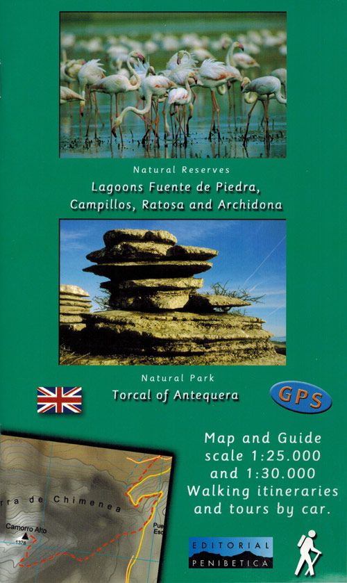
two separate maps, both with a UTM grid and latitude/longitude margin ticks at 1' intervals, but no overprint for cycling routes. One map at 1:30,000 (68x77cm) is centred on the Laguna de Fuente de Piedra and extends to Alameda in the north-east to Campillos in the south west. A small inset shows the Lagunas de Archidona which lie further to the east. The other map at 1:25,000 (65x48cm) covers the Torcal de Antequera Natural Park and includes Villanueva de la Conception in the south and part of Antequera in the north. The booklet is in English.
€ 12,95
Verzendkosten: € 2,95Specificaties
Merk:
n.b.
EAN:
Je bestelt bij:
De Zwerver
Categorie:
Subcategorie:
Maat:
n.v.t.
Materiaal:
n.v.t.
Levertijd:
Aantal beschikbaar:
n.b.
Verkoopprijs
€ 12,95
Prijzen vanaf:
n.v.t.
Verzendkosten:
€ 2,95
ISBN:
9788493444921
Editie:
None
Uitgever:
Editorial Penibetica
Beschrijft het volgende gebied:
Europa - Spanje - Andalusië - Zuid Spanje
Taal:
Engels - Spaans
Direct bestellen: