€ 37.50
Wegenatlas Navigator Camping and Caravanning - Atlas of Britain | Philip's Maps

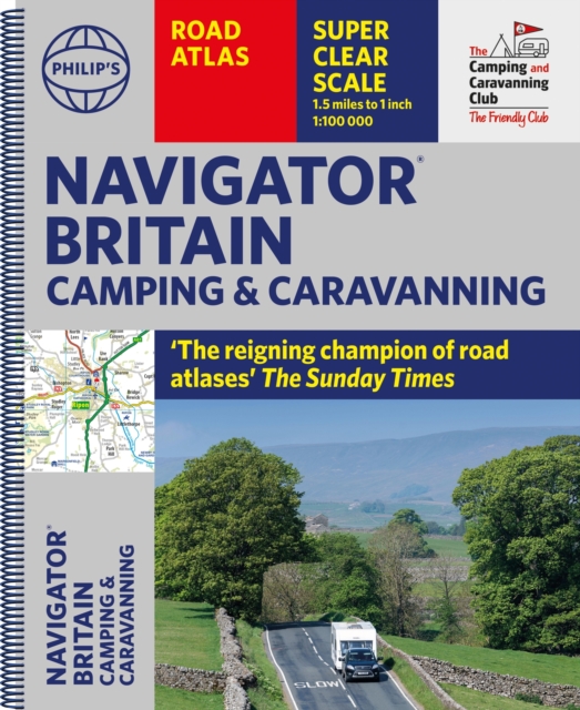
THE MUST-HAVE ATLAS OF BRITAIN FOR CAMPING, CARAVANNING AND MOTORHOMES'A map that beats all others' - The Daily Telegraph'Scale, accuracy and clarity are without parallel' - Driving Magazine'No. 1 in the UK for clear maps' - Independent research surveyThe lure of the open road and British countryside has never waned and the appeal of independent exploration has surely grown in recent years. However, the adventurous need practical information about what lies ahead - from bridge heights, widths and weights to places to stop and enjoy.


Philip's Navigator Camping and Caravanning Atlas of Britain is the No. 1 Choice of Road Atlas for the independent travelling motorist and camper van owner. * Scale: 1.5 miles to 1 inch = 1:100,000 (Northern Scotland: 3 miles to 1 inch = 1:200,000)* Over 1,880 approved campsites located, plus essential advice from The Camping and Caravanning Club* Includes essential information for caravanning motorists: 6000 bridge height limits, 1500 bridge weight limits and 260 bridge width limits- No other road atlas of Britain offers this level of detail and clarity- Britain's best road mapping in a great spiral format- Every street in Britain is marked on the maps- Over 3000 main roads named- 100 indexed town-centre maps plus approaches to 12 major urban areas- Super-detailed 6-page route-planning section- Exceptional road detail, from motorways to country lanes, with every junction, roundabout and slip-road shown- Thousands of individually named farms, houses and hamletsPhilip's Navigator Camping and Caravanning Atlas of Britain includes a special feature by The Friendly Club, which is packed with essential camping and caravanning information.

€ 39.95
Wegenatlas Australia Road & 4WD Touring Atlas A4 | Hema Maps

Uitstekende wegenatlas van heel Australië met goed leesbare kaarten, met stadsplattegronden en afstandstabel. A4-formaat in ringband, Engelstalig.

Featuring trusted Hema mapping for all of Australia, the Hema Road & 4WD Touring Atlas is the definitive travel guide for tourers and adventurers. Hema atlases feature more information useful to travellers, including 4WD tracks, campsites, caravan parks, rest areas, 24-hour fuel and points of interest.


This edition contains more mapping than ever before, which is enhanced by a striking new cartographic style that's incredibly easy to read. Included in this is up-to-date mapping for Australia's biggest 4WD destinations: Cape York, Fraser Island, the Top End, the Kimberley, the Pilbara, Central Australia, High Country Victoria and the Flinders Ranges.


A handy distance grid, national park guide, list of accredited information centres and a complete index are also included to assist with trip planning and navigation, making it the perfect tool for guiding tourers, campers, road trippers and off-roaders throughout Australia.


Key Features


Detailed 4WD tracks

Fuel

Points of interest

National parks

Campsites

Caravan parks

Rest areas

Road distances

Fully indexed


€ 16.50
Wegenatlas Travel Atlas South America - Zuid Amerika | ITMB

De eerste gedegen wegenatlas van Zuid Amerika: handig boekje met slappe kaft op A5 formaat.

This is unique! ALL of the continent of South America is now available in an easy-to-read, easy-to-use, easy-to-store road atlas at a superb scale. In addition to showing each country systematically, logically, and in great detail, physical features, points of interest, beaches, reefs, parks and reserves, major airports, and roads are shown. The atlas is 5 1/2" wide by 8 1/2" high (15cmx22cm), the same size as our Mexico Road Atlas. This atlas is 112 pages in length, is fully indexed, and has a hard card cover, and a spine. The advantage of this book format is that visitors to more than one country can save money and gain ease of use through a conveniently-sized and attractively presented book format. There is nothing equivalent to this in the world!

€ 26.95
Wegenatlas Peloponnese | Anavasi

Paperback, 237-page road atlas of the Peloponnese with detailed contoured mapping at 1;50,000 showing place names in Greek and Roman alphabets and providing a 2km UTM grid for GPS use.

The main section of the atlas has 178 pages of detailed maps with contours at 100m intervals, altitude colouring and relief shading to provide a vivid representation of the terrain. Nearly all names: town and villages, geographical features, etc., are given in both Greek and Roman alphabets, with just minor local churches shown in Greek only. Names of most archeological sites and many other places of interest are given in Greek and in English.

Road classification has 10 different grades, from toll motorways to minor dirt roads in poor condition and 4WD tracks. Intermediate driving distances are shown on main and secondary roads. The maps also indicate locations of petrol stations (with names of oil companies) and tire repairs facilities.

Local footpaths are also marked, with the E4 trans-European long-distance trail and routes 031, 032 and 033 highlighted. A wide range of symbols mark locations of various places of interest including accommodation (hotels, campsites, summer camps, mountain refuges), archaeological sites, churches and monasteries, beaches, caves, viewpoints, etc.

The maps have a 2km UTM grid and 1’ latitude/longitude ticks. Map legend includes English. Two indexes, one for each alphabet, include separate sections listing archaeological sites and religious monuments.

The atlas also has a 12 page section showing the Peloponnese at 1:250,000 for more general route planning. Also included are two tables giving driving distance and driving times between over 60 location.

€ 45.95
Wegenatlas Cape York Atlas & Guide | Hema Maps

A4 formaat, verschillende schalen / spiraal uitvoering

With detailed coverage of The Tip, the coast from Cairns to Cooktown, Rinyirru (Lakefield) National Park, the Peninsula Developmental Road, Old Telegraph Track, Torres Strait and the Savannah Way, it ensures you won’t miss the ‘must-see’ attractions, but it also describes some of the lesser known areas favoured by the experts. Whether you just want to make it to The Tip or are looking for a serious 4WD adventure, this informative book is an indispensable companion.


The book features 15 4WD trips, explored and revised by travel journalist Ian Glover, with photography by Matt Williams. Each trip has a detailed map, plus all the information you need to plan the trip including trip grading, longest distance without fuel, permits and contact details.


This brand new edition of Hema’s best-selling outdoor guidebook for discovering Cape York now features 22 atlas pages in a stunning new cartographic style and also incorporates content from the popular Cape York Travel & Adventure Guide by Ron and Viv Moon as well.


Key Features:


Featuring the top 15 4WD trips, including The Old Telegraph Track

Detailed inset maps for every track

Best campsites

Trip planning tips

Contains a detailed Road Atlas for Cape York, including detailed mapping for The Tip

Maps show fuel, camping areas and rest areas

New cartographic style with latest mapping, points of interest and facilities

Mapping field-checked by the Hema Map Patrol


€ 47.50
Wegenatlas The Kimberley Atlas & Guide | Hema Maps

A4 formaat, spiraal gebonden, verschillende schalen

This guide is jam-packed with information on what to do and see in the Kimberley. Travel writer Denis O'Byrne gives information on the Kimberley's amazing 'must see' landmarks as well as expert favourites that often go unseen.

Hema's guide helps you make the most of your visit to the remarkable corner of Australia. With detailed coverage of the Gibb River Road, Broome, Kununurra, Purnululu, (The Bungle Bungles) and many other famous destinations, it ensures you won't miss the 'must-see' attractions, but it also describes some of the lesser known areas favoured by the experts. 


Features:


New larger A4 format - easy-to-read

Town and locatlities GPS index

When to go and how to prepare

Handy atlas for navigation, plus detailed maps of the Gibb River Road, Great Northern Highway, Broome and Kununurra regions, and national parks

Where to go for the best outdoor experiences

Where to stay, from luxurious resorts to the best bush camping spots

Extensive listing of rental agencies and tour operators - fully organised excursions, Aboriginal culture tours, DIY adventures, scenic flights and more

Background reading on the region's unique geographical featues, flora and fauna.


Whether you're here for a relaxing holiday or a serious 4WD adventure, this informative book with its easy-to-follow maps is an indispensable companion.