
Wegenkaart - landkaart Maleisië Malaysia | Freytag & Berndt
Mooie duidelijke kaart met het vasteland van Maleisie op een zeer aanvaardbare schaal van 1:900.000. Bijzonder geschikt om rond te reizen, al dan niet met een eigen vervoermiddel.
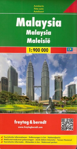
Malaysia on a large, double-sided, indexed map from Freytag & Berndt, covering the peninsular Malaysia at 1:900,000, with Sarawak and Sabah. Very effective relief shading with spot heights and graphics for swamps or mangrove areas and coral reefs provide good representation of the country’s topography.
Road network includes selected local tracks; intermediate distances are given on main routes. Railways, local airports and ferry routes are shown, as well as the country’s internal administrative boundaries with names of the provinces. National parks and other protected areas are highlighted, and symbols mark locations of various places of interest, including temples, beaches, caves, etc.
The map has a latitude and longitude grid at intervals of 1º and an index. Map legend includes English.
€ 14,95
Verzendkosten: € 2,95Specificaties
Merk:
n.b.
EAN:
Je bestelt bij:
De Zwerver
Categorie:
Subcategorie:
Maat:
n.v.t.
Materiaal:
n.v.t.
Levertijd:
Aantal beschikbaar:
n.b.
Verkoopprijs
€ 14,95
Prijzen vanaf:
n.v.t.
Verzendkosten:
€ 2,95
ISBN:
9783707914078
Editie:
01-08-2016
Uitgever:
Freytag & Berndt
Beschrijft het volgende gebied:
Azië - Maleisië -
Taal:
Duits - Engels
Direct bestellen: