€ 23.50
Reisgids Chiemgau & Berchtesgadener Land | Michael Müller Verlag

Uitstekende, diepgaande reisgids over Chiemgau. Met veel achtergrondinformatie en ook praktische zaken als overnachtingen en eet- en drinkgelegenheden. Thematische hoofdstukken over geschiedenis, geologie etc.

Let op: Duits!


Im Norden der Region liegen mit Wasserburg, Rosenheim, Mühldorf und Neuötting Städte, die einst vom Salzhandel entlang des Inns profitierten. Der Reichtum führte sogar zu einem eigenen Baustil, dem Inn-Salzach-Stil. Östlich von Rosenheim liegt Bayerns größter See, der Chiemsee. Unbedingt sehenswert sind hier Schloss Herrenchiemsee (das »bayerische Versailles«) und das uralte Kloster auf der malerischen Fraueninsel.


Auch Orte wie Altötting, Rott am Inn, Seebruck, Bernau und zahlreiche weitere finden Sie in unserem Reiseführer »Chiemgau & Berchtesgadener Land« ausführlich beschrieben. Dank der Geheimtipps von Thomas Schröder in unserem Reiseführer »Chiemgau« entdecken Sie alles Sehenswerte spielend leicht.


Die ruhige Gegend rund um Traun und Alz ist geprägt von grünem, hügeligem Bauernland. Die alte Salzsiederstadt Traunstein ist das Glanzlicht der Region. Rupertiwinkel, zwischen Chiemgau und Salzach, gehört erst seit 1816 zu Bayern. Hier locken insbesondere Laufen und Tittmoning und das nahe Burghausen. Aber auch Waging am See, Petting oder die Wallfahrtskirche Marienberg sind äußerst lohnende Ziele.


In den Chiemgauer Alpen locken Reit im Winkl, Ruhpolding und Inzell. Zahlreiche Gipfel bieten eindrucksvolle Panoramen mit dem Chiemsee am Horizont. Naturfreunden und Wanderern bieten sich viele reizvolle Routen.


Das Berchtesgadener Land schließlich ist ein Juwel inmitten faszinierender Bergwelt mit beeindruckender Natur. Must-Sees sind der Königssee, Berchtesgaden und Bad Reichenhall, das »Meran des Nordens«. Ein ausführlich beschriebener Ausflug nach Salzburg rundet den Reiseführer ab.


€ 22.50
Wandelkaart Turkart Nordkinnhalvoya | Noorwegen | Calazo

Calazo, een kaartenmaker uit Zweden, maakt heel goede wandelkaarten van bekende en minder bekende gebieden in Scandinavie. Wandelroutes, berghutten, bruggen en andere kenmerken in het landschap staan duidelijk ingetekend, de kaarten zijn zeer betrouwbaar en gedrukt op Tyvek, een watervast en superlicht materiaal wat echt duurzaam is en lang meegaat.

Op de Nordkinnhalvoya en elders rond Finnmark zijn er mogelijkheden voor veelzijdige tochten voor alle seizoenen. Het is ons doel dat steeds meer mensen het plezier zullen vinden om op reis te gaan, zowel bij mooi als bij slecht weer. Sommige tours zijn laag en dicht bij waar mensen wonen, terwijl andere hoger, veeleisender en iets verder weg zijn. Een goede tourkaart is een goede hulp bij het plannen van mooie tours hoog en laag in het machtige Finnmark. Deze kaart is ontwikkeld in samenwerking met de Finnmark Outdoor Council.

Plaatsen op deze kaart: Slettnes, Omgang, Skjotningberg, Kifjord, Tyfjord, Skjanes, Hopseidet, Nervei, Kalak, Lebesby, Ifjord, Torhop, Smalfjord

€ 22.50
Wandelkaart Turkart Sogndal - Årdal - Sognedal | Noorwegen | Calazo

Calazo, een kaartenmaker uit Zweden, maakt heel goede wandelkaarten van bekende en minder bekende gebieden in Scandinavie. Wandelroutes, berghutten, bruggen en andere kenmerken in het landschap staan duidelijk ingetekend, de kaarten zijn zeer betrouwbaar en gedrukt op Tyvek, een watervast en superlicht materiaal wat echt duurzaam is en lang meegaat.

Met kaartweergaven op zowel de voor- als achterkant, bestrijkt deze kaart het hele gebied van Fjærlan tot Luster en Årdal, met klassieke reisbestemmingen zoals het westen van Hurrungene, Jostedalen en het gebied rond Anestølen. Dit maakt deel uit van de moderne kaartenserie van Calazo, met unieke terreininformatie op basis van laserscanning van de vlieg en betere nauwkeurigheid in de details. We hebben onder meer gedetailleerde luchtfoto's gebruikt om alle paden in het gebied te corrigeren. We hebben ook veel routes geïdentificeerd en toegevoegd die ontbraken in de officiële databases.


De kaart beslaat alle meest populaire berggebieden, met hutten die worden beheerd door zowel DNT als andere operators. Het toont ook gemarkeerde wandelroutes in de omgeving en werkt net zo goed in de winter met gemarkeerde winterroutes en geprepareerde skipistes.

€ 17.50
Wandelkaart 1 Peneda-Geres Norte | Projekt Nord

Topografische kaart van het noordelijk deel van Parque Nacional Peneda-Geres waarop de wandelpaden en een aantal fietsroutes zijn ingetekend. Het zijn duidelijke kaarten en goed leesbaar met een coordinaten vermelding waardoor ze voor GPS goed te gebruiken zijn. Het is een éénzijdige kaart. 

Detaillierte Wanderkarte des Nationalpark Peneda-Gerês im Norden von Portugal auf der Grundlage der OpenStreetmap. Enthält Wanderwege und Radwanderwege soweit in der Datenbasis vorhanden.

€ 28.95
Wandelgids Wine Hiking Switzerland - Zwitserland | Helvetiq

Explore the landscape of Swiss winesWine lovers, these 50 hikes are for you!From dramatic vineyards in the Alps to stunning lakeside wineries, this guide will help you discover the extraordinary and diverse landscape of Swiss wine. The 50 hikes follow routes chosen for their beauty through Switzerland's leading wine regions. Every single one of them ends with a visit to an excellent Swiss winemaker.Wine writer Ellen Wallace has crisscrossed the country by trail and track, and her routes will permit hikers of all levels to discover her favorite wines.- A presentation of 50 carefully selected wineries and wines- A wide variety of grape varieties and price ranges- Beautiful itineraries with information for visitors- Downloadable GPX files for each route

€ 34.95
Reisgids North Coast 500 NC500 | Collins

Highly illustrated, full colour book showcasing what is unique about the North Coast 500. Striking images and descriptive text of the best places to visit are shown along with a simple route map showing locations.

100 of the best places to stop on route including;

* Beaches and bays; Sandwood Bay to Red Point Beach

* Engineering and architecture; Caledonian Canal to Noss Head Lighthouse

* Historic sites; Culloden battlefield to Dunrobin Castle

* Off the beaten track; Cape Wrath to Traligill Caves

* Urban areas: Ullapool to John o' Groats

* Wildlife and nature: Dunnet Head to Suilven

A book to help plan your trip around the dramatic North Scotland. An indication of how long to spend at each place is given along with full description and photograph.

€ 37.95
Reisgids Explore Kyrgyzstan | Ountravela

Get ready for an epic silk road adventure by 4x4, van, motorbike or bike off the beaten track ! This book is an invitation to explore the wildest corners of Kyrgyzstan by 4x4, van, motorbike or bike. Crossed east to west by the Celestial Mountains, Kyrgyzstan is a mountainous country overflowing with breathtaking natural scenery. From picturesque valleys to snow-capped summits, follow in the footsteps of the Silk Road caravans and encounter this nomadic people. Find yourself inspired to undertake a timeless journey using our carefully selected routes. Trip preparation : all of our advice for organizing your independent journey : visa, vehicle choice, rentals, gear, etc. 80 pages of detailed maps : a selection of 24 of the best routes in the country as well as the major, not-to-be-missed, attractions. 500 points of interest : all of the unmissable points in the country as well as a few hidden gems, chosen by the authors : cultural places, viewpoints, wild camping spots, lakes, hot springs, etc. Culture, history, flora and fauna : 40 pages on understanding the surrounding environment and our advice on how best to respect it. Outdoor activities : unmissable activities : horseback riding, hiking, climbing, rafting, etc.

€ 15.95
Fietskaart 14 Cycling guides Suffolk | Goldeneye

To be confronted with the variety and complexity of the cycling routes, trails and paths in Suffolk can be a bewildering experience.  For it appears that the Suffolk County Council and the three District Councils are all trying hard to promote their areas. This is indeed encouraging for the growth of cycling, but it can be confusing.  Our purpose is to provide clear, easy to use and easy to follow, cycling maps, and to illustrate these in a comprehensive form. 


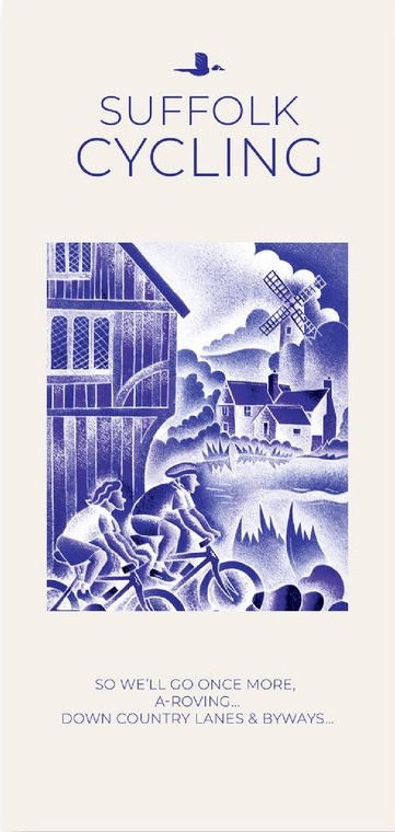
Suffolk must be one of the most charming of counties to explore by bicycle. When Al Churcher delivered his routes to us at Goldeneye we couldn’t keep him quiet, such was his enthusiasm and wonder at Suffolk’s country lanes and byways. He has cycled all over the UK, Canada, Mallorca, New Zealand and Sicily, but Suffolk remained a firm favourite. 


The inland scenery is not spectacular for the county’s main glory lies with its attractive villages; the local architecture jealously preserved from modern depredation. There is an abundance of churches, ranging from the magnificence of Lavenham and Long Melford to more modest churches, but almost all have a unique feature to be proud of. The quiet countryside has been immortalised in the paintings of John Constable who lived most of his life in the Stour Valley on the Essex  borders. 


We hope that by following these routes your enjoyment and knowledge of this corner of England will increase one hundredfold. The purists may prefer to follow their own course. They will, we hope, enjoy and appreciate the clarity of our mapping


Recommended Routes/Trails


National Cycle Network (NCN)


The following NCN routes cross Suffolk:-


NCN Route 1. Hull to Harwich. A 370-mile route, passing Cathedral cities, towns and villages through pastoral countryside.  This is the main north to south route through Suffolk, forming part of the Fakenham to Harwich cycle route. The route enters Suffolk from Essex at Stratford St Mary and passes through Hadleigh, around the north-west side of Ipswich, through Woodbridge and Halesworth, before entering Norfolk at Beccles.


NCN Route 13. This crosses Suffolk on a South to North axis via Sudbury to the pretty villages of Long Melford and Lavenham, to the market town of  Bury St Edmunds, up to Thetford, and on through the Breckland landscape to Fakenham in Norfolk. 


NCN Route 51. This route forms part of the Oxford to Felixstowe Cycle Route. In Suffolk the route takes you from pebbled beaches to country parks, and from urban docks, to rural lanes. Twenty five percent is off-road. It enters Suffolk from Cambridgeshire, and crosses west to east, connecting Newmarket with Bury St Edmunds, Stowmarket, Ipswich and Felixstowe


Regional Routes


Regional Route/NCN 30. Known as the “Two Rivers Cycle Route” which runs along the Norfolk/Suffolk border from Lowestoft and Thetford, via Beccles and Diss. 


Regional Route 41 (Suffolk Coastal Cycle Route). This route combines with NCN Route 1 to form an 88-mile circular route. Starting north of Felixstowe travelling through Orford (via the Butley Ferry), Blaxhall and Bruisyard, then south to Woodbridge returning to Felixstowe via Waldringfield. This circular route is set within the Suffolk Coast and Heaths Area of Outstanding Natural Beauty. Not illustrated on our map with RR41 to avoid confusion. But, follow NCN1 signs on this map.


Traffic-Free Family Routes/Trails


1. Alton Water Circuit.  An 8.5-mile circuit. There are two routes available, the easier (A) and more challenging (B). Café/Visitor Centre/Cycle Hire. (J10)


2. Icknield Way.  An ancient trackway crossing Southern England.  The best linear rides through Suffolk start from Icklingham, The King’s Forest (C4),  Euston (E3) and Lackford (C5). 


3. The King’s Forest Rides. Two circular (mostly) off-road routes through forest, heathland and farmland.  13 miles.  Cycle link to Bury Station. (D4)


4. Peddar’s Way. A challenging 46-mile route, the origin whose name is obscure, links Knettishall Heath near Thetfordwith the coast at Holme. For the most part it follows the old Roman road built to restrain the rebellious Iceni tribe. Open to cyclists, walkers and horse riders.  (E1)


5. Rendlesham Cycle Trail. Two family trails start from the Forest Centre. The shorter trail, the Tang Trail, is about 6-miles. The longer, the F.I.D.O. Trail is 10-miles. The tracks are made up of gravel, grass, sand and tarmac.  Nearby, in Tunstall Forest, there’s a popular Mountain Bike area. (L/M8)


6. Thetford Forest Park Cycle Trails:  There are four waymarked routes: Green (family route), Blue Route, and the more challenging Red and Black routes.  It encompasses a wide scope of off-road riding with links to the Peddar’s Way.  Bike hire at the Forest High Lodge. (D3)

€ 22.50
Wandelkaart Turkart Norge på tvers (Stjørdal-Sylan) | Noorwegen | Calazo

Calazo, een kaartenmaker uit Zweden, maakt heel goede wandelkaarten van bekende en minder bekende gebieden in Scandinavie. Wandelroutes, berghutten, bruggen en andere kenmerken in het landschap staan duidelijk ingetekend, de kaarten zijn zeer betrouwbaar en gedrukt op Tyvek, een watervast en superlicht materiaal wat echt duurzaam is en lang meegaat.

Noorwegen aan de overkant is een unieke expeditie-ervaring van 120 kilometer, verdeeld in 7 dagetappes door het berggebied van Sylan. De reis volgt de gemarkeerde routes van de toeristenorganisatie langs 63 graden noord met accommodatie in service- en zelfbedienings-DNT-cabines. Dit kaartblad beslaat het hele traject van de fjord in Stjørdal tot de Zweedse grens in Tydal met kaarten op zowel de voor- als achterkant. Een van de traktaties op de reis is de machtige Sylmassive, het verst naar het oosten in Trøndelag. De hoogste top, Storsylen (1.762 m), ligt net aan de Noorse kant van de Zweedse grens.


Deze kaart van Noorwegen is uitgegeven door Calazo in samenwerking met Trondhjems Turistforening en Nord-Trøndelag Turistforening. Dit maakt deel uit van een moderne kaartenserie waarbij de terreininformatie is gebaseerd op laserscanning vanuit vliegtuigen. De kaart is gemaakt van het materiaal Tyvek, dat bestand is tegen water, beschermd is tegen scheuren en een laag gewicht heeft.

€ 11.95
Wegenkaart - landkaart 10 Atiki - Attika | Anavasi

Gebaseerd op topografische kaarten, GPS compatible, gedrukt op watervast en scheurvast papier. Hoogtelijnen met 100 m interval, schaduwkleuren en punten met hoogte geven de topografie van het landschap aan. De kaart kent een UTM grid.

Het wegennet wordt aangeduid met verschillende gradaties: grote en kleine wegen, verhard en onverhard. Toeristische bezienswaardigheden staan als zodanig aangeduid zoals thermen, kloosters, berghutten, grotten etc. Namen van steden zowel in het normale schrift als in het Grieks, met een legenda die ook in het Engels is.

Abonneer op