€ 16.90
Wegenkaart - landkaart 7.3 Lykische Küste 3 | Projekt Nord

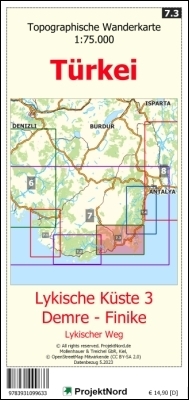
Detaillierteste Topographische Landkarte von Lykien, die sich derzeit auf dem Markt befindet, auf der Grundlage der OpenStreetMap. Enthält Wanderwege, u.a. den Lykischen Weg. Mit Detailplan des Stadtzentrums von Finike.Die Landkarte enthält ein dichtes Straßennetz mit Hauptverkehrsstraßen, Nebenstraßen sowie Wegen und Pfaden zum Wandern in dünn besiedelten Regionen.Mit allen Dörfern. Mit Höhenlinien und Geländeschummerung. Ebenso enthalten: Gastronomie, Trinkwasserstellen, Zeltplätze u.a.Ideal geeignet für Reisende, die sich intensiv mit dem Land beschäftigen und auf eigene Faust unterwegs sind, ob zu Fuß, per Fahrrad oder mit dem Auto.


€ 9.95
Reisgids South! Guide to Namibia's infinite South | Martial prod.

Welcome to the South of Namibia! Projects & Promotions' guide to the infinite South region is a nicely made manual with compact information on the most important aspects travelling the South. It features a very good, up-to-date and reliable region map designed by Prof. Dr. Uwe Jäschke, a skilled and experienced cartographer of Namibia maps of all kind. The action and travel tips, the regional information as well as the route recommendations - as listed in the table of content below - have been planned and compiled by Namibian travel and hiking enthusiasts.

A4 formaat - 22 pagina's 

€ 13.95
Wandelgids 15 Short Walks Dumfries and Galloway | Cicerone

Ronald Turnbull has chosen 15 of the best short walks around Dumfries and Galloway for you to explore. Our guide comes with easy-to-read Ordnance Survey maps and clear route descriptions, perfect if you're new to walking or are looking for something you can enjoy with the whole family. We've included information on local beauty spots and tasty refreshment stops, and most of the walks can be completed in under 4 hours.


We haven't included any walks with challenging terrain or complicated navigation, and all you'll need to take with you are a waterproof jacket and a pair of comfortable trainers.

€ 22.50
Wandelkaart Fjällkartor 1:50.000 Tärnaby & Södra Storfjället | Zweden | Calazo

Calazo, een kaartenmaker uit Zweden, maakt heel goede wandelkaarten van bekende en minder bekende gebieden in Scandinavie. Wandelroutes, berghutten, bruggen en andere kenmerken in het landschap staan duidelijk ingetekend, de kaarten zijn zeer betrouwbaar en gedrukt op Tyvek, een watervast en superlicht materiaal wat echt duurzaam is en lang meegaat.


Dit maakt deel uit van de moderne kaartenserie van Calazo met een unieke detailrijkdom op basis van nieuwe gegevens verkregen door laserscanning door vliegtuigen.

€ 12.50
Wandelkaart 31 Oberbergisches Talsperrenland | GeoMap

Wanderkarte Oberbergisches Talsperrenland 1:25.000 auf Grundlage der amtlichen topographischen Geobasisdaten des Landes NRW und dem Freizeitkataster NRW. Topographische Karte mit Wanderwegen und Freizeitinformationen.


€ 13.95
Reisgids Hidden Glasgow | Birlinn

Defining what is hidden in a city is not easy. In some cases, buildings are not open to public view, well off the beaten track, or are simply forgotten amidst the rapidly changing environment of a fast growing city. In other cases, we are looking at the building the wrong way and only seeing one aspect of its past life, and in others we are looking at them from the wrong perspective.


A darker side hides things that a city would rather forget. From the golden merchant ship on top of the Merchant's House, through the abandoned Britannia Panopticon Music Hall on Argyle Street, from the schoolroom in the attic of Trades House to the Lock Hospital for 'dangerous women', Carol Foreman takes us through the Glasgow we walk through every day and makes us see it with a different eye. From the top of the Tolbooth steeple to the many tunnels and preserved buildings under the ground, she reveals the essence of a great city in all its dimensions and brings to life a Glasgow both hidden and forgotten.

€ 9.95
Wandelkaart Südliches Siegerland | Sauerland | Grunes Herz

Wandern im Dreiländereck… in den Gemeinden Burbach, Wilnsdorf und Neukirchen.

Idyllische Dörfer gepaart mit der unverwechselbaren Landschaft schaffen eine Kulisse für aktive Erholung und entspannte Tage.


Ob über den Rothaarsteig oder Themenwege, für Wanderer gibt es zahlreiche Möglichkeiten, die sanft-hügelige Landschaft zu erkunden.


Plaatsen op de kaart

Siegen, Wilnsdorf, Haiger, Burbach, Neuenkirchen

Abonneer op