€ 28.95
Reisgids Portugal | Michael Müller Verlag

Anders reisen und dabei das Besondere entdecken


Mit den aktuellen Tipps aus den Michael-Müller-Reiseführern gestalten Sie Ihre Reise individuell, nachhaltig und sicher.


Sonne, Strand, weites Land und ein ganz spezielles Lebensgefühl - das ist Portugal, auch »Kalifornien Europas« genannt. Gehen Sie mit Michael Müller und dem Reiseführer »Portugal« in der 23. (!) Auflage auf Entdeckungstour im Südwesten Kontinentaleuropas.


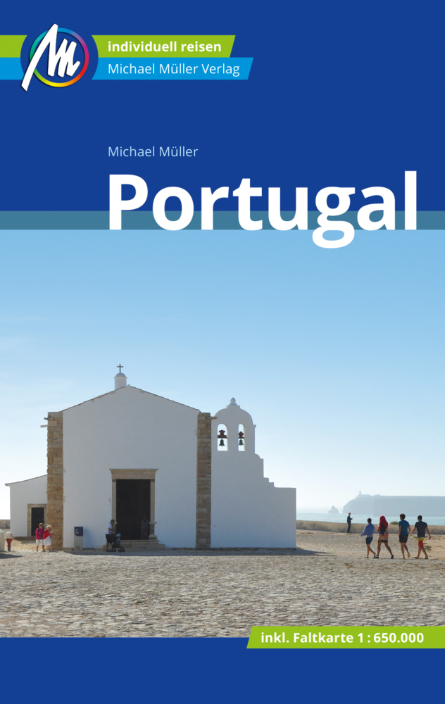
Auf 756 Seiten mit 237 Farbfotos spüren Sie die Liebe und Hingabe von Michael Müller an dieses Land. Mit Blick für das Besondere und viel Liebe zum Detail führt er Sie ebenso durch die Metropole Lissabon wie durch kleine, sehenswerte Dörfer an der Algarve im Süden des Landes sowie zu allem Sehens- und Erlebenswertem dazwischen. Dank 87 Karten und Plänen sind Sie so gut orientiert wie die Einheimischen. Praktisches Extra: eine herausnehmbare Portugal-Karte im Maßstab 1:650.000.


Ökologisch, regional und nachhaltig wirtschaftende Betriebe sind kenntlich gemacht. Michael Müller hat alles für Sie vor Ort recherchiert und ausprobiert. Zahlreiche eingestreute Kurz-Essays und Anekdoten vermitteln interessante Hintergrundinformationen und machen Ihnen Land und Leute leichter zugänglich.


Die Geheimtipps von Michael Müller erschließen Ihnen die Must-Sees ebenso, wie die versteckten Perlen des Landes. Erprobte Tipps und nützliche reisepraktische Ratschläge runden den Portugal-Reiseführer ab. Die Süddeutsche Zeitung schreibt: »Einen zuverlässigen Reiseführer hat, wer mit Michael Müllers Buch unterwegs ist.« Und die Mittelbayerische Zeitung findet: »Kein Portugal-Urlaub ohne Michael Müller.«


Portugal im Überblick


Altstadttrubel in Porto, Surfparadies und Fischerstädtchen Nazaré, Baden an wilder Küste in Vila Nova de Milfontes, einsame Berglandschaften in der Serra da Estrela, Flussdelfine in der Mündung des Rio Sado, fünf UNESCO-Welterbe-Stätten - mit unserem Reiseführer »Portugal« wird Ihr Urlaub alles, aber nicht langweilig.


Der Norden Portugals ist die Wiege der Nation. Das von dunklem Granit geprägte Guimarães war 1140 die erste Hauptstadt Portugals. Heute ist Porto das quirlige Zentrum der Region. Die Flüsse Minho und Douro prägen die Landschaft. Berühmt ist die Region für den Weinbau, sei es Portwein oder sommerlich-spritziger Vinho Verde. Vertrauen Sie den Geheimtipps von Michael Müller und entdecken Sie mit unserem Portugal-Reiseführer neben der Historie auch die süffigsten Tropfen und schmackhaftesten Spezialitäten der Region.


Mittelportugal zwischen Lissabon und Porto gliedert sich in die Regionen Beira im Norden, Oeste im Westen und Ribatejo im Süden. Badefreunde erfreuen sich an schier endlosen Sandstränden. Einmalig: Die Lagunenlandschaft um Aveiro. Im Landesinnern erheben sich die knapp 2.000 Meter hohen Berge der Serra da Estrela. Coimbra ist historische Universitätsstadt und bis heute geistiges Zentrum Portugals. Mit dem Reiseführer »Portugal« entdecken Sie die Must-Sees Portugals ebenso, wie versteckte Perlen, die garantiert nicht jeder kennt.


Auf mehreren Hügeln gelegen, erhebt sich die Hauptstadt Lissabon über die breite Mündung des Rio Tejo. Sie gilt als eine der schönsten Hauptstädte Europas. Erforschen Sie mit unserem kundigen Begleiter an Ihrer Seite die prachtvolle Altstadt, zahllose Kaffeehäuser, ein vitales Nachtleben, und die einmalige Mischung aus Moderne und Geschichte, die Lissabon so besonders macht. Ein Ausflug zum Pena-Palast ins nahe Sintra sowie zu den Stränden Estorils und Cascais gehören dazu. Unser Reiseführer hat für Ihre Entdeckungstouren alles Sehens- und Wissenswerte parat!


Im Süden liegen das Alentejo und die Algarve. Während das Alentejo trotz grandioser Strände bislang touristisch n

€ 17.95
Wandelgids La Transgaumaise | De Rouck

Mooie wandelroute in de Ardennen. Deze gids - Franstalig - geeft veel aanvullende informatie over de streek met een korte beschrijving hoe je moet lopen. Kaartmateriaal ontbreekt echter, de route is ook nergens anders ingetekend. Maar wel een mooi en goed boek om deze route te plannen.

Ce guide propose un itinéraire balisé de 140 km pour une randonnée autour de la capitale de la Gaume, Virton, avec une incursion dans la Lorraine française. Avec, comme point de départ, la vallée de Rabais, en passant par Torgny, jusqu'à la frontière française pour visiter Avioth, Montmédy et Marville.

€ 62.90
Wandelatlas Slowakije - Slovensko | Shocart

De eerste en meest gedetailleerde atlas van Slowakije in de schaal 1:50 000. De basis van de atlas is een gedetailleerde toeristenkaart, aangevuld met een compleet netwerk van gemarkeerde, voorbereide en aanbevolen fietsroutes, inclusief hun nummering. Natuurlijk zijn er contourlijnen van 10 m en schaduwrijk terrein. De kaart ondersteunt GPS. U vindt het hele grondgebied van Slowakije op 400 kaartpagina's.

De inleiding van de publicatie biedt enige basisinformatie over toerisme en fietsen, aan het eind is er een kaartgedeelte aangevuld met een register van gemeenten. De atlas wordt in een map geordend en in een kartonnen doos gedaan. De afzonderlijke vellen kunnen daarom op elk moment eenvoudig worden verwijderd, in een voorbereide PVC-hoes (kaart) worden gestoken en worden gebruikt voor wandelen of fietsen.

€ 18.50
Wandelgids 5904 Wanderführer La Gomera | Kompass

Goede Duitstalige wandelgids met heldere beschrijvingen van de wandeltochten. Met hoogteprofiel, kaartje en de benodigde praktische informatie als bijvoorbeeld de startlocatie met GPS coordinaten. De wandelingen zijn ingedeeld in zwaarte en dan op verschillende kleuren weergegeven. Beschreven worden eenvoudige wandelingen tot pittige (berg)tochten, voor getrainde en ongetrainde wandelaars, een aantal wandelingen zijn geschikt om met kinderen te doen. Belangrijke toevoeging bij de Kompass wandelgidsen is een bijgevoegde losse wandelkaart van het betreffende gebied waarop de wandelingen uit de gids op de kaart heel duidelijk zijn ingetekend. 


Kaart met schaal 1:40.000

€ 23.95
Wegenatlas Road Atlas Britain and Ireland 2024 | Philip's Maps

Let op! Ierland en een gedeelte van Schotland hebben een andere schaal dan de rest van de atlas.


PHILIP'S - Market leaders and No. 1 in the UK for clear maps'Good balance between detail and clarity with excellent town maps' What Car? * Super-clear mapping at a scale of 3 miles to 1 inch = 1:200,000* Includes the latest highway code requirements* Completely updated and revised for 2024* New map showing Smart Motorways- Practical spiral bound, lie-flat format- 160 pages of fully updated super-clear road maps - 10 pages of detailed route-planning maps - plan your route in advance - 88 indexed town-centre maps - 14 pages of city approach maps with named arterial roads - 2 page road map of Ireland- Map of scenic Britain and a map highlighting railways, airports and ferry ports Philip's 2024 Road Atlas Britain and Ireland is the top-of-the-range spiral road atlas featuring the latest maps from the Philip's digital database. Voted Britain's clearest and most detailed in an independent consumer survey, the mapping is super-clear.


Philip's 2024 Road Atlas Britain and Ireland contains 160 pages of road maps covering Britain at 3 miles to 1 inch, with the Western Isles, Orkney and Shetland at smaller scales. The maps clearly mark service areas, roundabouts and multi-level junctions, and in rural areas distinguish between roads over and under 4 metres wide. The atlas also includes a 2-page road map of Ireland, 10 pages of route-planning maps, a distance table, 10 large-scale city approach maps with named arterial roads, and 88 extra-detailed and fully indexed town and city plans.

€ 18.50
Reisgids - Kookboek Eat Malaysia and Singapore | Lonely Planet

For everybody excited about exploring the unique cuisine and food culture of Malaysia and Singapore, this book is the perfect primer. It introduces the key specialities of each region, covering their history and significance to the local people. Learn about the dishes that you will find on regional menus, how to order and eat them, and other essential words and phrases for navigating the food scene.

The extensive section on etiquette covers all the dos and don'ts of local customs so you need never feel awkward or uncertain. From how to sit opposite your hosts (tip: don't cross your legs), to when and how to eat with your hands.

Written by Simon Richmond, who has previously authored Lonely Planet's Malaysia and Singapore travel guides, this book provides an insight into the country's best neighbourhoods and latest trends. A dedicated feature also focuses on hawker and street food stalls so that you know what to try and can experience this vibrant and exciting aspect of local life.

Regions covered: Kuala Lumpur, Kota Bharu, Kuching, Penang, Melaka, Singapore

In-depth profiles of Malaysian and Singaporean specialities: nasi lemak, laksa, satay, murtabak, rendang curry, char kway teow, hawker and street food

For first time visitors, experienced travellers or those who simply love the region, Eat Malaysia & Singapore is a culinary companion packed with beautiful illustrations, inspirational photography and detailed insights that bring the distinctive food and culture of these famous destinations to life.


€ 18.50
Wandelgids Wandelen in Valencia | Odyssee Reisgidsen

Valencia is de derde stad van Spanje en tegelijk hoofdstad van zowel de provincie als de autonome regio met dezelfde naam: Valencia. De stad ligt aan de Golf van Valencia aan de Costa del Azahar. Het klimaat is er mild en aangenaam.


Met deze gids ontdek je Valencia met drie wandelingen: het historische centrum Barrio del Carmen, dat een sfeervolle mengelmoes van bouwstijlen heeft; L’Eixample, gebouwd voor de gegoede burgerij, waar de betere restaurants, bars en winkels te vinden zijn en De Jardines del Turia, de transformatie rivier tot uniek stadspark: de trots van de stad. Daarnaast neemt de gids je mee naar de stranden en havens van Valencia. Ook de omgving komt aan bod.


Deze Odyssee Reisgids biedt:

- Bekende en onbekende bezienswaardigheden

- Heldere, kleurrijke lay-out

- Duidelijke kaarten en sprekende kleurenfoto’s

- Relevante informatie over cultuur en geschiedenis

- Tips voor horeca en overnachtingsmogelijkheden

€ 10.95
Wegenkaart - landkaart Planning Map New Zealand - Nieuw Zeeland | Lonely Planet

Durable and waterproof, with a handy slipcase and an easy-fold format, Lonely Planet New Zealand Planning Map is your conveniently-sized passport to traveling with ease. Get more from your map and your trip with images and information about top country attractions, itinerary suggestions, a transport guide, planning information, themed lists and practical travel tips. With this easy-to-use, full colour navigation tool in your back pocket, you can truly get to the heart of New Zealand, so begin your journey now!

Durable and waterproof

Easy-fold format and convenient size

Handy slipcase

Full colour and easy-to-use

Before-you-go info

Beautiful imagery

Tailored itineraries

Can't-miss regional highlights

Detailed town index

Transport planner

Themed lists

Covers Auckland, Bay of Islands, Hauraki Gulf, Waiheke Island, Rotorua, Bay of Plenty, Coromandel Peninsula, Wellington, Abel Tasman National Park, Marlborough Wine Region, Taupo, Tongariro Alpine Crossing, Matamata, Waitomo, Otago Peninsula, Banks Peninsula, Christchurch, Kaikoura, Queenstown, Wanaka, Fiordland, Stewart Island, Aoraki/Mt Cook National Park, Tranzalpine Railway, South Island glaciers


€ 20.95
Reisgids Slow Travel Isle of Wight | Bradt Travel Guides

Een bijzondere serie van Bradt guides, waarin een gedeelte van Engeland uitgebreid beschreven wordt. Met veelv aandacht voor kleine details die je niet ao gauw elders zult vinden. Naast de beschrijvende informatie vind je ook een schat aan praktische informatie als accommodatie-adressen of leuke pubs. Een aanrader!

This brand-new guide to the Isle of Wight forms part of Bradt's top-selling, award-winning series of Slow travel guides to UK regions. Written by expert author and journalist Mark Rowe, who has visited the island over 30 times since first spending childhood holidays there, it is the perfect companion to help you get the most out of your visit, replete with not just all the practical information you could need, but also all the descriptive detail, anecdote and insider tips to make time spent there truly enjoyable and memorable.

The Isle of Wight is an island that is astonishingly - and unexpectedly - rich in food producers, wildlife, natural beauty, history, archaeology and dramatic landscapes. This is all the more remarkable for it being so close to the densely populated southern edges of England. At just 25 miles x 13 miles, in no other equivalent-sized area of Britain is there such a variety of landscapes (downland, estuaries, hills, saltmarshes, meadows, riverine, beach) or such a concentration of food producers (50+ independents at the last count). Here there is a real Island culture, a creative spirit that is quite quirky and independent.

Bradt's Isle of Wight includes where to go to see red squirrels, where to hire e-bikes, where to go foraging and where is best for families. It also covers historic and present quirks, curiosities and attractions, including Jimi Hendrix's unusual love affair with the island, a day in the life of a ferry master, tree climbing, World War II history, night-time wildlife, the annual walk at low tide to explore the wildlife underneath Ryde's grand Victorian pier, the island's award-winning wines and its dinosaur fossil-rich beaches - of which it has more than anywhere else in the UK!With 20 maps, including regional, walking and cycling maps, you'll be well placed to navigate your way from one point of interest to another. Whatever your interest, Bradt's Isle of Wight will help you to plan and enjoy a visit to remember.

€ 24.50
Wandelkaart West Highland Way | Vertebrate Publishing

The 153-kilometre West Highland Way encompasses the variety of Scotland's wild places. The route, which begins in Milngavie and finishes in Fort William, passes from Glasgow, Scotland's friendliest city, through lochs and forests, and across wild moors in the shadows of Munros. Offering panoramic views and clear waymarking, it is no wonder this is one of Scotland's most popular long-distance routes.


The West Highland Way appeals to people who have different levels of experience and travel at all speeds, and this Vertebrate Publishing Guidemap is unique in that it caters for four categories of user, providing custom itineraries for walkers, trekkers, fastpackers and trail runners. This lightweight, waterproof, durable and easy-to-use folding map features all the essential information for a successful West Highland Way, including 1:40,000-scale mapping for the linear route starting in Milngavie and finishing in Fort William. It also includes a detailed elevation profile and route planner, safety advice, terrain information and an accommodation directory, and a link to a GPX file download.

Abonneer op