€ 29.95
Wandelkaart 2495 Turkart Øyer - Lillehammer | Nordeca

Uitstekende wandelkaart van een deel van Noorwegen. De Noren zelf gebruiken deze kaarten ook voor hun wandeltochten in de berggebieden. Afhankelijk van de moeilijkheidsgraad van het gebied voldoet een 1:25.000, 1:50.000 of 1:100.000 kaart.


Alle noodzakelijke informatie vind je er op terug: bemande en onbemande hutten, campings, rivier-oversteken, wandelroutes en veelal ook langlaufroutes; daarnaast natuurlijk de topografische details als hoogtelijnen, soort landschap of wegennet. Met UTM grid


De legenda is in het Noors en Engels, verdere informatie op de achterzijde van de kaart is in het Noors. De kaart wordt geleverd in een papieren hoesje.


Gebied: Lillehammer - Rondane

Plaatsnamen op de kaart: Eldådalen, Follebu, Fåberg, Gausdal, Lillehammer, Mesnali, Oppland, Tretten, Vingnes, Åsta, Åstdalen, Øyer


€ 19.99
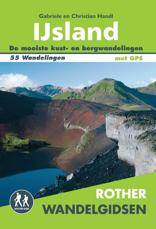
Wandelgids IJsland | Uitgeverij Elmar

De Rother wandelgids IJsland telt maar liefst 55 wandelingen door dit ruige gebied van vuur en water.

Van eenvoudige wandelingen tot zwaardere hoogtetochten voor de gevorderde wandelaar. De wandelroutes zijn voorzien van betrouwbare routebeschrijvingen, gedetailleerde wandelkaarten en informatieve hoogteprofielen.


Langs de ringweg naar de verste westelijke en oostelijke fjorden, in Þórsmörk, in Landmannalaugar en Skaftafell, in de Ásbyrgi en het Mývatn.


Elk hoofdstuk wordt voorafgegaan door een inleiding waarin u informatie vindt over het gebied, de bezienswaardigheden, de recreatiemogelijkheden en eet- en slaapgelegenheid. De gedetailleerde wandelkaarten met hoogteprofielen zorgen voor een goed overzicht. Een uitstekende wandelgids om mee te nemen op uw vakantie naar IJsland.


Let op: er is enige verwarring omtrent het jaartal van deze Nederlandse wandelgidsen van uitgever Elmar. Dit is een vertaling van de Duitse uitgever Rother maar daarna NIET bijgewerkt. De datum die wij vermelden is het moment van vertaling; er zijn andere – meer recente jaartallen – in omloop maar dat is de datum van een nieuwe druk ZONDER aanpassingen. Wilt u de meest recente wandelgids van dit gebied van deze uitgever: kies dan de Duitstalige versie van uitgever Rother. Deze zijn recent en WEL bijgewerkt. 


€ 25.95
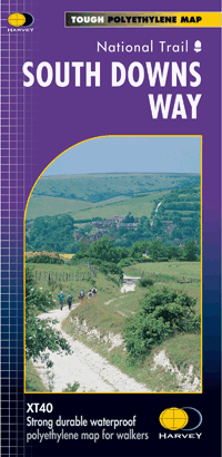
Wandelkaart - Fietskaart South Downs Way | Harvey Maps

Mooie, geplastificcerde kaart van de South Downs Way.


De kaart is geschikt voor zowel wandelaars, fietsers als ruiters. Met veel extra informatie en uitsnedes van de route. 


Suitable for walkers, cyclists and horse riders with alternative routes clearly shown.


A leap forward in technical excellence: Tough, durable and 100% waterproof - virtually indestructible in normal use. Compact and light - the map itself weighs just 60gms - a third of the weight of a bulky laminated map. You can fold or refold it time and again, or stuff it in your back pocket and it won't fall to pieces. 


Shows the entire 162km (101 miles) route between Winchester and Eastbourne on one sheet.Suitable for walkers, cyclists and horse riders with alternative routes clearly shown.


Information on finding accommodation, camping, food. Directions to the start. Also Ranger Service contact numbers and enlargements of towns/villages showing facilities available and tips on weather and clothing


Detailed mapping, full legend. National Grid - can be used with GPS. 1:40,000 scale. Supplied in a clear plastic pocket.

€ 29.95
Wandelkaart 2207 Turkart Blefjell | Nordeca

Uitstekende wandelkaart van een deel van Noorwegen. De Noren zelf gebruiken deze kaarten ook voor hun wandeltochten in de berggebieden. Afhankelijk van de moeilijkheidsgraad van het gebied voldoet een 1:25.000, 1:50.000 of 1:100.000 kaart. 


Alle noodzakelijke informatie vind je er op terug: bemande en onbemande hutten, campings, rivier-oversteken, wandelroutes en veelal ook langlaufroutes; daarnaast natuurlijk de topografische details als hoogtelijnen, soort landschap of wegennet. Met UTM grid


De legenda is in het Noors en Engels, verdere informatie op de achterzijde van de kaart is in het Noors. De kaart wordt geleverd in een hard papieren hoesje.


Gebied: Blefjell og Vegglifjell

Plaatsnamen op de kaart: Blefjell, Flesberg, Jondalen, Jonsknuten, Kongsberg, Lampeland, Numedal, Rollag, Svene


€ 10.49
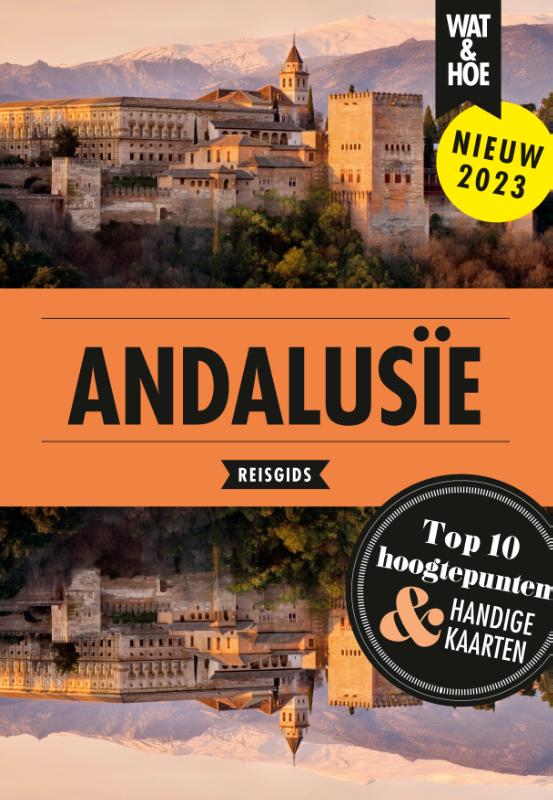
Reisgids Wat & Hoe Reisgids Andalusië | Kosmos Uitgevers

Wat & Hoe Andalusië is de ideale reisgids voor een korte vakantie. Met de uitklapkaarten, plattegronden en duidelijke wandelkaarten vind je altijd de weg. En dankzij de Top 10-selectie en de beste hotspots weet je zeker dat je niets mist. Deze eigentijdse reisgids van Wat & Hoe biedt je alle essentiële informatie die je nodig hebt voor een reis naar Andalusië. Andalusië is een streek vol passie en verrassingen. Lunchen met je voeten in het zand, architectuur uit Duizend-en-een-nacht, kleurrijke markten en culinaire hoogstandjes. Of denk aan de schitterende koningssteden Sevilla, Granada en Córdoba, vol historie, kunst en cultuur. De natuur in dit deel van Spanje is van een overweldigende schoonheid, met de machtige Sierra Nevada als het meest zuidelijke skigebied van Europa. En in Almería de enige woestijn van het continent. En als bakermat van de flamenco en de Spaanse tapascultuur kun je in Andalusië overal genieten van dans, muziek en lekker eten.

€ 22.95
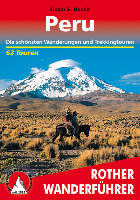
Wandelgids Peru | Rother Bergverlag

Uitstekende wandelgids met een groot aantal dagtochten in dal en hooggebergte. Met praktische informatie en beperkt kaartmateriaal! Wandelingen in verschillende zwaarte weergegeven in rood/blauw/zwart.

62 Höhenprofile, 62 Wanderkärtchen im Maßstab 1:25.000 bis 1:200.000, zwei Übersichtskarten

Kaum ein anderes lateinamerikanisches Land weist solch eine Vielfalt an unterschiedlichsten Landschaftsformen auf wie Peru. Die Palette der geografischen Gegensätze vereint alle Klimazonen der Erde und reicht von der 2800 km langen Pazifikküste zu den nahen, bis auf fast 6800 Meter Höhe aufragenden Andengipfeln, den endlosen Weiten des rauen Altiplano mit einer durchschnittlichen Höhe von 4000 Metern, der spektakulären Hochwüste im Süden des Landes, die mit eisbedeckten, teilweise noch aktiven Vulkanen gespickt ist – einige ebenfalls über 6000 Meter hoch –, bis hinab ins feuchtheiße Tiefland des Amazonasbeckens, das zwei Drittel der Landesfläche Perus einnimmt. Das alles ist zusätzlich geschmückt mit einer reichhaltigen exotischen Flora und Fauna, prunkvollen Kolonialbauten, farbenprächtigen Märkten und natürlich der allgegenwärtigen Inkakultur.


So vielfältig wie die Landschaftsformen sind auch die Wandermöglichkeiten in Peru. Von gemütlichen, familientauglichen Spaziergängen entlang malerischer Seen bis zu anspruchsvollen mehrtägigen Trekkingrouten durch einsame Gebirge mit 5000 Meter hohen Pässen und beeindruckenden Gletschern findet sich für jeden Geschmack die passende Tour.


Der Autor Oskar E. Busch, durch jahrzehntelange Reisen zu den Bergen Südamerikas ein ausgewiesener Kenner der peruanischen Anden, hat aus diesem breiten Spektrum 62 der schönsten Touren ausgewählt und in der bewährten Form der Rother Wanderführer aufbereitet: Ausführliche Routenbeschreibungen sowie detaillierte Wanderkärtchen mit eingezeichnetem Routenverlauf und aussagekräftige Höhenprofile, dazu jede Menge Informationen zu Anreise und Infrastruktur erleichtern die Planung und Durchführung der Touren und machen dieses Buch zu einem unverzichtbaren Begleiter für einen (Wander-)Urlaub in Peru.

€ 17.50
Wegenkaart - landkaart 3014 Adventure Map India South - Zuid | National Geographic

Wegenkaart van Zuid India met vermelding van veel bezienswaardigheden, nationale parken en attrakties. Watervast en scheurvast.

National Geographic's India South Adventure Map is designed to meet the unique needs of adventure travelers with its durability and detailed, accurate information. The map includes the locations of thousands of cities and towns with a user-friendly index, as well as a clearly marked road network complete with distances and designations for highways, major routes and secondary roads.


The India South Adventure Map differs from a traditional road map for it includes hundreds of points of interest that highlight the diverse and unique destinations found in this region. The map features UNESCO World Heritage sites, archaeological sites, wildlife sanctuaries, Hindu and Buddhist temples, sacred sites, forts, palaces, ruins, waterfalls, caves and other points of interest, making it an invaluable resource to travelers hoping to experience all the history and culture this part of India has to offer. Additional travel aids include the location of airports, ports and ferry routes.


The front side of the map covers the southern part of India, from the southern portion of the state of Madhya Pradesh extending south to Karnataka. The states of Andhra Pradesh, Chhattisgarh, Goa, Gujarat, Maharashtra and Orissa are included as well as the cities of Hyderabad, Mumbai (Bombay), Nagpur and Pune. The reverse side shows the most southern region of India extending from the state of Goa to the city of Trivandrum and the stores of the Gulf of Mannar. The cities of Bangalore, Chennai (Madras), Coimbatore and Madurai, are included as are the southern portion of the state of Andhra Pradesh, Karnataka, Kerala and Tamil Nadu. The India South Adventure Map is printed in the United States on a durable synthetic paper, making it waterproof, tear-resistant and tough—capable of withstanding the rigors of international travel.


Key Features:

Waterproof and tear-resistant

Detailed topography complete with activity symbols, ideal for exploring the country

Hundreds of points of interest including UNESCO World Heritage sites, archaeological sites, Hindu and Buddhist temples

Thousands of place names

Important travel aids including airports, ferry routes, and rail lines

€ 17.50
Wegenkaart - landkaart 3008 Adventure Map China East - Oost | National Geographic

Wegenkaart van Oost China  met vermelding van veel bezienswaardigheden, nationale parken en attrakties. Watervast en scheurvast.


National Geographic's China East Adventure Map is designed to meet the unique needs of adventure travelers with its durability and detailed, accurate information. The map includes the locations of thousands of cities and towns with a user-friendly index, plus a clearly marked road network complete with distances and designations for major highways, major routes and secondary roads. The China Adventure Map is printed in the United States on a durable synthetic paper, making it waterproof, tear-resistant and tough—capable of withstanding the rigors of international travel.


The China East Adventure Map differs from a traditional road map for it includes hundreds of points of interest that highlight diverse and unique destinations in the region. UNESCO World Heritage sites, national parks and reserves, archaeological sites, temples, caves and points of interest such as the Great Wall of China and the Wall of Genghis Khan are included, making it an invaluable resource to travelers hoping to experience all the history and culture China has to offer. Additional travel aids include the location of airports, ports and ferry routes. The front side of the China East map details the northeast region of the country, from its border with Russia and Mongolia to the north, to the North Korean border to the east, and extending south to the city of Nanjing. The reverse side of the map details China’s southeastern region, extending from Xi’an and Zhengzhou south to Hong Kong; west to the country’s borders with India and Myanmar (Burma); and east to the Vietnamese border and the shores of the South and East China Seas.


Key Features:

Waterproof and tear-resistant

Detailed topography complete with activity symbols, ideal for exploring the country

Hundreds of points of interest, including the location of World Heritage sites, national parks and reserves, archeological sites, temples, the Great Wall of China and more

Thousands of place names

Important travel aids including airports, ferry routes, and rail lines


€ 20.95
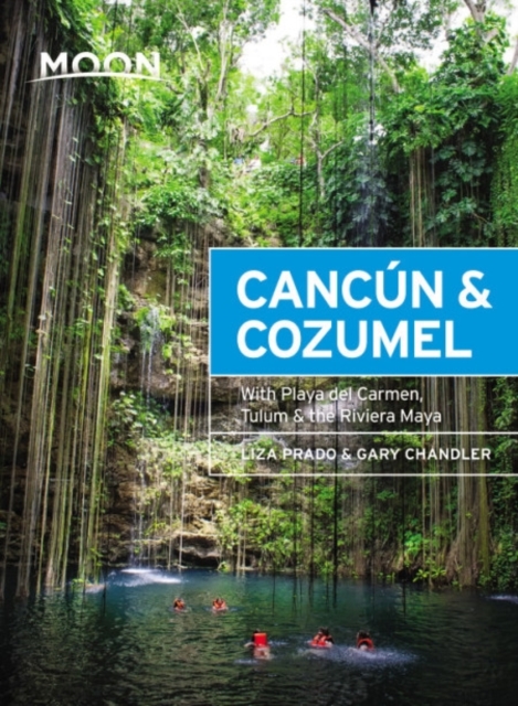
Reisgids Cancún and Cozumel, the Riviera Maya | Moon Travel Guides

Uitstekende Amerikaanse reisgids van uitgever Moon. De gids is vergelijkbaar met Lonely Planet en Rough guide en is voor de backpacker - zelfstandige reiziger geschreven; toch is deze door de grote mate van details en achtergronden geschikt voor alle reizigers! De gids onderscheidt zich door gedegen en uitgebreide achtergrondinformatie over bijvoorbeeld natuur en cultuur.

White sands and turquoise seas, cenotes and ruins, relaxation and adventure: dive in with Moon Cancún & Cozumel. Inside you’ll find:

Strategic itineraries from a Cozumel getaway to a week touring the length of the Riviera Maya, designed for families, honeymooners, ecotourists, history buffs, and adventurers

The top attractions and unique experiences: Wander the ancient ruins of Chichén Itzá or climb the second-highest Maya pyramid at Cobá. Kayak through mangrove forests, snorkel with whale sharks, and dive into pristine coral reefs full of sea life. Sunbathe on the best beaches of Cancún with a margarita, indulge in a picnic of tacos and empanadas, or dance the night away in a vibrant club

The best spots for sports and recreation, including sailing, fishing, kayaking, mountain biking, kiteboarding, and diving or snorkeling in reefs and in eerily beautiful underground cenotes

Honest advice from seasoned adventurers Gary Chandler and Liz Prado on when to go, how to get around, and where to stay, from backpacker hostels and beachy bungalows to high-end luxury resorts

Detailed maps and full-color photos throughout

Thorough information on the landscape, climate, wildlife, and local culture, including a Spanish phrasebook

Full coverage of Cancún, Isla Cozumel, Playa del Carmen and the Riviera Maya, Tulum and the Costa Maya, and Chichén Itzá

€ 25.95
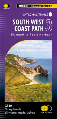
Wandelkaart 3 South West Coast Path 3 | Harvey Maps

Een bijzonder handige kaart voor een deel van dit lange-afstands-wandelpad (Minehead tot St Ives) van het in totaal maar liefst 1014 km lange South West Coast Path. Op waterafstotend papier met veel details, uitstekend en voldoende voor dit deel van de route. De totale route bestaat uit 3 kaarten. 


The South West Coast path is a 1014km (630mile) long distance path and the longest National Trail in England. The path stretches from Minehead in Somerset to Poole in Dorset. - This updated Trail Map covers the third and final section of the South West Coast Path from Plymouth to Poole Harbour which is 339km (211 miles).


- Includes the Jurassic Coast World Heritage Site and Durdle Door, the famous sea arch in Dorset. - The entire route on 3 sheets. This is map 3 of 3, a good two weeks? walking on one map.


- The XT40 is based on original HARVEY mapping with all the detail a walker would expect on a map at 1:40,000 scale. - Clear and easy to read mapping which is uncluttered by information irrelevant to the walker. - Printed on tough, light and 100% waterproof paper, less than half the weight of a laminated map.


- Shows facilities and services along the route


Abonneer op