€ 29.99
Fietsatlas - Fietsgids Nederland | Falk

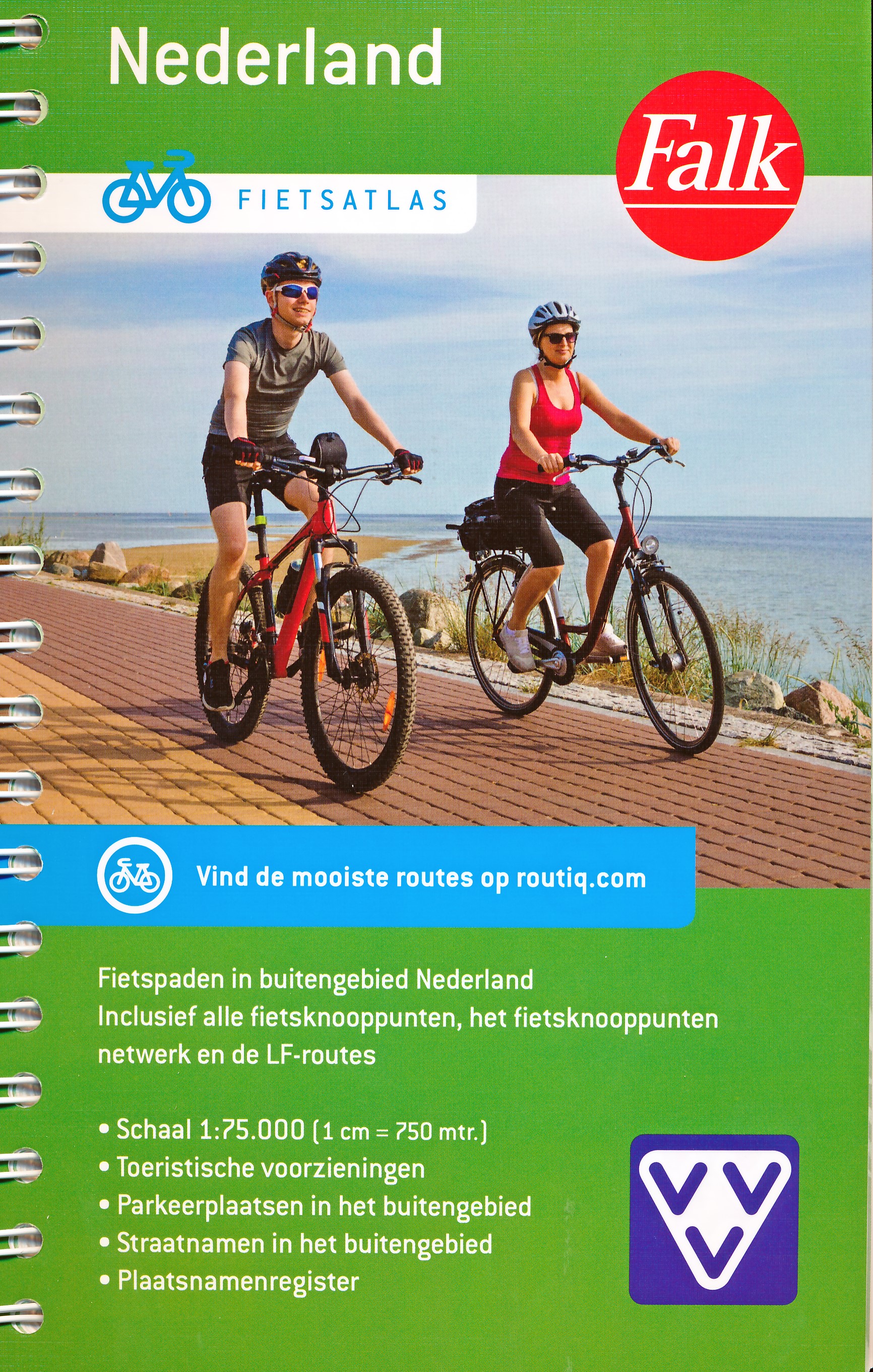
Alle fietsknooppunten en het gehele knooppuntennetwerk van Nederland gepresenteerd in een handige atlas met spiraalbinding. Mooie cartografische kaarten met alle straatnamen in het buitengebied weergegeven, inclusief een plaatsnamenregister.

Met de fietsatlas Nederland stel je gemakkelijk je eigen fietsroutes samen met behulp van het fietsnetwerk en de fietsknooppunten. Alle officiële fietspaden binnen Nederland zijn weergegeven. Het knooppuntennetwerk is uitgebreid met LF-routes. Ook is de grensregio met België weergegeven.

De Veluwe, Zeeland, Limburg, Drenthe en alles wat daar boven, onder of tussenin ligt. Dat alles vindt je moeiteloos terug in de gedetailleerde knooppunten fietsatlas van Nederland. Geniet van het mooie Nederlandse landschap en bezoek plaatsen waar je mogelijk nog nooit eerder geweest bent!

Schaal 1:75.000 (1 cm = 750 meter) Fiets knooppunten Knooppunten netwerk LF fietsroutes Gebruiksvriendelijk door spiraalbinding Toeristische voorzieningen: VVV-vestiging, parkeerplaatsen en veerdiensten (inclusief zomerdiensten) Locaties van ziekenhuizen en politiebureaus Plaatsnamen register

€ 22.50
Wandelgids North Downs Way national trail | Aurum Press

Goede engelstalige wandelgids van deze LAW in zuid oost Engeland, net onder Londen. Goede beschrijving en prima kaarten van Ordnance Survey, enigzins beperkte praktische tips, maar die zijn op de website van de route eenvoudig te vinden.

This is the complete official guide to walking the well-loved and popular North Downs. Whether you're an experienced long distance walker or a weekend stroller, this is the only companion you need to this beautiful and scenic route. The North Downs Way is the National Trail that follows the official acorn waymarks from Farnham to the coast at Dover.


This picturesque trail takes in chalk ridges, river valleys and sections of the Pilgrims' Way. At the eastern end you can either walk via Canterbury (a total distance of 130 miles, 208 km) or follow the southern route (123 miles, 197 km). With Ordnance Survey mapping for the entire route, this is a superb guide to the North Downs Way National Trail which can be enjoyed by all.


€ 20.95
Wandelgids Cleveland Way | Aurum Press

Uitstekend routeboek met goede kaarten van Ordnance Survey. Praktische info voor overnachten enigzins beperkt achterin.

The beautifully varied Cleveland Way winds for over a hundred miles around the North York Moors National Park, from the ancient moorland town of Helmsley to the seafront at Filey, passing stunning historic sites like Helmsley Castle and Rievaulx Abbey along the way.  Attractive farmland, woods and heather moorland, a blaze of purple in late-summer, dominate the first half of the walk, later replaced by dramatic cliffs, secluded coves and sandy beaches.


This comprehensive, fully updated official guide is the only companion you need – whether you’re interested in the industrial history of ironstone mining, or a weekend stroller seeking a coastal walk out of the seaside resort of Scarborough.


Ordnance Survey maps for the whole route

Background information on everything from archaeology to wildlife

Comprehensive information on places of interest, public transport and accommodation

Lavish colour photography throughout

€ 17.50
Reisgids Marco Polo DE Weimar | MairDumont

Een leuke handzame gids met veel informatie over bezienswaardigheden en geschiedenis van Weimar.

Zu Gast bei Goethe, Schiller und Gropius mit dem MARCO POLO Reiseführer Weimar


Du willst Kunst, Kultur und Party, und am besten keine langen Wege dazwischen? Dann ist Weimar das perfekte Ziel für deinen nächsten Städtetrip! Hier liegt ein Highlight neben dem anderen und wartet nur darauf, von dir entdeckt zu werden. Bestaune die prunkvolle Herzogin-Anna-Amalia-Bibliothek, schieße ein Selfie vor dem Haus am Horn oder durchtanze die Nacht bei Livemusik im C. Keller - mit dem MARCO POLO Reiseführer im Gepäck findest du die besten Spots der Stadt!

Goethe-Wanderweg oder Radtour durch die Bauhaus-Stadt: Erkunde Weimar mit den MARCO POLO Erlebnistouren und der kostenlosen Touren-App Bratwurst essen wie ein Thüringer? MARCO POLO führt dich zu den besten Restaurants, Bars und Cafés für jeden Geschmack und Geldbeutel Entdecke, was die Weimaraner an ihrer Stadt lieben: mit den MARCO POLO Insider-Tipps von Autoren, die vor Ort leben Keine Zeit für Langeweile mit den Best-of-Tipps für Regenwetter, Urlaub mit Kindern oder Ausflüge mit kleinem Budget Nie wieder planlos: Alle Highlight-Karten und Stadtpläne wurden komplett überarbeitet

Wo Dichterfürst auf Skater trifft: Erlebe einen Städtetrip voller unvergesslicher Momente


Verschlafenes Städtchen? Von wegen! Goethe und Schiller inmitten von Skatern, historische Fassaden mit modernster Projektionstechnik, Bach im Einklang mit Technosound - in Weimar treffen Gegensätze aufeinander. Ob Barhopping in der Altstadt, Sonnenbaden im historischen Park oder Bratwurst futtern auf dem Wochenmarkt: Mit dem MARCO POLO Reiseführer Weimar wird dein Städteurlaub zum Erlebnis!


MARCO POLO Top Highlights Das Beste zuerst So tickt Weimar Sightseeing Essen & Trinken Shoppen & Stöbern Ausgehen & Feiern Aktiv & Entspannt Erlebnistouren


Gut zu wissen: Die Basics für deinen Städtetrip Weimar-Feeling Travel Pursuit Register & Impressum Bloß nicht!


€ 49.95
Wandelgids Alpinwandern Südbünden | SAC Schweizer Alpenclub

Gids voor het betere wandelwerk in zuidelijk Graubuenden; met veel beroemde hoogalpiene wandelroutes. Gedetailleerde beschrijvingen en verder voorzien van alle praktische details met betrekking tot huttenovernachtingen, openbaar vervoer, en met overzichtskaartjes (die overigens niet voldoen als wandelkaart). Engadin, Müstair, Puschlav, Bergell, Misox. Weitwanderungen und Gipfelziele zwischen Samnaun und Santa Maria, Splügen und Sclupetoir.

€ 15.95
Reisgids Merian live Salzburg merian | Deltas

Handige en overzichtelijke, kleine reisgids voor een eerste kennismaking met het land. Voor- en achterin uitklapbare kaart. Aandacht voor o.a. taal, festivals en eten en drinken. Prettig formaat en toch met veel foto’s. Nederlands

€ 14.95
Wegenkaart - landkaart 2 Beieren Noord- Bayern nord | Freytag & Berndt

Goede wegenkaart van een deel van Duitsland. Helder kleurgebruik, tweezijdig waardoor meer gedetailleerd met veel toeristische informatie. Met register.


The map highlights picturesque towns and national parks, with a range of symbols marking campsites, youth hostels, museums, spas, various landmarks and places of interest. As with all Freytag & Berndt maps the cartography is clear and detailed with the topography shown by relief shading with plenty of spot heights.


A localities index with postcodes is in a small booklet attached to the cover and the legend is in various languages including English

€ 14.95
Wegenkaart - landkaart Nederland | Freytag & Berndt

Goede wegenkaart van het hele land. Met register en enkele stadsplattegronden.


De berijdbare wegen zijn goed weergeven, zowel de hoofdwegen als provinciale en lokale wegen; wegnummers worden vermeld. Afstanden tussen plaatsen zijn in kilometers op de kaart ingetekend, daarnaast worden ook op belangrijke plekken benzinepompen gemarkeerd.


In het kaartbeeld wordt door middel van schaduw het reliëf weergegeven en soms enkele punten in het landschap met de daadwerkelijke hoogte. Provinciegrenzen zijn goed terug te vinden, nationale parken en reservaten ook. Met allerhande symbolen worden toeristische bezienswaardigheden weergegeven als monumenten, historisch belangrijke plekken en uitzichtpunten. In bepaalde plaatsen zijn hotels en campings te vinden, luchthavens, treinverbindingen en havens vindt u er ook op!

€ 17.50
Wegenkaart - landkaart 3318 Adventure Map Cyprus | National Geographic

Wegenkaart van Cyprus met vermelding van veel bezienswaardigheden, nationale parken en attrakties. Watervast en scheurvast. Juist door deze vermeldingen onderscheidt de kaart zich van andere wegenkaarten.

National Geographic's Cyprus Adventure Map is designed to meet the unique needs of adventure travelers with its durability and accurate information. This folded map provides global travelers with the perfect combination of detail and perspective, highlighting hundreds of points of interest and the diverse and unique destinations within the country.


The front side of the Cyprus map shows the western portion of the island. This side details the regions of Paphos, Limassol, Nicosia, Larnaca, and Kyrenia. The reverse side of the map shows the eastern part of the island. This side details the regions of Larnaca, Kyrenia, and Famagusta. The map includes the locations of cities and towns with a user-friendly index, plus a clearly marked road network complete with distances and designations for major highways, main roads, and tracks and trails for those seeking to explore more remote regions. Every Adventure Map is printed on durable synthetic paper, making them waterproof, tear-resistant and tough—capable of withstanding the rigors of international travel.


Key Features:

Waterproof and tear-resistant

Detailed interpretive information and local travel tips

Detailed topography complete with activity symbols, ideal for exploring the country

City overview maps

Hundreds of points of interest, including the location of World Heritage sites, national parks and nature reserves, aboriginal settlements and protected lands, mines, archeological sites, wildlife parks and more

Thousands of place names

Important travel aids including airports, lighthouses, ferry routes and rail lines

Developed in cooperation with local agencies

Updated regularly to ensure accuracy

€ 17.50
Wegenkaart - landkaart 3305 Adventure Map Tuscany - Toscane | National Geographic

Wegenkaart van Toscane met vermelding van veel bezienswaardigheden, nationale parken en attrakties. Watervast en scheurvast. Juist door deze vermeldingen onderscheidt de kaart zich van andere wegenkaarten.

National Geographic's Tuscany Adventure Map is designed to meet the unique needs of adventure travelers—detailed, durable, and accurate. Tuscany includes the locations of thousands of cities and towns with an index for easily locating them, plus a clearly marked road network complete with distances and designations for expressways, motorways, scenic routes, and more.


What sets National Geographic Adventure Maps apart from traditional road maps are the hundreds of points of interest that highlight the diverse and unique destinations within Tuscany. Archeological sites, menhirs and other sites of interest from monuments, palaces, and castles to churches, chapels, and monasteries are noted making this map indispensable for travelers seeking to explore the region’s rich history. Users will find a variety of helpful travel aids on our map as well, including the location of airports, airfields, railroads, lighthouses, ferry routes, harbors, anchorages and petrol stations.


Tuscany’s coastline and the western portion of the province are shown on the front side of the map including the cities of Pisa and Livorno. An inset map of the Arcipelago Toscano National Park provides greater detail of the islands. The reverse side of the map covers the eastern portion of the province and shows the cities of Florence, Grosseto, Siena, and Arezzo. Lake Tresimeno in neighboring Umbria is also included.

Abonneer op