€ 10.50
Wandelkaart 709 Kiel - Naturpark Westensee - Mittelholstein | Kompass

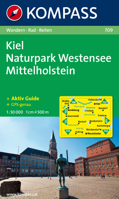
Goede wandelkaart met vrijwel alle topografische details als hoogtelijnen, vegetatie, schaduwtekening maar ook de ingetekende wandelroutes en in veel gevallen ook fietsroutes (MTB). Gevaarlijke routes worden als zodanig weergegeven met een bepaalde markering. Berghutten en campings zijn goed terug te vinden op deze kaarten.


Daarnaast staan de toeristische bezienswaardigheden met symbolen vermeld. Kleurgebruik kan soms vrij fel overkomen, daardoor oogt deze detailkaart wellicht wat druk, maar het blijft een goed leesbare kaart. Sommige kaarten zijn geplastificeerd, maar helaas niet allemaal. De graden staan aan de zijkanten van de kaart, daardoor te gebruiken voor GPS.


Steden/dorpen/gebieden:

Heikendorf, Kiel, Büdelsdorf, Rendsburg, Flintbek, Raisdorf, Preetz, Jevenstedt, Nortorf, Bordesholm, Ascheberg, Wankendorf, Aukrug, Neumünster


Rivieren/meren:

Eider, Nord-Ostsee-Kanal, Westensee

€ 11.50
Wegenkaart - landkaart Kreta - Crete | Borch

Mooie geplasticieerde kaart van Kreta. Deze kaart biedt een goed overzicht van dit eiland met detailkaarten.


Our soft-laminated folded map of Crete shows: Crete (West) 1:200 000, Crete (East) 1:200 000, Iraklio 1:7 000, Agios Nikolaos 1:6 000, Chania 1:10 000, Ierapetra 1:10 000, Rethimno 1:9 000, Samaria Gorge 1:90 000, Sitia 1:7 000 and Gavdos 1:200 000. Borch maps are easy to fold, durable and water-repellent with a wipeable surface. Borch Maps show hotels, museums, monuments, markets, top sights and points of interest, useful statistics, conversion charts for temperatures, weights and measurements, climate charts showing temperatures, sunshine hours, precipitation and humidity, overview maps, time zones, and much more...


Crete is more than just another Greek island, it is the fifth largest island in the Mediterranean Sea and the cradle of ancient Mediterranean civilization. By 2000 B.C. the Minoans had set up a base here for their international trade with the East, North Africa and Europe, and it was Sir Arthur Evans who, in the early 20th century, dug up the first finds at Knossos, before which the legendary palace was no more than a mark on the mythological map. Despite a history of brutal occupation, modern-day Crete is blessed by peace, wealth and fertility. Aside from it’s touristically misdeveloped regions, which can sometimes make it seem as though one were anywhere other than Greece, Crete’s greatest treasures include its rich cultural heritage and archaeological sites; scenery of breathtaking beauty; spectacular mountainscapes and ravines; idyllic fishing villages, particularly along the southern coast; splendid coastlines dominated by hypnotically blue seas; famous Cretan cuisine which is reputed to be the healthiest in the world; a lifestyle in which olives and olive oil play a meaningful and significant role; and, above all, the warm hospitality of the proud Cretan people.


€ 14.95
Wegenkaart - landkaart Italie - Italien | Freytag & Berndt

Gedetailleerde, tweezijdige landkaart van Italië, prima geschikt voor planning en rondtrekken. De berijdbare wegen zijn goed weergeven, zowel de hoofdwegen als provinciale en lokale wegen; wegnummers worden vermeld. Afstanden tussen plaatsen zijn in kilometers op de kaart ingetekend, daarnaast worden ook op belangrijke plekken benzinepompen gemarkeerd. In het kaartbeeld wordt door middel van schaduw het reliëf weergegeven en soms enkele punten in het landschap met de daadwerkelijke hoogte. Provinciegrenzen zijn goed terug te vinden, nationale parken en reservaten ook. Met allerhande symbolen worden toeristische bezienswaardigheden weergegeven als monumenten, historisch belangrijke plekken en uitzichtpunten. In bepaalde plaatsen zijn hotels en campings te vinden, luchthavens, treinverbindingen en havens vindt u er ook op!

Explore Italy with this Freytag & Berndt double-sided road map. The best way to plan your trip, prepare your itinerary, and to travel independently in this country. As with all Freytag & Berndt maps the cartography is clear and detailed with the topography shown by relief shading with plenty of spot heights.

The map includes a localities index and inset maps of Ancona, Bari, Cagliari, Bozen / Bolzano, Florence, Genova, Milan, Naples, Palermo, Rome, Torino, Venice. 


Tourist information and places of interest are clearly marked by a range of icons, including: 


airports

monasteries, castles, ruins and antique sites

accommodation

caves

mountain cabins

spas

marinas

camping sites

monuments

view points


Distances between points are shown as well as indications of steep gradients, all distances are in kilometres. The legend is in 10 languages (English, Italian and German included).


€ 289.00
Wandkaart - Magneetbord Europa - Europe 140 x 100 cm | Maps International

Fraaie politieke kaart van het continent, waarbij vooral de politieke aspecten heel duidelijk te lezen zijn. Alle landen hebben verschillende kleuren, steden en belangrijke verbindingen zijn goed te vinden. 


Maps International's large European political wall map is great looking map available to buy.


This politically coloured wall map of Europe features countries marked in a different colour, with international boundaries shown. All major towns and cities are featured within our large map of Europe. Map contains hill and sea shading adding to the vibrant overall effect. The wall map also contains a section showing the different flags of countries in Europe.


Maps International's Europe map is available either plain or laminated. If you are looking to buy a map of Europe, you won't be disappointed with this large stunning wall map.


De kaart wordt in deze versie gelijmd op een plaat, voorzien van een mooie aluminium lijst en een ophangsysteem wordt meegeleverd.

€ 23.95
Fietskaart Biking Lhasa to Kathmandu | Himalayan Maphouse

1000 kms Bicycling Map of Lhasa to Kathmandu is most detailed map series of Himalayan map house. Whether you are travelling by bicycle this map provides invaluable information for the independent traveler. The map provides information for km-by-km road distances, day wise trips, trekking trails, highroads, gravel roads, cave and camp sides, speed information, uphill and downhill road information, monasteries, places of  interest, with all counter lines topo based map.

LHASA, GYANTSE, SHIGATSE, TINGRI,
NYALAM, ZHANGMU, KATHMANDU

€ 13.95
Stadsplattegrond Budapest - Boedapest | Freytag & Berndt

Stadsplattegrond met register. Helder kaartbeeld waarbij de naamgeving goed leesbaar is weergegeven. Met de toeristische bezienswaardigheden in symbolen weergeven: monumenten, musea, stadions e.a. Daarnaast handige zaken als postkantoren, parkeergarages en stations. Veelal ook met een openbaar vervoer of metro kaart als inzet.

Explore Budapest with this Freytag & Berndt street map. The best way to plan your trip, prepare your itinerary, and to travel independently in the Hungarian capital.


The map includes an inset of the central area in more detail at 1:5 000 as well as diagram of the whole public transport network.


The legend is in several languages inlcuding English.

€ 27.50
Natuurgids - Reisgids NaturReiseführer Neuseeland - Nieuw Zeeland | Tecklenborg

Uitstekende reisgids specifiek op natuur gericht: Geeft nadrukkelijk en met veel praktische informatie aan waar je moet zijn om wat te zien!

Neuseeland, das "Inselparadies am schönsten Ende der Welt", ist für reisebegeisterte Naturfreunde ein Traumziel. Wenn Sie ursprüngliche Wildnis und unberührte Natur suchen, werden Sie die Urwälder, weiten Grassteppen, schneebedeckten Südalpen, einsamen Küsten und rauchenden Vulkanenschlote Neuseelands sicher begeistern.

Dieser "NaturReiseführer" ermöglicht Ihnen die optimale Planung Ihrer Reise nach Neuseeland - und somit ein eindrucksvolles Naturerlebnis vor Ort.

€ 19.95
Reisgids Oberlausitz, Lausitzer Seenland | Reise Know-How Verlag

Der kompakte Reiseführer für individuelles Entdecken der Oberlausitz (inkl. Zittauer Gebirge), mit vielen praktischen Reisetipps: Empfehlungen für Unterkünfte in allen Preisklassen, Restauranttipps, Vorschläge für Wanderungen und Radtouren, Anreise, Preise und Öffnungszeiten, ... Bekannte und weniger bekannte Sehenswürdigkeiten der Region werden detailliert beschrieben. 


Die Oberlausitz ist eine abwechslungsreiche Ferienregion im Dreiländereck von Deutschland, Polen und Tschechien mit den in Sachsen gelegenen traditionsreichen Städten Bautzen, Görlitz, Kamenz, Löbau, Zittau und dem heute polnischen Lauban (früher Mitglied des Oberlausitzer Sechsstädtebundes). Zu der auch für Wanderungen und Radtouren reizvollen Landschaft gehören das Zittauer Gebirge, das UNESCO-Biosphärenreservat der Heide- und Teichlandschaft, das Weltkulturerbe Pücklers Park in Bad Muskau, die Neiße und die allmählich entstehende größte künstliche Seenlandschaft Deutschlands, das Lausitzer Seenland im einstigen Braunkohle-Tagebaurevier. 


Zwischen Bautzen und Hoyerswerda lebt das kleine slawische Volk der Sorben, mit deren Alltags- und Festkultur dieser nützliche Reiseführer ebenfalls bekanntmacht.

€ 9.95
Vogelgids - Natuurgids Mexico Birds | Waterford Press

Mexico Birds is the perfect pocket-sized, folding guide for the bird lover and travelling nature enthusiast. This beautifully illustrated guide highlights over 164 familiar species and includes a map featuring prominent country-wide birding destinations including Veracruz, considered one of the world's prime birding hotspots. Laminated for durability, this handy guide is a great source of portable information and ideal for field use by novices and experts alike.

€ 9.95
Wegenkaart - landkaart 131 Forêt Noire, Alsace, Vallée du Rhin | Michelin

Speciale toeristische kaart, gemaakt voor een goed bezocht gebied en uitvergroot. Daardoor zeer prettig leesbaar met een hoog nivo wat we van Michelin al veel langer gewend zijn. Alle wegen staan er op, met verschillende kleuren voor de aparte soorten wegen. Verder veel aandacht met symbolen voor de bezienswaardigheden in de regio, de bekende groene stroken naast de mooie wegen en ingetekende doorgaande wandelroutes als grande randonnees.

Part of Michelin's Zoom series covering major towns and popular holiday areas throughout France, this map of the Black Forest, Alsace and the Rhine Valley covers both sides of the Rhine Valley, extending from northern Switzerland to Saarland and Heidelberg, with the Black Forest on the German side and the Vosges mountains in France.

The map shows road detail from motorways to rough tracks and footpaths, with intermediate road distances shown on most roads, toll and toll-free sections of motorways are indicated and various road obstacles such as steep hills, height limits, one way streets and prohibited roads are marked. The map also shows cycling routes chosen by the Association Francaise des Veloroutes et Voies Vertes and some of the long-distance GR routes.

The map includes relief shading and spot heights to indicate topography. View points, scenic routes, religious and historic buildings, caves, palaces and villas, parks and loads of other places of touristic interest are marked out with symbols. The legend is in French and English.

Let op: het kaartvoorbeeld is van een andere kaart uit deze serie.

Bâle, Fribourg-en-Brisgau, Gérardmer, Mulhouse, Saverne, Strasbourg

Abonneer op