€ 10.95
Wandelgids The Jurassic Coast | Northern Eye Books

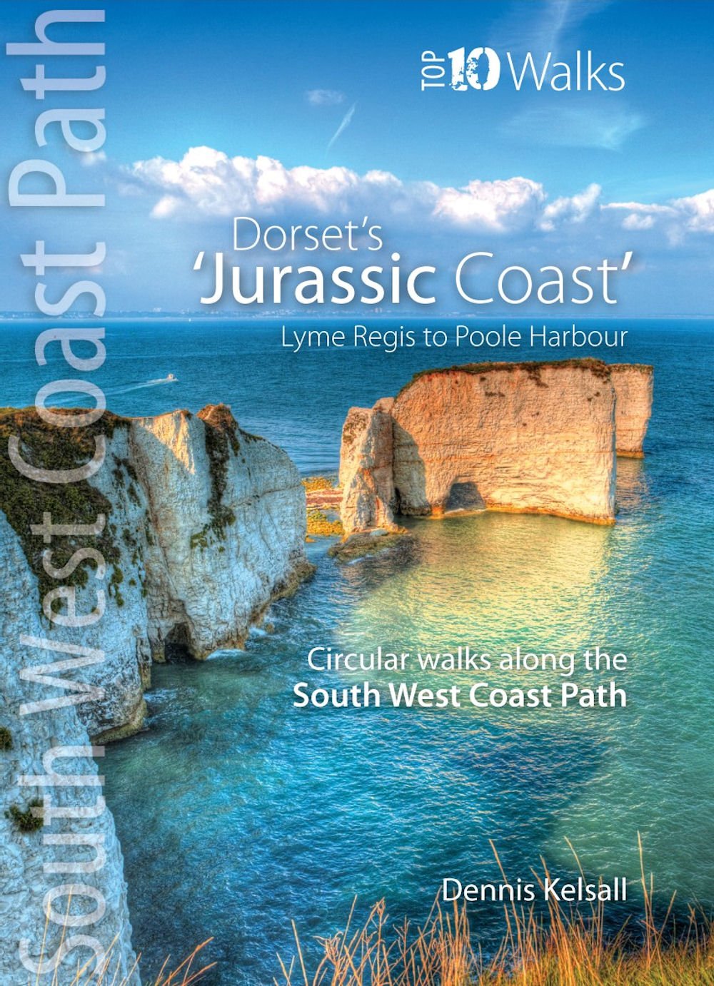
One of five books in the upcoming South West Coast Path: Top 10 Walks series. Handy, pocket-sized, full colour walking guides written by experts. The perfect impulse buy. Free display stands and spinners. Other titles in the new series will be: North Devon Coast, North Cornwall Coast, South Cornwall Coast, and South Devon Coast. These attractive and cleverly structured guides will give walkers ten of the best short circular walks along every section of the 630-mile long South West Coast Path in a popular pocket-size format. With clear information, an overview and introduction for each walk, expertly written numbered directions, large scale Ordnance Survey maps, superb eye-grabbing panoramic photographs, and interpretation of points of interest along the way, these guides set a new standard in clarity and ease-of-use. Featured walks in the Jurassic Coast include: Golden Cap , Chesil Beach & Abbotsbury, Portland Bill, Ringstead Bay, Durdle Door & Lulworth Cove, Kimmeridge Ledges, St Aldhelm¿s Head, Dancing Ledge, Durlston Head and Old Harry Rocks.

€ 15.50
Reisgids ANWB extra Normandië | ANWB Media

ANWB Extra reisgids Normandië - Frankrijk
 
Beleef Normandië met de compleet vernieuwde reisgids ANWB Extra Normandië! De combinatie van badplaatsen met villa’s en hotels uit de belle époque, de trendy winkels, hippe bars en prachtige natuur maken Normandië de perfecte bestemming voor een leuke vakantie.
 
De compacte ANWB Extra reisgids Normandië biedt naast diverse routes door de streek veel praktische tips over hotels en vervoer ook 15 inspirerende bezienswaardigheden die je tijdens je vakantie niet mag missen. Struin door de tropische Jardin botanique de Vauville, beklim de Mont St-Michel, of ga proeven van de kazen in Camembert.
 
Deze kleine reisgids past gemakkelijk in de tas en heeft een handige uitneembare kaart met daarop de beste tips voor winkelen, eten en drinken en uitgaan.
 
ANWB Extra is de succesvolste reisgidsenserie van Nederland! Met meer dan 100 compacte gidsen biedt deze serie een reisgids voor nagenoeg iedere denkbare bestemming.

€ 19.50
Wandelgids Wilde Wege Dolomiten | Rother Bergverlag

De ‘Rother Wanderbücher’ behandelen telkens de 45 mooiste wandelingen, die variëren van eenvoudige kindvriendelijke wandelingen tot routes die aanzienlijk meer ervaring vereisen. Uitvoerige routebeschrijvingen, een aantrekkelijke lay-out met vele kleurenfoto’s, niets aan duidelijkheid te wensen gelaten hoogteprofielen, kaartjes met de ingetekende route en enige achtergrondinformatie. Het verschil met de rode wandelgidsjes van Rother is dat ze een groter gebied bestrijken: handig voor de één, minder bruikbaar voor de ander.
Ausgetretene Pfade verlassen, auf fast vergessenen Steigen wandern, über Schrofen und leichten Fels auf einsame Gipfel kraxeln – so verspürt man wohl das erhebende Gefühl von Ursprünglichkeit, Abenteuer und Exklusivität. Das Rother Wanderbuch »Wilde Wege Dolomiten« beschreibt 45 Touren zwischen Brixen, Sexten und Belluno, die genau das ermöglichen.

Die Touren sind allesamt ungewöhnlich und zeichnen ein stilles und unberührtes Bild von den Dolomiten, wie man es vielleicht noch nicht gesehen und erlebt hat. Dabei kann ein solch »Wilder Weg« durchaus relativ leicht sein, wie etwa am Sentiero Paola im Rosengarten oder an der Lastia di Framont hoch über dem Cordèvole. Natürlich lässt sich aber der Anspruch auch steigern und so manch ausgesetzter, zackiger Gipfel steht zur Auswahl! Keine Tour geht jedoch über gelegentliche mittelschwere Klettersteigpassagen (etwa im Zuge alter Kriegspfade) bzw. Klettern im II. Grad hinaus. Etwas verzwickt kann mitunter die Wegführung sein – wenn man wie beispielsweise auf der Cengia Paolina an der Tofana auf spärlichen Spuren über ausgesetzte Bänderrouten schleicht. Doch es ist vorgesorgt: Autor und Dolomiten-Spezialist Mark Zahel hat die Touren für dieses Wanderbuch sorgfältig recherchiert, bestens beschrieben und zudem mit GPS-Daten versehen.

Anhand ausführlicher Charakterisierungen hinsichtlich Art und Schwierigkeit leistet dieses Buch wichtige Entscheidungshilfe und sorgt mit seinen detailreichen Routenbeschreibungen dafür, dass Unwägbarkeiten kalkulierbar bleiben. Detaillierte Kartenausschnitte mit eingezeichnetem Routenverlauf und aussagekräftige Höhenprofile ermöglichen eine effektive Planung und Durchführung der Touren. Die GPS-Daten stehen zum Download von der Internetseite des Bergverlag Rother bereit. Die anschaulichen Fotos machen Lust, sofort den Rucksack zu packen und die »wilden Wege« der Dolomiten selbst zu erkunden.

€ 9.95
Stadsplattegrond City map Athens | Lonely Planet

Durable and waterproof, with a handy slipcase and an easy-fold format, Lonely Planet Athens City Map is your conveniently-sized passport to traveling with ease. Get more from your map and your trip with images and information about top city attractions and transport maps, itinerary suggestions, extensive street and site index, and practical travel tips and directory. With this easy-to-use, full colour navigation tool in your back pocket, you can truly get to the heart of Athens, so begin your journey now!

Durable and waterproof

Easy-fold format and convenient size

Handy slipcase

Full colour and easy-to-use

Extensive street and site index

Images and information about top city attractions

Handy transport maps

Practical travel tips and directory

Itinerary suggestions
About Lonely Planet: Since 1973, Lonely Planet has become the world's leading travel media company with guidebooks to every destination, an award-winning website, mobile and digital travel products, and a dedicated traveller community. Lonely Planet covers must-see spots but also enables curious travellers to get off beaten paths to understand more of the culture of the places in which they find themselves. The world awaits!
Lonely Planet guides have won the TripAdvisor Traveler's Choice Award in 2012, 2013, 2014, 2015, and 2016.
'Lonely Planet. It's on everyone's bookshelves; it's in every traveller's hands. It's on mobile phones. It's on the Internet. It's everywhere, and it's telling entire generations of people how to travel the world.' -- Fairfax Media
'Lonely Planet guides are, quite simply, like no other.' - New York Times

€ 17.50
Fietsgids La Bretagne à vélo, deel 1 Rennes - Roscoff | Editions Ouest

Duidelijke en bijzonder bruikbare fietsgids van defietsroute tussen Rennes en Roscoff via Saint Malo, Goed leesbaar kaartmateriaal.
500 km sur voies sécurisées, 40 cartes détaillées, des conseils pratiques et toutes les adresses utiles pour organiser son séjour (hébergements, loueurs et réparateurs de vélo, points d'information), les plus belles étapes, les villes et, tout au long de l'itinéraire, des escapades pour découvrir les sites incontournables.

€ 15.95
Vogelgids Pocket Guide to Birds of Namibia | Struik Nature

Handzame vogelgids voor Namibië met de 357 meestvoorkomende vogels. Inclusief kleurenfoto's en duidelijke omschrijvingen om het spotten te vergemakkelijken.
This pocket-sized guide to the Birds of Namibia has been designed primarily for use in the field. It features some 340 of the region's birds, particularly those most frequently seen, but including some that are sought after by birders. Concise text for each species gives key ID pointers in italics, and describes their call and favoured habitat. Accounts are accompanied by colour photographs of all the birds - selected to show their most obvious identifying features; where there is a marked difference, for example, between the sexes or between breeding and non-breeding plumage, more than one photograph has been included. Distribution maps are provided for all featured species. Light and handy for use in the field, this guide will give birders an excellent introduction to Namibia's bird life.

€ 13.95
Reisgids - Wandelgids Explore Dubrovnik | Insight Guides

Handzame gids met de top bezienswaardigheden van Dubrovnik plus informatie over restaurants, hotels en het nachtleven. Daarnaast staan er elf wandelingen in de stad en de omgeving beschreven.
Insight Explore Guides: pocket-sized books to inspire your on-foot exploration of top international destinations. Now with free eBook. Experience the best of Dubrovnik with this indispensably practical Insight Explore Guide. From making sure you don't miss out on must-see attractions like the old historic centre to discovering hidden gems like the sleepy harbour of Sudurad, the easy-to-follow, ready-made walking routes will help you plan your trip, save you time, and enhance your exploration of this fascinating city.
- Practical, pocket-sized and packed with inspirational insider information, this will make the ideal on-the-move companion to your trip to Dubrovnik
- Enjoy over 11 irresistible Best Routes to walk, from a tour of the old city walls to exploring the stunning islands of Lokrum and Mljet
- Features concise insider information about landscape, history, food and drink, and entertainment options
- Invaluable maps: each Best Route is accompanied by a detailed full-colour map, while the large pull-out map provides an essential overview of the area
- Discover your destination's must-see sights and hand-picked hidden gems - Directory section provides invaluable insight into top accommodation, restaurant and nightlife options by area, along with an overview of language, books and films
- Includes an innovative extra that's unique in the market
- all Insight Explore Guides come with a free eBook
- Inspirational colour photography throughout
About Insight Guides: Insight Guides is a pioneer offull-colour guide books, with almost 50 years' experience of publishing high-quality, visual travel guides with user-friendly, modern design. We produce around 400 full-colour print guide books and maps as well as phrasebooks, picture-packed eBooks and apps to meet different travellers' needs. Insight Guides' unique combination of beautiful travel photography and focus on history and culture create a unique visual reference and planning tool to inspire your next adventure.

€ 13.95
Wegenkaart - landkaart Southern Alberta & Southern British Columbia |

ITMB, being based in Vancouver, BC, understandably has a local/regional market for our map line. We have a map of Western Canada, as well as an atlas, a very nice map of BC itself, a map of the south half of BC, and a map of part of BC combined with Washington State. What we did not have, until now, was a map covering the most touristically-visited part of all of Canada – namely, the southern halves of both British Columbia and its neighbour, Alberta, with a small amount of Washington State, Idaho, and Montana (to assist those heading north and needing to know about border crossings). Therefore, ITMB is pleased to announce the release of Southern BC and Alberta. Side One covers BC from the US border (with a carry-on to Seattle) north to Prince George and east to the Alberta border, with a carry-on to Calgary. All of Vancouver Island, the Okanagan Valley, and the Rock Mountain National Parks of Banff and Jasper, are included. The map is rich with wilderness campsite (almost 1,000 are shown, ski areas, fishing areas, even gas stations in more remote parts of the vast province. Side Two covers Alberta from somewhat north of Edmonton (the provincial capital) to the American border and a bit beyond, and from the Rocky Mountains east to a bit beyond the Saskatchewan border. This side focusses on the movement from the high Rockies to the foothills and plains of the enormous Canadian Prairies The highlights of this side of the map are showcased in our Top Attractions guide and include such world-class features as the Drumheller Dinosaur Museum, the world’s best, to the Columbia Icefield, one of the few in the world easily accessible to walk on. Naturally, the road network, train lines, urban areas, parks, and numerous attractions (who could pass up visiting Head-Smashed-In Buffalo Jump?) are all clearly shown.

€ 18.95
Wandelkaart 16 Autour du Thabor | Didier Richard

Gebaseerd op de topografische gegevens van IGN (de Franse topografische dienst) heeft deze kaartenserie een uitstekend kaartbeeld van delen van de bekende wandelgebieden van Frankrijk. Hoogtelijnen, gebruik van schaduw en kleur, de leesbaarheid: prima kaart! De GR en GRP routes staan ingetekend, maar ook de kleinere wandelpaden. Symbolen voor uitzichtpunten, informatiecentra, gite d'etappes, parkeerplaatsen, liften etc. UTM grid, dus met GPS bruikbaar. Enige - kleine - nadeel is dat de campings niet zijn ingetekend.
Bardonecchia - Nevache - Le Monetier les Bains - Orelle - Valmenier - Valloire - Modane-Valfrejus

Abonneer op