Complete beschrijving - Duitstalig - van alle etappes van de GR10 van west naar oost. Veel praktische informtie, redelijk kaartmateriaal, maar goede wegbeschrijving.
der einfachste der drei großen Fernwanderwege durch die Pyrenäen
detaillierte Wanderkarten
aussagekräftige Höhenprofile
GPS-Tracks zum Download
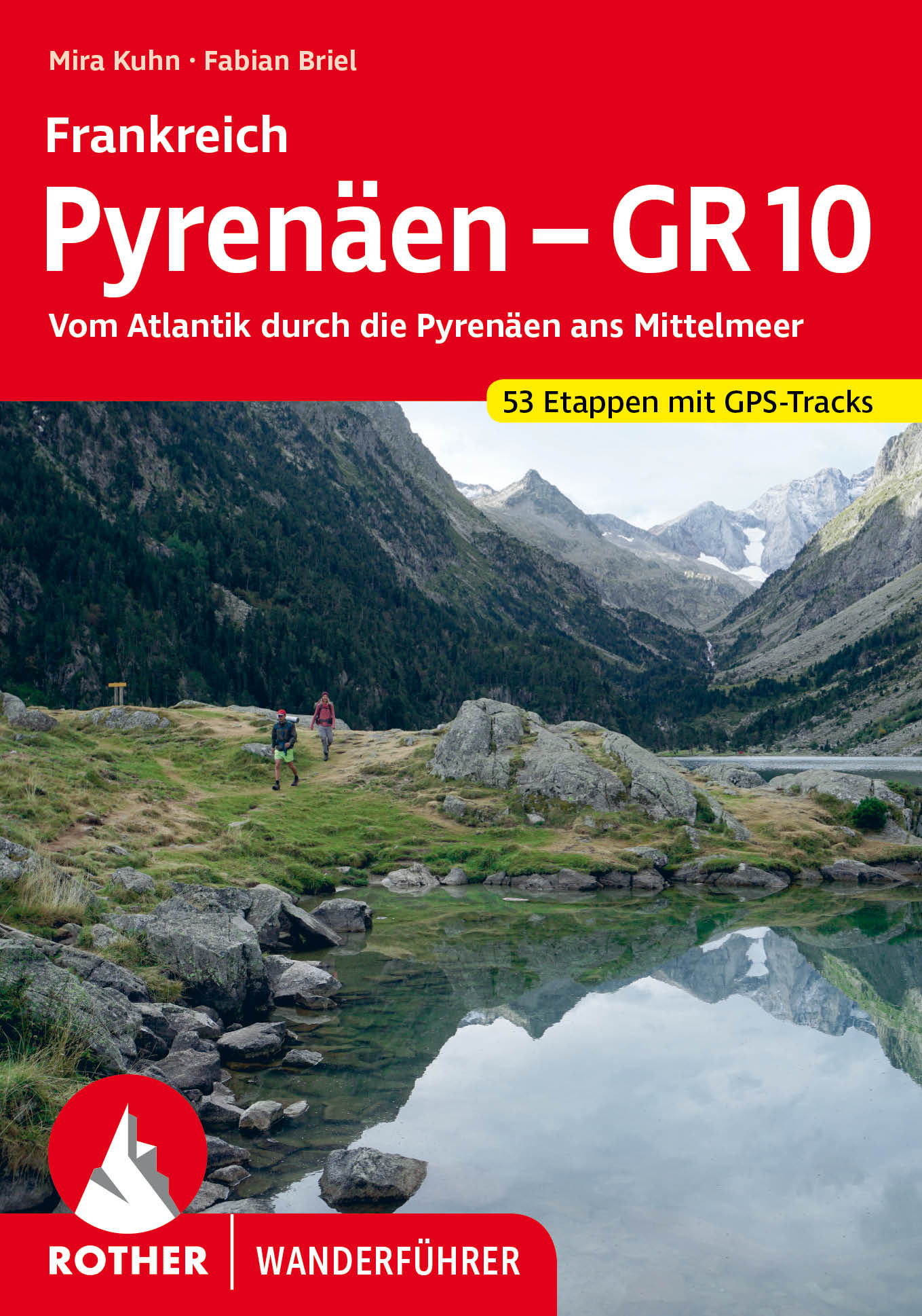
Im äußersten Südwesten Frankreichs reckt sich der imposante Gebirgszug der Pyrenäen dem Himmel entgegen. Er bildet die natürliche Grenze zwischen Frankreich und Spanien. Als einer von drei großen Fernwanderwegen durch die Pyrenäen gilt der GR 10 als der einfachste und der am besten markierte. Der Rother Wanderführer »Pyrenäen GR 10« stellt alle Etappen dieser Tour umfassend und zuverlässig vor.
Auf dem Fernwanderweg durch die Pyrenäen vom Atlantik zum Mittelmeer gilt es mehr als 920 Wanderkilometer zurückzulegen. Dabei zeigt der GR 10 viele Gesichter: Am Fuße der baskischen Hügellandschaft startend führt der Weg zunächst durch die felsigen Hochpyrenäen, die mit Highlights wie dem Vignemale und dem Cirque du Gavarnie begeistern. Im sich anschließenden Ariège finden Wandernde vor allem Ruhe und unberührte Natur. Den krönenden Abschluss bilden die östlichen Pyrenäen, wo beständiges Wetter und die mediterrane Pflanzenwelt schon auf das nahende Mittelmeer hinweisen.
Mit diesem Rother Wanderführer lässt sich der GR 10, der die Pyrenäen auf französischer Seite durchquert, in 53 Etappen erwandern. Jede Etappe wird mit zuverlässigen Wegbeschreibungen und allen wichtigen Informationen vorgestellt. Dazu gehören Hinweise zu Zeltmöglichkeiten als auch zu Unterkünften, die die Weitwanderung ohne Zelt ermöglichen. Hinzu kommen Infos zu Einkehr und Wasserstellen. Abkürzungen einzelner Etappen und zusätzliche alternative Routenvorschläge lassen die Tour an individuelle Bedürfnisse anpassen. Kartenausschnitte mit eingezeichnetem Routenverlauf, aussagekräftige Höhenprofile und GPS-Tracks zum Download machen die Infos komplett.
Das junge Autorenteam Mira Kuhn und Fabian Briel hat die Informationen zum GR 10 in mehreren Sommern vor Ort recherchiert. Damit ist dieser Rother Wanderführer die optimale Planungsgrundlage für alle, die die Pyrenäen auf diesem fantastischen Weitwanderweg durchqueren wollen.
Anzahl der Touren:53 Etappen und 5 Varianten
Anzahl der Bilder:205
Ausstattung:59 Wanderkärtchen im Maßstab 1:75.000, 58 Höhenprofile, zwei Übersichtskarten, GPS-Tracks zum Download
Format:11,5 x 16,5 cm