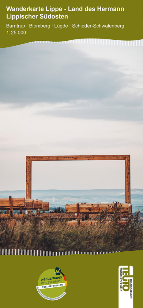
€ 17.50
Wandelgids Iceland - Ijsland | Rother Bergverlag

Rother walking guides are pocket-sized, in full colour and include 50 walks, varying from day-long hikes, mountain and valley walks, some easy some more demanding. Each walk has accompanying mapping and colour photos capture the 'feel' of each of the countries.

The selection of walks mostly concentrates on the national parks which provide the prerequisites for independent visitors. 49 walks on this unique island, from glaciers to stunning waterfalls, geysers and rocky ridge scrambles. Beautifully illustrated, this guide will make you start planning your trip immediately.

€ 10.25
Wegenkaart - landkaart Mapa Provincial Huelva | CNIG - Instituto Geográfico Nacional

Deze kaart is zuiver gericht op de provincie als in de titel. Gebieden naast de kaart worden zonder kleur weergegeven. Ideale kaart als het gaat om het onderscheid in topografische details als hoogte, nationale parken, vegetatie en plaatsen. Met schaduwrelief wordt hoogte goed zichtbaar. Zeker geschikt voor fietsers, al heb je er soms wel veel nodig.

Nadeel is het feit dat deze kaarten niet altijd even goed up-to-date zijn. Het komt soms wel voor dat bepaalde wegen inmiddels veel groter zijn geworden dan ingetekend op de kaart. Maar dan gaat het vooral om de grotere wegen: voor kleinere details is het een prima kaart.

One of the titles in a series of contoured road maps from Spain's civilian survey organisation, each covering one administrative province, excellent in presenting the country’s topography and locations of its many national and natural parks. The maps have contours at 100-metre intervals enhanced by relief shading, plus spot heights. Additional colouring is used to indicate various types of vegetation. Boundaries of national/natural parks are highlighted. Road network includes minor local roads and tracks, and motorways distinguish between free and toll routes. Railways show high speed, double, and single track lines. Unless indicated to the contrary in the individual descriptions, the maps have UTM grid, plus latitude and longitude margin ticks at 15' intervals, and an index of place names on the reverse. The legend is in Spanish only. Unlike in the older versions of this series, on each title all the information continues outside the provincial boundary, but without the relief shading and vegetation colouring.

€ 11.95
Wegenkaart - landkaart 758 Turkije | Michelin

Zoals je van Michelin mag verwachten is deze kaart zeer overzichtelijk en heeft een duidelijk helder kaartbeeld. De kaart geeft uitgebreid toeristische informatie weer. Met register, afstanden en reistijden.


Wegen worden naar verschillende klasse ingedeeld en - mooi van Michelin - de interessante mooie routes worden gemarkeerd met een groene streep. Hindernissen voor automobilsiten met caravans zijn gemarkeerd: steile hellingen, bergpassen of een anderzins moeilijke route. Bezienswaardigheden als een kasteel, religieus gebouw, ruine of grot is door een symbool goed te vinden.


Van de uitgever

Une carte routière et touristique Michelin pour être maître de votre itinéraire : • Mise à jour régulièrement • Une vue d'ensemble claire de la Turquie • Une cartographie précise et ultra lisible • Echelle : 1/1 000 000 (1cm = 10km) • Les plus : tableau des distances et des temps de parcours, index des localités, légende intuitive • Plans : Ankara et Istanbul Pensez à utiliser en complément notre Guide Vert Week&Go Istanbul. Avec la carte MICHELIN trouvez bien plus que votre route !


Turquie

€ 14.99
Woordenboek Miniwoordenboek Zweeds | van Dale

Nederlands-Zweeds en Zweeds-Nederlands handig in één band

Lidwoord in de kantlijn (een, en, ett)

Handig zakformaat met flexibele kaft

Duidelijk door grote letters en kleur

Actuele en adequate woordenschat

Informatie over de uitspraak

Extra: thematische woordenlijsten zoals culinaire woordenlijsten, veelgebruikte afkortingen, telwoorden, dagen van de week en klokkijken

Extra: nuttige zinnen, bijvoorbeeld om te vragen waar het station is of hoe men een biertje bestelt

Extra: Onregelmatige werkwoorden

Inhoud: 20.000 trefwoorden

Bladzijden: 478


De Van Dale Miniwoordenboeken zijn handig om mee te nemen op (zaken)reis en om snel even een woord in op te zoeken. Het zijn kleine boekjes met een flexibele omslag die makkelijk in zak of tas passen. De goed leesbare lettergrootte en de steunkleur maken het opzoeken eenvoudig. De Van Dale Miniwoordenboeken bevatten 20.000 trefwoorden per boekje en zijn er in het Engels, Frans, Duits, Spaans, Italiaans, Portugees, Turks, Noors, Zweeds, Deens, Indonesisch, Pools, Kroatisch, Slowaaks, Tsjechisch, Sloveens, Afrikaans, Grieks, Arabisch en Chinees.

€ 15.50
Reisgids Jersey | Sunflower books

Gids met 25 wandelingen en 2 autoroutes over het eiland.

This new  edition of Landscapes of Jersey has been thoroughly revised with completely new, easily readable 1:25,000 maps based on OpenStreet mapping and our own GPS research.


Walking in Jersey can be quite challenging: the coastline features some steep paths with endless steps. But away from the coast there is slightly more variety in the landscape, and walking is relaxed and easy, mainly along quiet lanes and country paths. Geoff Daniel has the happy knack of finding sights and places to stir the imagination — from the Pinnacle (one-time scene of pagan rituals) to the eerie towering concrete relics dating from the German Occupation during World War II. Whether you’re a first-timer seeing Jersey by car or a regular visitor, you’ll enjoy exploring places you might never see without this guide.


Area covered: the entire island


Best months for walking: Walk here in April or May if you can, to catch the spring flowers. Otherwise, good walking can be enjoyed through to the end of October, and even in winter the climate is usually milder than on the mainland. Many keen walkers prefer to walk out of season — they take a chance with the possibility of rain and blustery breezes to enjoy the island free from summer visitors. However, even at the height of summer, it’s possible to find walks on which you’ll scarcely see another soul.

€ 29.95
Wegenatlas Australia Road & 4WD Handy Atlas B5 | Hema Maps

Wegenatlas Australie met toeristische informatie, uitgevoerd in handige spiraalbinding. Geweldige kaarten, goed leesbaar (beetje kleine letters wellicht voor sommigen) met veel toegevoegde waarde als het gaat om details als Nationale Parken, campsites, stranden en afstanden. De schaal varieert per bladzijde

Featuring trusted Hema mapping for all of Australia, the Hema Road & 4WD Handy Atlas is the definitive travel guide for tourers and adventurers. Hema atlases feature more information useful to travellers, including 4WD tracks, campsites, caravan parks, rest areas, 24-hour fuel and points of interest.


This edition in a handy size contains more mapping than ever before, which is enhanced by a striking new cartographic style that?s incredibly easy to read. Included in this is up-to-date mapping for Australia's biggest 4WD destinations: Cape York, Fraser Island, the Top End, the Kimberley, the Pilbara, Central Australia, High Country Victoria and the Flinders Ranges.


A handy distance grid, national park guide, list of accredited information centres and a complete index are also included to assist with trip planning and navigation, making it the perfect tool for guiding tourers, campers, road trippers and off-roaders throughout Australia.


Key Features

Detailed 4WD tracks

Fuel

Points of interest

National parks

Campsites

Caravan parks

Rest areas

Road distances

Fully indexed


€ 15.95
Wandelkaart Tour & Trail Alpujarras | Discovery Walking Guides

Scheur- en watervaste wandelkaart van de Alpujarras met hoogtelijnen en graden.

For the best adventures, use the best map.

The Moorish white villages of the Alpujarras are well known to day trippers from the Costa del Sol.

For walkers this is an idyllic region with stone-laid donkey trails linking the tipico villages and stretching up the southern slopes of the Sierra Nevada to Mulhacen; at 3,483 metres the highest mountain peak on mainland Spain. From Spring to the end of Autumn this is a paradise for hikers, whether you are walking from village to village sampling the local delicacies or tackling the challenging major ascents.

One thing you will know is that using the Alpujarras Tour & Trail Map will help you plan, and get the best out of, your adventures.


On a large 960mm by 700mm, double sided, map sheet at 40k scale this map has all the detail you need.

20 and 100 metre contours, combined with altitude shading, giving you a true feel to this impressive landscape.

 Stretching from west of Lanjaron to Ohanes in the east taking in the Poqueira and Trevelez valleys,

while going north to include Mulhacen and Veleta mountain peaks along with the Sierra Nevada ski area.

The GR240, GR142 & GR7 (official long distance hiking routes) are specially highlighted (in green) along with all the walking routes from Walk! the Alpujarras guidebook (in red).


Our new edition Alpujarras Tour & Trail Map covers an area of 70 kms (E-W) by 28 kms (N-S); more than twice the land area of our earlier editions.

A special 'Concertina Map Fold' makes Tour & Trail Maps easy to use, and more importantly easy to fold back to their handy pocket size.


€ 10.95
Wegenkaart - landkaart 365 Sicilia - Sicilië | Michelin

De Michelin kaart is actueel, gedetailleerd, nauwkeurig, praktisch en internationaal. 


De Lokale Michelin streekkaart biedt u: nauwkeurige en toeristische informatie over een streek of regio, een plaatsnamenregister om uw route gedetailleerd uit te stippelen, een nog waarheidsgetrouwere weergave van de topografie door het satellietbeeld en een selectie van de mooiste plekken.


From Michelin's yellow Local series of Europe maps comes this map of Sicily at 1:200 000, showing excellent detail in this region of Italy. The map has the usual excellent road detail characteristic of Michelin maps, with everything from motorways down to rough tracks and footpaths marked out clearly. The number of lanes is indicated on most roads, with intermediate road distances, European route numbers and tolled roads also shown.


The map includes highly detailed relief shading that's derived from satellite photos, with plenty of spot heights also. View points, scenic routes, religious and historic buildings, caves, palaces and villas, parks and loads of other places of touristic interest are marked out with symbols. The legend is in a few lanaguages, one of them is English.


The map also has a table gving distances and driving times between major towns and citites throughout the region and an extensive index of places.


Catane, Italie, Messine, Palerme, Sicile, Syracuse

€ 25.99
Reisgids National Geographic Londen | Kosmos Uitgevers

Reis door Londen onder begeleiding van National Geographic - sinds 1888 wereldwijd geroemd voor haar expedities, ontdekkingen en onderzoek. Deze exclusieve reisgids - met sublieme fotografie - neemt u mee naar de bekende en minder bekende bezienswaardigheden. De selectie is uniek en biedt u de kans om de stad te bereizen zoals dat nog nooit met een reisgids mogelijk was.

Uitgebreide plaatsbeschrijvingen en diepgaande achtergrondinformatie

Speciale reportages over geschiedenis, cultuur en hedendaags leven

Meer dan 190 prachtige kleurenfoto's

19 gedetailleerde plattegronden

Uitgezette wandelingen en autotochten

Exclusief voor deze serie vervaardigde tekeningen en dwarsdoorsnedes

Duidelijk en eenvoudig in gebruik

Uitgebreide praktische informatie, adressen van hotels, restaurants en winkels

€ 13.95
Stadsplattegrond Helsinki | Freytag & Berndt

Stadsplattegrond met register. Helder kaartbeeld waarbij de naamgeving goed leesbaar is weergegeven. Met de toeristische bezienswaardigheden in symbolen weergeven: monumenten, musea, stadions e.a. Daarnaast handige zaken als postkantoren, parkeergarages en stations. Veelal ook met een openbaar vervoer of metro kaart als inzet.

Covers the whole city including the airport, and reaching southern Vantaa. One-way streets are indicated and pedestrian zones, car parks and public transport routes - bus, tram, metro, rail and ferry - are marked. Other details include: churches, police stations, hospitals, schools, post offices, campsites, tourist information offices, monuments, parks, forests, marshes. Legend includes English.


There is a diagram of the commuter rail and metro system and a small road map of the Helsinki - Turku region

Abonneer op