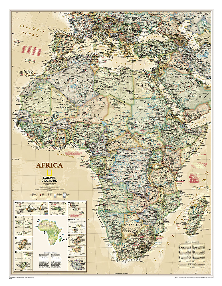
Mooie wandkaart van Afrika, staatkundig, met rustig kleurgebruik en helder kaartbeeld, Ondanks het wat kleiner formaat staan er toch heel wat topografische details op vermeld.
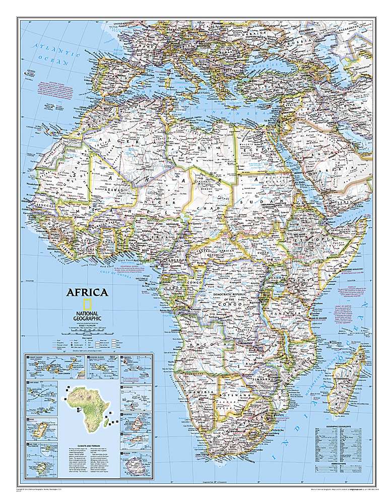
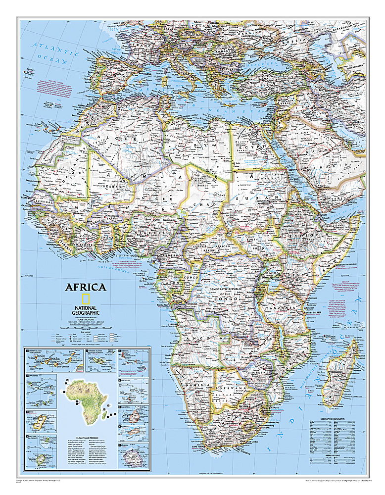
The map presents Africa at 1: 9.328.000 and coverage includes the whole of the Mediterranean Basin, extending north to London. Islands in the Atlantic and the Indian Ocean are included on a separate inset. The base map has relief shading to show the continent’s topography, with additional graphics indicating deserts, swamps, salt flats, etc. The map shows the names of the main geographic features such as mountain ranges, deserts, peaks etc. Heights are given in metres, except for Kilimanjaro, shown in both metres and feet. In the Congo basin many of the tributaries are named.
Country boundaries are shown in contrasting colours. All place names are in English, except for selected cities such as Cairo, Tripoli or Algiers where the original names are shown first (El Quahira, etc) with the English equivalents in brackets. Where appropriate, administrative, legislative and judicial capital cities are indicated (e.g. Dar Es Salam/Dodoma, Johannesburg/Cape Town/Bloemfontein, etc).