Wandelkaart 51 Outdoorkarte Rheingau Westlicher Taunus | Kümmerly & Fr
€ 14,-Hele goede wandelkaart met alle noodzakelijke topografische details, hoogtelijnen, ingetekende wandelroutes en hut…
De Zwerver →
Hele goede wandelkaart met alle noodzakelijke topografische details, hoogtelijnen, ingetekende wandelroutes en hut…
De perfecte reisgids voor zowel de georganiseerde als de zelfstandige reiziger. Naast een algemene inleiding van h…

Uitstekende wandelgids van Boheems Zwitserland met een groot aantal dagtochten in dal en hooggebergte. Met praktis…
Klein handzaam kaartje van de Stad Granollers en de omgeving. Mapa excursionista • Escala: 1: 20.000 • Equid…
Engels EN franstalige wandelgids met een beschrijving van via Francigena. Uitstekende beschrijvingen met duidelij…

De themagids bevat acht afwisselende dagtochten in Vlaanderen met een station aan begin- en eindpunt. Het zijn stu…

Ga erop uit! Tuinen, parken en bossen zitten vol geheimen. Met deze 50 kaarten kun je achter een aantal van deze g…
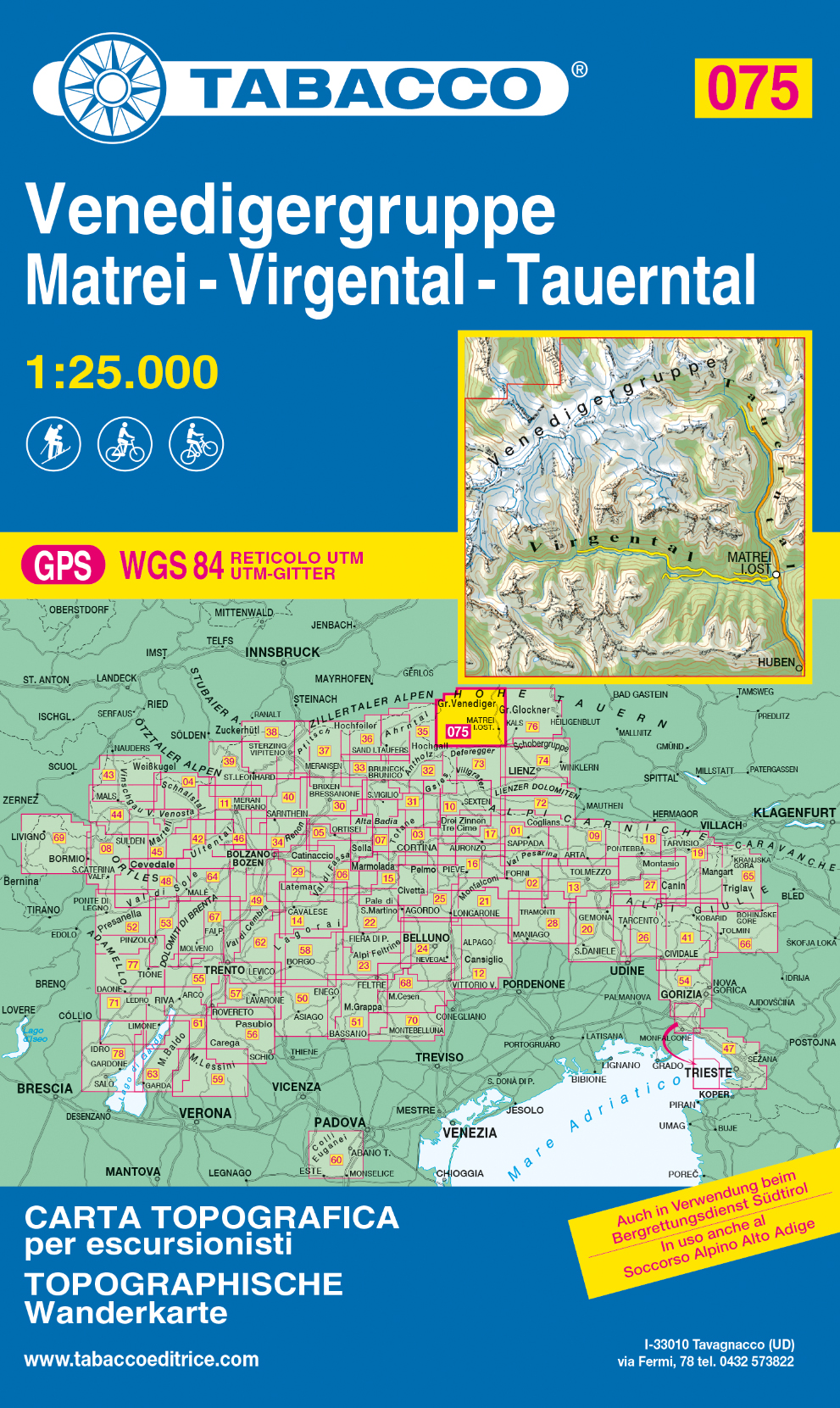
De beste wandelkaarten voor de Dolomieten. Zeer veel topografische details met secure hoogtelijnen (25 meter inter…
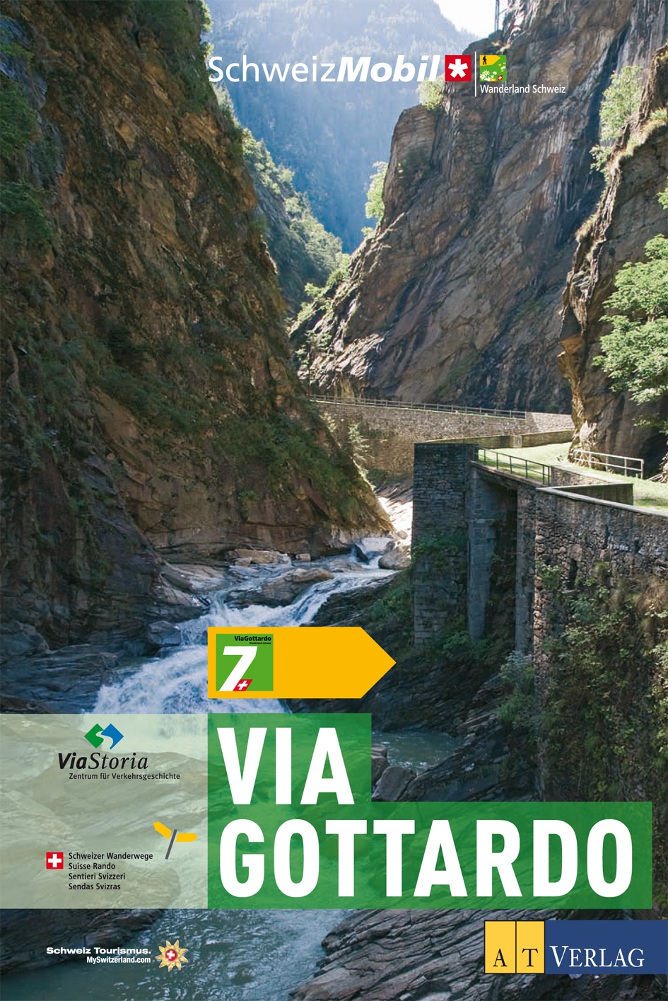
Die nationalen Wanderland Routen 7 und 77 ViaGottardo folgen den frühen Alpenquerern auf ihrem Weg in den Süden. S…
In angenehmer Höhe wandernd geniesst man ein umfassendes Panorama und erlebt abwechslungsreiche Landschaften und K…