€ 20.95
Wandelgids Friends Way 2 | Rucksack Readers

The Friends Way route will appeal not only to all Quakers who enjoy walking, but also to those walkers who don't yet know about Margaret Fell's remarkable story. This volume, a sequel to Friends Way 2, continues the route from Sedbergh to Swarthmoor Hall near Ulverston. After George Fox reached Swarthmoor Hall, he deeply impressed Margaret Fell (1614-1702) with his radical ideas.


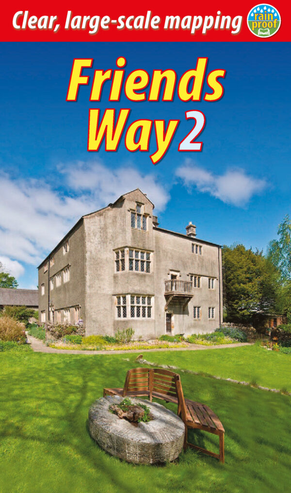
She later became a committed Quaker who was imprisoned for her beliefs, and also his wife. She worked tirelessly to organise the movement, to lobby for releasing prisoners of conscience and to spread the Quaker word by publishing letters. This book covers her journey from mistress of Swarthmoor to mother of Quakerism, as well as devoting a section to Swarthmoor Hall which was and is the most important centre of Quakerism in northern England.


The route takes in major Quaker sites in Sedbergh and Kendal en route to Swarthmoor Hall, and it can comfortably be completed inside one week.

€ 13.50
Wandelkaart 30 Namur - Namen | Mini-Ardenne

De Mini-Ardenne kaarten zijn volledig nieuwe topografische kaarten op een schaal van 1/25000, die je zullen meenemen op een gigantisch netwerk van honderden kilometers wandelroutes voor wandelaars, fietsers en ruiters.


Met hun systeem van knooppunten, elk geassocieerd met een specifieke plaats, bieden ze zowel de gelegenheidswandelaar die de voorkeur geeft aan kleine rondjes, als de professionele trekker die houdt van grote tochten, de mogelijkheid om het diepe Ardennerland en zijn fantastische sfeer te ontdekken.


BELANGRIJKSTE EIGENSCHAPPEN


Geografische gegevens ©ODbL OpenStreetMap Contributors

Reliëf en hoogtelijnen met een interval van 5 m

Vertaling van teksten in het Frans, Nederlands, Duits, Engels

Talrijke bezienswaardigheden (restaurants, hotels, B&B's, bakkerijen, slagerijen, snacks, cafés, apotheken, supermarkten, kastelen, musea, kerken, kruisen, kapellen, stations, speeltuinen, picknicktafels, barbecues, enz.)

Extra vermeldingen (prive-wegen, fietspaden, parkeerplaatsen, bankjes, enz.)

Afstand aangegeven op elk segment tussen twee knooppunten om de totale routeafstand te berekenen

QR-codes gelinkt aan de website www.mini-ardenne.be die alle bezienswaardigheden per dorp opsomt.

Ook toeristische attracties, campings en talrijke bezienswaardigheden zoals bakkerijen, cafés, speelplaatsen, ... zijn op de kaart opgenomen.

€ 20.99
Reisverhaal Het Spaanse van Spanje | Cees Nooteboom

De mooiste literaire verhalen over Spanje van de auteur van De omweg naar Santiago.


‘Armzalig degenen die hun Spanje alleen aan de toeristenkusten zoeken, er is nog een ander Spanje, oneindig veel groter en onbekender, dat van de gewone mensen en verborgen schatten, het Spanje dat ik al jaren zoek en vind.’ Aldus Cees Nooteboom.


In zijn talrijke verhalen over Spanje toont hij de rigoureuze veranderingen die het land sinds de jaren vijftig van de vorige eeuw heeft doorgemaakt. Nooteboom neemt ons mee naar het Spanje van Franco, naar de uitgestrekte natuur van het binnenland en naar hypermoderne badplaatsen blakend van de toeristen. De grote contrasten tussen de bergdorpen en het flamboyante Barcelona weet hij als geen ander te vatten in schitterend proza. In dit boek met zijn beste Spanje-verhalen dringt Nooteboom door tot de ziel van het land. Dit is Spanje in zijn puurste vorm.

€ 19.95
Wandelgids 736 Gorges et Vallée du Tarn - GR 736 | FFRP

Franstalige wandelgids met een beschrijving van een aantal dagtochten / rondwandelingen. Uitstekende beschrijvingen met duidelijk kaartmateriaal. Mislopen is nauwelijks mogelijk, maar ja .. de franse taal! Ook praktische informatie staat in deze gids. Alle gidsen bevatten een door ons toegevoegde uitgebreide frans - nederlandse wandelwoordenlijst.

Le GR®736 accompagne la rivière Tarn du mont Lozère, où elle prend sa source, jusqu'à Albi.


Le long de ses rives, ou sur les crêtes et plateaux qui la surplombent, il traverse les somptueux paysages du Parc national des Cévennes, du Parc naturel régional des Grands Causses puis du Ségala tarnais.


De l'amont vers l'aval, découvrez des sites d'exception tels les détroits des gorges du Tarn, les escarpements des Raspes et le méandre d'Ambialet, de grands espaces façonnés par la tradition agropastorale, des cités (Millau, Albi) et villages (Sainte-Énimie, Peyre, Brousse-le-Château...) remarquables qui vivent en harmonie avec la rivière.


L'intégralité du GR® 736 est décrit dans ce topoguide, de Villefort en Lozère à Albi dans le Tarn.

€ 4.95
Zaklamp Expedition Natur met karabijnhaak | Moses Verlag

Verlicht je avonturen met deze robuuste LED zaklamp, uitgerust met een handige karabijnhaak. Hiermee kan de zaklamp eenvoudig aan je rugzak worden geklikt, zodat je hem altijd bij de hand hebt wanneer je hem nodig hebt.


Deze zaklamp is ontworpen om helder, betrouwbaar licht te leveren waar en wanneer je het nodig hebt. Dankzij de LED-verlichting produceert het een krachtige straal die je pad verlicht, zelfs in de donkerste omstandigheden. Of je nu kampeert, wandelt of gewoon een betrouwbare lichtbron nodig hebt, deze zaklamp is een essentieel onderdeel van je uitrusting.


De zaklamp wordt geleverd met drie AAA-batterijen, zodat je direct uit de verpakking klaar bent voor je volgende avontuur.


Afmetingen:


Lengte: 9,7 cm

Diameter: 3 cm

€ 13.95
Wegenkaart - landkaart Sachsen-Anhalt | Marco Polo

Es ist gut zu wissen, wo sich die bedeutenden kulturellen und landschaftlichen Sehenswürdigkeiten befinden. Das präzise und klar lesbare Kartenbild der MARCO POLO Karte führt Sie nicht nur zu diesen wirklich interessanten Stellen, sondern zeigt Ihnen außerdem noch viele andere wissenswerte Details. Dank des großen Maßstabs 1:200 000 können Sie sich sehr gut orientieren und finden auch auf interessanten, abgelegenen Straßen sicher zum Ziel. Die wichtigsten Ballungsraumkarten und Citypläne sorgen zusammen mit dem praktischen Zoom-System für die beste Orientierung auch in den Städten.


Sprachen: Deutsch, Englisch, Französisch


Hauptkarte im Maßstab 1:200 000; Übersichtskarte zum Ausklappen/ Entfernungstabelle/ Index: mehrsprachige Legende (D, GB, F, NL, I, E, CZ, PL)/ Marco Polo Highlights/ 3 Durchfahrtspläne 1:100 000 und dazugehörige Citypläne 1:20 000: - Dessau - Halle (Saale) - Magdeburg Sonderkarte: - Flughafen Leipzig/Halle Verkehrsinformationen/ Reiseinformationen/ Ortsregister mit Bundesland, Postleitzahl und Suchfeldangabe und ausgewählten Sehenswürdigkeiten, Landschafts- und Gewässernamen/ Blattübersicht mit Bundesländern/

€ 16.99
Reisgids Simpelweg Schotland | Lannoo

Wil je ten volle genieten van je reis door Schotland, zonder je tijd kwijt te zijn aan voorbereiding? Hou je niet van overbodige informatie? Dan is Simpelweg Schotland jouw perfecte match! Even door de gids bladeren en je je weet meteen wat je wil zien of doen.


Simpelweg is de meest praktische reisgids ter wereld:


Gemakkelijk en snel te raadplegen

Superduidelijke kaarten en plattegronden van Edinburgh, Glasgow, Loch Lomond, Oban, Fort William, Isle of Skye, Inverness, Pitlochry

De mooiste plekken en leukste activiteiten in Schotland

De beste adressen van locals

Inclusief een roadtrip van vijf dagen langs de noordkust van Schotland, de bekende North Coast 500.

€ 12.50
Reisgids Mini Rough Guide Frankrijk (France) | Rough Guides

This pocket-sized travel guide to France is a convenient, quick-reference companion to discovering what to do, what to see and how to get around the destination. It covers top attractions like Provence, as well as hidden gems, including Perigord. Our France guide book will save you time and enhance your exploration of this fascinating country.


This France travel guide has been fully updated post-COVID-19. This Mini Rough Guide to FRANCE covers: Ile de France, The Northeast, The Southeast, The Southwest. In this guide book to France you will find: RECOMMENDATIONS FOR EVERY TYPE OF TRAVELLER Experiences selected for every kind of trip to France, from cultural explorations in The French Alps to family activities in child-friendly places, like Versailles or chilled-out breaks in popular tourist areas, like Paris.


TOP TEN ATTRACTIONSThis France travel guide covers the destination's top ten attractions not to miss, including The Eiffel Tower, the Cote d'Azur, Versailles, Disneyland Paris, Parc Asterix and a Perfect Day itinerary suggestions. COMPACT FORMATCompact, concise, and packed with essential information, with a sharp design and colour-coded sections, this guide book to France is the perfect on-the-move companion when you're exploring Normandy. HISTORICAL AND CULTURAL INSIGHTSIncludes an insightful overview of landscape, history and culture of France.


WHAT TO DODetailed description of entertainment, shopping, nightlife, festivals and events, and children's activities. PRACTICAL MAPSHandy colour maps on the inside cover flaps of this travel guide to France will help you find your way around. PRACTICAL TRAVEL INFORMATIONPractical information on eating out, including a handy glossary and detailed restaurant listings, as well as a comprehensive A-Z of travel tips on everything from getting around to health and tourist information.


STRIKING PICTURESInspirational colour photography throughout. FREE EBOOK Free eBook download with every purchase of this France guide book to access all content from your phone or tablet for on-the-road exploration.

€ 24.95
Wandelgids Walking in the Picos de Europa | Cicerone

Guidebook to 38 walks and 4 short treks of 3-4 days in the stunning Picos de Europa mountains of northern Spain. The walking routes are between 8 and 24 km in length and are graded by difficulty, ranging from easy valley walks to difficult ascents of the high peaks. The walks cover the areas of Cangas de Onis, Cabrales, Liebana, Valdeon and Sajambre.


Alongside detailed route descriptions and 1:50k mapping, there is plenty of information on potential bases, manned refuges, local transport and facilities along the routes. There are also background notes on the area's rich geology, plants and wildlife. Spain's first national park, the Picos de Europa feature striking karst landscapes of jagged peaks and deeply incised gorges.


However, there are also beech woods and picturesque alpine lakes, and the diverse landscapes support a wide variety of plants, wildlife and birdlife. The walks showcase many of the region's highlights, including its high peaks, the Covadonga lakes and the breathtaking Cares Gorge. The landscape of the Picos is widely considered the jewel in Spain's mountainous crown.

€ 29.95
Campergids Take the Slow Road: Spain and Portugal | Bloomsbury

The ultimate guide to the very best scenic and fun routes for camper vans and motorhomes around the mountains, coastlines and winding roads of beautiful Spain and Portugal. Forget hurrying. Forget putting your foot down and racing through sweeping bends.


Forget the understeer (whatever that is). Forget the blur of a life lived too fast. This is a look at taking life slowly.


It's about taking the time to enjoy journeys and places for their own sake. It's about stopping and putting the kettle on. Stopping to take a picture.


Stopping to enjoy stopping. How are you going to do it? In a camper van or a motorhome, of course. In this book we define the best driving routes around Spain and Portugal for camper vans and motorhomes.


We show you the coolest places to stay, what to see, what to do and explain why it's special. We meander around Spain and Portugal on the most breathtaking roads, chugging up mountain passes and pootling along the coast. We show you stuff that's fun, often free.


We include the best drives for different kinds of drivers; for walkers, culture-buffs, sea-swimmers and sun-worshippers. We include the steepest, the bendiest, the most picturesque and most interesting. And you don't even have to own a camper van or motorhome - we'll tell you the many places you can rent one to take you on the journey.


All of this is interspersed with beautiful photos, handy maps and quirky travel writing from the king of camper vans and motorhomes, Martin Dorey. So if all you want to do is flick through on a cold day and plan your next outing, you'll be transported (albeit slowly) to cobbled streets, beaches, mountains and winding roads that make you want to turn the key and go, go, go!

Abonneer op