
€ 20.95
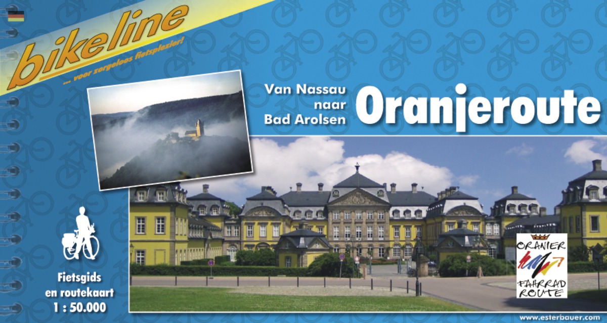
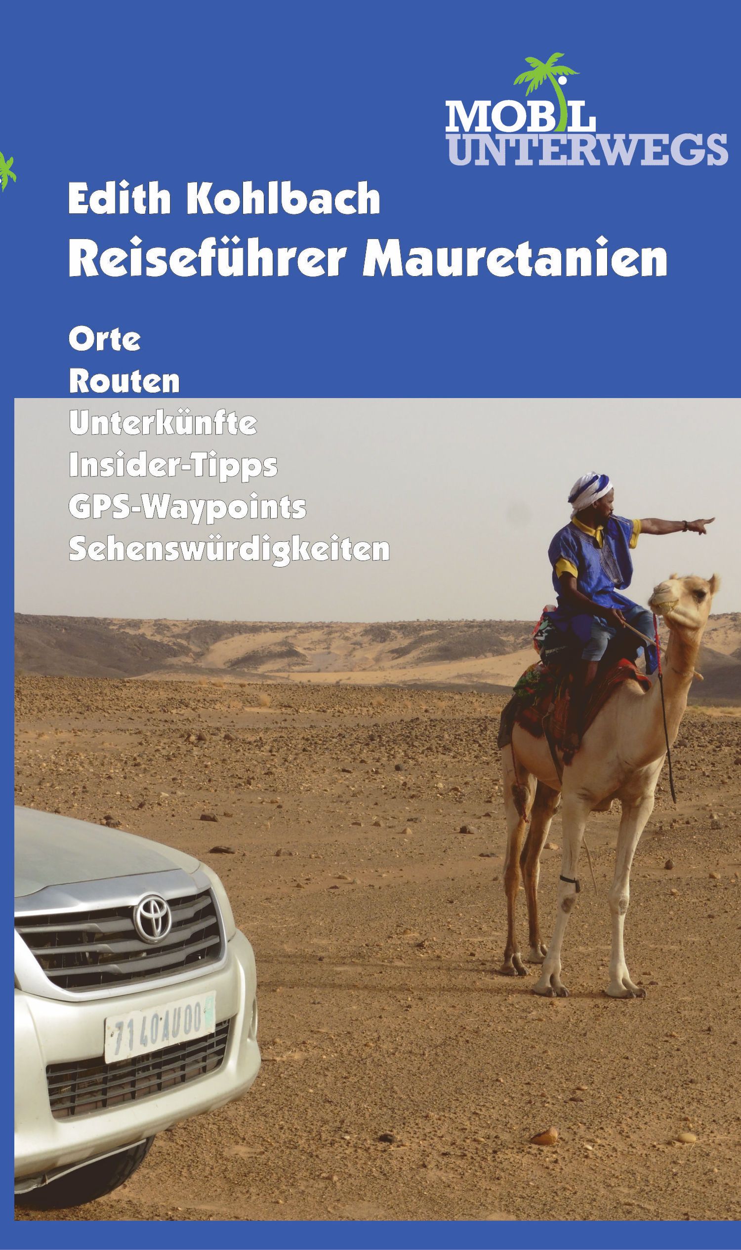
Endlich hat Mauretanien seine Probleme in den Griff bekommen, die Sicherheitslage hat sich so weit gebessert, dass selbst die deutsche Botschaft sagt, man kann in das Gebiet nahe der Grenze zu Mali im Osten reisen und die Traumstrecke Chinguetti – Tichit – Oualata wird damit zugänglich. Und die zeitweise stark überteuerte Visumsgebühr wurde auf 55 Euro gesenkt, nicht ohne meine tätige Mithilfe. Die Wohnmobilfahrer sind weitgehend verschwunden, nur sehr abenteuerlustige Menschen wagen sich noch hierher, gibt es ja auch wenig Infrastruktur für sie, aber für die Geländewagenfahrer wird Mauretanien wieder sehr interessant, ist doch Marokko so ziemlich zugeteert.
Die echten großen Pistenstrecken, von denen es noch reichlich gibt, können natürlich nur von Allradfahrzeugen mit kompletter Wüstenausrüstung befahren werden und möglichst nicht allein, denn die Distanzen sind lang, Fahrzeuge können Schäden bekommen und technische Hilfe ist unterwegs nicht zu finden. Auf Asphalt oder mit öffentlichen Verkehrsmitteln können Frauen (oder auch Männer) jedoch ohne Bedenken allein reisen. Selten habe ich mich so sicher gefühlt. Französische Sprachkenntnisse sollten allerdings vorhanden sein.
€ 30.95
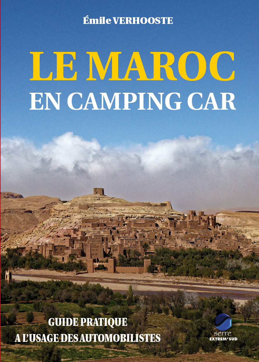
Mieux que quiconque, le peintre Eugène Delacroix avait su saisir, dès le milieu du XIXe siècle, les formidables couleurs de ce pays et sa grande leçon de vie. Imaginez toutes les nuances de la palette du peintre et vous appréhenderez alors celle de ce pays, tout particulièrement au printemps et en automne.
Le Maroc, c’est le dépaysement et l’émerveillement à notre porte. Pays accueillant, aux paysages variés, toujours très francophone, parfois hors du temps, si proche et si différent de nous… Idéal pour la découverte en couple, en famille, entre amis. Chaque année, des milliers de touristes se rendent dans ce merveilleux pays et, pour une grande partie d'entre-eux, le visitent sans faire appel aux structures traditionnelles d'organisation de voyages, avec leur propre véhicule. Ce guide du Maroc s'adresse à eux, leur proposant toute une palette de lieux et de circuits routiers extraordinaires, pour en faire ce que Jacques Gandini appelle des DPM, des « Dévoreurs de Pays Magnifique » ou encore « Dévoreurs de Paysages Marocains ». Même si son titre semble le destiner aux seuls camping-caristes, le guide d'Emile Verhooste s'adresse à tous les automobilistes désireux de découvrir un Maroc hors des sentiers battus, authentique et chaleureux.
Emile Verhooste, déjà auteur du Guide des Campings du Maroc, réédité chaque année depuis 2001 par Extrem'Sud, a fait appel, dans la rédaction de ce guide pratique, à sa longue expérience du terrain, en essayant d’être le plus clair et le plus simple possible afin que ses lecteurs puissent découvrir et choisir les lieux, les itinéraires, les sites les plus adaptés à leurs goûts personnels. Son but n’est pas de publier un guide touristique supplémentaire, mais simplement de guider les visiteurs de ce pays avec le regard d'un automobiliste curieux et intéressé, soucieux de l'environnement et du respect dû aux populations qui vont si bien les accueillir.
Cette troisième édition a été entièrement refondue et surtout remise à jour car, en quelques années, des changements énormes sont intervenus : ouverture de nouvelles routes, accès à des régions autrefois presque impossible... et l'auteur en a découvert de fabuleuses. Il a fait des quantités inimaginables de nouveaux sites de toute beauté ! Emile Verhooste poursuit ainsi son désir de témoigner de sa passion pour ce Maroc profond et authentique.
Elle regroupe plus de 70 circuits dont 50 entièrement nouveaux; les autres ont été revus, corrigés et agrémentés de variantes afin de profiter au mieux des nouvelles routes. 55 cartes sont incluses dans le guide.
Pour tenir compte de l’usage désormais presque systématique d’un deuxième véhicule (buggy, quad, scooter, moto, etc.), Emile Verhooste a adjoint un certain nombre de « petits circuits » empruntant la plupart du temps des pistes ou des routes difficilement praticables en camping car. 4 randonnées pédestres sont par ailleurs proposées à nos amis marcheurs. Il a parcouru tous les circuits proposés à bord d’un camping-car de 7 m 40 de long, et il est donc à même d’évaluer leur faisabilité, avec ou sans réserve.
Un ouvrage indispensable, non seulement pour les adeptes du camping-car, mais aussi pour tous ceux qui souhaitent visiter autrement, et par leurs propres moyens, ce magnifique pays.
€ 59.00
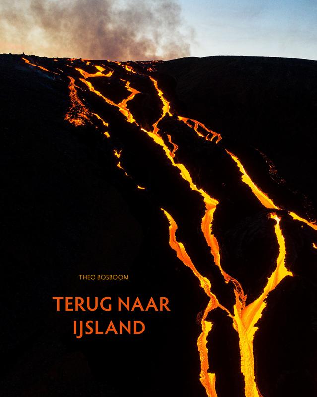
Theo Bosboom – Terug naar IJsland Het fotoboek Terug naar IJsland vormt een prachtige en persoonlijke ode aan IJsland van de bekende Nederlandse landschapsfotograaf Theo Bosboom. Hij voelt zich op IJsland veel dichter bij de natuur dan op welke andere plek ook. “Het is net alsof ik de natuur hier intenser beleef. IJsland kruipt onder mijn huid, het raakt me, het overweldigt me, iedere keer weer opnieuw”, schreef hij al in 2012.
Dit fraai vormgegeven boek bevat meer dan 100 foto’s in de herkenbare stijl van Bosboom, waaronder veel spectaculaire beelden van de recente Fagradalsfjall vulkaanuitbarsting. Ook zijn in het boek enkele persoonlijke teksten van Bosboom opgenomen over onder meer de opkomst van het massatoerisme, de twee vulkaanuitbarstingen die hij heeft kunnen fotograferen en IJslandse muziek. Een absolute aanrader voor IJsland fans en liefhebbers van spannende natuur- en landschapsfotografie!
€ 14.90
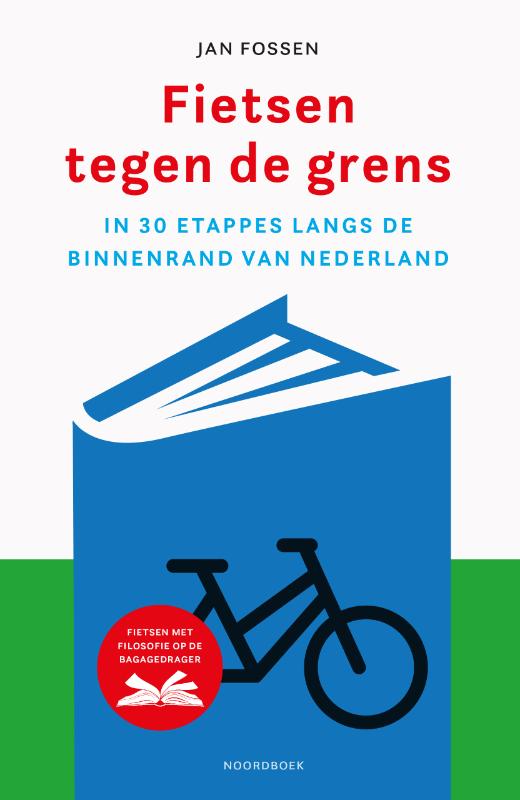
Drieduizend kilometer in dertig etappes langs de grens van Nederland, soms met wind mee en soms op zijn tandvlees. Want dat is niet alleen goed voor het lichaam, maar ook voor de geest. De eenvoud van het fietsen relativeert én verrijkt. Terwijl Jan Fossen zich onderweg verwondert over de soms grillige grens, het weidse landschap en de geschiedenis ervan, fietst hij tegen zijn eigen grenzen aan.
Maar hij heeft ook voldoende tijd om zich te laten inspireren door filosofen als Nietzsche, die zegt: ‘Maar als de spieren niet feestvieren, raakt ook het denken bloedeloos.’ Of door hedonist Epicurus, die zijn verlangens onder controle heeft en daardoor optimaal van kleine dingen kan genieten: ‘Niets is genoeg voor degene voor wie genoeg te weinig is.’ Filosofische uitstapjes, onverwachte ontmoetingen, de helende cadans van de trappers, in contact met de natuur.
Jan Fossen laat je inzien waarom fietsen zo leuk is. Jan Fossen (1963) is gezondheidswetenschapper en theaterregisseur. Daarnaast is hij een fervent fietser en heeft hij lange tochten gemaakt naar de bron van de Rijn, de Elbe en de Donau. Hij is verslaafd aan het ritme van de pedalen, het trotseren van de elementen en het volop gebruiken van alle zintuigen.
€ 17.50
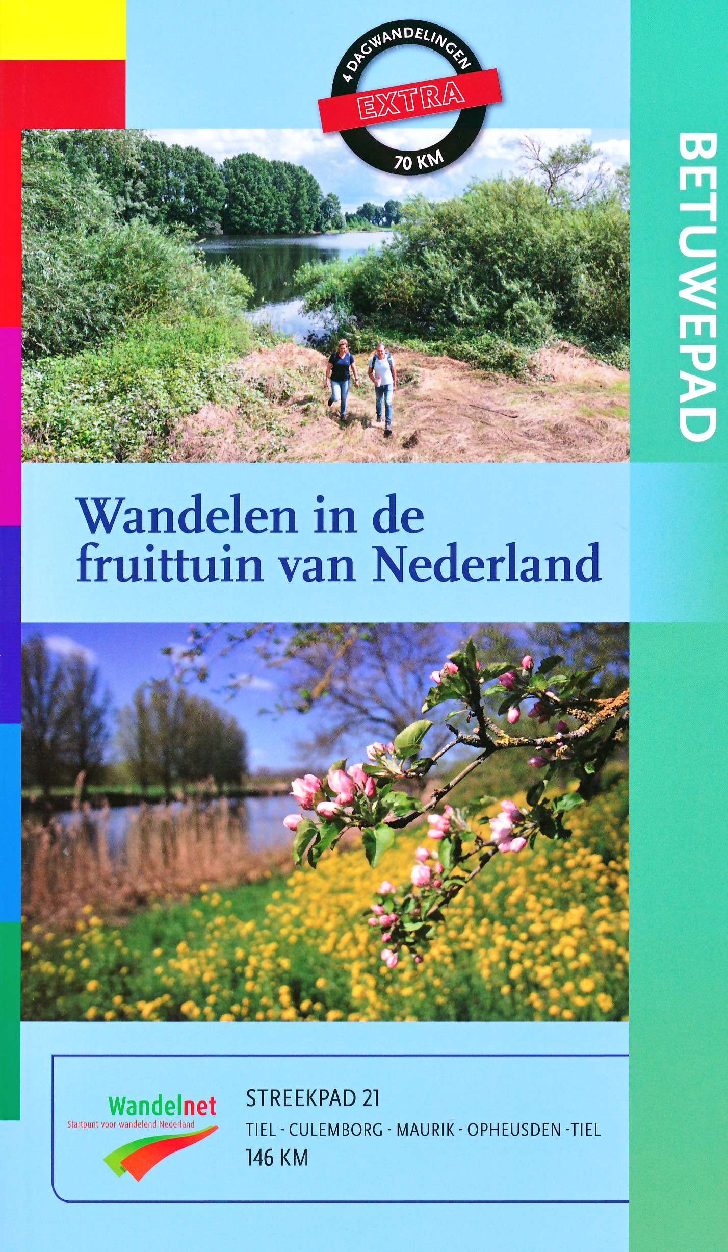
Bloeiende bloesems, groene weides, slingerende rivieren, uiterwaarden en karakteristieke stadjes. Dat is de Betuwe ten voeten uit. Letterlijk zelfs, want wandelen is een perfecte manier om de streek te ontdekken. Het nieuwe Betuwepad wijst je de weg.
De route
Het ‘kersverse’ Streekpad begint en eindigt bij het station in Tiel en is 146 kilometer lang. Het is een grote, rondgaande wandelroute door de Betuwe, die is op te splitsen in kleinere etappes. Zo kun je er een meerdaagse tocht van maken.
Het Betuwepad biedt volop variatie. Graspaden, dijken en stille asfaltweggetjes leiden je door een kleinschalig rivierenlandschap met afwisselend boerderijen, molens, forten, dorpen en stadjes. In het voorjaar kun je genieten van bloeiende boomgaarden, in de nazomer wandel je langs fruitstalletjes, overal langs de weg.
Fruit
Wie ‘Betuwe’ zegt, zegt bloesems en fruit. Fruitbomen gedijen goed op de vruchtbare stroomruggen, ontstaan doordat de rivieren er eeuwenlang hun slib afzetten. Nergens in ons land wordt er zoveel fruit geproduceerd als in de Betuwe; zowel oude, traditionele rassen als nieuwe soorten. Laagstambomen zijn goedkoop en efficiënt, omdat het fruit laag aan de stam zit. Maar juist de ouderwetse hoogstamboomgaarden sieren de streek; ze zijn van cultuurhistorische waarde.
Flipje
Ken je Flipje nog? Jarenlang stond het bessenmannetje uit Tiel symbool voor het Betuwse fruit. De oudste jamfabriek van Nederland, ‘De Betuwe’, zette Flipje in om haar product te promoten. Met succes, want Flipje werd razend populair. Totdat de fabriek begin deze eeuw uit de streek verdween. Flipje kreeg een standbeeld op de Markt in Tiel. Je vindt hem ook in het museum, nabij het begin- en eindpunt van het Betuwepad.
Onderweg
Terug naar de route. Van Tiel loop je eerst naar Buren, het Oranjestadje waarmee de koninklijke familie een speciale band heeft. De Linge leidt je naar landgoed Mariënwaerdt, waar ze (h)eerlijke streekproducten verkopen. Tussen Culemborg en Rhenen loop je geregeld door de uiterwaarden, eerst langs de Lek, later de Neder-Rijn. Dorpjes als Maurik, Ingen en Lienden liggen aan het pad. Voorbij Rhenen duik je naar het zuiden, waar de Betuwe wordt begrensd door de Waal. Via polders, plassen en dijken keer je terug naar Tiel.
€ 5.00
Handige markeerspelden voor de landkaarten die als prikbord uitgevoerd zijn. De speldlengte is 16 mm., doorsnede bolletje 5 mm.
aantal stuks in doosje: 100 stuks
kleur: wit
€ 18.50
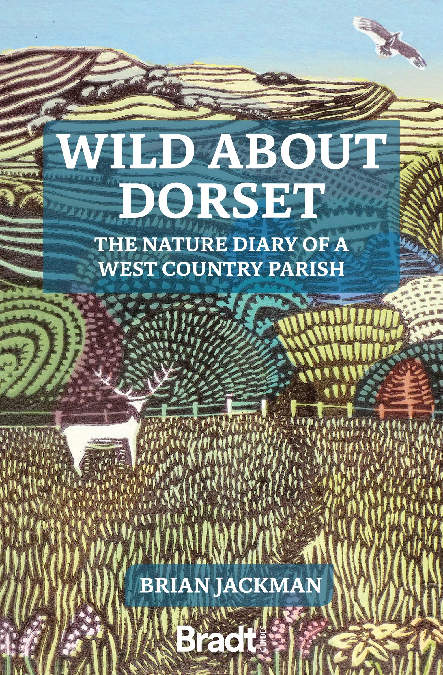
Wild About Dorset is a new collection of nature writing from award-winning journalist and author Brian Jackman. Drawing on a decade's worth of monthly columns in his local community magazine, Jackman paints a 'year in the life' of wildlife and wild places in West Dorset's Area of Outstanding Natural Beauty (AONB), where he has lived for fifty years. A rumpled, tumbling world of green-gold hills, bordered by the Jurassic Coast's crumbling cliffs and melting away inland somewhere north of Beaminster, few corners of England are so rich in wildlife or so intensely rural.
Arranged month-by-month, this book celebrates the only place in the British Isles that reminds Jackman of the lost countryside of his youth. Complementing Jackman's love letter are thirteen full-page color illustrations by celebrated nature artist Carry Akroyd, an award-winning member of the Society of Wildlife Artists. This is a book about nature - an account of natural history observations. Start the year by joining Jackman to watch sea trout and mating foxes, and close it with mistletoe and 'Viking thrushes'. In between, watch peregrine falcons fly along Dorset's Jurassic Coast, marvel at mad March hares, glow worms and dormice, and witness the fallow deer rut amid ancient oakwoods.
This is also a book about place - celebrating the vigorously local and unequivocally rural even more deeply than his book Wild About Britain (also published by Bradt). Via Jackman's pen, explore the holloways (old sunken trackways) and lynchets (medieval field systems) that characterise West Dorset landscapes. Indulge in haymaking, beekeeping and the pleasure of log fires. Visit Powerstock, a thatched village straight out of Cider with Rosie. Marvel at Kingcombe, 'the farm that time forgot', which was declared a National Nature Reserve in 2021. And enjoy views from a giant Iron Age hillfort marking the geological divide between southern England's chalklands and the true West Country. Evocative, personal and authoritative, Wild About Dorset is a unique portrait of rural England's wildlife and landscapes, a breath of country air that will inspire reader to don walking boots and grab binoculars, then fall in love again with the great British countryside.
€ 32.50
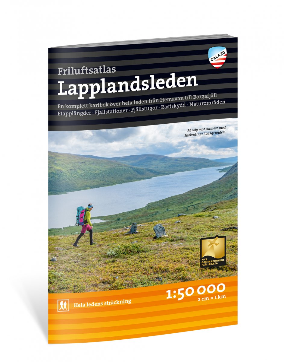
Voor iedereen die - een deel van - Lapplandsleden gaat lopen is dit eigenlijk een onmisbaar handige atlas met alle wandelkaarten van de hele route en aansluitende zijpaden. Op schaal 1:50.000 is dit bijzonder gedetailleerd, zeker voldoende om op te wandelen gelet op de markeringen in het veld. Weliswaar in het Zweeds, maar uiteindelijk gaat het vooral om de kaarten en informatie die met tekens goed wordt aangegeven. A5 formaat
Van uitgever Calazo: De Laplandsleden is het grootste dat in de Zweedse bergen in een zeer lange tijd is gebeurd - een gloednieuw doorlopend pad tussen Hemavan in het noorden en Borgafjäll in het zuiden. Het Lapland-pad verbindt de Kungsleden in het noorden met de bergwereld van Jämtland in het zuiden. Voor het nieuwe parcours zijn dertien bruggen gebouwd, acht kilometer overspanning gelegd en honderdvijftig borden geplaatst.
In dit kaartenboek vind je alle informatie die je nodig hebt om een bergwandeling langs de Laplandroute te plannen en uit te voeren. Het grootste deel van de atlas bestaat uit gedetailleerde bergkaarten op schaal 1:50.000 over de 190 kilometer van het parcours. U ontvangt ook een voorstel voor de indeling van de etappes en beschrijvingen van elke sectie, evenals informatie over hutten, geschikte tentplaatsen en hoe u bij de verschillende startpunten langs het parcours komt.
Aantal pagina's: 60
€ 32.50
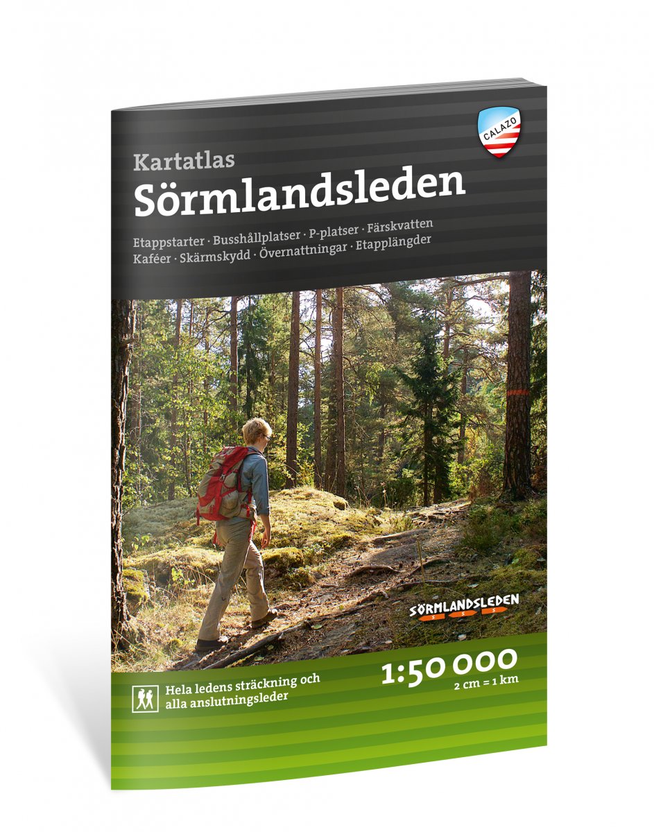
Voor iedereen die - een deel van - Sörmlandsleden gaat lopen is dit eigenlijk een onmisbaar handige atlas met alle wandelkaarten van de hele route en aansluitende zijpaden. Op schaal 1:50.000 is dit bijzonder gedetailleerd, zeker voldoende om op te wandelen gelet op de markeringen in het veld. Weliswaar in het Zweeds, maar uiteindelijk gaat het vooral om de kaarten en informatie die met tekens goed wordt aangegeven. A5 formaat
Van uitgever Calazo: Heb je geen kaart van de Sörmlandsleden? Dit is een van de meest voorkomende vragen die we krijgen van de uitgever. Meestal leggen we uit dat het niet zo eenvoudig is om een 100 mijl lang pad op één en dezelfde kaart te krijgen.
Zo ontstond het idee om een kaartatlas te maken van het hele parcours met alle etappekaarten van de Sörmlandsleden op één en dezelfde plek!
De kaartenatlas bevat 38 speciaal ontwikkelde terreinkaarten op schaal 1:50.000, gepresenteerd in een handig boekformaat. Een handig hulpmiddel, of u nu een korte excursie of een lange wandeling plant.
Start van etappes, parkeerterreinen, accommodatie, bushaltes, verbindingsroutes en meer zijn duidelijk aangegeven op de kaart.