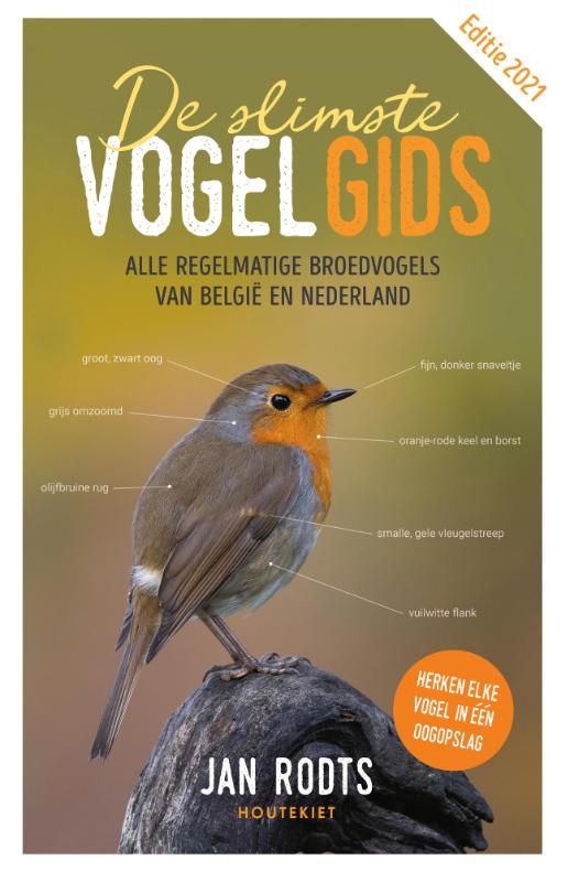
Vogelgidsen kan je grosso modo in twee groepen verdelen: enerzijds zijn er de gidsen voor de diehards, waarin de ongeveer 530 vogelsoorten van Europa worden beschreven aan de hand van tekeningen, anderzijds die voor beginners, meestal geïllustreerd met foto’s. Debuterende vogelkijkers hebben vaak moeite om in hun gids de vogelsoort terug te vinden die ze tijdens hun wandeling gespot hebben. Deze veldgids is anders. Aan de hand van schitterende foto’s behandelt hij de 192 regelmatige broedvogelsoorten van België en Nederland, gerangschikt volgens lichaamsgrootte. Dankzij fijne pijltjes vind je in één oogopslag de karakteristieke kenmerken terug van elke vogel. De ideale compagnon de route dus voor elke vogelkijker, wandelaar en doorsnee natuurliefhebber.
€ 34.99
€ 36.99
Welkom in de wondere wereld van reisfotografie. Dit type fotografie wordt in één adem genoemd met de andere bekende thema's van de fotografie, maar omvat eigenlijk het hele fotografische spectrum van onderwerpen. Als u op reis gaat, komt u namelijk alle onderwerpen tegen die een fotograaf voor zijn lens kan krijgen: landschap, architectuur, natuur, macro, portret, product, actie, onderwater, nacht...
U moet van alle markten thuis zijn, niet alleen met de ervaring en kennis die u in uw dagelijkse fotografie gebruikt. U wordt mogelijk in extreme situaties geconfronteerd met exotische modellen van mensen, dieren en planten. Dat maakt het soms allemaal nog een stukje moeilijker, maar tegelijk uitdagender en de bevrediging van een geslaagde opname is daarmee des te groter. De auteurs van dit boek willen u zodanig inspireren met mooie fotografie, dat u niet kunt wachten op pad te gaan om uw kijk op de wereld vast te leggen.
€ 16.99
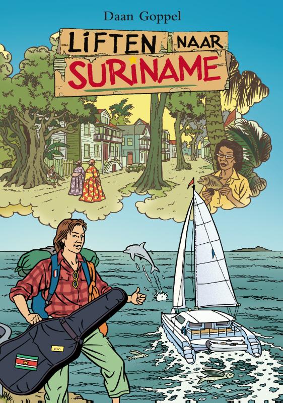
Liften naar Suriname, dat tot de moderne klassiekers van de eenentwintigste-eeuwse reisliteratuur gerekend kan worden, verhaalt over een jongeman die zijn droom probeert te verwezenlijken door zonder eigen vervoer naar de andere kant van de wereld te reizen. In een tijd dat het massatoerisme zich tot in de verste uithoeken op aarde heeft verspreid, vormt Liften naar Suriname een aandoenlijke zoektocht naar een historisch-authentieke reiservaring, het verlangen om het werkelijke avontuur te beleven.
Liften naar Suriname is een reis naar het verre, een avontuur op eigen kracht vol bijzondere gebeurtenissen en vreemde ontmoetingen.
Hoe slaagt Daan erin om de oceaan over te steken en tienduizend kilometer te worden meegenomen?
Liften naar Suriname is een moderne ontdekkingsreis. Het is het klassiek geworden verhaal van een jongen die zijn droom probeert waar te maken, door zonder eigen vervoersmiddel naar de andere kant van de wereld te reizen.
Hoe slaagt Daan erin om tienduizend kilometer over land en zee te worden meegenomen? Liften naar Suriname is een avontuur op eigen kracht, vol vreemde ontmoetingen en hilarische gebeurtenissen.
€ 34.95
Groningen
‘Wie zich Nederlander wil voelen moet naar Groningen gaan.’ Dat concludeerde de schrijver Alfred Kossmann toen hij in 1965 een rondreis maakte door Nederland. Wadapatja gaat over het eigene van Groningen. Over zaken die Nederlanders in Groningen zich Nederlands laten voelen. Of die Groningers zich juist ervan bewust maken dát ze Groningers zijn.
Wadapatja
101 Groninger tradities, gebruiken en (eigen)aardigheden, is voor iedereen die zich interesseert voor immaterieel erfgoed, maar vooral voor Groningers is het boek een aanrader. Er staat een hele bult in, de teksten zijn lekker bondig en de prijs is ja bijna vergeefs.
De 101 gebundelde artikelen over ‘typisch Gronings’ roepen een gevoel van milde verbazing, of ze zijn juist een warm bad van herkenning – afhankelijk van waar u als lezer vandaan of weg komt. Ook Groningers zullen regelmatig denken ‘wat apart ja’ (uit te spreken als ‘wadapatja’). De rijk geïllustreerde hoofdstukken geven voortreffelijk inzicht in hoe (regionale) cultuur functioneert, hoe ze zich ontwikkelt en telkens weer vernieuwt. Ze worden voorafgegaan door een inleiding over immaterieel erfgoed en regionale identiteit.
Van knipselbonen tot krentjebrij, van Groninger dracht tot de academische toga en van blaarkop tot het babyhokje. Dat allemaal van ‘Lauwerszee tot Dollard tou, van Drenthe aan ’t Wad.’
101 Groningse tradities, gebruiken en (eigen)aardigheden
Warm bad van herkenning voor alle Groningers
Samengesteld en geschreven door Martin Hillenga
Beste Groninger boek 2020
€ 11.99
Twee sets speelkaarten in een giftdoos. De achterkant van elke set is bedrukt met een klassieke wereldkaart. De kaarten zijn in bridge formaat: 58 x 89 mm.
€ 22.99
In dit nieuwe autobiografische boek van Sir David Attenborough (Life, Planet Earth, Blue Planet) neemt de filmmaker je mee in zijn wereld – en de planeet van ons allemaal. Voor het eerst beschrijft hij op geheel eigen wijze de belangrijkste momenten in zijn leven als bioloog. Hoe hij oog in oog stond met wilde dieren en zijn leven wijdde aan het vastleggen van de natuur in al haar schoonheid en diversiteit. Ook vertelt Attenborough over de verwoestende veranderingen die hij in al zijn jaren met eigen ogen heeft gezien. Een actueel boek met dringende, maar hoopvolle boodschappen voor de toekomst. Kijk door de ogen van de man die de natuur een stem gaf.
€ 9.99
Een tweetalig boek (Nederlands en Engels) over Holland, voor Nederlanders én buitenlanders die hier op bezoek zijn. Een boek waarin een aantal bekende hoogtepunten niet mag ontbreken, maar dat ook oog heeft voor verborgen schatten. Dus: het welbekende bloemencorso in Aalsmeer en ook het verfijnde Museum Belvédère in Heerenveen. Een pareltje als Natuurgebied de Hoeksche Waard naast de wereldberoemde Deltawerken. Een bezoek aan de veel gefotografeerde Zaanse Schans en eten bij de aller hipste fritesateliers. Waar te shoppen in Maastricht en waarom een bezoek aan het stadje Buren in Gelderland onontbeerlijk is. Een veelzijdig boek dus, dat begint met een korte inleiding in de Nederlandse geschiedenis, uiteraard met veel foto's waarin dat verleden nog steeds zichtbaar is.
€ 11.95
Zeer gedetailleerde wandelkaart , schaal 1:25.000 van Baden Württemberg met ingetekende wandelroutes.
Auf dieser sehr detaillierten Karten werden Wanderwege in rot und Radwege in grün markiert. Benannte Wege wie z.B. dem Leinpfad wird eine Nummer zugewiesen, die auf der Karte den Wegverlauf kennzeichnet. Neben den Wander- und Radwanderwegen sind auch weitere für Wanderungen interessante Informationen verzeichnet, wie zum Beispiel: Schutzhütten, Aussichtspunkte, Campingplätze, Jugendherbergen, Bahnhöfe, Grillstellen, Restaurants (oft namentlich bezeichnet) und vieles mehr. Auf der Rückseite ist ein Ortsverzeichnis der weiteren Umgebung enthalten mit Koordinaten zu den Orten und der Information auf welcher Karte der NaturNavi Serie der Ort zu finden ist.
• Sehr genaue und aktuelle topografische Kartographie im Ideal-Maßstab 1 : 25 000
• Detaillierte Wander- und Radwege inkl. Rund- und Fernwege
• 3D-Darstellung der Landschaft und Höhenlinien im 10 m Abstand inkl. Höhenlinienzahlen
• Die Verkehrsstruktur von Bahn, S-Bahn, Straßenbahn sowie Bushaltestellen sind übersichtlich enthalten
• Viele Einkehrmöglichkeiten (Restaurants) sind dargestellt und namentlich bezeichnet
• Darstellung der Wanderwege mit den Symbolen der Ausschilderung
• Parkplätze, Parkflächen und Parkhäuser sind blau gekennzeichnet
• Die farbliche Abstimmung ist lebhaft, an der Realität orientiert und angenehm für das Auge
• Gedruckt auf wasserfestem, strapazierfähigem und umweltfreundlichem Papier
• UTM-Koordinatennetz für GPS-Nutzer mit feinem 1000 m Abstand
• Schnellsuch-Register für Städte, Gemeinden und Ortsteile
• Inklusive Übersichtskarte
€ 11.95
Zeer gedetailleerde wandelkaart , schaal 1:25.000 van Baden Württemberg met ingetekende wandelroutes.
Auf dieser sehr detaillierten Karten werden Wanderwege in rot und Radwege in grün markiert. Benannte Wege wie z.B. dem Leinpfad wird eine Nummer zugewiesen, die auf der Karte den Wegverlauf kennzeichnet. Neben den Wander- und Radwanderwegen sind auch weitere für Wanderungen interessante Informationen verzeichnet, wie zum Beispiel: Schutzhütten, Aussichtspunkte, Campingplätze, Jugendherbergen, Bahnhöfe, Grillstellen, Restaurants (oft namentlich bezeichnet) und vieles mehr. Auf der Rückseite ist ein Ortsverzeichnis der weiteren Umgebung enthalten mit Koordinaten zu den Orten und der Information auf welcher Karte der NaturNavi Serie der Ort zu finden ist.
Wandelroutes op deze kaart:
Main-Donau-Bodensee-Weg, HW 4: Würzburg - Ulm - Friedrichshafen
Schwäbische-Alb-Oberschwaben-Weg, HW 7: Lorch, Göppingen, Bad Saulgau, Friedrichshafen
Alpenblick, Wanderweg 10: Standorttafel in Oberteuringen, Franz-Roth-Platz
Bodensee-Rundweg: Rund um den Bodensee
Heuberg-Allgäu-Weg, HW 9: Schwäbische Alb, Oberschwaben, Bodensee, Allgäu
Jubiläumsweg Bodenseekreis: Durch das Hinterland des Bodenseekreises
Gemeinde Bodnegg: 8: Rundweg 1, 9: Rundweg 2, 10: Rundweg3
Premiumweg Gehrenberg GuckinsLand
Gemeinde Grünkraut: 12: Weg 1, 13: Weg 2, 14: Weg 6, 15: Weg 7
Berghölzleweg, Wanderweg 4: Standorttafel in Bitzenhofen
Burgstallweg, Wanderweg 3: Standorttafel in Bitzenhofen
Gehrenbergweg, Wanderweg 1: Standorttafel in Bitzenhofen
Tettnanger Hopfenpfad: Durch Hopfengärten und Obstanlagen mit Infos
Hirschlatter Runde: Ailingen Hirschlatt - Ettenkirch Lindenholz
Gemeinde Waldburg: Wanderweg 7
Rohmbachweg, Wanderweg 2: Standorttafel in Bitzenhofen
Rotachweg, Wanderweg 8: Standorttafel in Oberteuringen, Franz-Roth-Platz
Glaubensweg Tannau: 11 Stationen der Seelsorgeeinheit Argental
Teuringertal Bahnweg: Ittenhausen - Unterteuringen
Wanderwege Markdorf: Froschweg
Rammetshofer Runde, Wanderweg 6: Standorttafel in Oberteuringen, Altweiherwieser
Teuringer Bächlespfad, Wanderweg 9: Standorttafel in Oberteuringen, Franz-Roth-Platz
Teuringer Riedweg, Wanderweg 11: Standorttafel in Oberteuringen, Franz-Roth-Platz
Kapellenweg, Wanderweg 7: Standorttafel in Oberteuringen, Altweiherwiesen
Fietsroutes op deze kaart:
Bodenseeradweg: Rund um den Bodensee
Donau-Bodensee-Radweg: Zwischen Bodensee und Ulm, mehrere Routen
Fahrrad-Tour R3: Haslach - Hinteressach - Amtzell Pfärricth
Hopfenschlaufe: Friedrichshafen - Tettnang - Langenargen
Obstroute 2: Bodnegg
Radrunde Allgäu: 4* Qualitätsroute
Georoute 18: Bodnegg
Wasserroute 14: Wangen im Allgäu
Obstroute 3: Grünkraut
Wasserroute 10: Grünkraut
Belangrijke plaatsen op deze kaart:
Weingarten, Ravensburg, Meckenbeuren, Tettnang, Friedrichshafen, Ringgenweiler, Berg, Neubriach, Horgenzell, Winterbach, Schmalegg, Unterankenreute, Sattelbach, Wetzisreute, Happenweiler, Bavendorf, Schlier, Waldburg, Hefigkofen, Oberzell, Torkenweiler, Grünkraut, Oberhofen, Bitzenhofen, Obereschach, Rotheidlen, Oberteuringen, Liebenau, Bodnegg, Ettenkirch, Raderach, Ailingen, Siggenweiler, Obereisenbach, Kehlen, Kau, Tannau, Neukirch, Bürgermoos, Mariabrunn, Laimnau, Oberlangnau, Achberg, Eriskirch
€ 11.95
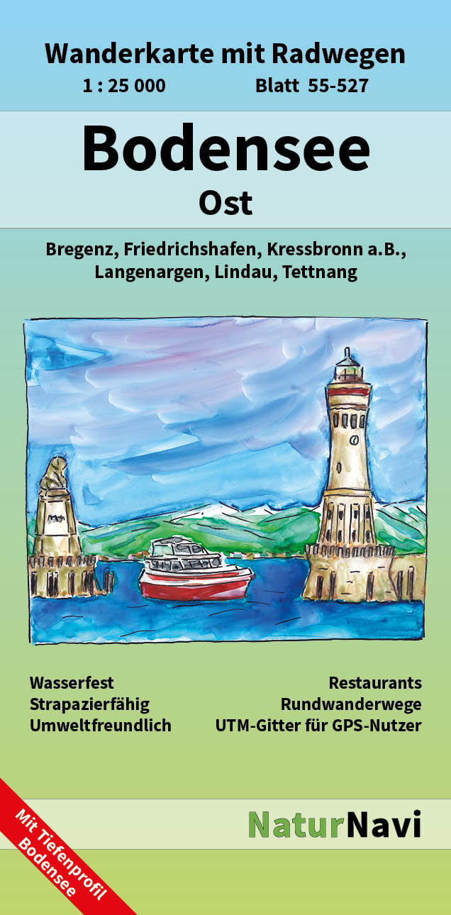
Zeer gedetailleerde wandelkaart , schaal 1:25.000 van Baden Württemberg met ingetekende wandelroutes.
Auf dieser sehr detaillierten Karten werden Wanderwege in rot und Radwege in grün markiert. Benannte Wege wie z.B. dem Leinpfad wird eine Nummer zugewiesen, die auf der Karte den Wegverlauf kennzeichnet. Neben den Wander- und Radwanderwegen sind auch weitere für Wanderungen interessante Informationen verzeichnet, wie zum Beispiel: Schutzhütten, Aussichtspunkte, Campingplätze, Jugendherbergen, Bahnhöfe, Grillstellen, Restaurants (oft namentlich bezeichnet) und vieles mehr. Auf der Rückseite ist ein Ortsverzeichnis der weiteren Umgebung enthalten mit Koordinaten zu den Orten und der Information auf welcher Karte der NaturNavi Serie der Ort zu finden ist.
Wandelroutes op deze kaart:
Main-Donau-Bodensee-Weg, HW 4: Würzburg-Ulm-Friedrichshafen
Wanderweg 10, Wangen im Allgäu: Neuravensburg und Argenzusammenfluss
Bodensee-Rundweg: Premiumweg durch Wald und Flur am Albtrauf und durch das Naturschutzgebiet Bergrutsch am Hirschopf bei Mössingen
Wanderweg 12, Wangen im Allgäu: Von Haslach durchs Argental bis Schombug
Heuberg-Allgäu-Weg, HW: Werthelm Aichtal Pliezhausen -Lörrach am Rhein
Jubiläumsweg Bodenseekreis: Durch das Hinterland des Bodenseekreises
Argenpfad Langenargen: Mit 9 Stationen zur Natur des Argentals
Bauernpfad Kressbronn: Mit verschiedenen Stationen und Naschgarten
Maximiliansweg: Von Lindau entlang der Alpen nach Berchtesgaden
Nordic-Walking Bayerischer Bodensee: Enzlsweiler Runde R13; Taubenberg Runde R16; Hermannsberg Runde R17; Schachener Runce R11; Halbmarathon Bodolz R1; Unterreitnauer Runde R2; Oberreitnauer Runde R3; Sauters Runde R4; Lampertsweiler Runde R5; Heimesreutiner Runde R6; Sulzenberger Runde R7; Streitelsfinger Runde R9
Tettnanger Hopfenpfad: Durch Hopfengärten und Obstanlagen mit Infos
Hirschlatter Runde: Ailingen Hirschlatt Ettenkirch - Lindenholz
Wangen im Allgäu: Neuravensburg und Argen, Weg 10, (6,6 km); Rund um Primsweiler, Weg 11, (6,4 km); Haslach, Argental, Schomburg, Weg 12, (6,9 km); Siglisberg, Haslach, Weg 13, (6:7 km)
Glaubensweg Tannau: 11 Stationen der Seelsorgeeinheit Argental
Fietsroutes op deze kaart:
Bodenseeradweg: Rund um den Bodensee
Donau-Bodensee-Radweg: Zwischen Bodensee und Ulm, mehrere Routen
Fahrrad-Tour R3: Haslach - Hinteressach - Amtzell - Pfärrich
Hopfenschlaufe: Friedrichshafen - Tettnang - Langenargen
Obstroute 2: Bodnegg
Wasserroute 14: Wangen im Allgäu
Bodensee-Königssee-Radweg: Lindau Berchtesgarden/Königssee
Rhein-Route, ncn 2: Andermatt - Basel
Bregenzerwald Route: Bregenz - Schoppernau
Dörfer Städte Route: Bregenz - Bludenz
Fahrrad-Tour R1: Neuravensburg - Primisweiler - Niederwangen
III - Rhein Route: Von Bregenz entlang des Rheins und der Ill
Leiblachtal Route: Bregenz - Hohenweiler
Seen-Route, ncn 9: Montreux - Rorschach
Pfänderroute MTB: Bregenz – Pfänder
Belangrijke plaatsen op deze kaart:
Friedrichshafen (ost), Tettnang, Bregenz, Lindau, Wiggenhausen, Kehlen, Kau, Bürgermoos, Obereisenbach, Primisweiler, Tannau, Neukirch, Mariabrunn, Schlatt, Eriskirch, Oberdorf, Laimnau, Oberlangnau, Langenargen, Kressbronn, Oberreitnau, Schlachters, Nonnenhorn, Wasserburg, Weißensberg, Wannental, Hörbranz, Unterhochsteg, Lochau.

