€ 24.50
Reisgids PassePartout Vorstelijke Loire | Edicola

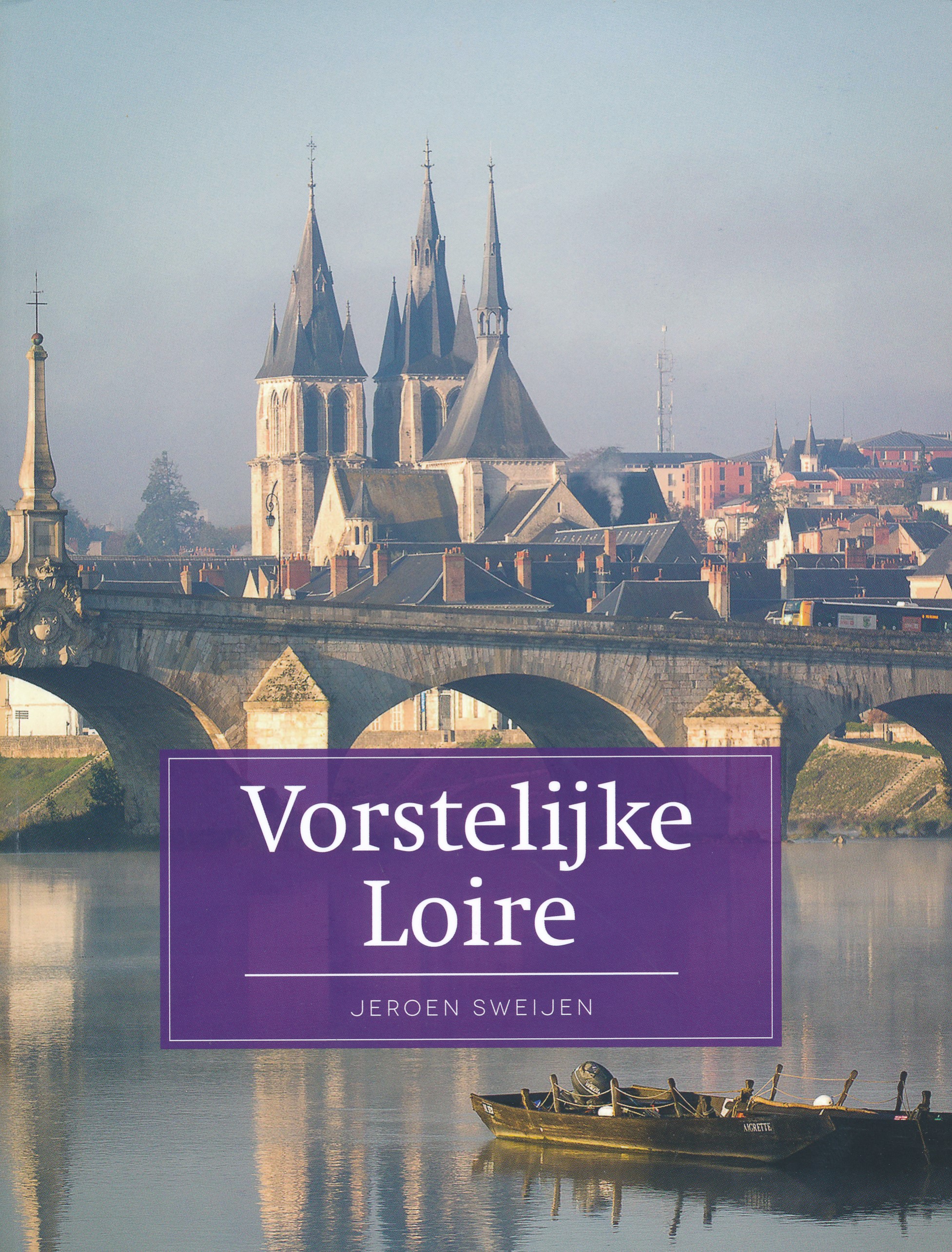
Van Beaugency tot Béhuard stroomt de Loire loom en majestueus door het West-Franse landschap. Zij gedraagt zich waarlijk als een vorst en bepaalt al eeuwenlang het levensritme van de inwoners. Leonardo da Vinci, François Rabelais en Sint Maarten drukten elk hun eigen stempel op deze gevarieerde streek vol zacht glooiende heuvels, vele kastelen, vruchtbare wijngaarden, verrassende bossen en steile tufsteenkliffen met grotwoningen. De steden Blois, Amboise, Tours, Saumur en Angers hebben elk hun eigen karakter en het machtige water is altijd dichtbij.

De Loire is de laatste ongetemde grote rivier van Europa, waar grote schepen nooit vat op kregen en de platte gabares en toues nog stil op dobberen. De rivier staat symbool voor de douceur de vivre, die de dichter Joachim du Bellay al boven Rome verkoos. De Loirevallei leent zich uitstekend voor een vorstelijke vakantie. Van schrijver en Frankrijkkenner Jeroen Sweijen (1974) verscheen eerder in deze reeks al Haute Bretagne. Hij is als redacteur verbonden aan de bekende Frankrijktijdschriften En Route en Maison en France, waarin hij schrijft over Frankrijk in het algemeen en West-Frankrijk in het bijzonder.

€ 24.50
Reisgids PassePartout Eifel en Moezel | Edicola

Zo dichtbij huis en toch zo buitenland. Nederlanders en Vlamingen zijn dol op de Eifel en het Moezeldal. De bergen, gevarieerde landschappen, talrijke kastelen en kloosters, vele lieflijke dorpen en stadjes van de Eifel trekken bezoekers in alle jaargetijden. De welgevormde Moezel kronkelt tussen de steile hellingen met wijngaarden en langs historische dorpen en steden als Trier, de oudste stad van Duitsland. Zij mondt tenslotte uit op een inmiddels iconische plek bij Koblenz in de Rijn. Cochem kennen velen, maar plaatsen als Piesport of Beilstein?

In deze reisgids passeren de plekken waar iedereen wil komen, maar zeker ook minder bekende fraaie oorden. Daarnaast komen randgebieden zoals een aangrenzende deel van het Rijndal en Saardal voorbij. Er is aandacht voor wijn, vergezichten, natuur, wandelen, culturele bezienswaardigheden, geschiedenis en nog veel meer, kortom datgene wat Eifel en Moezeldal zo boeiend maakt.

Elio Pelzers is een ervaren reisjournalist, die zich zowel dichtbij huis als in verafgelegen streken thuis voelt. Hij komt al van vanaf zijn jeugd regelmatig in de Eifel en het Moezeldal. Hij volgde onder andere de lerarenopleiding biologie en aardrijkskunde en werkt(e) onder meer in deeltijd voor het Nationale Park De Hoge Veluwe en het Gelders Archief

€ 15.50
Campinggids - Campergids - Reisgids FKK Reiseführer Europa 2024 | Drei Brunnen Verlag

Reisgids voor naturisten met oa naturisme campings, terreinen, naaktzwemmen en naaktstranden door Europa met beschrijvingen, kaarten en adressen in Nederland, Belgie, Luxemburg, Oostenrijk, Zwitserland, Tsjechie, Duitsland, Denemarken, Spanje, Portugal, Frankrijk, Groot-Brittannie, Griekenland, Hongarije, Kroatie, Slovenie, Italie, Noorwegen en Zweden  (duitstalig)


Rund 500 FKK-Campingplätze, FKK-Clubanlagen und viele FKK-Strände in ganz Europa. Seriös recherchiert. Auskunft über Anreise, Lage, Öffnungszeiten, Sportmöglichkeiten, Animation, Dienstleistungen und Unterhaltungsprogramme auf den Anlagen sowie Preisinformationen. Viele farbige Abbildungen. Übersichtskarten.

€ 22.50
Wandelkaart Terrängkartor Nationalpark Mols Bjerge | Denemarken | Calazo

De Calazo Outdoor Maps is een nieuwe serie wandelkaarten ontwikkeld die is gericht op wandelen, kajakken of kanoën, fietsen en mountainbiken.


Deze kaart is ontwikkeld met een focus op het buitenleven van het Nationaal Park Mols Bjerge, waar de lokale wandel- en mountainbikeroutes zorgvuldig worden beschreven. 


Fietsroutes en andere lokale wandelpaden worden ook duidelijk op de kaart weergegeven. U vindt hier ook informatie over gratis kampeerplekken, schuilplaatsen, parkeermogelijkheden en tips over accommodatie.


Op de kaart heeft elke buitenfaciliteit een uniek nummer, zodat u deze eenvoudig op kunt zoeken op calazo.dk/sog. Daar vindt u gedetailleerde informatie over de exacte plaats en serviceniveau van schuilplaatsen, vuurplaatsen en staanplaatsen.

€ 21.95
Reisgids The 500 Hidden Secrets of Paris - Parijs | Luster

Bijzondere reisgids over Parijs waarbij de nadruk ligt op plekken die je niet zo snel vindt in de gewone reisgidsen. Uit allerlei top-lijsten kun je zelf kiezen wat je interessant lijkt. Uitgevoerd met veel illustraties. 

De vijfde gids in de reeks The 500 Hidden Secrets concept, geschreven door een Parisienne pur sang.


Voor toeristen die alombekende hotspots willen vermijden en de favoriete adressen van de locals willen ontdekken, en voor inwoners die hun stad nog beter willen leren kennen.

Geschreven door een local.

Met lijstjes zoals de 5 beste brocantemarkten, de 5 beste werkplekken voor freelancers en de 5 leukste concertlocaties.

500 adressen en wetenswaardigheden die weinig mensen kennen zoals een restaurant waar je tot 3u30 's nachts een typisch Frans gerecht kunt bestellen, een klein papierwinkeltje waar het daglicht royaal binnenstroomt en waar je de mooiste Japanse papiercreaties vindt, of een winkeltje waar cadeaus zoals geborduurde servetten op maat gemaakt worden.

Journaliste Marie Farman woont en werkt in Parijs. Ze weet alles over design en hedendaagse kunst - ze verzorgt onder andere de vaste Design/Déco rubrieken in magazines als GQ, Figaro Madame, BE, BIBA, Culte(s) en Buybuy.com - en is op de hoogte van wat hot and happening is in Parijs.


What are the 5 best vintage markets in Paris?

Where can you find the 5 best workplaces for freelancers?

What are the 5 coolest clubs to party after midnight?

What are 5 excellent Japanese restaurants?

Where can you find the 5 most secret streets?

The 500 Hidden Secrets of Paris reveals these good-to-know addresses and many more. It is an affectionate guide to the city, written by a born-and-bred Parisian, journalist Marie Farman. She selected 500 addresses and facts that few people know, such as an elegant spice shop that sells condiments from all over the world,  a small stationer's where the daylight streams in gloriously and you can find the most beautiful Japanese paper creations, or a little shop where gifts like embroidered serviettes are made to order.


This is a book for tourists who want to avoid the well-known tourist spots and discover the locals' favourite addresses, and for residents who want to get to know their city even better.


€ 21.95
Reisgids The 500 Hidden Secrets of Dublin | Luster

Bijzondere reisgids over Dublin waarbij de nadruk ligt op plekken die je niet zo snel vindt in de gewone reisgidsen. Uit allerlei top-lijsten kun je zelf kiezen wat je interessant lijkt. Uitgevoerd met veel illustraties. 

- An insider's guide to Dublin's hidden gems and lesser-known spots

- Written by a true local, filled with independent advice, based on thorough research and the author's personal opinions

- An inspirational and practical guide to the city's most interesting places, buildings, restaurants, shops, museums, galleries, neighborhoods, gardens and cafes, presented in 100 original lists of 5 secrets

- Photography by Sam Mellish

- A recently edition in Luster's successful and attractive series of city guides

Where to go for the best pints of Guinness in Dublin? Or when you're craving the ultimate sandwich? And what are the 5 shops you absolutely have to visit on Grafton Street? Shane O'Reilly knows! With lots of love and enthusiasm, he shares hundreds of his favorite places in his hometown of Dublin, like the wood-panelled and plush club serving as a multi-purpose arts center, Ireland's oldest reggae shop, or the stunning and family-run delicatessen serving up delicious seafood straight from the ocean half a mile away. The 500 Hidden Secrets of Dublin is the perfect book for those who wish to discover the city, but avoid all the usual tourist haunts, as well as for residents who are keen to track down the city's best-kept secrets. Discover the series at the500hiddensecrets.com

€ 21.95
Reisgids The 500 Hidden Secrets of London - Londen | Luster

Bijzondere reisgids over Londen waarbij de nadruk ligt op plekken die je niet zo snel vindt in de gewone reisgidsen. Uit allerlei top-lijsten kun je zelf kiezen wat je interessant lijkt. Uitgevoerd met veel illustraties. 

In The 500 Hidden Secrets of London deelt Londenaar Tom Greig zijn favoriete adressen en geheimen, zoals de bakker op Brick Lane waar mensen van heinde en verre naartoe komen om er salt-beef beigels te kopen, een vintage- en antiekmarkt in een voormalige department store, een klein maar bekroond theatertje met een gegolfd stalen dak of de straat waar de eerste inwoners van Londen, de Hugenoten, zich vestigden en waar nu bekende artiesten wonen.


500 adressen in handige lijstjes van 5 - inclusief kaartjes en index.

Where are the 5 best places to find street food? Which are the 5 best restaurants to grab your lunch at in Soho? Which pubs have the most amazing interiors? Where are the best places to discover vintage vinyl? Which are the most innovative theatre companies? Where will you find the most unusual museums? The best places for an outdoor swim? 'The 500 Hidden Secrets of London' reveals these good-to-know places and many more. Discover a diverse range of under-the-radar yet outstanding addresses that will allow you to explore the best of the city away from the crowds. An affectionate and informed guide to London, written by a true local. This is a book for visitors who want to avoid the usual tourist spots and for residents who are keen to track down the city's best-kept secrets. 

€ 11.50
Wegenkaart - landkaart Montenegro | Reise Know-How Verlag

Tweetalige kaart (Engels en Duits). Door ingetekende lengte- en breedtegraden is het gebruik van GPS mogelijk. Met hoogtelijnen en uitgebreid wegennetwerk: daarnaast worden ook de afstanden tussen belangrijke plaatsen duidelijk leesbaar weergegeven. Het kleurgebruik is zodanig dat je een goede indruk krijgt van hoogteverschillen en soorten landschap. Natuurlijk staan de toeristische bezienswaardigheden duidelijk vermeld.

€ 20.95
Wegenatlas Essential Road Atlas Britain 2025 | A4 | Ringband | Collins

This A4 road atlas with lie-flat spiral binding provides clear and detailed road mapping for England, Wales and Southern Scotland at a scale of 3.2 miles to 1 inch (1:200,000). For Northern Scotland the mapping is at a scale of 4.2 miles to 1 inch (1:266,000), with land height shown by different layers of colouring. Main features: Route planning section including maps at a scale of 22 miles to 1 inch for long distance route planning, motorway services information, and a handy distance calculator chart26 urban area approach maps at a larger scale which clearly show the best routes through and into the busiest built-up-areas

64 street maps focused on town centres showing places of interest, car park locations and one-way streets.


All the street maps are fully indexedOver 30 categories of places of interest including castles, theme parks, sports venues, universities, mountain bike trails and surfing beachesThe top 1000 most visited places of interest are indexed with full postcodes to aid integration with satnav systems This is the ideal purchase for drivers, navigators and route planners who want the very best road atlas of Britain in an A4 format.

€ 13.95
Wegenkaart - landkaart South Pacific Cruising & Samoa | ITMB

Een overzichtskaart van de zuidelijke Stille Oceaan met de cruise routes tussen de verschillende eilanden aangegeven.
Op de achterzijde een overzichtskaart van Samoa

This is a new venture for ITMB. Cruising is a rapidly-growing segment of the travel industry, experiencing double-digit growth rates annually. Obviously, this is a thriving market. In conjunction with several cruise ship lines, we have prepared a map of the South Pacific Ocean, which extends southwards from Hawai'i to the southern tip of New Zealand and eastwards from central Australia/Papua New Guinea to the Pitcairn Islands. Thus, it does not include the popular South East Asia and China coast routes. We think this has to change at a time when 25,000,000 people are travelling by cruise ships. At the same time, we must keep coverage area relevant for those end users of the artwork. Even at 1:12M, most of the area covered is water, with island countries such as Fiji, Tonga, Kiribati, Tahiti, and the Cook Islands being visible, but without details. For those readers more familiar with Caribbean or Mediterranean cruising, the reason our focus on the South Pacific is due to the fact that this region of the world is the fastest-growing portion of cruise travel growth. The map of the South Pacific region fills one side of the map. The cruise routes at the moment are shown with red dashed lines. As several lines use the same routes, we have not designated the names of actively-operating lines. The ocean area includes hill shading for the deep trenches of the Pacific Ocean. By doing so, the blue of the water areas is softened by the grey of deep trenches. ITMB intends to prepare other cruising titles in the future. The reverse side of the artwork covers the two entities known collectively as Samoa, which has been included for two reasons. First, it is in the centre of the South Pacific and several cruise companies stop at Pago Pago. Second, the two Somoas form a unit that two main islands and two small islands, which have been portrayed at 1:160,000 scale. An inset map of the capital, Apia is included. American Samoa is one the those areas of the USA acquired during its expansion during the colonial era (Cuba, Hawai'i, Philippines, Puerto Rico, and Virgin Islands being other examples). The overseas territory, as the Americans prefer to call it, consists of half a dozen islands that are rather far apart from each other. The main urban area is Fagatogo in Pago Pago harbour on the only island with an airport, Tutuila. The residents are American citizens, but cannot vote, as in Puerto Rico and the US Virgin Islands, as it is a 'territory' and not a state.

Abonneer op