€ 25.95
Wandkaart 02814 Germany - Duitsland, 58 x 76 cm | National Geographic

Decoratieve wandkaart van Duitsland. Naast de mooie kleuren staan er bijzonder veel plaatsen op vermeld.


National Geographic's political map of Germany includes everything from country boundaries, major roads, towns and cities, airports, bodies of water, and other geographic details. It's a great addition to any classroom, office, or home.


€ 27.95
Wandkaart Frankrijk - France, 111 x 100 cm | Michelin

Dubbelzijdig geplastificeerde wandkaart van de klassieke overzichtskaart van Michelin Frankrijk. Als altijd zeer overzichtelijk en voorzien van een mooie heldere kleurstelling. Prachtig aan de muur!

Op deze kaart is het wegennet identiek aan de gevouwen kaart van Frankrijk ( 721 ) . De meest verkochte wegenkaart van Frankrijk met het volledige wegennet van hoofdwegen en secundaire wegen. De kaart bevat ook zeer veel plaatsnamen. 

€ 16.95
Wandelkaart 50 Cap de Creus | Editorial Alpina

Zeer gedetailleerde wandelkaart van een klein gebied. Met ingetekende wandelroutes en andere informatie. Spaanstalig, maar uitstekende kaart. Coordinaten zijn weergegeven, dus GPS compatible met UTM grid. 


Op de topografische wandelkaart worden o.a. berghutten, campings aangeduid en hoogtelijnen, ingetekende wandelroutes en de GR paden (doorgaande langeafstandswandelpaden). De kaart is inclusief een Spaanstalig boekje met extra informatie over aanwezige voorzieningen en enkele routes.


Gebied: Roses, Cadaqués, Port Lligat, Llançà, el Port de la Selva, la Selva de Mar, Castelló d'Émpúries, Empuriabrava, Paul, Villaüt, Sant Pere de Rodes, Vilajuiga, Pedret.


Ingetekende GR-wandelroutes

GR-11, GR-92


GR-11 Etappes

Etappe 45

Etappe 46

Etappe 47


Book Language: Catalan, Spanish, French, English

•Hiking map and guidebook

•Scale 1:25.000

•Equidistance contours: 10 m distance

•Master contours: at 50 m

•Shady relief

•Compatible with GPS

•Marked routes

•Land use symbolized at three levels

•Guidebook with hikes, potholing, gully descent, climbing, mountain biking and all the facts of  interest


€ 19.95
Wandelkaart 03 Valles de Anso y Echo | Editorial Alpina

Kaartenset met 2 kaarten: Zeer gedetailleerde wandelkaart van een klein gebied. Met ingetekende wandelroutes en andere informatie. Spaanstalig, maar uitstekende kaart. Coordinaten zijn weergegeven, dus GPS compatible met UTM grid. 


Op de topografische wandelkaart worden o.a. berghutten, campings aangeduid en hoogtelijnen, ingetekende wandelroutes en de GR paden (doorgaande langeafstandswandelpaden). De kaart is inclusief een Spaanstalig boekje met extra informatie over aanwezige voorzieningen en enkele routes.


Gebied: Echo Ansó, Ciresa, Zuriza, Urdos, Borce, Etsaut, Fago,Mesa de los Tres Reyes, Castillo d'Archer, Pena Ezcaurri, Petrachema]


Ingetekende GR-wandelroutes

GR 11


€ 49.95
Wereldkaart 66ML-mvlE Political, 136 x 100 cm | Maps International

Prachtige geplastificeerde wereldkaart met blauw metalen strips om makkelijk op te hangen. Door het heldere en vrij felle kleurgebruik is deze kaart uitermate geschikt voor scholen, kantoren of gewoon als politieke wereldkaart thuis. De kleurstellig is zodanig dat elk land zich zeer goed onderscheidt van haar buren. De natuurkundige aspecten zijn minder goed te zien, al worden de gebergten door schaduwwerking goed uitgelicht. De nadruk ligt echter duidelijk op een ‘gewone’ wereldkaart. De belettering is uitstekend leesbaar door vetgedrukte naamgeving.


ENGELSTALIG, maten: 136 x 100 cm. met vlaggen. De kaart is geplastificeerd en voorzien van blauw metalen strips aan de onder- en bovenzijde. Een spijker in de muur en de kaart kun je er eenvoudig aan hangen.

€ 38.95
Wereldkaart 66P-mvl Politiek, 136 x 100 cm | Maps International

Prachtige geplastificeerde wereldkaart. Door het heldere en vrij felle kleurgebruik is deze kaart uitermate geschikt voor scholen, kantoren of gewoon als politieke wereldkaart thuis. De kleurstellig is zodanig dat elk land zich zeer goed onderscheidt van haar buren. De natuurkundige aspecten zijn minder goed te zien, al worden de gebergten door schaduwwerking goed uitgelicht. De nadruk ligt echter duidelijk op een ‘gewone’ wereldkaart. De belettering is uitstekend leesbaar door vetgedrukte naamgeving.


Nederlandstalig, maten: 136 x 100 cm. Met vlaggen, geplastificeerd 

€ 14.50
Wandelkaart 208 Wienerwald | Kompass

Goede 2-delige wandelkaartenset met vrijwel alle topografische details als hoogtelijnen, vegetatie, schaduwtekening maar ook de ingetekende wandelroutes en in veel gevallen ook fietsroutes (MTB). Gevaarlijke routes worden als zodanig weergegeven met een bepaalde markering. Berghutten en campings zijn goed terug te vinden op deze kaarten.


Daarnaast staan de toeristische bezienswaardigheden met symbolen vermeld. Kleurgebruik kan soms vrij fel overkomen, daardoor oogt deze detailkaart wellicht wat druk, maar het blijft een goed leesbare kaart. Sommige kaarten zijn geplastificeerd, maar helaas niet allemaal. De graden staan aan de zijkanten van de kaart, daardoor te gebruiken voor GPS.


Steden/dorpen/gebieden:

Tulln, Korneuburg, St. Andrä-Wördern, Klosterneuburg, Sieghartskirchen, Neulengbach, Purkersdorf, Pressbaum, Neustift-Innermanzig, Kaltenleutgeben, Perchtoldsdorf, Mödling, Alland, Traiskirchen, Altenmarkt, Kaumberg, Baden, Bad Vöslau, Berndorf, Hainfeld, Oberwaltersdorf


Bergen/dalen:

Schöpfl, Hoher Lindkogel, Gföhlberg


Rivieren/meren:

Große Tulln, Kleine Tulln, Donau (am nördlichen Kartenrand), Wien, Mödling, Triesting, Schwechat


€ 14.95
Wegenkaart - landkaart Europa politiek | Freytag & Berndt

Explore Europe with this Freytag & Berndt one-sided road map. The best way to plan your trip, prepare your itinerary, and to travel independently in the European continent. This is a political map, so each country has its own colour.


Main roads such as motorways, dual-carriageways and highways are shown, as are some minor roads. National boundaries are clearly marked, with railways, airports, ferry routes all clearly marked. Intermediate driving distances between locations are shown in kilometres alongside the road.


This map is ideal for route-planning, the legend is in several languages including English.

€ 47.50
Wegenatlas The Kimberley Atlas & Guide | Hema Maps

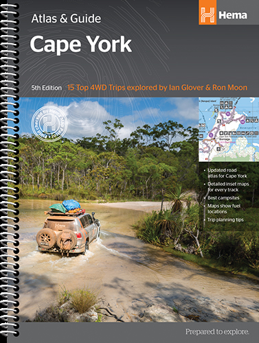
A4 formaat, spiraal gebonden, verschillende schalen

This guide is jam-packed with information on what to do and see in the Kimberley. Travel writer Denis O'Byrne gives information on the Kimberley's amazing 'must see' landmarks as well as expert favourites that often go unseen.

Hema's guide helps you make the most of your visit to the remarkable corner of Australia. With detailed coverage of the Gibb River Road, Broome, Kununurra, Purnululu, (The Bungle Bungles) and many other famous destinations, it ensures you won't miss the 'must-see' attractions, but it also describes some of the lesser known areas favoured by the experts. 


Features:


New larger A4 format - easy-to-read

Town and locatlities GPS index

When to go and how to prepare

Handy atlas for navigation, plus detailed maps of the Gibb River Road, Great Northern Highway, Broome and Kununurra regions, and national parks

Where to go for the best outdoor experiences

Where to stay, from luxurious resorts to the best bush camping spots

Extensive listing of rental agencies and tour operators - fully organised excursions, Aboriginal culture tours, DIY adventures, scenic flights and more

Background reading on the region's unique geographical featues, flora and fauna.


Whether you're here for a relaxing holiday or a serious 4WD adventure, this informative book with its easy-to-follow maps is an indispensable companion.

€ 45.95
Wegenatlas Cape York Atlas & Guide | Hema Maps

A4 formaat, verschillende schalen / spiraal uitvoering

With detailed coverage of The Tip, the coast from Cairns to Cooktown, Rinyirru (Lakefield) National Park, the Peninsula Developmental Road, Old Telegraph Track, Torres Strait and the Savannah Way, it ensures you won’t miss the ‘must-see’ attractions, but it also describes some of the lesser known areas favoured by the experts. Whether you just want to make it to The Tip or are looking for a serious 4WD adventure, this informative book is an indispensable companion.


The book features 15 4WD trips, explored and revised by travel journalist Ian Glover, with photography by Matt Williams. Each trip has a detailed map, plus all the information you need to plan the trip including trip grading, longest distance without fuel, permits and contact details.


This brand new edition of Hema’s best-selling outdoor guidebook for discovering Cape York now features 22 atlas pages in a stunning new cartographic style and also incorporates content from the popular Cape York Travel & Adventure Guide by Ron and Viv Moon as well.


Key Features:


Featuring the top 15 4WD trips, including The Old Telegraph Track

Detailed inset maps for every track

Best campsites

Trip planning tips

Contains a detailed Road Atlas for Cape York, including detailed mapping for The Tip

Maps show fuel, camping areas and rest areas

New cartographic style with latest mapping, points of interest and facilities

Mapping field-checked by the Hema Map Patrol


Abonneer op