€ 18.50
Wandelgids 1 Madeira Walks | Discovery Walking Guides

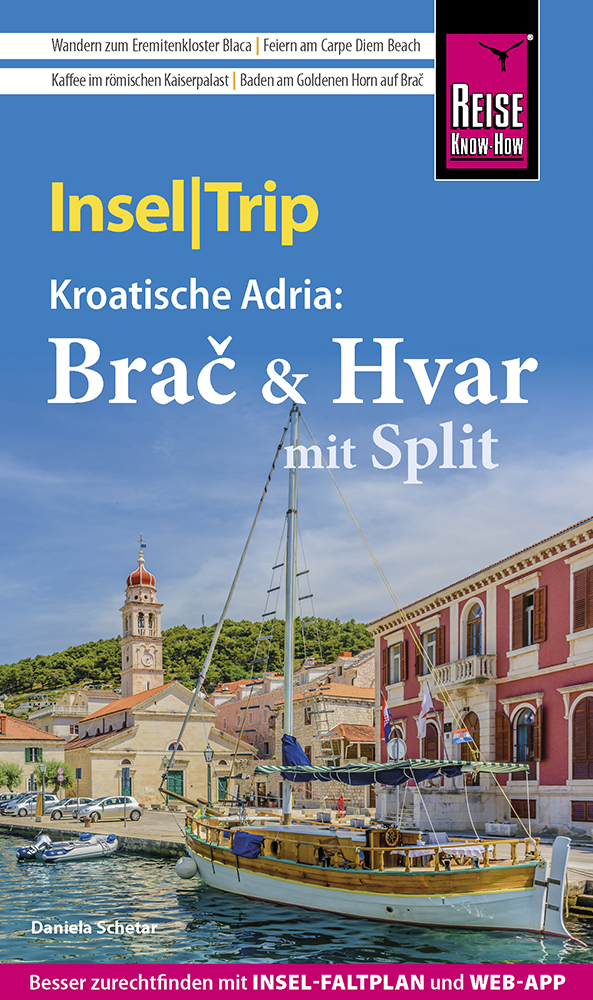
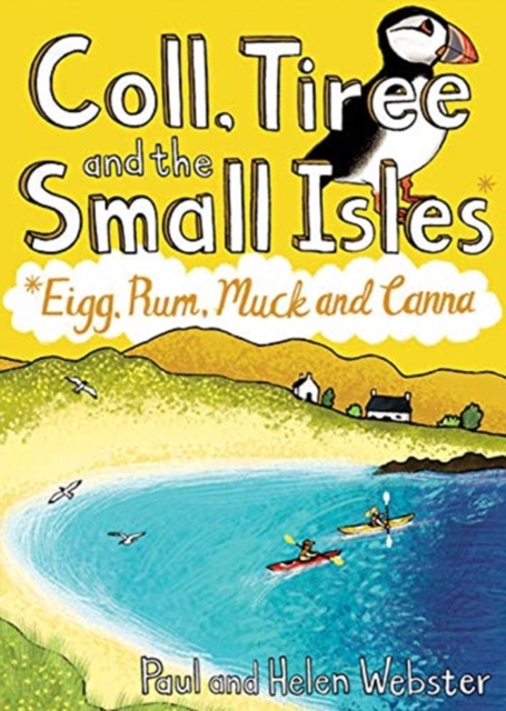
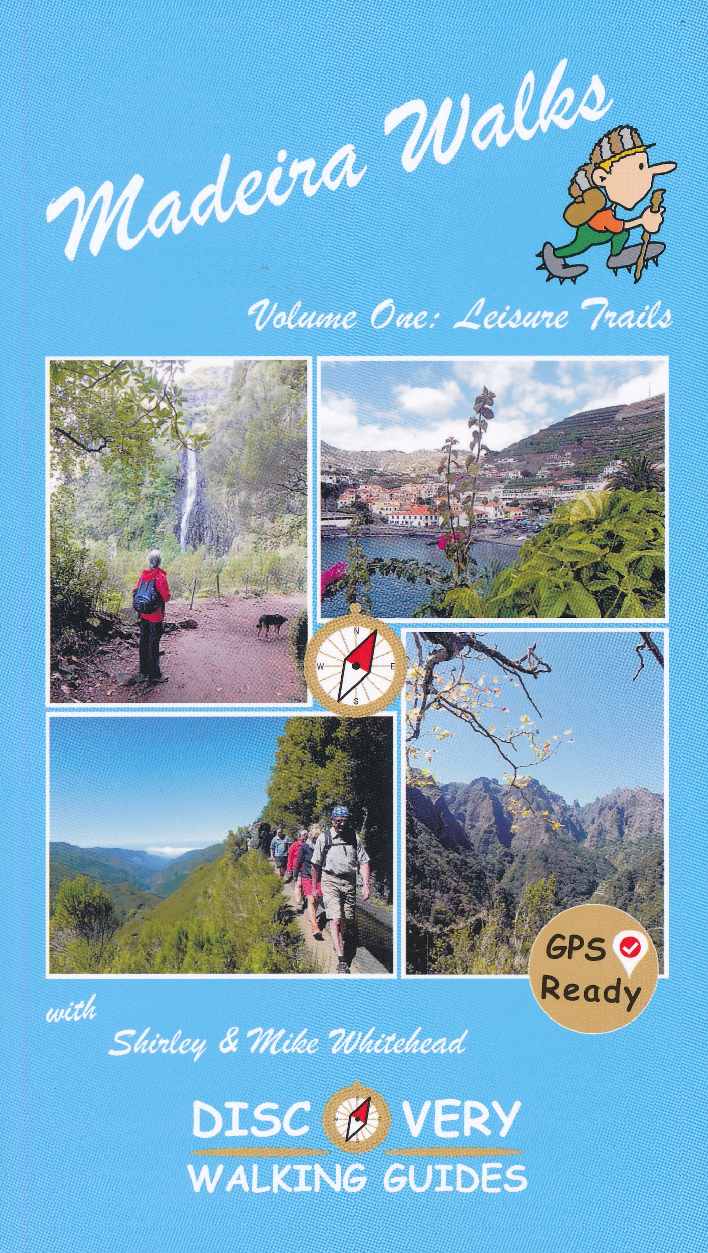
Engelstalige wandelgids Madeira, met uitgebreide beschrijvingen van wandelroutes, routekaartjes en praktische informatie zoals bussen en accommodatie.


Dit eerste deel heeft wandelingen voor zowel de beginnende als de geoefende wandelaar.


Madeira is a wonderful destination for walkers, offering a breathtaking diversity of landscapes; lushly verdant slopes, towering volcanic peaks, dramatic gorges and soaring cliffs surprise and amaze the newcomer. Add the levada network, primeval forests, subtropical flora and the superb landscaped gardens - little wonder that the island is fondly called "The floating garden of the Atlantic". Shirley Whitehead, Madeira's resident walking expert, has brought together over 40 'Leisure Walks' adventures suitable for a wide range of abilities and age groups.


Madeira Walks volume 1 offers a wealth of choice for every walker and explores the best areas the island has to offer. With Madeira Walks in your pocket, your visit to Madeira becomes an unforgettable adventure.Each 'Leisure Walk' description includes:- Route Summary giving overall view of the route and access information; Ratings for Effort, Time, Distance, Ascents/Descents, Refreshments, and Vertigo risk (where applicable), in an easy to see pictorial 'Summary' box; fully detailed walk description, including frequent timings to aid navigation and check your progress; gps waypoints at every key point on every route (subject to reception); full colour 1:40,000 scale mapping for each route taken from the latest edition of Madeira Tour & Trail Map. Shirley is an expert on Madeira's flora, describing the varied and exotic plant life we encounter on each Leisure Walk.


For gps users Discovery Walking Guides provides free gpx waypoint files for Madeira Walks as a zip file download from its website.


€ 18.50
Reisgids Insel|Trip Brac & Hvar mit Split | Reise Know-How Verlag

Reise Know-How is een duitstalige praktische reisgids voor alle leeftijden, boordevol informatie over accommodatie van budget tot luxe, vervoer en plaatsbeschrijvingen. Kenmerk: brede cultuur en achtergrondinformatie, bondig geschreven


Einsame Buchten mit türkisblauem Meer, der quirlige Charme mediterraner Hafenstädte, lila leuchtende Lavendelfelder, Gaumenfreuden in rustikalen Konobas und Romantik pur im Fackelschein schicker Beachbars - so vielfältig präsentieren sich die kroatischen Schwesterinseln Brač und Hvar. Dazu lockt auf dem Festland das lebhafte Split mit großstädtischem Flair in antiken Mauern.


Dieser aktuelle Reiseführer ist der ideale Begleiter, um alle Seiten der beiden Nachbarinseln an der Adria selbstständig zu entdecken:


Die interessantesten Orte, Sehenswürdigkeiten und Attraktionen ausführlich vorgestellt und bewertet

Die schönsten Strände rund um die Inseln

Die besten Hotspots zum Schnorcheln, Tauchen, Windsurfen …

Ausgewählte Anbieter für Segel- und Bootsausflüge sowie weitere Aktivitäten

Inselentdeckung mit Auto, Bus oder Fahrrad

Drei Wanderungen für jedermann

Ausflug nach Split

Die ganze Bandbreite der kroatischen Küche

Shoppingtipps vom traditionellen Markt bis zu den besten Winzern und angesagten kroatischen Designern

Die prächtigsten Kirchen und Palazzi

Die erstaunlichsten Bräuche und Feiern

Besonderheiten der Flora und Fauna

Vom Tauziehen um eine Insel bis zum Olivenanbau: spannende Tipps, Exkurse und Hintergrundinfos

Ausgesuchte Unterkünfte von Wellness-Hotels bis zu hippen Hostels und romantischen Landhäusern

Alle praktischen Infos zu Anreise, Preisen, Touren, Events, Hilfe im Notfall, Verkehrsmitteln, Wetter ...

Kleine Sprachhilfe Kroatisch mit den wichtigsten Vokabeln für den Reisealltag

Inselfaltplan zum Herausnehmen und detaillierte Stadtpläne

Mit kostenloser Web-App für Smartphone, Tablet und PC!

€ 14.99
Reisgids Michelin groene gids weekend Kaapverdië - Kaapverdische eilanden | Lannoo

Voor wie slechts één compacte gids in zijn tas wil stoppen en toch geen enkele bezienswaardigheid of topadres wil missen.

Geen tijd te verliezen: elke gids begint al op pagina 1 met een uitgebreid blok praktische informatie.


Met extra aandacht voor de must sees en must do's in Kaapverdië

Kaapverdië in 1 of 2 weken: met een uitgewerkt reisplan

Meer dan 90 adressen om gezellig te tafelen, een glaasje te drinken, uit te gaan of te shoppen

De hoogtepunten van Kaapverdië, met de handige Michelin sterrenbeoordeling

Overzichtelijke stadsplattegronden op basis van de beproefde Michelincartografie

€ 10.95
Wandelgids Oban and North Argyll | Pocket Mountains

This guidebook covers a large swathe of Mid and North Argyll, sweeping inland from the fractured western seaboard between Crinan and Appin to Arrochar and Bridge of Orchy on the region’s eastern periphery. Between these four points lies a landscape awash with sea lochs, with Inveraray roughly at the geographical centre. There are no large urban areas here and Oban is the largest settlement. Although the road network and public transport infrastructure are good, many routes feel off the beaten track. This is not only down to the low scattered population but also to the indented coast and its many islands, the sea lochs encroaching deep inland, the elongated freshwater lochs and the mountainous interior – making road travel much more convoluted than direct ‘as-the-crow-flies’ distances would suggest.

As well as many great sea lochs, tumbling rivers and iconic mountains, Oban and North Argyll also boasts ancient, wildlife-rich woodlands and several fine gardens. Add to this the Crinan Canal, often described as 'the most beautiful shortcut in Scotland', and some of the most important historical and archaeological sites in the country and you have all the makings of a fascinating walking destination.From the harbourside bustle of Oban to the ancient peace of Kilmartin Glen, this guide features 40 walks over varied landscapes that take in the very best the 'Coastland of the Gaels' has to offer.

€ 18.50
Wandelgids Rother Wandefuhrer Spanje Mallorca - GR 221 | Rother Bergverlag

Uitstekende beschrijving van de bergtocht op Mallorca, de GR221 door de Tramuntana. Per etappe een goede beschrijving van de route, een klein hoogteprofiel en praktische informatie over deze etappe. Kaartmateriaal is redelijk.

Ein außergewöhnlicher Weitwanderweg verläuft durch den Nordwesten Mallorcas: der GR 221. Die sogenannte »Route der Trockensteinmauern« verläuft durch das Tramuntana-Gebirge, bietet atemberaubende Meerblicke und lässt die mallorquinische Bergwelt erleben. Je nach Kondition ist man acht bis zehn Tagesetappen unterwegs.
Der Rother Wanderführer »Mallorca – GR 221« stellt den 140 Kilometer langen Weitwanderweg detailliert und umfassend vor, mit allen Varianten und etlichen Gipfelbesuchen. Er liefert zuverlässige Wegbeschreibungen mit aussagekräftigen Höhenprofilen und Wanderkärtchen mit eingetragenem Routenverlauf. Zudem stehen die GPS-Daten zum Download von der Internetseite des Bergverlag Rother bereit. Er liefert detaillierte Übernachtungsvorschläge zu Wanderherbergen und anderen Unterkünften und viele extra Tipps zu Sehenswürdigkeiten und Einkehrmöglichkeiten. Hinzu kommen zahlreiche Infos zur mediterranen Flora.
Rolf Goetz ist Autor und Fotograf und veröffentlichte bereits etliche Reise- und Wanderführer zum Mittelmeerraum, den Kanarischen Inseln und Madeira. Er gehört zu den besten Kennern der spanischen Inseln. 

€ 10.95
Wandelgids Coll, Tiree and the Small Isles | Pocket Mountains

Handige compacte wandelgids met 40 dagwandelingen. Deze gids bevat kleine kaartjes en leuke uitgebreide informatie over wat er langs de route te zien is. Goede wandelkaarten zijn echter we noodzakelijk voor deze tochten: de Ordnance Survey explorer maps of Landanger maps zijn zeer geschikt.


Off the west coast of Scotland, south of the Isle of Skye and north of Mull and Ardnamurchan, the islands' of Coll and Tiree are the most westerly of the Inner Hebrides and have a reputation as being amongst Scotland's sunniest places. Together with the Small Isles archipelago of Eigg, Rum, Muck and Canna to the north, these Hebridean gems provide a remarkable range and variety of walking. The 36 routes in this book explore these six magical islands rich histories and thriving wildlife as well as the fine sandy beaches, awe-inspiring cliffs and coves, wild interiors and dramatic mountain ranges which make them so special.


€ 19.90
Reisverhaal Cappuccino in Jordanie | Anika Redhed

'Cappuccino in Jordanië' is een waargebeurd verhaal over een reis door een land vol wonderen. Soms heb je er het gevoel dat je door de Bijbel rijdt, maar diezelfde middag kom je ineens in Indiana Jones terecht, of speel je de hoofdrol in een roman van Stephen King. Het is alsof je er zelf bij bent. Drijf mee op de Dode Zee, ga paardrijden door een Mars-landschap en overnacht onder de sterrenhemel in de woestijn. Wat ontdek jij in het wonderlijke Jordanië? Dit boek vol humor biedt je de kans vanuit je luie stoel een nieuw land te ontdekken. Het geeft een kleine inkijk in de geschiedenis, sleept je mee in emotionele ervaringen en toont de schokkende keerzijde van het toerisme. Kan jij daarna de verleiding nog weerstaan om niet te gaan?

€ 24.95
Wandelgids Japan's Kumano Kodo Pilgrimage | Cicerone

Guidebook to Japan's Kumano Kodo, a series of UNESCO-listed pilgrimage routes that crisscross the mountainous Kii peninsula, south of Osaka. Centred on three Shinto-Buddhist shrines known as the Kumano Sanzan, the ancient trails blend great hiking and exceptional natural beauty with a unique insight into Japan's rich history, culture and spirituality. The guide covers the 64km Nakahechi and 63km Kohechi trails in full, as well as the Choishimichi route to Koyasan (20km), the Hongu loop (17km) and highlights of the Iseji trail. It can be used to plan and undertake an independent trek or to enrich an organised tour.


Clear route description and mapping is accompanied by comprehensive details of accommodation and facilities, as well as notes on local points of interest and inspirational colour photography. You'll find a wealth of practical information to help plan your trip, covering transport, climate, accommodation, budgeting, equipment and safety, as well as fascinating background information on history, religion and wildlife. There is also a Japanese glossary and helpful advice on Japanese customs and etiquette.


The Kumano Kodo offers a different view of Japan: far removed from the modern cities, this is a world of forested slopes, hidden valleys, waterfalls, traditional villages, moss-covered stone deities and tranquil oji shrines. There are opportunities to experience hot-spring bathing and to sample local cuisine as you follow in the footsteps of emperors, samurai, priests and ascetics traversing traditional flagstone paths and forest trails.


To celebrate both the trails and those who travel them, the Kumano Kodo and Spain's Camino de Santiago were twinned: if you complete both you can register as a 'dual pilgrim'.


Tanabe, Hongu, Shingu, Nachisan, Nachi-Katsuura, Koyasan, Owase, Kumano

€ 29.99
Reisinspiratieboek Lonely Planet's ultieme reisplanner Wereld | Lannoo

In dit boek ontdek je tientallen bestemmingen die elk worden aanbevolen omdat ze tijdens een bepaalde maand het best bezocht kunnen worden: door hun klimaat, 'value for money' of gewoonweg omdat er juist dan veel te beleven valt.

Er zijn suggesties voor elke soort reis: van culturele uitstapjes en tropische strandvakanties tot avontuurlijke roadtrips en wildlife expedities. Tangolessen in Buenos Aires, wandelingen tussen de bloeiende kersenbomen in Japan, shopping in Parijs, genieten van la dolce vita aan de Amalfitaanse kust, proeven van plaatselijke specialiteiten in de Provence, enz. in deze gids komt het allemaal aan bod.Tientallen illustraties, diagrammen en pictogrammen wijzen je de weg naar je droomvakantie.

€ 9.95
Stadsplattegrond City map Boston | Lonely Planet

De stadsplattegronden van Lonely Planet zijn uitgevoerd op scheur- en watervast papier, zijn lichtgewicht en kennen een handig formaat. Het centrum van de stad is in heldere kleuren in beeld gebracht met straatnamen, bezienswaardigheden en symbolen voor openbaar vervoer. Op de achterzijde staat informatie over de toeristische hoogtepunten en in de meeste gevallen een schematische plattegrond van het openbaar vervoer. Met een register.


Durable and waterproof, with a handy slipcase and an easy-fold format, Lonely Planet Boston City Map is your conveniently-sized passport to traveling with ease.

Get more from your map and your trip with images and information about top city attractions, transport maps, itinerary suggestions, extensive street and site index, and practical travel tips and directory. With this easy-to-use, full colour navigation tool in your back pocket, you can truly get to the heart of Boston so begin your journey now!


Easy-fold format and convenient size

Handy slipcase

Full colour and  easy-to-use

Extensive street and site index

Images and information about top city attractions

Handy transport maps

Practical travel tips and directory

Itinerary suggestions


Covers: Charlestown, West End, North End, Beacon Hill, Boston Common, Downtown, Waterfront, South End, Chinatown, Back Bay, Kenmore Square, Fenway, Seaport District, South Boston, Cambridge


Abonneer op