€ 11.95
Wandelkaart 218 Central Pelion | Terrain maps

Central Pelion 

De 'Terrain Maps' zijn gedetailleerde wegenkaarten en wandelkaarten met alle kleine wegen, wandelpaden, hoogtelijnen en toeristische informatie aangegeven. Alle tekst is tweetalig in het Engels en het Grieks. De kaart is waterproof en geschikt voor het gebruik met een GPS.

€ 20.95
Wandelgids Hadrian's Wall Path | Aurum Press

Beschrijving van Hadrian's Wall Path. Historische en culturele aspecten komen vrij uitgebreid aan bod, praktische informatie is wel summier. Kaartmateriaal van Ordnance Survey is zonder meer uitstekend!

Since it opened in 2003 Hadrian's Wall Path has become one of Britain's most popular long-distance paths. Its 84 miles are a convenient week's walking, shadowing for the most part the historic line of Hadrian's Wall in its spectacular progress across the superbly wild landscape of the north of England. Starting in what used to be Tyneside's shipbuilding heart, and joining Newcastle in the east with Carlisle in the west, it takes you via the extraordinary Roman forts of Vindolanda and Housesteads, close to handsome towns like Hexham and Corbridge, to finish on the lonely shores of the Solway Firth with views of Scotland.

Comprehensive and engrossing, this official guide, published in conjunction with Natural England, is the only companion you need.

Ordnance Survey mapping for the entire route
Circular walks to major archaeological sites
Background information on everything from archaeology to wildlife
Comprehensive, up-to-date information on public transport, accommodation and places of interest
Lavishly illustrated with colour photography throughout

€ 10.50
Wandelkaart 710 Bad Segeberg - Holsteins Herz | Kompass

Goede wandelkaart met vrijwel alle topografische details als hoogtelijnen, vegetatie, schaduwtekening maar ook de ingetekende wandelroutes en in veel gevallen ook fietsroutes (MTB). Gevaarlijke routes worden als zodanig weergegeven met een bepaalde markering. Berghutten en campings zijn goed terug te vinden op deze kaarten.


Daarnaast staan de toeristische bezienswaardigheden met symbolen vermeld. Kleurgebruik kan soms vrij fel overkomen, daardoor oogt deze detailkaart wellicht wat druk, maar het blijft een goed leesbare kaart. Sommige kaarten zijn geplastificeerd, maar helaas niet allemaal. De graden staan aan de zijkanten van de kaart, daardoor te gebruiken voor GPS.


Steden/dorpen/gebieden:

Wankendorf, Bosau, Neumünster, Seedorf, Trappenkamp, Ahrensbök, Wahlstedt, Bad Segeberg, Bad Bramstedt, Stockelsdorf, Reinfeld, Kaltenkirchen, Reinfeld (Holstein), Bad Oldesloe


Rivieren/meren:

Großer Plöner See, Stör, Trave


€ 24.90
Reisgids Bali - Lombok (Engels) | Insight Guides

Een rijk geillustreerde reisgids met diepgaande teksten: één van de beste reisgidsen die er bestaan. Eerste deel bestaat uit een beschrijving van de unieke aspecten van de regio, daarna een deel echte reisgids en als afsluiting een deel met praktische informatie. De uitstekende informatie wordt vergezeld van prachtige foto's en heldere kaarten. Niet alleen om mee te nemen, maar ook om vooraf en zelfs achteraf weer in de stemming te komen.

This brand new edition Insight Regional Guide to Bali has been completely revised and updated, and features a wealth of inspiring full-colour photography, including double page spreads of some of the most outstanding views. The top ten sights are identified, including a visit to the Elephant Safari Park, seeing the ancient temple of Gunung Kawi and a trip to view the waterfalls and ancient forests at Rinjani National Park, to show you the very best of the region and to help you plan your trip priorities. An 'Editor's Choice' section highlights the most unique experiences Bali has to offer, along with personal recommendations on what to see and do, from Bali for families to best beaches, best activities, best spas, best museums and galleries, and much more. An in-depth 'Places' section covers the entire island, with all the principal sites cross-referenced by number to the accompanying full-colour maps. Additional maps inside the front and back covers enable instant orientation and easy navigation. Colour-coded sections cover history and interesting features on everything from art and culture to the local people. A comprehensive 'Travel Tips' section details transport, accommodation for all budgets, eating out, activities, and an A-Z of other practical information, including useful contact numbers, to ensure your trip goes smoothly. The unique combination of insightful exploration alongside practical advice means that this guide truly is a pleasure to read before, during and after your visit.


€ 14.50
Wegenkaart - landkaart Deutschland Nord - Duitsland Noord | Hallwag

Goede overzichtelijke wegenkaart van de noordelijke helft van Duitsland met register en afstandentabel.

The Hallwag road map is a good clear map which includes places of interest marked on the map. The map also includes a distoguide which is an integrated mileage chart on the outer map cover. This allows you to read off more than 2000 distances by using the sliding mileage chart.

Detailed touring map of northern Germany extending just south of Koln and Dresden. Separate plans present road access to and main routes across Berlin, Dortmund, Dusseldorf, Bremen, Duisburg/Essen, Leipzig, Dresden, Hamburg, Hanover and Koln

€ 14.95
Wegenkaart - landkaart West Europa | Freytag & Berndt

Goede overzichtskaart van West Europa: ideaal om een reis te plannen.

High quality road maps with place name index. In many countries these are simply the best maps available. Scales vary according to the size of the country. Index is in several languages.

Western Europe at 1:2,000,000 from Freytag & Berndt, with coverage extending from the British Isles to Denmark, the western half of Germany, Switzerland and north-western Italy, with street plans of nine capitals in an index booklet.

€ 49.95
Wandelgids Bergwandern von Hütte zu Hütte - Zwitserland | SAC Schweizer Alpenclub

Es gibt sie, die genussvollen Hüttenwanderungen, die nicht mehr als fünf Stunden dauern und sich im familien- und mehrheitsfähigen Schwierigkeitsbereich (T5) bewegen und trotzdem total alpine Atmosphäre vermitteln.

Der SAC und der Autor präsentieren diese Wanderungen "pfannenfertig", dass heisst alle Informationen für die einzelnen Touren finden sich hier auf einen Blick. Der Führer lebt aber von den schönen Stimmungsbildern, die die Schönheit der Touren zur Geltung bringen.

Nichts wie los, wir haben die Qual de Wahl, die Ideen zu den Touren sind hier zu finden und die Hütten warten auf viele Besucher.

€ 14.95
Wegenkaart - landkaart Noord Europa - Scandinavië | Freytag & Berndt

Overzichtskaart van Noord Europa en Scandinavië.

Neben der übersichtlichen Gestaltung verfügt die Straßenkarte "Nordeuropa - Skandinavien 1:2.000.000" über Zusatzinformationen wie z.B. Straßenbeschaffenheit und diverse Innenstadtpläne.Mit dem umfangreichen Ortsregister gelingt zudem eine rasche Orientierung. Details: Ortsregister mit Postleitzahlen, Entfernungen in km; Citypläne: Helsinki, Kopgenhagen, Oslo, Reykjavik, Riga, Stockholm, Tallinn, Minsk, Vilnius.freytag & berndt Autokarten sind für viele Länder und Regionen weltweit erhältlich.

€ 17.50
Fietsgids Bikeline Alpe Adria Radweg | Esterbauer

Praktische fietsgids met detailkaarten, ingetekende route, informatie over overnachten en fietsenmakers, zwaarte en hoogteprofiel. In spiraalbinding. Scheur- en watervast papier!


Der Alpe Adria Radweg beginnt bereits mit einem Highlight - der Mozartstadt Salzburg. So geht es weiter - Schlag auf Schlag reihen sich die sehenswerten Täler aneinander auf Ihrem Weg an die Adria. Am Anfang das idyllische Salzachtal mit seinen saftig grünen Almen, gefolgt vom Gasteinertal mit dem absoluten Höhepunkt - im wahrsten Sinne des Wortes - das hoch im Gebirge gelegene Bad Gastein und schließlich der Abschluss des ersten Abschnitts, die Tauernschleuse Böckstein-Mallnitz. Nach der Bahnfahrt geht es hinunter ins Mölltal - durch die beeindruckende Hochgebirgslandschaft gelangen Sie in das sonnige Drautal mit den sehenswerten Städten Spittal und Villach.Nach dem Gailtal folgt die Grenzüberquerung und schließlich landen Sie auf der alten Bahntrasse hoch über dem wild zerklüfteten Kanaltal. Nach dem Abschnitt entlang der Flüsse Tagliamento und Cormor erwartet Sie das lebendige Udine. Von hier durchqueren Sie die Ebene Richtung Adria - über Palmanova und Aquileia radeln Sie auf der historischen Via Julia Augusta in die Lagune und erreichen schließlich das bezaubernde Fischerstädtchen Grado. Augusta.

€ 10.25
Stadsplattegrond Orlando | Borch

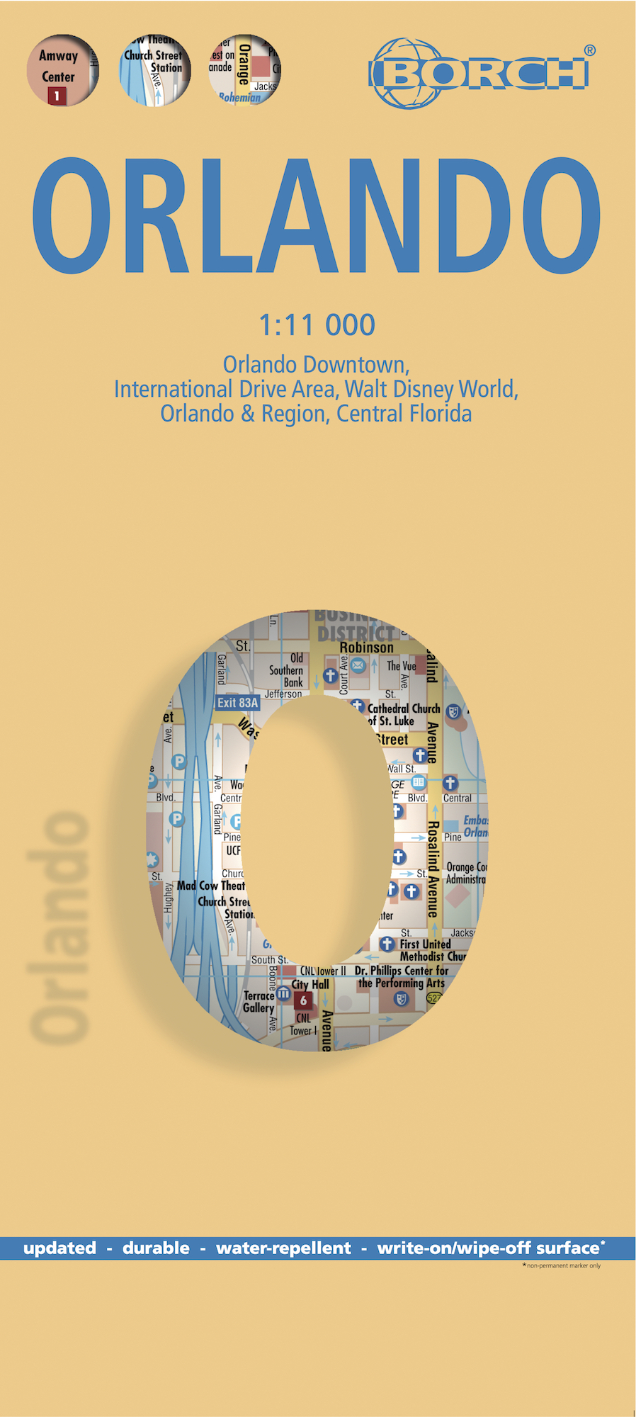
Borch Orlando is een duidelijke, geplastificeerde plattegrond van het centrum met informatie over openbaar vervoer en bezienswaardigheden. Inclusief straatnamenregister.


Our soft-laminated folded map of Orlando shows: Orlando Downtown 1:11 000, Central Florida 1:1 200 000, Orlando and Region 1:200 000, Walt Disney World 1:25 000, International Drive Area 1:25 000, Top 30 Sights, USA administrative and time zones. Borch Maps are easy to fold, durable and water-repellent with a wipeable surface. Borch Maps show hotels, museums, monuments, markets, public transport, top sights and points of interest, useful statistics, conversion charts for temperatures, weights and measurements, climate charts showing temperatures, sunshine hours, precipitation and humidity, overview maps, time zones, and much more...


Orlando, America’s fantasy capital, has the second largest number of hotel rooms in the country and is home to the Walt Disney World Resort (including the Magic Kingdom, Epcot, Disney's Hollywood Studios and Animal Kingdom), Universal Orlando Resort and Sea World Orlando, among others. Besides the Orlando Museum of Art, Orlando Science Center and the Arboretum of the University of Central Florida, Orlando's "culture coast" (Daytona Beach, Ormond Beach and New Smyrna Beach) is home to the Museum of Arts and Sciences, Atlantic Center for the Arts, Southeast Museum of Photography, Ormond Beach Art Museum and many smaller, quaint establishments. Moderate temperatures and low rainfall can be expected from November to March, the rest of the year is hot, humid and rainy, hurricane season usually lasting from June to November. The list of attractions and activities in the Greater Orlando area is very long indeed and wholesome family fun can be enjoyed by all.


Abonneer op